Colliers Wood

Wood, Forest in Nottinghamshire Broxtowe

England

Colliers Wood

Playing fields No one is using the pitches at the moment.
Playing fields Credit: Malcolm Neal

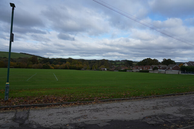
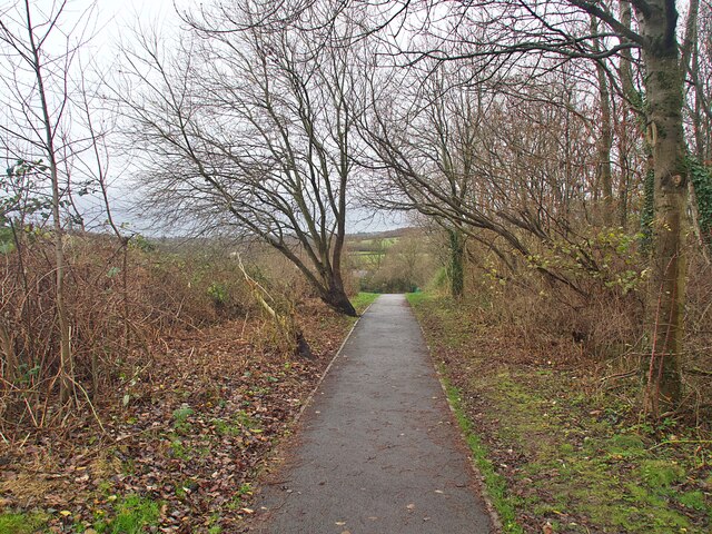
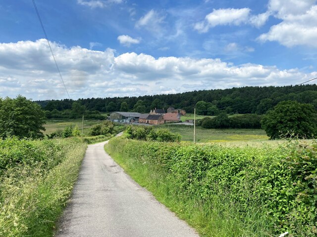
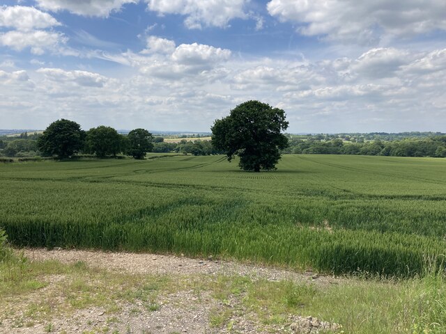
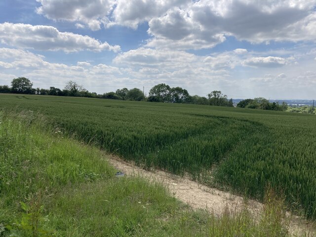
Colliers Wood is a charming woodland area located in Nottinghamshire, England. Situated within the Sherwood Forest, this ancient woodland is a haven for nature enthusiasts and history buffs alike. Spanning over 50 hectares, Colliers Wood is known for its diverse range of flora and fauna, making it a popular spot for wildlife enthusiasts and birdwatchers.

The wood is named after the colliers, or coal miners, who used to work in the area during the 19th century. Today, remnants of the coal mining industry can still be found, including disused mine shafts and spoil heaps. These historical features add an intriguing element to the wood, providing a glimpse into the region's industrial past.

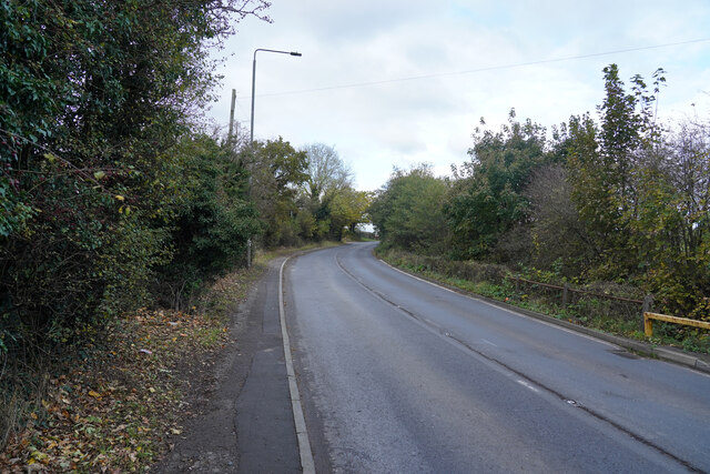
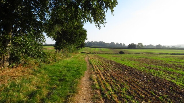
Visitors to Colliers Wood can explore the extensive network of walking trails, which wind through the wood and provide breathtaking views of the surrounding countryside. The wood is home to a variety of tree species, including oak, beech, and birch, creating a picturesque backdrop throughout the seasons.

The wood is also home to a rich array of wildlife, including deer, foxes, and a wide range of bird species. The tranquil environment provides a peaceful retreat from the hustle and bustle of city life, making it an ideal location for those seeking solace in nature.

Colliers Wood is easily accessible from nearby towns and cities, with ample parking facilities available for those arriving by car. Whether you are an avid nature lover, history enthusiast, or simply seeking a peaceful retreat, Colliers Wood is a must-visit destination in Nottinghamshire.

If you have any feedback on the listing, please let us know in the comments section below.

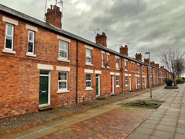
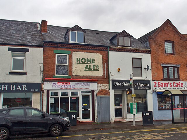
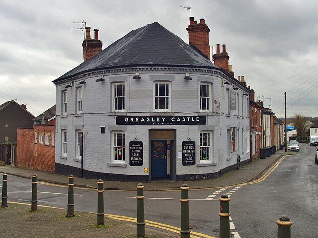
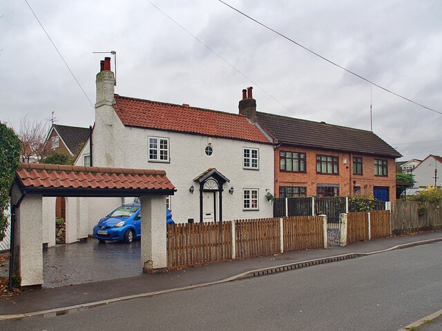
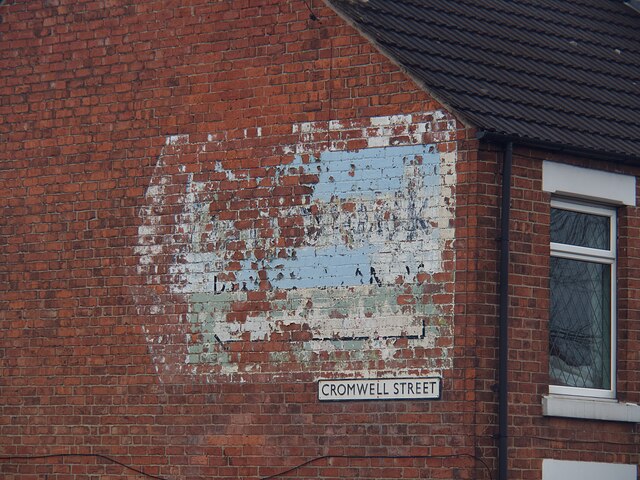
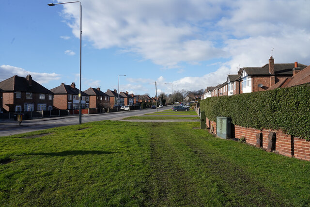
Colliers Wood Images

Images are sourced within 2km of 53.025857/-1.2825931 or Grid Reference SK4847. Thanks to Geograph Open Source API. All images are credited.

Playing fields No one is using the pitches at the moment.
Playing fields
No one is using the pitches at the moment.
Mansfield Road Autumnal leaf fall on the edge of Mansfield Road.
Mansfield Road
Autumnal leaf fall on the edge of Mansfield Road.
Robin Hood Way leading northeast towards Greasley
St Mary's Church, Greasley
D.H. Lawrence Birthplace Museum The Museum is located in the childhood home of the author D.H. Lawrence in the ex-mining town of Eastwood.
D.H. Lawrence Birthplace Museum
The Museum is located in the childhood home of the author D.H. Lawrence in the ex-mining town of Eastwood.
Princes Street, Eastwood One of a group of streets known locally as "the squares" this now pedestrianised street of terraced houses was built by the local colliery company in the 1850s.  DH Lawrence's home was nearby <a href="https://www.geograph.org.uk/photo/7043172">SK4647 : D.H. Lawrence Birthplace Museum</a> and he later described the houses as "sordid and hideous". They look very clean and smart today.
Princes Street, Eastwood
One of a group of streets known locally as "the squares" this now pedestrianised street of terraced houses was built by the local colliery company in the 1850s. DH Lawrence's home was nearby SK4647 : D.H. Lawrence Birthplace Museum and he later described the houses as "sordid and hideous". They look very clean and smart today.
Public footpath in Eastwood Running between Garden Road and Walker Street
Public footpath in Eastwood
Running between Garden Road and Walker Street
Ghost sign on Nottingham Road For Home Ales, a brand which disappeared in the 1990s but I believe used to supply the Greasley Castle opposite <a href="https://www.geograph.org.uk/photo/7045094">SK4746 : The Greasley Castle</a>
Ghost sign on Nottingham Road
For Home Ales, a brand which disappeared in the 1990s but I believe used to supply the Greasley Castle opposite SK4746 : The Greasley Castle
The Greasley Castle Public House at the Castle Street/Raglan Street junction.  I believe the pub used to sell Home Ales, for which beer there remains a ghost sign opposite on Nottingham Road <a href="https://www.geograph.org.uk/photo/7045090">SK4746 : Ghost sign on Nottingham Road</a>
The Greasley Castle
Public House at the Castle Street/Raglan Street junction. I believe the pub used to sell Home Ales, for which beer there remains a ghost sign opposite on Nottingham Road SK4746 : Ghost sign on Nottingham Road
Houses on Pinfold Road, Giltbrook
Ghost sign  Pointing the way to 'Gilbrook Dyers and Cleaners' whose premises were to the left of the sign but have now moved to Ilkeston.
Ghost sign
Pointing the way to 'Gilbrook Dyers and Cleaners' whose premises were to the left of the sign but have now moved to Ilkeston.
Giltbrook Dyers and Cleaners Ghost sign on a gable end on Cromwell Street. The sign was pointing the way to their premises but the company has moved and is now located in Ilkeston. Local knowledge from a walking colleague assisted in deciphering the wording.
For context see <a href="https://www.geograph.org.uk/photo/7045107">SK4845 : Ghost sign </a>.
Giltbrook Dyers and Cleaners
Ghost sign on a gable end on Cromwell Street. The sign was pointing the way to their premises but the company has moved and is now located in Ilkeston. Local knowledge from a walking colleague assisted in deciphering the wording. For context see SK4845 : Ghost sign .
Nottingham Road Looking along the Nottingham Road from the corner of Pinfold Road. The grass verbe is very wide at this point.
Nottingham Road
Looking along the Nottingham Road from the corner of Pinfold Road. The grass verbe is very wide at this point.
Beauvale Priory and Abbey Farm Pictured from the access road to the south of the location. The priory can be seen by visitors when the tea room nearby is open. It wasn't on this day and I was shunted off.
Beauvale Priory and Abbey Farm
Pictured from the access road to the south of the location. The priory can be seen by visitors when the tea room nearby is open. It wasn't on this day and I was shunted off.
Remains of Beauvale Priory This priory was built for Carthusian monks in 1343 - one of only a handful to be built in England for this order. They resisted Henry VIII's Oath of Supremacy and two members of the charterhouse later achieved martyrdom. A small portion of the remains are located outside this grid square in SK4950.
Remains of Beauvale Priory
This priory was built for Carthusian monks in 1343 - one of only a handful to be built in England for this order. They resisted Henry VIII's Oath of Supremacy and two members of the charterhouse later achieved martyrdom. A small portion of the remains are located outside this grid square in SK4950.
Farmland near Colliers Wood Pictured from a field entrance off New Road. Moorgreen Reservoir is located in the middle distance but out of sight here.
Farmland near Colliers Wood
Pictured from a field entrance off New Road. Moorgreen Reservoir is located in the middle distance but out of sight here.
Field of Wheat near Moorgreen Pictured from an un-gated entrance on New Road.
Field of Wheat near Moorgreen
Pictured from an un-gated entrance on New Road.
Roadworks on Greenhill Road Similar works were blighting Eastwood town centre as well on this day.
Roadworks on Greenhill Road
Similar works were blighting Eastwood town centre as well on this day.
Show me another place!

Colliers Wood is located at Grid Ref: SK4847 (Lat: 53.025857, Lng: -1.2825931)

Administrative County: Nottinghamshire

District: Broxtowe

Police Authority: Nottinghamshire

What 3 Words

///stealing.recruiter.fruits. Near Eastwood, Nottinghamshire

Nearby Locations

Moorgreen Colliers Wood

Related Wikis

St Mary's Church, Greasley

St Mary's Church, Greasley is a parish church in the Church of England in Greasley, Nottinghamshire. The church is Grade II listed by the Department for...

Greasley

Greasley is a civil parish north west of Nottingham in Nottinghamshire, England. Although it is thought there was once a village called Greasley, there...

Newthorpe, Nottinghamshire

Newthorpe is a village in the English county of Nottinghamshire. It is in the Broxtowe Borough Council ward of Greasley (Giltbrook and Newthorpe). It forms...
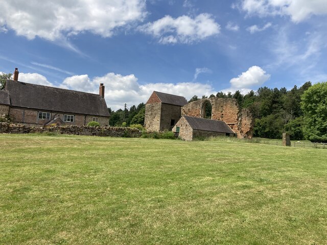
Beauvale Priory

Beauvale Priory (also known as Beauvale Charterhouse) was a Carthusian monastery in Beauvale, Nottinghamshire. It is a scheduled ancient monument. ��2...

Beauvale

Beauvale, or Beauvale Newthorpe, is a village in Nottinghamshire, England. It is located 1 mile to the east of Eastwood. It is in Greasley parish. Beauvale...

Eastwood Town F.C.

Eastwood Town Football Club was an English football club based in Eastwood, Nottinghamshire. The club last participated in the Northern Premier League...

Eastwood C.F.C.

Eastwood Community Football Club is a football club based in Eastwood, Nottinghamshire, England. They are currently members of the United Counties League...

Eastwood, Nottinghamshire

Eastwood is a former coal mining town in the Broxtowe district of Nottinghamshire, England, 8 miles (13 km) northwest of Nottingham and 10 miles (16 km...

Nearby Amenities

Located within 500m of 53.025857,-1.2825931
Bus Stop
Moorgreen
Both Ways: yes
Bus: yes
Naptan AtcoCode: 3300BR0164
Naptan Bearing: SW
Naptan CommonName: Church Road
Naptan Crossing: Church Road
Naptan Indicator: adj
Naptan NaptanCode: ntsawgpm
Naptan Notes: BW
Naptan Street: Moorgreen
Naptan Verified: yes
Public Transport: platform
Shelter: yes
Source: naptan_import
Lat/Long: 53.0224128/-1.2783623
Bus Stop
Church Road
Bus: yes
Local Ref: BR0165
Naptan AtcoCode: 3300BR0165
Naptan Bearing: N
Naptan CommonName: Church Road
Naptan Crossing: Church Road
Naptan Indicator: opp
Naptan Landmark: Horse and Groom
Naptan NaptanCode: ntsawgpt
Naptan Notes: none
Naptan Street: Moorgreen
Naptan Verified: yes
Note: 528, 532, 533
Public Transport: platform
Shelter: yes
Source: naptan_import
Lat/Long: 53.0235172/-1.2781501
Bus Stop
Nursery
Both Ways: yes
Bus: yes
Local Ref: BR0166
Naptan AtcoCode: 3300BR0166
Naptan Bearing: S
Naptan CommonName: Nursery
Naptan Indicator: opp
Naptan Landmark: Nursery
Naptan NaptanCode: ntsawgpw
Naptan Notes: none
Naptan Street: Moorgreen Road
Naptan Verified: yes
Note: 528, 532, 533
Public Transport: platform
Source: naptan_import
Lat/Long: 53.0255659/-1.2782765
Bus Stop
Nursery
Bus: yes
Local Ref: BR0167
Naptan AtcoCode: 3300BR0167
Naptan Bearing: NW
Naptan CommonName: Nursery
Naptan Indicator: adj
Naptan Landmark: Nursery
Naptan NaptanCode: ntsawgta
Naptan Notes: none
Naptan Street: Moorgreen Road
Naptan Verified: yes
Note: 528, 532, 533
Public Transport: platform
Shelter: no
Source: naptan_import
Lat/Long: 53.0271452/-1.2799528
Bus Stop
Engine Lane
Bus: yes
Naptan AtcoCode: 3300BR0168
Naptan Bearing: SE
Naptan CommonName: Engine Lane
Naptan Crossing: Engine Lane
Naptan Indicator: opp
Naptan NaptanCode: ntsawgtd
Naptan Notes: none
Naptan Street: Moorgreen Road
Naptan Verified: yes
Note: 528, 532, 533
Public Transport: platform
Shelter: yes
Source: naptan_import
Lat/Long: 53.0284932/-1.2818991
Bus Stop
Engine Lane
Bus: yes
Ele: 77.9920654
Naptan AtcoCode: 3300BR0169
Naptan Bearing: N
Naptan CommonName: Engine Lane
Naptan Crossing: Engine Lane
Naptan Indicator: adj
Naptan NaptanCode: ntsawgtg
Naptan Notes: none
Naptan Street: Moorgreen Road
Naptan Verified: yes
Public Transport: platform
Source: naptan_import
Lat/Long: 53.0297423/-1.2828658
Church Road
Local Ref: NR
Naptan AtcoCode: 3300BR0550
Naptan Bearing: N
Naptan BusStopType: CUS
Naptan CommonName: Church Road
Naptan Crossing: Church Road
Naptan Indicator: nr
Naptan NaptanCode: ntsgpatd
Naptan Notes: 3300BR0164
Naptan Street: Moorgreen
Naptan Verified: no
Source: naptan_import
Lat/Long: 53.0225752/-1.278464
039
Ele: 101.544189
Wpt Description: 03-OCT-09 12:22:53
Wpt Symbol: Crossing
Lat/Long: 53.027055/-1.2804562
Barrier: bollard
Lat/Long: 53.0271833/-1.2802575
Turning Circle
Source: survey
Lat/Long: 53.0252686/-1.2862144
Barrier: height_restrictor
Maxheight: 2
Source: survey
Lat/Long: 53.0279529/-1.2843605
Man Made: dipping_platform
Source: GPS
Lat/Long: 53.0265133/-1.2855878
Post Box
Collection Times: Mo-Fr 16:00; Sa 10:30
Operator: Royal Mail
Operator Wikidata: Q638098
Post Box Type: lamp
Ref: NG16 30
Royal Cypher: EIIR
Royal Cypher Wikidata: Q33102113
Source: survey
Lat/Long: 53.0231111/-1.2781719
Information: board
Tourism: information
Lat/Long: 53.0274589/-1.2845363
Cafe
Reuben's Coffee House
Addr Housename: Hollydene Nursery
Addr Housenumber: 121
Addr Postcode: NG16 2FF
Addr Street: Moorgreen
Source Addr: Food Hygiene Open Data
Lat/Long: 53.0268065/-1.2794497
The Country of My Heart
Information: board
Source: survey
Tourism: information
Lat/Long: 53.0231092/-1.2781246
Advertising: board
Description: Moorgreen community notices
Lat/Long: 53.023088/-1.2781782
Entrance: main
Lat/Long: 53.0233167/-1.2776887
Bench
Lat/Long: 53.0224264/-1.2783529
Welcome to Collier's Wood
Information: board
Source: survey
Tourism: information
Lat/Long: 53.0270202/-1.2805255
Waste Basket
Lat/Long: 53.0270315/-1.2804316
Barrier: kissing_gate
Lat/Long: 53.0271218/-1.2803538
Entrance: yes
Lat/Long: 53.023325/-1.2774489
Defibrillator
Defibrillator Location: On outside wall of Horse and Groom pub, in seating area at front of building (off Moorgreen road)
Emergency: defibrillator
Lat/Long: 53.0233686/-1.2778057
Direction: SE
Generator Method: photovoltaic
Generator Output Electricity: yes
Generator Solar Modules: 4
Generator Source: solar
Generator Type: solar_photovoltaic_panel
Location: roof
Power: generator
Lat/Long: 53.027294/-1.2806105
Direction: SW
Generator Method: photovoltaic
Generator Output Electricity: yes
Generator Solar Modules: 4
Generator Source: solar
Generator Type: solar_photovoltaic_panel
Location: roof
Power: generator
Lat/Long: 53.027295/-1.2805444
Direction: SW
Generator Method: photovoltaic
Generator Output Electricity: yes
Generator Solar Modules: 8
Generator Source: solar
Generator Type: solar_photovoltaic_panel
Location: roof
Power: generator
Lat/Long: 53.0274646/-1.2809089
Direction: SE
Generator Method: photovoltaic
Generator Output Electricity: yes
Generator Solar Modules: 5
Generator Source: solar
Generator Type: solar_photovoltaic_panel
Location: roof
Power: generator
Lat/Long: 53.0274851/-1.2809649
Direction: 0
Man Made: surveillance
Surveillance: public
Surveillance Type: ALPR
Surveillance Zone: traffic
Lat/Long: 53.0230896/-1.2780797
The data included in this document is from www.openstreetmap.org. The data is made available under ODbL.

Have you been to Colliers Wood?

Leave your review of Colliers Wood below (or comments, questions and feedback).