Grange Wood

Wood, Forest in Nottinghamshire Broxtowe

England

Grange Wood

Park Cemetery, Ilkeston A view towards the main entrance to the cemetery
Park Cemetery, Ilkeston Credit: Francis Dolman

Grange Wood is a picturesque forest located in Nottinghamshire, England. Covering an area of approximately 100 hectares, it is a haven for nature enthusiasts and a popular destination for outdoor activities. The wood is situated near the village of Grange, offering easy access to visitors from nearby towns and cities.

The woodland is predominantly composed of native tree species, including oak, beech, and birch, which create a dense canopy overhead. This provides a habitat for a variety of wildlife, such as deer, foxes, and a wide range of bird species. The forest floor is adorned with an array of wildflowers and ferns, adding to its natural beauty.

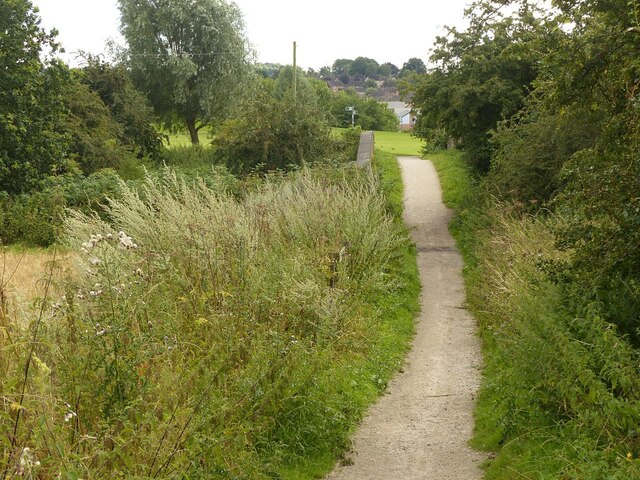
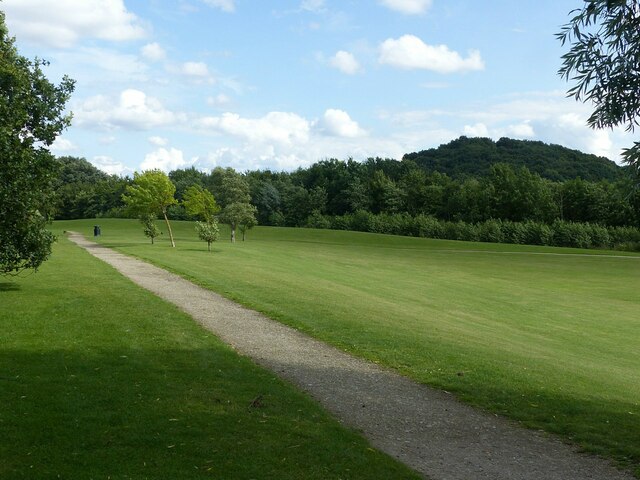
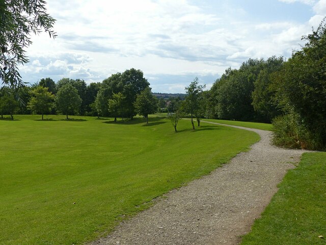
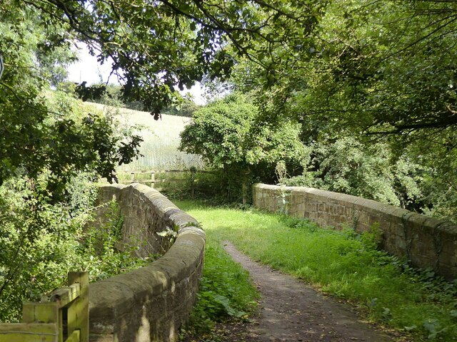
Walking trails crisscross the wood, offering visitors the opportunity to explore its serene surroundings. These paths are well-maintained and suitable for all ages and fitness levels. Additionally, there are designated picnic areas and benches scattered throughout the forest, providing a perfect spot for visitors to rest and enjoy the peaceful ambiance.

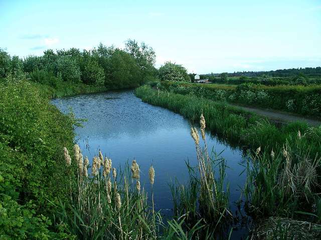
Grange Wood is also home to a small pond, which serves as a watering hole for the resident wildlife. This tranquil water feature is a popular spot for birdwatching and photography enthusiasts.

The wood is open to the public year-round and is a popular destination for outdoor recreation. Whether visitors are looking for a leisurely stroll, birdwatching, or a peaceful picnic amidst nature, Grange Wood offers a delightful experience for all.

If you have any feedback on the listing, please let us know in the comments section below.
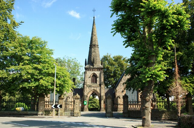
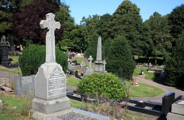
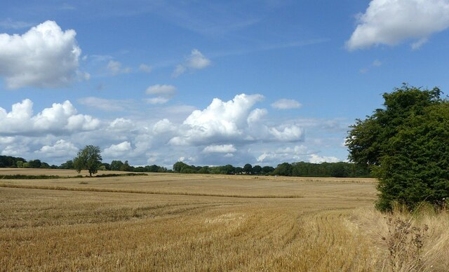
Grange Wood Images

Images are sourced within 2km of 52.960219/-1.2845133 or Grid Reference SK4840. Thanks to Geograph Open Source API. All images are credited.

Park Cemetery, Ilkeston A view towards the main entrance to the cemetery
Park Cemetery, Ilkeston
A view towards the main entrance to the cemetery
Park Cemetery, Ilkeston
Partly harvested field Near the former Swancar Farm.
Partly harvested field
Near the former Swancar Farm.
Footpath over the railway near Trowell Originally an agricultural accommodation bridge. The path is now part of the Robin Hood Way and Erewash Valley Trail long distance footpaths.
Footpath over the railway near Trowell
Originally an agricultural accommodation bridge. The path is now part of the Robin Hood Way and Erewash Valley Trail long distance footpaths.
Pit Lane Recreation Area Redevelopment of the former Trowell Moor Colliery area as open space.
Pit Lane Recreation Area
Redevelopment of the former Trowell Moor Colliery area as open space.
Pit Lane Recreation Area Redevelopment of the former Trowell Moor Colliery area as open space. The path forms part of the Robin Hood Way long distance path.
Pit Lane Recreation Area
Redevelopment of the former Trowell Moor Colliery area as open space. The path forms part of the Robin Hood Way long distance path.
Train to Nottingham and Norwich Looking west from the footbridge near Pit Lane. The train consists of two Class 158 units, 158 806 and 158 864. Now operated by East Midland Railway, the units are still in the old Stagecoach Group livery of East Midlands Trains.
Train to Nottingham and Norwich
Looking west from the footbridge near Pit Lane. The train consists of two Class 158 units, 158 806 and 158 864. Now operated by East Midland Railway, the units are still in the old Stagecoach Group livery of East Midlands Trains.
Train to Nottingham and Norwich Looking east from the footbridge near Pit Lane. The train consists of two Class 158 units, 158 806 and 158 864. Now operated by East Midland Railway, the units are still in the old Stagecoach Group livery of East Midlands Trains.
Train to Nottingham and Norwich
Looking east from the footbridge near Pit Lane. The train consists of two Class 158 units, 158 806 and 158 864. Now operated by East Midland Railway, the units are still in the old Stagecoach Group livery of East Midlands Trains.
Trowell Garden Centre The commercial entrance, as seen when passing on the Robin Hood Way.
Trowell Garden Centre
The commercial entrance, as seen when passing on the Robin Hood Way.
On the Robin Hood Way passing Trowell Garden Centre The Robin Hood Way follows the former Nottingham Canal towpath, but makes a diversion round the garden centre which has taken over the former canal bed at this point. This is also part of National Cycle Route 6, cycling being permitted over what is a public footpath but not a bridleway. The M1 ensures that this is not a quiet location!
On the Robin Hood Way passing Trowell Garden Centre
The Robin Hood Way follows the former Nottingham Canal towpath, but makes a diversion round the garden centre which has taken over the former canal bed at this point. This is also part of National Cycle Route 6, cycling being permitted over what is a public footpath but not a bridleway. The M1 ensures that this is not a quiet location!
Swansea Bridge, Nottingham Canal An original bridge from the creation of the Nottingham Canal, c.1795, Listed Grade II. It now carries the Robin Hood Way long distance footpath.
Swansea Bridge, Nottingham Canal
An original bridge from the creation of the Nottingham Canal, c.1795, Listed Grade II. It now carries the Robin Hood Way long distance footpath.
Garden Centre, Trowell Recreating this 'First' for the square <a title="https://www.geograph.org.uk/photo/17066" href="https://www.geograph.org.uk/photo/17066">Link</a> . The canal bed and garden centre have become largely obscured by the significant tree growth in the intervening years.
Garden Centre, Trowell
Recreating this 'First' for the square Link . The canal bed and garden centre have become largely obscured by the significant tree growth in the intervening years.
Stop gate, Nottingham Canal at Swansea Bridge These gates could be used to stop the flow of water along the canal in the event of a breach. A bridge hole where the passage narrowed was always a favoured place. Stop gates were always prudent on long stretches without any proper locks.

More overgrown than when I visited in 2007 <a title="https://www.geograph.org.uk/photo/622412" href="https://www.geograph.org.uk/photo/622412">Link</a> . The access to the nearside towpath is now formally not available.
Stop gate, Nottingham Canal at Swansea Bridge
These gates could be used to stop the flow of water along the canal in the event of a breach. A bridge hole where the passage narrowed was always a favoured place. Stop gates were always prudent on long stretches without any proper locks. More overgrown than when I visited in 2007 Link . The access to the nearside towpath is now formally not available.
Swansea Bridge, Nottingham Canal An original bridge from the building of the canal, c.1795, Listed Grade II. The bridge has been provided with stop-board slots. These could be inserted if it was necessary to drain a particular section of the canal for maintenance purposes. Note also how the bridge has been reinforced with railway rails.

The boarding on the right prevents unwanted access into the garden centre which has taken over the canal bed.
Swansea Bridge, Nottingham Canal
An original bridge from the building of the canal, c.1795, Listed Grade II. The bridge has been provided with stop-board slots. These could be inserted if it was necessary to drain a particular section of the canal for maintenance purposes. Note also how the bridge has been reinforced with railway rails. The boarding on the right prevents unwanted access into the garden centre which has taken over the canal bed.
Small Tortoiseshell (Aglais urticae) on umbellifer The vivid colours suggest this year's brood rather than last year's.
Small Tortoiseshell (Aglais urticae) on umbellifer
The vivid colours suggest this year's brood rather than last year's.
Show me another place!

Grange Wood is located at Grid Ref: SK4840 (Lat: 52.960219, Lng: -1.2845133)

Administrative County: Nottinghamshire

District: Broxtowe

Police Authority: Nottinghamshire

What 3 Words

///cliff.scenes.finely. Near Ilkeston, Derbyshire

Nearby Locations

Grange Wood

Related Wikis

Trowell railway station

Trowell railway station served the village of Trowell, Nottinghamshire, England from 1884 to 1967 on the Erewash Valley Line. == History == The station...

Gallows Inn

Gallows Inn is an area of Ilkeston in Derbyshire, in the East Midlands of England. On the southern outskirts of Ilkeston, the area is named after the Gallows...
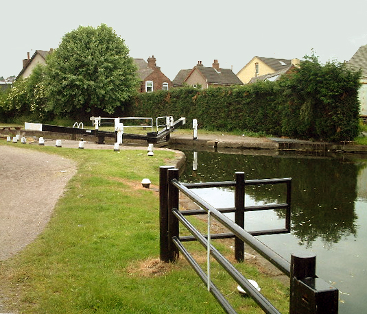
Nottingham Canal

The Nottingham Canal is a canal in the English counties of Nottinghamshire and Derbyshire. As built, it comprised a 14.7-mile (23.7 km) long main line...

Trowell

Trowell () is a village and civil parish in Nottinghamshire, England. It lies a few miles west of Nottingham, in the borough of Broxtowe on the border...

Nearby Amenities

Located within 500m of 52.960219,-1.2845133
Railway: switch
Lat/Long: 52.9564835/-1.2881291
Bus Stop
Stoney Lane
Bus: yes
Naptan AtcoCode: 3300BR0018
Naptan Bearing: NW
Naptan CommonName: Stoney Lane
Naptan Crossing: Stoney Lane
Naptan Indicator: opp
Naptan NaptanCode: ntsgajmd
Naptan Notes: none
Naptan Street: Ilkeston Road
Naptan Verified: yes
Public Transport: platform
Shelter: no
Source: naptan_import
Lat/Long: 52.9573509/-1.2881545
Bus Stop
Stoney Lane
Bus: yes
Naptan AtcoCode: 3300BR0462
Naptan Bearing: SE
Naptan CommonName: Stoney Lane
Naptan Indicator: adj
Naptan Landmark: Stoney Lane
Naptan NaptanCode: ntsawgdj
Naptan Notes: None
Naptan Street: Ilkeston Road
Naptan Verified: yes
Public Transport: platform
Shelter: yes
Source: naptan_import
Waste Basket: yes
Lat/Long: 52.9573227/-1.2879466
Post Box
Collection Times: Mo-Fr 09:00; Sa 07:00
Operator: Royal Mail
Operator Wikidata: Q638098
Post Box Manufacturer: Machan, Scotland
Post Box Type: lamp
Ref: NG9 672D
Royal Cypher: EIIR
Royal Cypher Wikidata: Q33102113
Source: survey
Lat/Long: 52.9564158/-1.2866282
Barrier: stile
Lat/Long: 52.9569853/-1.2892592
Power: substation
Source: survey
Lat/Long: 52.957158/-1.287963
Railway: switch
Lat/Long: 52.9565/-1.2880745
Railway: switch
Lat/Long: 52.9581188/-1.2883588
Railway: switch
Lat/Long: 52.9587236/-1.2884019
Railway: switch
Lat/Long: 52.9591358/-1.2886489
Railway: switch
Lat/Long: 52.9595454/-1.2887142
Railway: switch
Lat/Long: 52.9596069/-1.2886299
Railway: switch
Lat/Long: 52.9599111/-1.288822
Railway: switch
Lat/Long: 52.9602832/-1.2888231
Railway: switch
Lat/Long: 52.9593409/-1.2885802
Advertising: board
Operator: Trowell Parish Council
Lat/Long: 52.9564224/-1.2866464
Entrance: main
Lat/Long: 52.9629416/-1.28979
Bench
Source: survey
Lat/Long: 52.9570813/-1.2855949
Bench
Backrest: yes
Source: survey
Lat/Long: 52.9590113/-1.2863164
Bench
Backrest: no
Source: survey
Lat/Long: 52.9606423/-1.2848881
Bench
Source: survey
Lat/Long: 52.9623315/-1.2837347
Bench
Backrest: no
Lat/Long: 52.9645044/-1.2831554
Bench
Backrest: no
Lat/Long: 52.9644632/-1.2830856
Bench
Source: survey
Lat/Long: 52.9615216/-1.2907326
Generator Method: photovoltaic
Generator Output Electricity: yes
Generator Source: solar
Generator Type: solar_photovoltaic_panel
Location: roof
Power: generator
Lat/Long: 52.9575985/-1.2868212
Generator Method: photovoltaic
Generator Output Electricity: yes
Generator Source: solar
Generator Type: solar_photovoltaic_panel
Location: roof
Power: generator
Lat/Long: 52.9575541/-1.2867769
Generator Method: photovoltaic
Generator Output Electricity: yes
Generator Source: solar
Generator Type: solar_photovoltaic_panel
Location: roof
Power: generator
Lat/Long: 52.957563/-1.2867434
Generator Method: photovoltaic
Generator Output Electricity: yes
Generator Source: solar
Generator Type: solar_photovoltaic_panel
Location: roof
Power: generator
Lat/Long: 52.9562344/-1.2871363
Trowell South Junction
Railway: junction
Lat/Long: 52.9564915/-1.2881007
The data included in this document is from www.openstreetmap.org. The data is made available under ODbL.

Have you been to Grange Wood?

Leave your review of Grange Wood below (or comments, questions and feedback).