Ash Plantation

Wood, Forest in Berkshire

England

Ash Plantation

A34 northbound towards the M4
A34 northbound towards the M4 Credit: Ian S

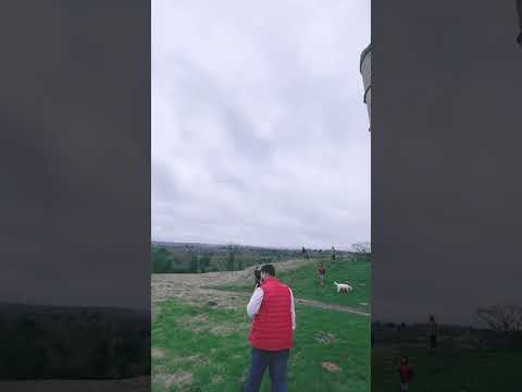
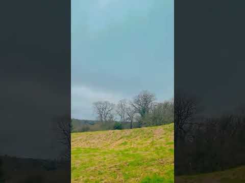
Ash Plantation is a woodland area located in Berkshire, England. Situated near the village of Ashampstead, it covers an estimated area of 150 acres. The plantation is predominantly comprised of ash trees, which give the area its name. It is a popular destination for nature enthusiasts and hikers, offering a serene and tranquil environment.

The woodland is characterized by its dense vegetation, boasting a rich variety of flora and fauna. Ash trees dominate the landscape, with their tall, slender trunks and distinctive foliage. The trees provide a dense canopy, creating shade and shelter for smaller plants and wildlife.

Walking through Ash Plantation, visitors can expect to encounter a diverse range of plant species. Bluebells, primroses, and wood anemones carpet the forest floor during the spring months, creating a vibrant and colorful display. The undergrowth also hosts ferns, mosses, and various wildflowers, adding to the visual allure of the woodland.

The plantation is home to a multitude of wildlife, making it a haven for nature lovers. Birdwatchers can spot species such as woodpeckers, owls, and warblers among the tree branches. Small mammals like squirrels and rabbits are commonly seen scurrying through the underbrush. Additionally, the area is known to support a variety of insects, including butterflies and dragonflies.

Ash Plantation offers several walking trails for visitors to explore, ranging from short strolls to longer hikes. The paths wind through the woodland, leading to picturesque viewpoints and tranquil spots. The plantation's natural beauty and peaceful ambiance make it a cherished destination for locals and tourists alike.

If you have any feedback on the listing, please let us know in the comments section below.

Ash Plantation Images

Images are sourced within 2km of 51.43035/-1.3118773 or Grid Reference SU4770. Thanks to Geograph Open Source API. All images are credited.

A34 northbound towards the M4
The A34 northbound at the M4 junction
Joining the A34, southbound The A34 is a 200 mile long major trunk road that runs from Salford to Winchester via The Potteries, Birmingham and Oxford. It is divided into two sections <span class="nowrap"><a title="http://www.sabre-roads.org.uk/wiki/index.php?title=A34" rel="nofollow ugc noopener" href="http://www.sabre-roads.org.uk/wiki/index.php?title=A34">Link</a><img style="margin-left:2px;" alt="External link" title="External link - shift click to open in new window" src="https://s1.geograph.org.uk/img/external.png" width="10" height="10"/></span> 
Wikipedia: <span class="nowrap"><a title="http://en.wikipedia.org/wiki/A34_road" rel="nofollow ugc noopener" href="http://en.wikipedia.org/wiki/A34_road">Link</a><img style="margin-left:2px;" alt="External link" title="External link - shift click to open in new window" src="https://s1.geograph.org.uk/img/external.png" width="10" height="10"/></span>
Joining the A34, southbound
The A34 is a 200 mile long major trunk road that runs from Salford to Winchester via The Potteries, Birmingham and Oxford. It is divided into two sections LinkExternal link Wikipedia: LinkExternal link
The A34 looking northbound
Curridge Village Hall
Well Dug In Foxes? Badgers? Bionic Rabbits? Something is taking advantage of this heap of sand.
Well Dug In
Foxes? Badgers? Bionic Rabbits? Something is taking advantage of this heap of sand.
Old Tractor in a Field
A Bigger Pond The map shows a small pool in the corner of this field. Recent heavy rain has swollen it a bit.
A Bigger Pond
The map shows a small pool in the corner of this field. Recent heavy rain has swollen it a bit.
A New Gate On Arlington Grange Farm.
A New Gate
On Arlington Grange Farm.
Home Farm
Home Farm
Start of Marsh Lane A well deserved name. The first bit is unsurfaced residential, and just a bit wet. Beyond the last house it degenerates into a quagmire.
Start of Marsh Lane
A well deserved name. The first bit is unsurfaced residential, and just a bit wet. Beyond the last house it degenerates into a quagmire.
The Fox and Hounds, Donnington If ever a pub was a survivor, it's this one.
Originally an isolated roadside pub beside the old A34, which is the road in front, now unclassified, it was firstly by passed by a new A34 alignment running behind the pub, and then by yet another  rebuild of the A34, the Newbury by pass, on an embankment in front again.
The pub is sandwiched onto this narrow island of land between the three roads, and is still serving a decent pint.
The Fox and Hounds, Donnington
If ever a pub was a survivor, it's this one. Originally an isolated roadside pub beside the old A34, which is the road in front, now unclassified, it was firstly by passed by a new A34 alignment running behind the pub, and then by yet another rebuild of the A34, the Newbury by pass, on an embankment in front again. The pub is sandwiched onto this narrow island of land between the three roads, and is still serving a decent pint.
Fire & Flood Snelsmore Common is a variable environment. In dry weather, fire on the gorse and heather heath is a constant threat, hence the need for this watchtower.
But in wet weather, many areas become very waterlogged.
Fire & Flood
Snelsmore Common is a variable environment. In dry weather, fire on the gorse and heather heath is a constant threat, hence the need for this watchtower. But in wet weather, many areas become very waterlogged.
Fire Beaters, Snelsmore Common
Road from the coach parking area at Chieveley Services Viewed looking towards the Chievely Services access road from the A34. 
The white letters painted on the road surface are NO HGV COACHES ONLY.
The coach parking area <a title="https://www.geograph.org.uk/photo/4967475" href="https://www.geograph.org.uk/photo/4967475">Link</a> is 50 metres behind the camera.
Signs pointing right on the island in the background show All routes and M4 & A34.
Road from the coach parking area at Chieveley Services
Viewed looking towards the Chievely Services access road from the A34. The white letters painted on the road surface are NO HGV COACHES ONLY. The coach parking area Link is 50 metres behind the camera. Signs pointing right on the island in the background show All routes and M4 & A34.
Thank you for calling at Chieveley Services The turquoise notice is alongside the exit road (on the right) from Chieveley Services to the A34. 
M4 motorway junction 13 is about 500 metres away.
Thank you for calling at Chieveley Services
The turquoise notice is alongside the exit road (on the right) from Chieveley Services to the A34. M4 motorway junction 13 is about 500 metres away.
Propane tank enclosure at Chieveley Services Located near the BP filling station in Chieveley Services alongside the A34 near M4 junction 13 in Berkshire, north of Newbury. Propane (C3H8) is a hydrocarbon gas, compressible to a transportable liquid (LPG). A by-product of natural gas processing and petroleum refining, propane is used as a fuel for engines, residential central heating, oxy-gas torches and portable stoves.
Propane tank enclosure at Chieveley Services
Located near the BP filling station in Chieveley Services alongside the A34 near M4 junction 13 in Berkshire, north of Newbury. Propane (C3H8) is a hydrocarbon gas, compressible to a transportable liquid (LPG). A by-product of natural gas processing and petroleum refining, propane is used as a fuel for engines, residential central heating, oxy-gas torches and portable stoves.
Show me another place!

Ash Plantation is located at Grid Ref: SU4770 (Lat: 51.43035, Lng: -1.3118773)

Unitary Authority: West Berkshire

Police Authority: Thames Valley

What 3 Words

///whom.expressed.lentil. Near Winterbourne, Berkshire

Related Wikis

Mary Hare School

Mary Hare School is a residential co-educational Non-Maintained special school for deaf pupils in Newbury, Berkshire, England. It consists of around 230...

Shaw-cum-Donnington

Shaw-cum-Donnington is a civil parish in West Berkshire, England with all of its urban or suburban area immediately north of the largest town in the district...

Donnington, Berkshire

Donnington is an English suburban village in the civil parish of Shaw-cum-Donnington, just north of the town of Newbury, Berkshire. It contains a ruined...

Trinity School, Newbury

Trinity School is a co-educational secondary school with academy status in Newbury, Berkshire, England. The school opened in September 1999 when two existing...

Snelsmore Common

Snelsmore Common is a 104-hectare (260-acre) biological Site of Special Scientific Interest north of Newbury in Berkshire. It is owned by West Berkshire...

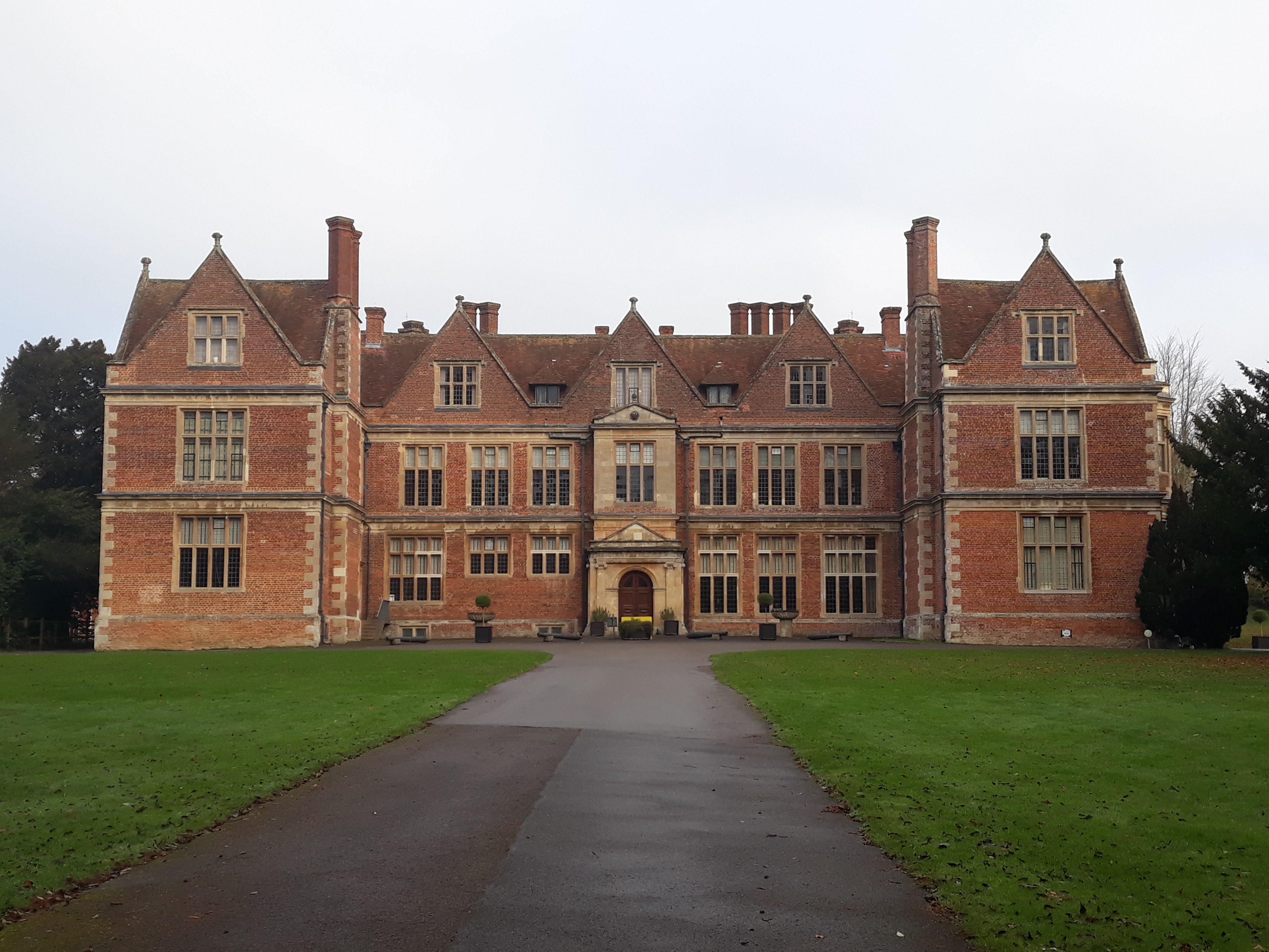
Shaw House, Berkshire

Shaw House is an important example of an early symmetrical H-plan Elizabethan mansion, located at Shaw, on the north-eastern outskirts of Newbury in Berkshire...

Curridge

Curridge is a village in the civil parish of Chieveley in the English county of Berkshire. == Geography == Curridge is located in the south-east of the...
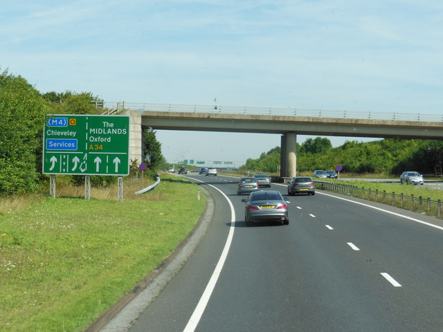
Chieveley services

Chieveley services is a UK motorway service station just off the M4 motorway at Chieveley near Newbury in Berkshire, England. It is owned by Moto. It is...

Related Videos

Berkshire 3.5 mile circular walk: Snelsmore Common & Donnington Castle

Snelsmore Common - Donnington Castle : 3.5 mile circular walk ** one of our favouites ** Guided Walk: ...

Nearby Amenities

Located within 500m of 51.43035,-1.3118773
Man Made: utility_pole
Lat/Long: 51.4292485/-1.3167796
The data included in this document is from www.openstreetmap.org. The data is made available under ODbL.

Have you been to Ash Plantation?

Leave your review of Ash Plantation below (or comments, questions and feedback).