Highfield Spinney
Wood, Forest in Oxfordshire Cherwell
England
Highfield Spinney

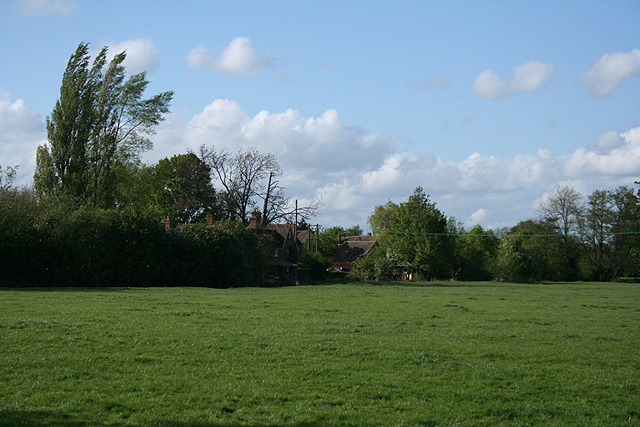
Highfield Spinney is a small woodland area located in Oxfordshire, England. It is nestled in the picturesque countryside, just a short distance from the village of Highfield. The spinney covers an area of approximately 10 acres and is characterized by its dense vegetation and tall, mature trees.
The woodland consists mainly of deciduous trees such as oak, beech, and ash, which provide a rich canopy that shields the forest floor from excessive sunlight. This creates a cool and tranquil atmosphere within the spinney, making it a popular spot for nature enthusiasts and walkers.
Highfield Spinney is home to a diverse range of flora and fauna. The forest floor is covered in a thick carpet of mosses, ferns, and wildflowers, creating a vibrant and colorful undergrowth. The trees provide a habitat for various bird species, including robins, blackbirds, and woodpeckers. Squirrels can also be spotted scurrying through the treetops, while rabbits and deer occasionally graze in the open glades.
The spinney is crisscrossed by a network of footpaths, allowing visitors to explore and appreciate the natural beauty of the area. These paths lead to secluded clearings and hidden ponds, providing peaceful spots for reflection and relaxation.
Highfield Spinney is a haven for wildlife and a tranquil retreat for those seeking solace in nature. With its lush vegetation, diverse wildlife, and serene atmosphere, it is a true gem in the Oxfordshire countryside.
If you have any feedback on the listing, please let us know in the comments section below.
Highfield Spinney Images
Images are sourced within 2km of 52.135063/-1.3031796 or Grid Reference SP4748. Thanks to Geograph Open Source API. All images are credited.


Highfield Spinney is located at Grid Ref: SP4748 (Lat: 52.135063, Lng: -1.3031796)
Administrative County: Oxfordshire
District: Cherwell
Police Authority: Thames Valley
What 3 Words
///elated.goal.gossiping. Near Claydon, Oxfordshire
Nearby Locations
Related Wikis

Prescote
Prescote is a hamlet and civil parish about 4 miles (6.4 km) north of Banbury in Oxfordshire. Its boundaries are the River Cherwell in the southeast, a...

Clattercote
Clattercote or Clattercot is a hamlet in Claydon with Clattercot civil parish, just over 5.5 miles (8.9 km) north of Banbury in Oxfordshire, England....
RAF Chipping Warden
Royal Air Force Chipping Warden or more simply RAF Chipping Warden was a Royal Air Force station located 6 miles (10 km) north-east of Banbury near the...
Clattercote Priory
Clattercote Priory was a Gilbertine priory in Oxfordshire, England. It was founded for Gilbertine canons to run a hospital in the mid-twelfth century,...

Chipping Warden
Chipping Warden is a village and former civil parish, now in the parish of Chipping Warden and Edgcote, in the West Northamptonshire district, in the ceremonial...
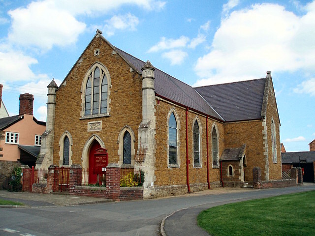
Cropredy Methodist Church
Cropredy Methodist Church is a Methodist church in the village of Cropredy, Oxfordshire. == History == The Wesleyan congregation in Cropredy was established...
Battle of Cropredy Bridge
The Battle of Cropredy Bridge was fought on Saturday 29 June 1644 (9 July 1644 Gregorian) near Banbury, Oxfordshire during the First English Civil War...
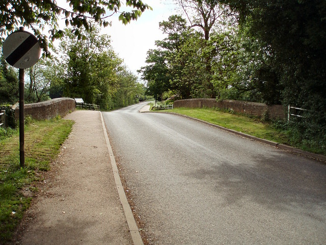
Cropredy Bridge
Cropredy Bridge is a bridge in north Oxfordshire, England, that carries the minor road between Cropredy and the hamlet of Williamscot. It spans the River...
Nearby Amenities
Located within 500m of 52.135063,-1.3031796Have you been to Highfield Spinney?
Leave your review of Highfield Spinney below (or comments, questions and feedback).