Burrow Wood

Wood, Forest in Leicestershire North West Leicestershire

England

Burrow Wood

Puddle, Bardon Hill Despite the very hot and dry weather this puddle was encountered on one of the footpaths on Bardon Hill.
Puddle, Bardon Hill Credit: David Bremner

Burrow Wood is a picturesque woodland located in Leicestershire, England. Covering an area of approximately 100 acres, it is a popular destination for nature enthusiasts and outdoor lovers. The wood is situated near the village of Burrow, hence its name.

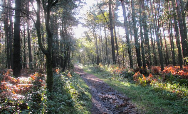
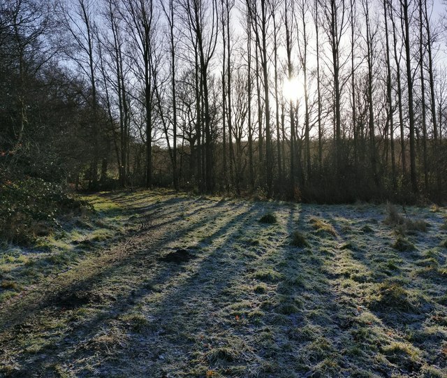
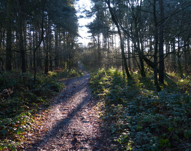
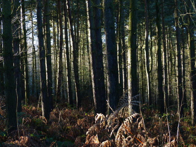
The woodland is predominantly composed of a mix of deciduous and coniferous trees, creating a diverse and vibrant ecosystem. The variety of tree species includes oak, beech, birch, and pine. This combination provides a rich habitat for a wide range of flora and fauna.

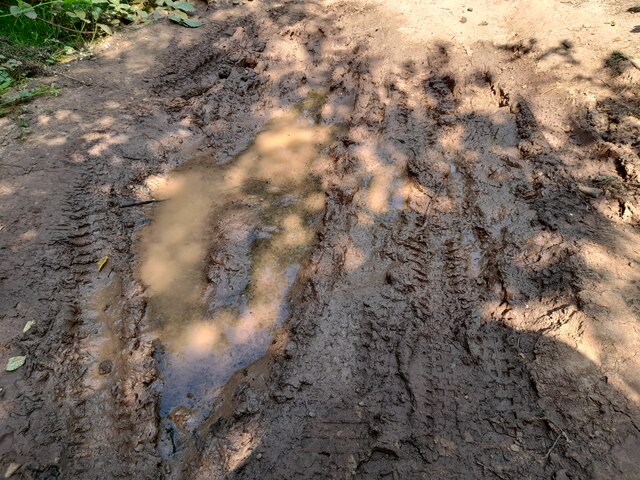
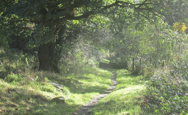
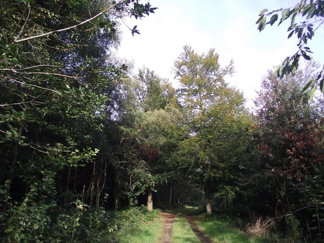
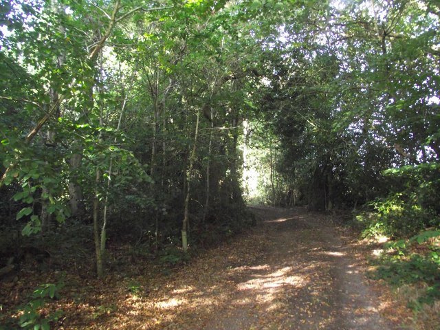
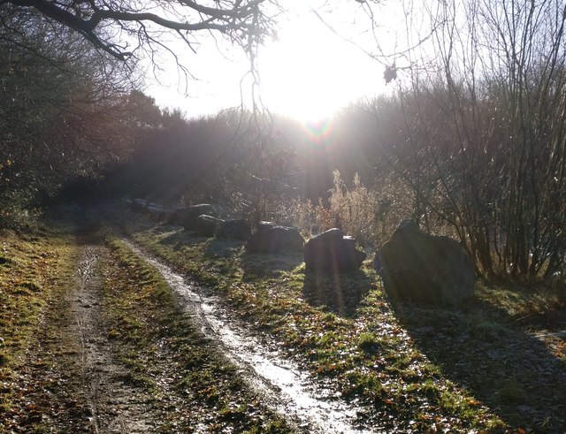
Walking through Burrow Wood, visitors can enjoy the tranquil atmosphere and immerse themselves in nature. The wood is crisscrossed by a network of well-maintained footpaths and trails, making it easily accessible to visitors of all ages and abilities. These paths offer the opportunity to explore the different sections of the woodland and discover its hidden treasures.

Wildlife is abundant in Burrow Wood, with various bird species, mammals, and insects calling it home. Birdwatchers can spot woodpeckers, owls, and a variety of songbirds. If lucky, visitors might even catch a glimpse of deer or foxes that roam the area.

Throughout the year, the wood undergoes seasonal changes, each offering its own unique beauty. In spring, the woodland floor is carpeted with colorful wildflowers and bluebells, creating a vibrant display. In autumn, the trees transform into a stunning palette of golden, red, and orange hues, providing a breathtaking sight.

Burrow Wood is not only a haven for nature lovers but also serves as an important ecological site, contributing to the overall biodiversity of Leicestershire. Whether it's for a peaceful walk, birdwatching, or simply connecting with nature, Burrow Wood offers a delightful experience for visitors of all interests.

If you have any feedback on the listing, please let us know in the comments section below.

Burrow Wood Images

Images are sourced within 2km of 52.72627/-1.2958249 or Grid Reference SK4714. Thanks to Geograph Open Source API. All images are credited.

Puddle, Bardon Hill Despite the very hot and dry weather this puddle was encountered on one of the footpaths on Bardon Hill.
Puddle, Bardon Hill
Despite the very hot and dry weather this puddle was encountered on one of the footpaths on Bardon Hill.
Charnwood Forrest Farm Entrance to the farm shop
Charnwood Forrest Farm
Entrance to the farm shop
The Copt Oak The Copt Oak pub is operated by Rotisserie Pub Restaurants, part of the Marston's estate. The emphasis is very much on dining. The building has evidently had a makeover since this view 15 years earlier: <a href="https://www.geograph.org.uk/photo/188366">SK4812 : Copt Oak</a>.
The Copt Oak
The Copt Oak pub is operated by Rotisserie Pub Restaurants, part of the Marston's estate. The emphasis is very much on dining. The building has evidently had a makeover since this view 15 years earlier: SK4812 : Copt Oak.
Copt Oak public house, Whitwick Road
Copt Oak youth hostel and church When Copt Oak's school closed it became a youth hostel, self-catering only at weekends and school holidays. Water was collected from the village stand-pipe by the volunteer wardens
Copt Oak youth hostel and church
When Copt Oak's school closed it became a youth hostel, self-catering only at weekends and school holidays. Water was collected from the village stand-pipe by the volunteer wardens
Footpath to Bardon Hill Lovely track through the trees.
Footpath to Bardon Hill
Lovely track through the trees.
Footpath near Upper Greenhill Farm Bardon Hill walk.
Footpath near Upper Greenhill Farm
Bardon Hill walk.
St Peter's church
St Peter's church
A wet M1, southbound The M1 is a north–south motorway connecting London to Leeds, where it joins the A1(M) near Aberford. It was the first motorway to be completed in the United Kingdom.
The motorway is 193 miles long and was constructed in four phases. Most of the motorway was opened between 1959 and 1968 but the southern end was extended in 1977 and the northern end was extended in 1999.
A wet M1, southbound
The M1 is a north–south motorway connecting London to Leeds, where it joins the A1(M) near Aberford. It was the first motorway to be completed in the United Kingdom. The motorway is 193 miles long and was constructed in four phases. Most of the motorway was opened between 1959 and 1968 but the southern end was extended in 1977 and the northern end was extended in 1999.
Overbridge, M1
Overbridge, M1
A wet M1, southbound The M1 is a north–south motorway connecting London to Leeds, where it joins the A1(M) near Aberford. It was the first motorway to be completed in the United Kingdom.
The motorway is 193 miles long and was constructed in four phases. Most of the motorway was opened between 1959 and 1968 but the southern end was extended in 1977 and the northern end was extended in 1999.
A wet M1, southbound
The M1 is a north–south motorway connecting London to Leeds, where it joins the A1(M) near Aberford. It was the first motorway to be completed in the United Kingdom. The motorway is 193 miles long and was constructed in four phases. Most of the motorway was opened between 1959 and 1968 but the southern end was extended in 1977 and the northern end was extended in 1999.
Track through Poultney Wood Part of Ulverscroft Nature Reserve, owned by the National Trust and managed by the Leicestershire & Rutland Wildlife Trust.
Track through Poultney Wood
Part of Ulverscroft Nature Reserve, owned by the National Trust and managed by the Leicestershire & Rutland Wildlife Trust.
Track through Fox Covert The woodland is part of Ulverscroft Nature Reserve.
Track through Fox Covert
The woodland is part of Ulverscroft Nature Reserve.
Low winter sunlight along the Ivanhoe Way The Ivanhoe Way has just left Vercor Close in Agar Nook, and is heading south towards Bardon Hill.
Low winter sunlight along the Ivanhoe Way
The Ivanhoe Way has just left Vercor Close in Agar Nook, and is heading south towards Bardon Hill.
The Ivanhoe Way towards Bardon Hill
Path through Bardon Hill Wood
Bardon Hill Wood This wood is on the northern slope of Bardon Hill.
Bardon Hill Wood
This wood is on the northern slope of Bardon Hill.
Show me another place!

Burrow Wood is located at Grid Ref: SK4714 (Lat: 52.72627, Lng: -1.2958249)

Administrative County: Leicestershire

District: North West Leicestershire

Police Authority: Leicestershire

What 3 Words

///rots.dignify.hexes. Near Shepshed, Leicestershire

Related Wikis

Charley Woods

Charley Woods is a 26.8 hectares (66 acres) nature reserve north of Copt Oak in Leicestershire. It is owned and managed by the Leicestershire and Rutland...

Charley, Leicestershire

Charley is a civil parish located in the North West Leicestershire district of Leicestershire, England. According to the 2001 census, it had a population...

Charley Priory

Charley Priory was a small former priory in Leicestershire, England. == History == The exact date Charley Priory was established is unknown, but is at...

Oaks in Charnwood

Oaks in Charnwood is a hamlet of scattered houses in the English county of Leicestershire within the Charnwood Forest. Oaks in Charnwood is located in...

Abbots Oak

Abbots Oak is a hamlet near Coalville, Leicestershire, comprising a cluster of dwellings near Warren Hills, either side of the road between Whitwick and...

Charnwood Lodge

Charnwood Lodge is a 134.2-hectare (332-acre) biological and geological Site of Special Scientific Interest in Charnwood Forest, east of Coalville in Leicestershire...

Holly Rock Fields

Holly Rock Fields is a 3.9 hectares (9.6 acres) biological Site of Special Scientific Interest east of Coalville in Leicestershire.This is a nationally...
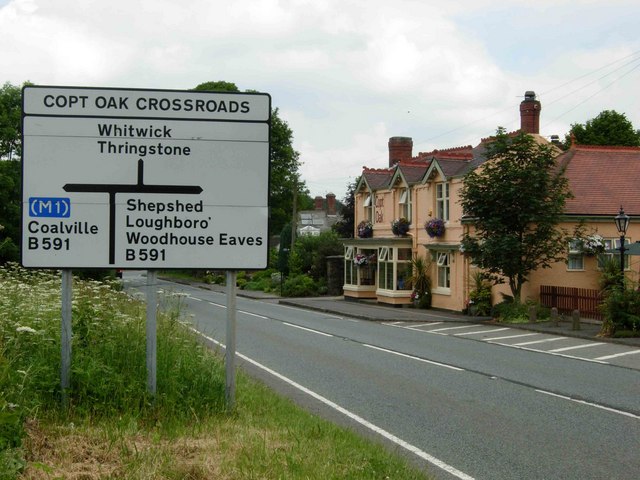
Copt Oak

Copt Oak is a hamlet in Leicestershire, England. It is located in the North West Leicestershire district near the large village of Markfield and the rural...

Nearby Amenities

Located within 500m of 52.72627,-1.2958249
Power: tower
Source: Bing
Lat/Long: 52.7234093/-1.2924089
Power: tower
Source: Bing
Lat/Long: 52.7257125/-1.2897276
Charley Hall
Place: isolated_dwelling
Source: Bing
Lat/Long: 52.7280697/-1.2914105
Charley Mill
Place: isolated_dwelling
Source: Bing
Lat/Long: 52.7232949/-1.2968553
Little Hill
Place: locality
Source: Bing
Lat/Long: 52.7300805/-1.2966104
Barrier: kissing_gate
Material: wood
Source: survey
Lat/Long: 52.7256106/-1.298318
Barrier: kissing_gate
Lat/Long: 52.7256565/-1.2984802
Bench
Lat/Long: 52.7258086/-1.2985586
Ford: yes
Lat/Long: 52.7280076/-1.2938416
Ford: yes
Lat/Long: 52.7267147/-1.2933651
The data included in this document is from www.openstreetmap.org. The data is made available under ODbL.

Have you been to Burrow Wood?

Leave your review of Burrow Wood below (or comments, questions and feedback).