Drayton

Settlement in Berkshire Vale of White Horse

England

Drayton

Bridleway heading to Drayton From Landmead Farm the bridleway heading to Drayton
Bridleway heading to Drayton Credit: Shaun Ferguson

Drayton is a charming village located in the county of Berkshire, England. Situated approximately 5 miles west of Abingdon, it is nestled in the beautiful countryside and offers a peaceful and picturesque setting.

The village of Drayton boasts a rich history that dates back to the Saxon era, with evidence of human habitation found in the area since ancient times. It is home to several historic buildings, including the Church of St. Peter, a stunning medieval church that stands as a testament to the village's heritage.

With a population of around 1,500 residents, Drayton provides a close-knit community atmosphere. The village offers a range of amenities, including a local pub, village hall, and a primary school. It also benefits from easy access to nearby towns such as Abingdon, Didcot, and Oxford, providing residents with additional amenities and employment opportunities.

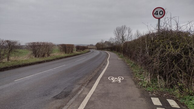
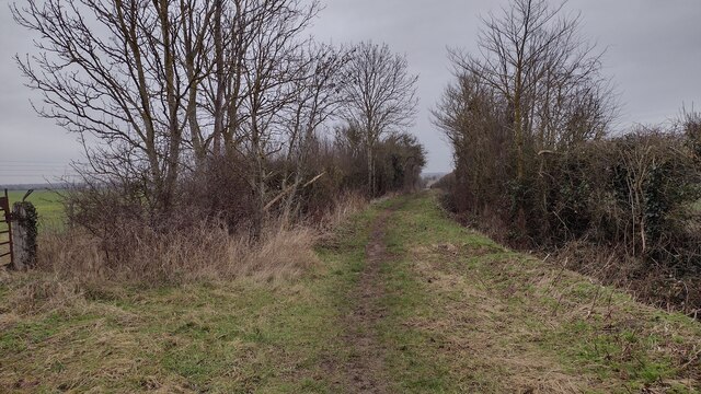
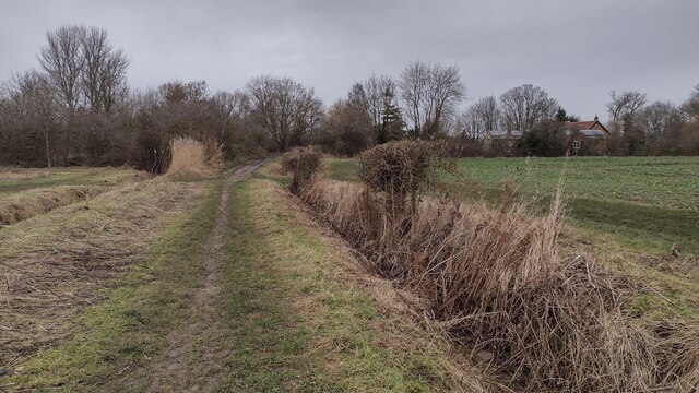
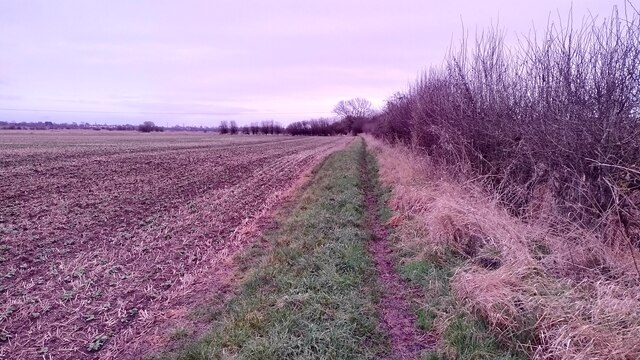
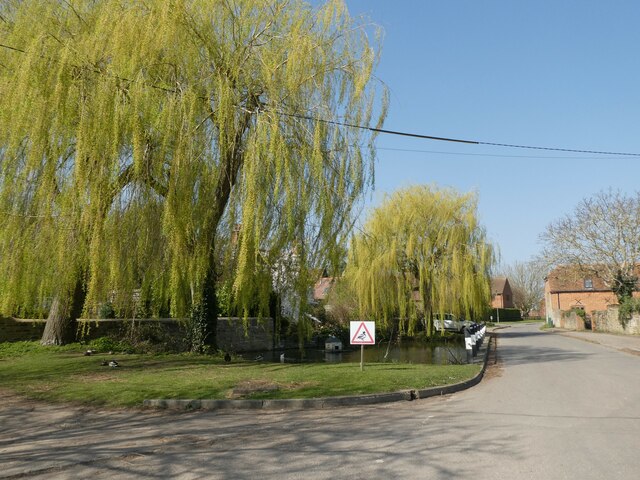
Nature lovers will appreciate the abundance of natural beauty surrounding Drayton. The village is enveloped by lush green fields, rolling hills, and meandering rivers, making it an ideal location for outdoor activities such as walking, cycling, and birdwatching.

Transport links in Drayton are well-established, with regular bus services connecting the village to neighboring towns and villages. The A34 road is also easily accessible, providing convenient connections to major cities like Oxford and Winchester.

Overall, Drayton offers a tranquil and idyllic place to live, combining a rich historical heritage, a close community spirit, and stunning natural surroundings.

If you have any feedback on the listing, please let us know in the comments section below.

Drayton Images

Images are sourced within 2km of 51.644471/-1.3127753 or Grid Reference SU4794. Thanks to Geograph Open Source API. All images are credited.

Bridleway heading to Drayton From Landmead Farm the bridleway heading to Drayton
Bridleway heading to Drayton
From Landmead Farm the bridleway heading to Drayton
From Landmead Farm the bridleway heading to Drayton Bridleway heading to Drayton
From Landmead Farm the bridleway heading to Drayton
Bridleway heading to Drayton
Bridleway towards Drayton Copse From Drayton the bridleway towards Drayton Copse
Bridleway towards Drayton Copse
From Drayton the bridleway towards Drayton Copse
Drayton Road Drayton Road B4017 heading to Abingdon
Drayton Road
Drayton Road B4017 heading to Abingdon
Restricted Byway Restricted Byway heading to New Cut Mill
Restricted Byway
Restricted Byway heading to New Cut Mill
Restricted Byway Restricted Byway nearing New Cut Mill
Restricted Byway
Restricted Byway nearing New Cut Mill
Informal Path Informal path joins the bridleway to Drayton at the left hedge line
Informal Path
Informal path joins the bridleway to Drayton at the left hedge line
High Street, Drayton
St Peter, Drayton: late March 2022
Looking north-west in Sutton Wick Lane
St Peter, Drayton: VC commemoration For more about Mott see <span class="nowrap"><a title="http://vconline.org.uk/edward-j-mott-vc/4587677611.html" rel="nofollow ugc noopener" href="http://vconline.org.uk/edward-j-mott-vc/4587677611.html">Link</a><img style="margin-left:2px;" alt="External link" title="External link - shift click to open in new window" src="https://s1.geograph.org.uk/img/external.png" width="10" height="10"/></span>
St Peter, Drayton: VC commemoration
For more about Mott see LinkExternal link
St Peter, Drayton: porch
St Peter, Drayton: tower
St Peter, Drayton: churchyard
St Peter, Drayton: south door
St Peter, Drayton: stained glass window (a)
St Peter, Drayton: stained glass window (b)
St Peter, Drayton: stained glass window (c)
Show me another place!

Drayton is located at Grid Ref: SU4794 (Lat: 51.644471, Lng: -1.3127753)

Administrative County: Oxfordshire

District: Vale of White Horse

Police Authority: Thames Valley

What 3 Words

///annual.washing.translate. Near Steventon, Oxfordshire

Nearby Locations

Drayton Drayton

Related Wikis

Drayton, Vale of White Horse

Drayton is a village and civil parish about 2 miles (3 km) south of Abingdon, Oxfordshire. It was part of Berkshire until the 1974 boundary changes transferred...

Sutton Wick

Sutton Wick is a hamlet contiguous with the village of Drayton in Oxfordshire, England. It was part of Berkshire until the 1974 boundary changes transferred...

Sutton Wick air crash

The Sutton Wick air crash occurred on 5 March 1957 when a Blackburn Beverley C Mk 1 heavy transport aircraft, serial number XH117, of 53 Squadron Royal...

Milton, Vale of White Horse

Milton is a village and civil parish about 3 miles (5 km) west of Didcot and a similar distance south of Abingdon. The 2011 Census recorded the parish...

Nearby Amenities

Located within 500m of 51.644471,-1.3127753
Mini Roundabout
Direction: clockwise
Lat/Long: 51.6439659/-1.3128173
Drayton
Place: village
Wikidata: Q2792527
Wikipedia: en:Drayton, Vale of White Horse
Lat/Long: 51.6441906/-1.3120932
Bus Stop
The Green
Bus: yes
Naptan AtcoCode: 340000204GOP
Naptan Bearing: S
Naptan CommonName: Green
Naptan Indicator: Opposite Post Office
Naptan Landmark: Post Office
Naptan NaptanCode: oxfajtdj
Naptan Street: Abingdon Road
Naptan Verified: no
Public Transport: platform
Source: naptan_import
Lat/Long: 51.6446084/-1.3126428
Bus Stop
The Green
Bus: yes
Naptan AtcoCode: 340000204GPO
Naptan Bearing: N
Naptan CommonName: Green
Naptan Indicator: Outside Post Office
Naptan Landmark: Post Office
Naptan NaptanCode: oxfajtdg
Naptan Street: Abingdon Road
Naptan Verified: no
Public Transport: platform
Source: naptan_import
Lat/Long: 51.6443887/-1.3131009
Bus Stop
High Street
Bus: yes
Naptan AtcoCode: 340000643CH
Naptan Bearing: E
Naptan CommonName: High Street
Naptan Indicator: Opposite Halls Close
Naptan Landmark: Halls Close
Naptan NaptanCode: oxfapwtp
Naptan Street: High Street
Naptan Verified: no
Public Transport: platform
Source: naptan_import
Lat/Long: 51.6435165/-1.3073987
High Street
Naptan AtcoCode: 340000643OCH
Naptan Bearing: W
Naptan BusStopType: CUS
Naptan CommonName: High Street
Naptan Indicator: Halls Close Corner
Naptan Landmark: Halls Close
Naptan NaptanCode: oxfapwam
Naptan Street: High Street
Naptan Verified: no
Source: naptan_import
Lat/Long: 51.6434471/-1.3078189
Bus Stop
East Way
Bus: yes
Naptan AtcoCode: 340001991CNR
Naptan Bearing: S
Naptan CommonName: East Way
Naptan Indicator: Corner
Naptan Landmark: Doctors Surgery
Naptan NaptanCode: oxfgjmjp
Naptan Street: Steventon Road
Naptan Verified: no
Public Transport: platform
Source: naptan_import
Lat/Long: 51.6407502/-1.3140596
Bus Stop
East Way
Bus: yes
Naptan AtcoCode: 340001991OPP
Naptan Bearing: N
Naptan CommonName: East Way
Naptan Indicator: Opposite
Naptan Landmark: Doctors Surgery
Naptan NaptanCode: oxfgjpag
Naptan Street: Steventon Road
Naptan Verified: no
Public Transport: platform
Source: naptan_import
Lat/Long: 51.6412642/-1.3143119
Pub
Red Lion
Lat/Long: 51.6451218/-1.312776
Barrier: bollard
Lat/Long: 51.644488/-1.3131905
Post Office
Drayton Post Office
Addr Country: GB
Addr Postcode: OX14 4JA
Brand: Post Office
Brand Wikidata: Q1783168
Contact Website: https://www.postoffice.co.uk/branch-finder/2261375/drayton
Ref Pol Id: 8572
Lat/Long: 51.6445963/-1.3129571
The Sitting Room
Addr City: Drayton
Addr Housename: The Sitting Room
Addr Housenumber: 22
Addr Postcode: OX14 4JL
Addr Street: High Street
Opening Hours: Mo-Sa 10:00-17:00
Phone: +441235 531738
Shop: furniture
Website: https://www.thesittingroom.co.uk/
Lat/Long: 51.6435284/-1.3113555
Drayton Village Hall
Building: yes
Lat/Long: 51.6413016/-1.3163405
Barrier: kissing_gate
Lat/Long: 51.6442131/-1.3092788
Barrier: kissing_gate
Lat/Long: 51.6445917/-1.309775
Fixme: continue
Lat/Long: 51.6414567/-1.3106429
Crossing
Crossing: uncontrolled
Crossing Ref: zebra
Source: Bing
Lat/Long: 51.6462769/-1.3121822
The data included in this document is from www.openstreetmap.org. The data is made available under ODbL.

Have you been to Drayton?

Leave your review of Drayton below (or comments, questions and feedback).