Dumbleton's Copse

Wood, Forest in Hampshire Eastleigh

England

Dumbleton's Copse

Plaque on a bench Located alongside the B3036, Lower Northam Road in Hedge End. 
The plaque reads: 'Site of Toll Gate. To commemorate the freeing of the toll road (Hedge End - Southampton) on 16th May 1929. Presented by R Pugh, Esq, 1979'.
Wider view: <a href="https://www.geograph.org.uk/photo/4656599">SU4913 : Commemorative bench, Hedge End</a>.
Plaque on a bench Credit: Richard Dorrell

Dumbleton's Copse is a picturesque wood located in the county of Hampshire, England. Situated near the village of Dumbleton, the copse covers an area of approximately 20 acres and is known for its natural beauty and diverse range of flora and fauna.

The copse is predominantly made up of deciduous trees, including oak, beech, and ash, which form a dense canopy, providing shade and creating a tranquil atmosphere. The woodland floor is covered with a rich carpet of wildflowers, such as bluebells and primroses, adding splashes of color to the greenery.

Dumbleton's Copse is home to a variety of wildlife, making it a popular spot for nature enthusiasts and birdwatchers. The wood is a haven for many bird species, including thrushes, woodpeckers, and owls, which can be heard and spotted throughout the year. Squirrels can often be seen darting between the trees, and if one is lucky, it is possible to catch a glimpse of a deer grazing in the clearing.

The copse is crisscrossed by a network of footpaths, allowing visitors to explore its enchanting surroundings. These paths lead to a small pond, which acts as a watering hole for the woodland creatures and attracts a variety of insects and amphibians.

Dumbleton's Copse offers a peaceful retreat from the hustle and bustle of everyday life, providing a place to reconnect with nature and enjoy the tranquility of the Hampshire countryside. Whether it is a leisurely stroll, birdwatching, or simply enjoying the beauty of the wood, Dumbleton's Copse offers something for everyone.

If you have any feedback on the listing, please let us know in the comments section below.

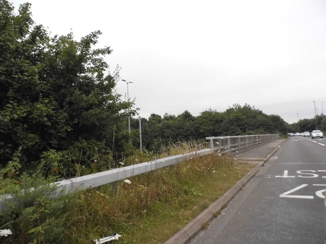
Dumbleton's Copse Images

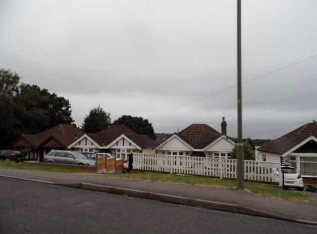
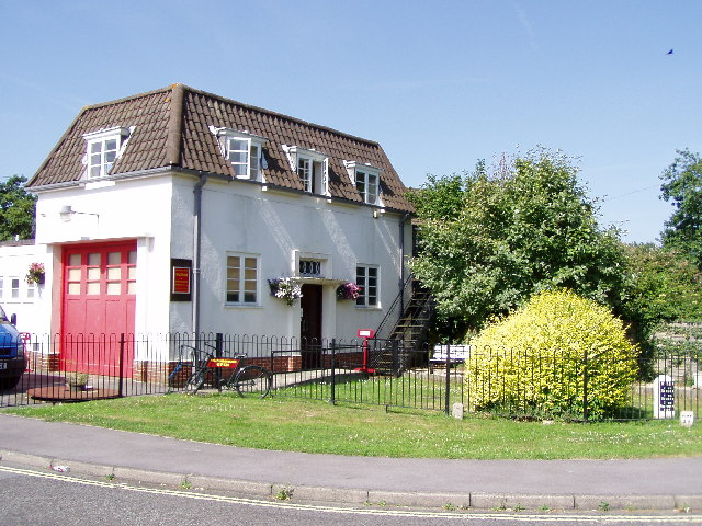
Images are sourced within 2km of 50.906218/-1.3259024 or Grid Reference SU4712. Thanks to Geograph Open Source API. All images are credited.

Plaque on a bench Located alongside the B3036, Lower Northam Road in Hedge End. 
The plaque reads: 'Site of Toll Gate. To commemorate the freeing of the toll road (Hedge End - Southampton) on 16th May 1929. Presented by R Pugh, Esq, 1979'.
Wider view: <a href="https://www.geograph.org.uk/photo/4656599">SU4913 : Commemorative bench, Hedge End</a>.
Plaque on a bench
Located alongside the B3036, Lower Northam Road in Hedge End. The plaque reads: 'Site of Toll Gate. To commemorate the freeing of the toll road (Hedge End - Southampton) on 16th May 1929. Presented by R Pugh, Esq, 1979'. Wider view: SU4913 : Commemorative bench, Hedge End.
Commemorative bench, Hedge End Located alongside the B3036, Lower Northam Road in Hedge End, a plaque on the bench commemorates the freeing of the Hedge End to Southampton toll road in 1929.
 Detail: <a href="https://www.geograph.org.uk/photo/4656590">SU4913 : Plaque on a bench</a>.
Commemorative bench, Hedge End
Located alongside the B3036, Lower Northam Road in Hedge End, a plaque on the bench commemorates the freeing of the Hedge End to Southampton toll road in 1929. Detail: SU4913 : Plaque on a bench.
M27 gantry at junction 7
M27 gantry approaching junction 8
Bitterne Road East allotments Off Upper Deacon Road the Bitterne Road East allotments
Bitterne Road East allotments
Off Upper Deacon Road the Bitterne Road East allotments
2016: a year on Geograph (Day 42) Top end of Hinkler Road
2016: a year on Geograph (Day 42)
Top end of Hinkler Road
Demolishing a house
Demolishing a house
The M27 from Charles Watts Way This is junction 7 at Hedge End
The M27 from Charles Watts Way
This is junction 7 at Hedge End
Charles Watts Way crossing the M27
Roundabout on the M27 junction 7
Charles Watts Way, Hedge End
Shops on Lower Northam Road, Hedge End
Barclays Bank on Lower Northam Road
Green on Lower Northam Road, Hedge End
Bungalows on Upper Northam Road, Hedge End
Upper Northam Road, Hedge End
Show me another place!

Dumbleton's Copse is located at Grid Ref: SU4712 (Lat: 50.906218, Lng: -1.3259024)

Administrative County: Hampshire

District: Eastleigh

Police Authority: Hampshire

What 3 Words

///hope.pots.fall. Near Hedge End, Hampshire

Related Wikis

Netley Common

Netley Common is a 12.8-hectare (32-acre) Local Nature Reserve in Southampton in Hampshire. It is owned by Hampshire County Council and managed by Hampshire...

Thornhill, Southampton

Thornhill is a suburb of Southampton, United Kingdom, situated on the eastern border of the city and bounded by three major roads. According to the 2001...
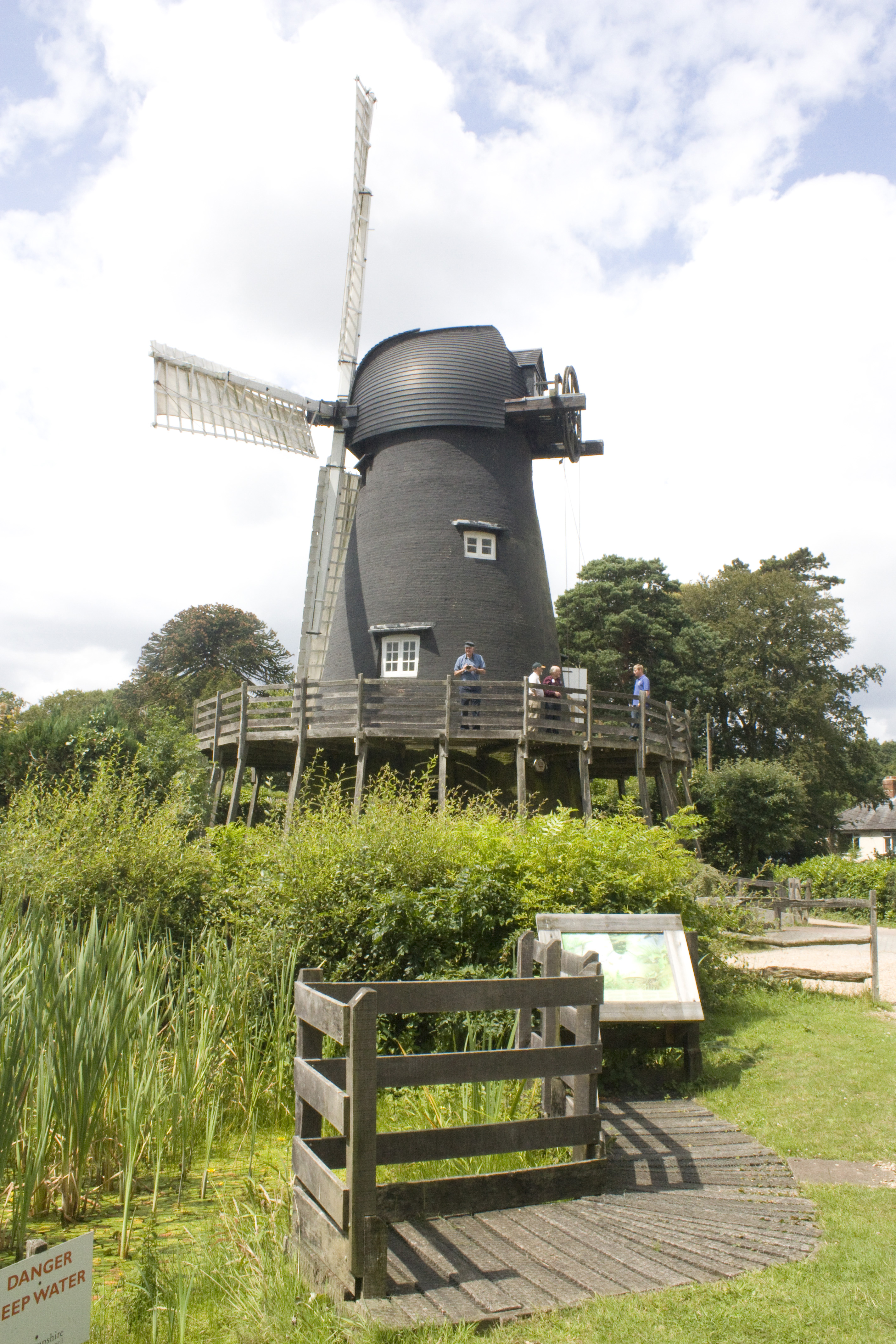
Bursledon Windmill

Bursledon Windmill is a Grade II* listed windmill in Bursledon, Hampshire, England which has been restored to working order. == Description == Bursledon...

Sholing F.C.

Sholing Football Club is an English football club based in Sholing, Southampton, Hampshire. Formerly known as Vosper Thorneycroft FC and later VTFC the...

Woodlands Community College

Woodlands Community College is a mixed secondary school located in east Southampton, Hampshire, in the south of England. It was officially opened as a...

Hedge End

Hedge End is a town and civil parish in Hampshire, England. Situated to the east of the City of Southampton, it adjoins the districts of West End and Botley...

West End, Hampshire

West End is a parish in Hampshire in the borough of Eastleigh, five miles (8.0 km) east of the city of Southampton. The village of West End is small and...

Harefield, Southampton

Harefield is a suburb and Electoral Ward near Bitterne in Southampton, England. Harefield Ward consists of a small council housing estate built around...

Related Videos

The Hundred Vlog | Day 24 - Travel day to Manchester!

Day 24 of my Hundred vlog - Follow Me - Facebook page - https://www.facebook.com/amandawello Instagram page ...

Passing by Bursledon -Village in England #beautiful #seaview #seaside #traintravel #ytshorts

shots #youtubeshorts #reels #beautiful #beauty #travel #nature #sea #peace #beauty #hampshire #happiness #travel #traveling ...

Aero Executive Travel #Southampton

Our #luxury #Mercedes S Class at the #Hilton Ageas Bowl Southampton.

The Hundred Vlog | Day 27 - Travel day to Southampton & Training at the Ageas Bowl!

Day 27 of my Hundred vlog - Follow Me - Facebook page - https://www.facebook.com/amandawello Instagram page ...

Nearby Amenities

Located within 500m of 50.906218,-1.3259024
Surface: asphalt
Traffic Calming: cushion
Lat/Long: 50.907679/-1.3291485
Mini Roundabout
Direction: clockwise
Lat/Long: 50.9070246/-1.3325777
Bus: yes
Public Transport: stop_position
Lat/Long: 50.9030593/-1.3307197
Power: tower
Ref: M 80
Source: interpolation
Lat/Long: 50.9068468/-1.3224992
Power: tower
Ref: M 81
Source: interpolation
Lat/Long: 50.9059439/-1.3251786
Bus: yes
Public Transport: stop_position
Lat/Long: 50.9041635/-1.3298535
Post Box
Collection Plate: CP1
Collection Times: Mo-Fr 18:00; Sa 11:30
Operator: Royal Mail
Operator Wikidata: Q638098
Post Box Type: pillar
Ref: SO19 641
Royal Cypher: EIIR
Royal Cypher Wikidata: Q33102113
Lat/Long: 50.9042336/-1.3320857
Telephone
Addr Street: Junction Warburton Road / Tunstall Road
Booth: KX100
Covered: booth
Payment Coins: yes
Phone: +44 23 8040 4186
Lat/Long: 50.904171/-1.3320957
Post Box
Collection Plate: CP1D
Collection Times: Mo-Fr 09:00; Sa 07:00
Operator: Royal Mail
Operator Wikidata: Q638098
Post Box Type: pillar
Ref: SO19 602D
Royal Cypher: EIIR
Royal Cypher Wikidata: Q33102113
Lat/Long: 50.9076601/-1.3293796
Booth: K6
Removed Amenity: telephone
Lat/Long: 50.9076721/-1.329357
Hinkler Road Mini Mart
Brand: Premier
Brand Wikidata: Q7240340
Opening Hours: Mo-Sa 7:00-21:30; Su 8:00-20:00
Shop: convenience
Lat/Long: 50.9096853/-1.3272254
Crossing
Crossing: uncontrolled
Crossing Island: no
Crossing Markings: surface
Traffic Calming: table
Lat/Long: 50.9070578/-1.3310482
Barrier: cycle_barrier
Lat/Long: 50.9071227/-1.3310892
Recycling
Lat/Long: 50.9083473/-1.3317678
Bus: yes
Public Transport: stop_position
Lat/Long: 50.9093359/-1.3277049
Barrier: kissing_gate
Lat/Long: 50.9043878/-1.3272847
Barrier: kissing_gate
Lat/Long: 50.903806/-1.3265894
Bus Stop
Ellis Road
Bus: yes
Naptan AtcoCode: 1980SN120615
Naptan Bearing: NE
Naptan NaptanCode: sohjpaw
Public Transport: platform
Lat/Long: 50.9077825/-1.3290402
Surface: asphalt
Traffic Calming: cushion
Lat/Long: 50.9080536/-1.3285515
Bus Stop
Ellis Road
Bus: yes
Naptan AtcoCode: 1980SN120614
Naptan Bearing: SW
Naptan NaptanCode: sohjpat
Public Transport: platform
Lat/Long: 50.9076276/-1.329146
Surface: asphalt
Traffic Calming: cushion
Lat/Long: 50.9101638/-1.3276915
Bus Stop
Holcroft Road
Bus: yes
Naptan AtcoCode: 1980HA120613
Naptan Bearing: NE
Naptan NaptanCode: sohjpdp
Public Transport: platform
Lat/Long: 50.9093416/-1.3277715
Bus Stop
Holcroft Road
Bus: yes
Naptan AtcoCode: 1980HA120612
Naptan Bearing: SW
Naptan NaptanCode: sohjpdt
Public Transport: platform
Lat/Long: 50.9092239/-1.3276598
Surface: asphalt
Traffic Calming: cushion
Lat/Long: 50.9092207/-1.3277334
Surface: asphalt
Traffic Calming: cushion
Lat/Long: 50.9074388/-1.3296525
Bus Stop
Chettle Road
Bench: yes
Bin: no
Bus: yes
Lit: no
Naptan AtcoCode: 1980SN120609
Naptan Bearing: N
Naptan NaptanCode: sohjmwa
Public Transport: platform
Shelter: yes
Tactile Paving: no
Lat/Long: 50.9068055/-1.3327616
Bus Stop
Dumbleton's Towers
Bench: yes
Bin: yes
Bus: yes
Naptan AtcoCode: 1980SN120708
Naptan Bearing: NW
Naptan NaptanCode: sohjmwg
Public Transport: platform
Shelter: yes
Tactile Paving: no
Lat/Long: 50.9045568/-1.3324922
Bus Stop
Dumbleton's Towers
Bench: no
Bin: yes
Bus: yes
Naptan AtcoCode: 1980SN120707
Naptan Bearing: SE
Naptan NaptanCode: sohjmwm
Public Transport: platform
Shelter: no
Tactile Paving: no
Lat/Long: 50.9044013/-1.3319874
Bus: yes
Public Transport: stop_position
Lat/Long: 50.9045454/-1.332386
Bus Stop
Chettle Road
Bench: no
Bin: no
Bus: yes
Naptan AtcoCode: 1980SN120709
Naptan Bearing: S
Naptan NaptanCode: sohjmwd
Public Transport: platform
Shelter: no
Tactile Paving: no
Lat/Long: 50.9065989/-1.3327234
Bus Stop
Burgoyne Road
Bus: yes
Naptan AtcoCode: 1980SN121059
Naptan Bearing: W
Naptan NaptanCode: sohjpad
Public Transport: platform
Lat/Long: 50.9029838/-1.3306904
Bus Stop
Meredith Towers
Bus: yes
Naptan AtcoCode: 1980SNA09412
Naptan Bearing: S
Naptan NaptanCode: sohjwad
Public Transport: platform
Lat/Long: 50.9041314/-1.3298012
Crossing
Crossing: uncontrolled
Crossing Island: no
Crossing Markings: zebra
Crossing Ref: pelican
Kerb: flush
Tactile Paving: yes
Traffic Calming: table
Lat/Long: 50.90969/-1.3276459
Bus: yes
Public Transport: stop_position
Lat/Long: 50.9076644/-1.3291792
Surface: asphalt
Traffic Calming: cushion
Lat/Long: 50.9069871/-1.3323241
Surface: asphalt
Traffic Calming: cushion
Lat/Long: 50.9071708/-1.330531
Surface: asphalt
Traffic Calming: cushion
Lat/Long: 50.9084698/-1.3281301
Tourism: picnic_site
Lat/Long: 50.9072652/-1.3327428
Eversley B&B
Tourism: guest_house
Lat/Long: 50.9095845/-1.3237707
The Co-operative Food
Addr City: Southampton
Brand: The Co-operative Food
Brand Wikidata: Q107617274
Phone: +44 2380 402115
Shop: convenience
Lat/Long: 50.9041583/-1.3321733
Bus: yes
Public Transport: stop_position
Lat/Long: 50.9043666/-1.3320854
Bus: yes
Public Transport: stop_position
Lat/Long: 50.9066497/-1.3327578
Bus: yes
Public Transport: stop_position
Lat/Long: 50.9067477/-1.3327107
Bus: yes
Public Transport: stop_position
Lat/Long: 50.9077579/-1.3290029
Bus: yes
Public Transport: stop_position
Lat/Long: 50.9092369/-1.3277291
Barrier: bollard
Lat/Long: 50.9106287/-1.325173
Barrier: kissing_gate
Lat/Long: 50.9040102/-1.3279249
Barrier: kissing_gate
Lat/Long: 50.9041979/-1.3237766
Barrier: kissing_gate
Lat/Long: 50.902852/-1.3231837
Barrier: kissing_gate
Lat/Long: 50.9051886/-1.3278739
Barrier: kissing_gate
Lat/Long: 50.905121/-1.3278949
Waste Basket
Waste: dog_excrement
Lat/Long: 50.9042135/-1.3205327
Board Type: history
Information: board
Tourism: information
Lat/Long: 50.904106/-1.3209904
Information: map
Tourism: information
Lat/Long: 50.9040788/-1.3205023
Bench
Backrest: no
Material: wood
Lat/Long: 50.903407/-1.3229863
Bench
Backrest: no
Material: wood
Lat/Long: 50.9036458/-1.3240631
Barrier: kissing_gate
Lat/Long: 50.9042794/-1.3242714
Barrier: kissing_gate
Lat/Long: 50.9028271/-1.323501
Barrier: kissing_gate
Lat/Long: 50.9028273/-1.3249747
Barrier: kissing_gate
Lat/Long: 50.9032788/-1.3259807
Bench
Backrest: no
Material: wood
Lat/Long: 50.9028472/-1.325172
Barrier: kissing_gate
Lat/Long: 50.9042823/-1.3255731
Barrier: bollard
Lat/Long: 50.9055304/-1.3303788
Board Type: nature
Information: board
Tourism: information
Lat/Long: 50.9040559/-1.327819
The data included in this document is from www.openstreetmap.org. The data is made available under ODbL.

Have you been to Dumbleton's Copse?

Leave your review of Dumbleton's Copse below (or comments, questions and feedback).