Hid's Copse

Wood, Forest in Berkshire Vale of White Horse

England

Hid's Copse

Fields north of Youlbury Wood
Fields north of Youlbury Wood Credit: Nekisa Gholami-Babaahmady

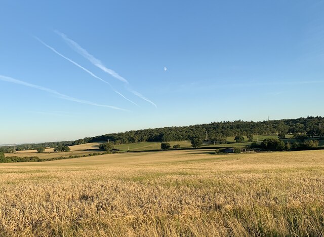
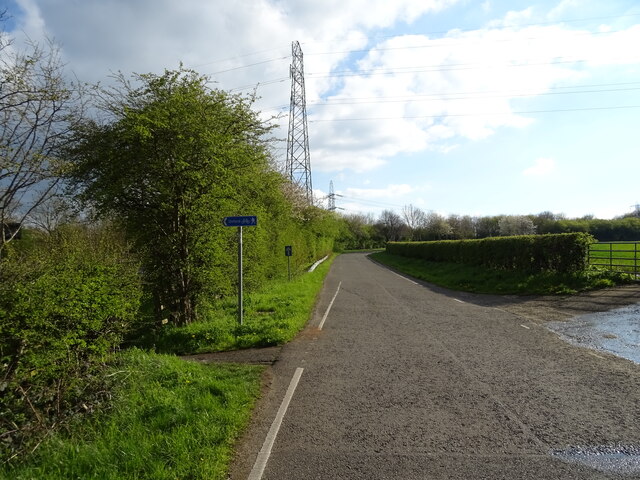
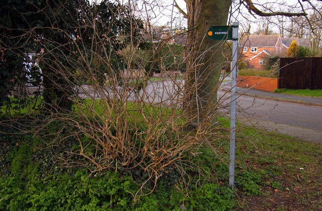
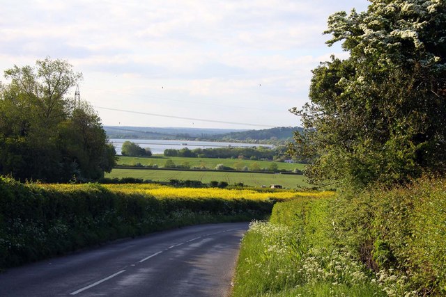
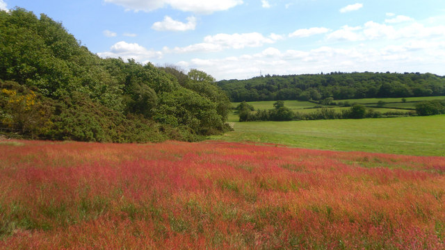
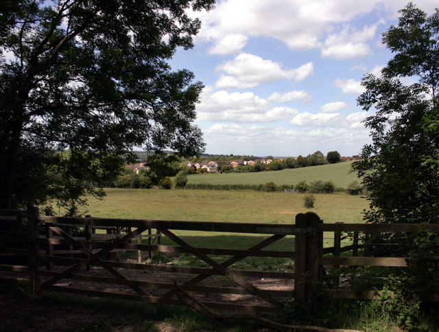
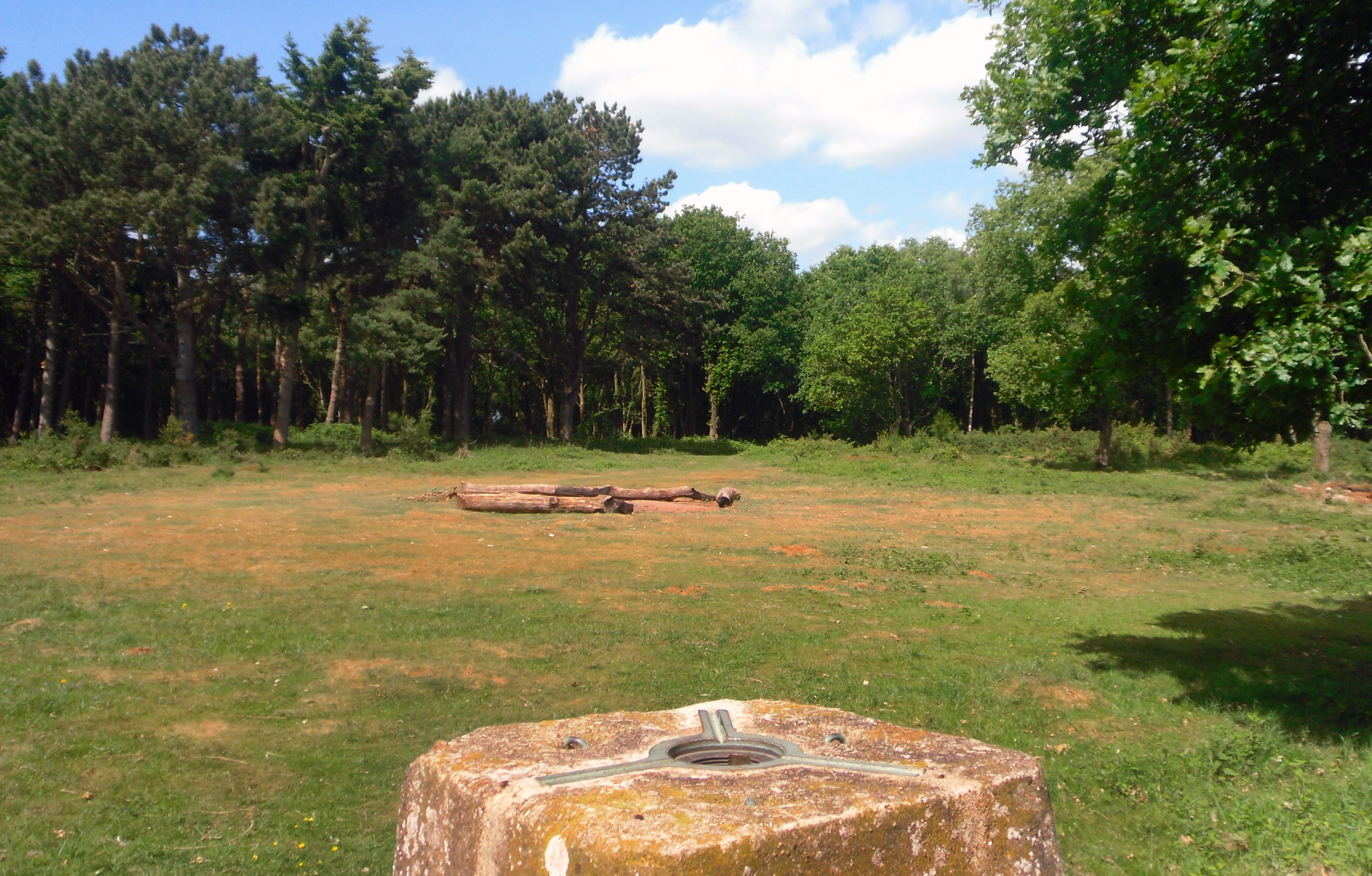
Hid's Copse is a picturesque woodland located in Berkshire, England. Situated near the town of Reading, it covers an area of approximately 30 acres. The copse is a popular destination for nature lovers, hikers, and birdwatchers due to its abundant flora and fauna.

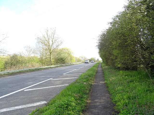
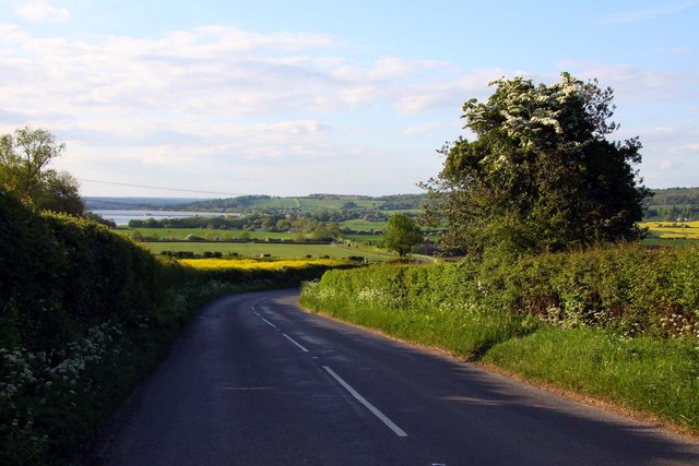
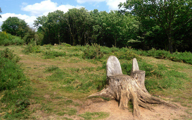
The woodland is primarily composed of broadleaf trees, such as oak, beech, and ash, which create a dense canopy, providing a cool and shaded environment. The forest floor is covered in a thick layer of leaf litter, creating a natural carpet.

Hid's Copse is home to a diverse array of wildlife. Bird species such as the great spotted woodpecker, tawny owl, and chiffchaff can be spotted amongst the treetops. On the ground, visitors may encounter small mammals like squirrels and rabbits. The copse is also known for its rich insect population, including butterflies and dragonflies.

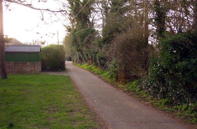
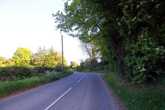
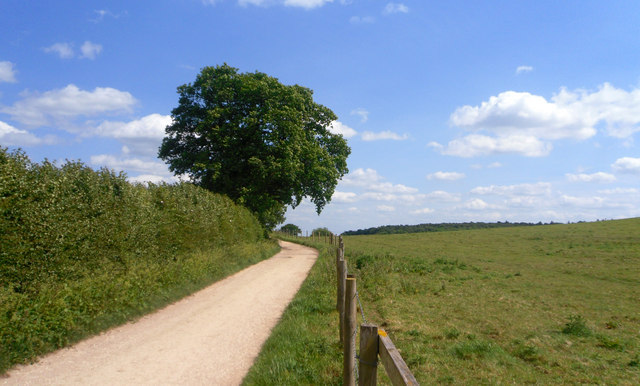
Several well-marked trails wind through the woodland, allowing visitors to explore its natural beauty. The paths are well-maintained, making it accessible for families and individuals of all ages. In addition to its natural attractions, Hid's Copse offers a serene and peaceful atmosphere, making it an ideal place for relaxation and meditation.

Overall, Hid's Copse is a hidden gem in Berkshire, offering a tranquil retreat away from the hustle and bustle of nearby urban areas. Its beautiful woodland, diverse wildlife, and well-maintained trails make it a must-visit destination for nature enthusiasts.

If you have any feedback on the listing, please let us know in the comments section below.

Hid's Copse Images

Images are sourced within 2km of 51.744889/-1.3148309 or Grid Reference SP4705. Thanks to Geograph Open Source API. All images are credited.

Fields north of Youlbury Wood
The A420 Botley
The A420 Botley
The A420 Botley Looking south across the town.
The A420 Botley
Looking south across the town.
Faringdon Road, Cumnor
Seacourt Lane
Seacourt Lane
Cycle Path beside the A34
The Vine Inn in Cumnor
Footpath in Cumnor
Footpath in Cumnor
Footpath in Cumnor
Footpath in Cumnor
Looking down Tumbledown Road towards Farmoor Reservoir
Tumbledown Hill in Cumnor
Tumbledown Hill to Farmoor
Red Field on Hurst Hill The upper section of this field is covered with a flowering plant called Sheep's Sorrel (Rumex acetosella)
Apparently it is edible and has various medicinal properties too.
Here it is also a geological indicator. You see where it suddenly stops at the break of slope halfway down the field. This is where the Lower Greensand, which forms an acid soil cap at the top of Hurst Hill, gives way to the underlying limestone.
The lime intolerant gorse, centre left, also stops.
Red Field on Hurst Hill
The upper section of this field is covered with a flowering plant called Sheep's Sorrel (Rumex acetosella) Apparently it is edible and has various medicinal properties too. Here it is also a geological indicator. You see where it suddenly stops at the break of slope halfway down the field. This is where the Lower Greensand, which forms an acid soil cap at the top of Hurst Hill, gives way to the underlying limestone. The lime intolerant gorse, centre left, also stops.
Tree Stump Seats Quite a lot of trees have been taken out of the southern part of Hurst Hill Wood.
These stumps have been carved into chairs, a good place to sit and look out over the view to the south.
Tree Stump Seats
Quite a lot of trees have been taken out of the southern part of Hurst Hill Wood. These stumps have been carved into chairs, a good place to sit and look out over the view to the south.
Track on Cumnor Hill In the shallow dip between Hurst and Cumnor Hills.
Track on Cumnor Hill
In the shallow dip between Hurst and Cumnor Hills.
Louie Memorial Playing Field
Gate to Hurst Hill A short walk through woodland takes you to the trig point and overlook on the  top of this small hill.
Gate to Hurst Hill
A short walk through woodland takes you to the trig point and overlook on the top of this small hill.
Micro Topography In a tiny bunker on the golf course at Westminster College, wind and rain have created this small sandscape.
Micro Topography
In a tiny bunker on the golf course at Westminster College, wind and rain have created this small sandscape.
Show me another place!

Hid's Copse is located at Grid Ref: SP4705 (Lat: 51.744889, Lng: -1.3148309)

Administrative County: Oxfordshire

District: Vale of White Horse

Police Authority: Thames Valley

What 3 Words

///skills.hired.makes. Near Oxford, Oxfordshire

Related Wikis

Dean Court, Oxfordshire

Dean Court is a suburb 2 miles (3.2 km) west of the centre of Oxford, England. Dean Court was part of Berkshire until the 1974 local government boundary...

Matthew Arnold School, Oxford

Matthew Arnold School is a coeducational secondary school and sixth form located just west of Oxford near Cumnor Hill and Botley and is named after 19th...

Cumnor Hill

Cumnor Hill is a hill in the civil parish of Cumnor, to the west of (but not within) the city of Oxford, in the English county of Oxfordshire. In 1974...

Oxford West and Abingdon (UK Parliament constituency)

Oxford West and Abingdon is a constituency represented in the House of Commons of the UK Parliament since 2017 by Layla Moran, a Liberal Democrat. ��2...

Botley, Oxfordshire

Botley is a village in the civil parish of Botley and North Hinksey, in the Vale of White Horse district, in the county of Oxfordshire, England, just west...

Hurst Hill, Oxfordshire

Hurst Hill or Cumnor Hurst is a 20.6-hectare (51-acre) biological and geological Site of Special Scientific Interest west of Oxford in Oxfordshire. It...

Cumnor

Cumnor is a village and civil parish 3½ miles (5.6 km) west of the centre of Oxford, England. The village is about 2 miles (3.2 km) south-west of Botley...

North Hinksey

North Hinksey is a village in the civil parish of Botley and North Hinksey, in the Vale of White Horse district, in Oxfordshire, England, on the west side...

Nearby Amenities

Located within 500m of 51.744889,-1.3148309
Turning Circle
Lat/Long: 51.7474178/-1.31042
Turning Circle
Lat/Long: 51.7480585/-1.3151506
Turning Circle
Lat/Long: 51.7483721/-1.314906
Turning Circle
Lat/Long: 51.7461292/-1.3131201
Post Box
Collection Times: Mo-Fr 17:00; Sa 11:30
Postal Code: OX2
Ref: OX2 290
Lat/Long: 51.7421931/-1.3108888
Power: substation
Lat/Long: 51.7479995/-1.3117701
Dean Court Social Club
Club: yes
Note: Not sure if they're licensed. Sign advertising pool in the window.
Lat/Long: 51.7480206/-1.3122023
Parking
Access: customers
Fee: no
Parking: surface
Source: photograph
Lat/Long: 51.7481969/-1.3121817
Turning Circle
Lat/Long: 51.7460969/-1.3145799
Turning Circle
Lat/Long: 51.7460673/-1.31572
Turning Circle
Lat/Long: 51.7463565/-1.3167574
Barrier: stile
Lat/Long: 51.7488248/-1.3183006
Barrier: stile
Foot: yes
Lat/Long: 51.7459917/-1.3181233
Barrier: stile
Foot: yes
Lat/Long: 51.7464208/-1.3184022
Bus Stop
Cotswold Road
Bus: yes
Local Ref: adj
Naptan AtcoCode: 340001090CNR
Naptan Bearing: S
Naptan CommonName: Cotswold Road
Naptan Indicator: Corner
Naptan Landmark: Cotswold Road
Naptan NaptanCode: oxfadgmw
Naptan PlusbusZoneRef: OXFD
Naptan Street: Cotswold Road
Naptan Verified: no
Public Transport: platform
Shelter: no
Source: naptan_import
Lat/Long: 51.7418164/-1.3111397
Bus Stop
Cotswold Road
Bus: yes
Local Ref: opp
Naptan AtcoCode: 340001090OPP
Naptan Bearing: N
Naptan CommonName: Cotswold Road
Naptan Indicator: Opposite
Naptan Landmark: Cotswold Road
Naptan NaptanCode: oxfadgmt
Naptan PlusbusZoneRef: OXFD
Naptan Street: Cotswold Road
Naptan Verified: no
Public Transport: platform
Shelter: yes
Source: naptan_import
Lat/Long: 51.742372/-1.3108271
Bus Stop
Arnolds Way
Bus: yes
Local Ref: adj
Naptan AtcoCode: 340001101CNR
Naptan Bearing: SW
Naptan CommonName: Arnolds Way
Naptan Indicator: Corner
Naptan Landmark: Arnolds Way
Naptan NaptanCode: oxfadgdj
Naptan PlusbusZoneRef: OXFD
Naptan Street: Cummor Hill
Naptan Verified: no
Public Transport: platform
Shelter: no
Source: naptan_import
Lat/Long: 51.745883/-1.3084851
Bus Stop
Dean Court Road
Bus: yes
Frequency: 0
Naptan AtcoCode: 340001102CNR
Naptan Bearing: N
Naptan CommonName: Dean Court Road
Naptan Indicator: Corner
Naptan Landmark: Dean Court Road
Naptan NaptanCode: oxfadgda
Naptan PlusbusZoneRef: OXFD
Naptan ShortCommonName: Dean Court Rd
Naptan Street: Cumnor Hill
Naptan Verified: no
Note Frequency: stop moved north of junction, but old stop still there
Public Transport: platform
Source: naptan_import
Lat/Long: 51.745419/-1.3091005
Bus Stop
Pinnocks Way
Bus: yes
Frequency: 0
Naptan AtcoCode: 340001106TER
Naptan Bearing: N
Naptan CommonName: Pinnocks Way
Naptan Indicator: Terminus
Naptan Landmark: Terminus
Naptan NaptanCode: oxfadjaw
Naptan PlusbusZoneRef: OXFD
Naptan Street: Pinnocks Way
Naptan Verified: no
Public Transport: platform
Route Ref: 63
Source: naptan_import
Lat/Long: 51.7485366/-1.3117473
Bus Stop
Stanville Road
Bus: yes
Naptan AtcoCode: 340001107OPP
Naptan Bearing: NW
Naptan CommonName: Stanville Road
Naptan Indicator: Opposite
Naptan Landmark: Stanville Road
Naptan NaptanCode: oxfadjat
Naptan PlusbusZoneRef: OXFD
Naptan Street: Arnolds Way
Naptan Verified: no
Public Transport: platform
Source: naptan_import
Lat/Long: 51.7450058/-1.3076439
Barrier: stile
Lat/Long: 51.7411882/-1.318927
Barrier: kissing_gate
Lat/Long: 51.7427792/-1.3200965
Barrier: kissing_gate
Lat/Long: 51.7427194/-1.3200374
Addr Housenumber: 107
Addr Street: Cumnor Hill
Lat/Long: 51.7422255/-1.3104661
Addr Housenumber: 67
Addr Street: Cumnor Hill
Lat/Long: 51.7450987/-1.3087495
Addr Housenumber: 87
Addr Street: Cumnor Hill
Lat/Long: 51.7433582/-1.3095112
Addr Housenumber: 57
Addr Street: Cumnor Hill
Lat/Long: 51.7458523/-1.308125
Turning Loop
Lat/Long: 51.7433581/-1.3126438
Yasmin Store
Addr City: Oxford
Addr Country: GB
Addr Housenumber: 2
Addr Postcode: OX2 9DG
Addr Street: Pinnocks Way
Fhrs Id: 263797
Shop: convenience
Lat/Long: 51.7486273/-1.3119572
Fast Food
Jamona
Addr City: Oxford
Addr Country: GB
Addr Housenumber: 2
Addr Postcode: OX2 9DG
Addr Street: Pinnocks Way
Contact Website: https://jamonaoxford.co.uk/
Cuisine: indian
Fhrs Id: 560570
Takeaway: only
Website: https://www.jamona-oxford.co.uk/
Lat/Long: 51.7486288/-1.3120191
Power: pole
Source: Bing
Lat/Long: 51.7428991/-1.3174888
Power: pole
Source: Bing
Lat/Long: 51.7448123/-1.3163676
Power: pole
Source: Bing
Lat/Long: 51.7423062/-1.3178482
Power: pole
Source: Bing
Lat/Long: 51.7438242/-1.3169416
Defibrillator
Defibrillator Location: Left front, on wall by bike parking
Emergency: defibrillator
Indoor: no
Lat/Long: 51.7480179/-1.312106
The data included in this document is from www.openstreetmap.org. The data is made available under ODbL.

Have you been to Hid's Copse?

Leave your review of Hid's Copse below (or comments, questions and feedback).