Allwoods Copse

Wood, Forest in Hampshire New Forest

England

Allwoods Copse

Houses by the sea, Lepe The Watch House and the Coastguard Cottages make up a large part of the housing in the scattered hamlet of Lepe.
Houses by the sea, Lepe Credit: Des Blenkinsopp

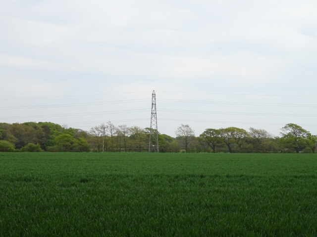
Allwoods Copse is a charming woodland located in Hampshire, England. This beautiful copse covers an area of approximately 50 acres and is nestled within the picturesque countryside of the county. It is a popular destination for nature enthusiasts and those seeking a peaceful retreat from the bustling city life.

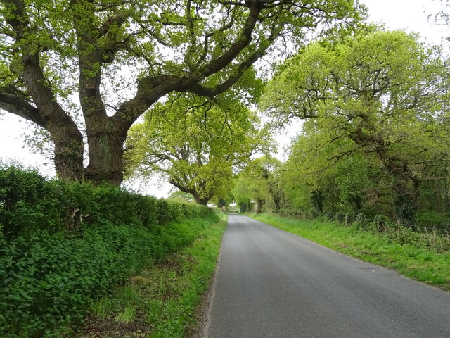
The copse is primarily comprised of deciduous trees, including oak, beech, and ash, which create a dense canopy that provides shade and shelter for a variety of wildlife. The forest floor is covered in a thick carpet of ferns, moss, and wildflowers, adding to the enchanting atmosphere of the woodland.

A network of well-maintained footpaths winds its way through the copse, allowing visitors to explore the area at their own pace. These paths lead to hidden clearings, babbling brooks, and small ponds, providing ample opportunities for wildlife spotting and bird watching. The copse is home to a diverse range of animals, including deer, foxes, badgers, and a wide array of bird species.

Allwoods Copse is also a designated Site of Special Scientific Interest (SSSI), highlighting its importance for biodiversity and conservation. The copse is a habitat for various rare and protected species, such as the lesser spotted woodpecker and the silver-washed fritillary butterfly.

Visitors to Allwoods Copse can enjoy a peaceful and tranquil atmosphere, perfect for picnics, leisurely walks, and photography. The copse is open to the public throughout the year, and its natural beauty makes it a popular destination for both locals and tourists alike. With its rich biodiversity and serene surroundings, Allwoods Copse is a true gem within the Hampshire countryside.

If you have any feedback on the listing, please let us know in the comments section below.

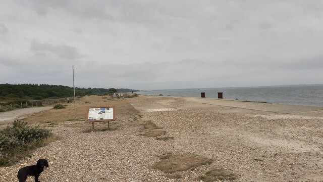
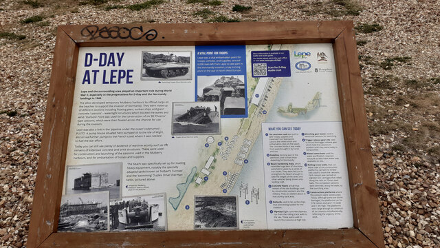
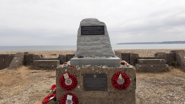
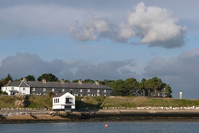
Allwoods Copse Images

Images are sourced within 2km of 50.79475/-1.3406876 or Grid Reference SZ4699. Thanks to Geograph Open Source API. All images are credited.

Houses by the sea, Lepe The Watch House and the Coastguard Cottages make up a large part of the housing in the scattered hamlet of Lepe.
Houses by the sea, Lepe
The Watch House and the Coastguard Cottages make up a large part of the housing in the scattered hamlet of Lepe.
Coastguard Cottages, Lepe A terrace of houses built in 1828 when smuggling was a problem around here.
Coastguard Cottages, Lepe
A terrace of houses built in 1828 when smuggling was a problem around here.
Dark Water Sluice, Lepe Outfall The Dark Water river flows into the sea at Lepe via a tidal lake on the other side of the road. The Environment Agency sluice here controls the flow either into or out of the lake depending on the state of the tide. Just now at high tide, sea water is going upstream into the lake.
The square thing on the horizon is a freight ship heading for Southampton loaded with containers.
Dark Water Sluice, Lepe Outfall
The Dark Water river flows into the sea at Lepe via a tidal lake on the other side of the road. The Environment Agency sluice here controls the flow either into or out of the lake depending on the state of the tide. Just now at high tide, sea water is going upstream into the lake. The square thing on the horizon is a freight ship heading for Southampton loaded with containers.
"The Lookout" Lepe Country Park Visitor centre and cafe at this popular coastal park. They do very good breakfasts.
"The Lookout" Lepe Country Park
Visitor centre and cafe at this popular coastal park. They do very good breakfasts.
Parking Barrier, Lepe Country Park Hi-tech camera and gate equipment controls the parking access at Lepe Country Park, which is ok as long as it works. The seaside isn't the kindest environment for outdoor electronics though, so good luck with that.
Parking Barrier, Lepe Country Park
Hi-tech camera and gate equipment controls the parking access at Lepe Country Park, which is ok as long as it works. The seaside isn't the kindest environment for outdoor electronics though, so good luck with that.
Dark Water, Lepe Country Park The Dark Water is a short river flowing out of the New Forest which forms an expanse of tidal marshland here before entering the sea.
Dark Water, Lepe Country Park
The Dark Water is a short river flowing out of the New Forest which forms an expanse of tidal marshland here before entering the sea.
Cereal crop and pylon off Lepe Road
Lepe Road
Lepe Road
Lepe Visitor Centre
Lepe Visitor Centre
Beach and groyne, Lepe
Coastal road and path, Lepe
Beach and groynes, Lepe
Coastal path and sea defences, Lepe
The Watch House, Lepe
Coastguard Cottages, Lepe
View of D-Day preparation area at Lepe To the right two bollards used to tie up ships. Beyond and above the righthand side of the noticeboard is a war memorial and the area used for constructing the massive concrete caissons that were floated across the Channel and then sunk. See also <a href="https://www.geograph.org.uk/photo/7529571">SZ4698 : Information board on D-Day at Lepe</a>.
View of D-Day preparation area at Lepe
To the right two bollards used to tie up ships. Beyond and above the righthand side of the noticeboard is a war memorial and the area used for constructing the massive concrete caissons that were floated across the Channel and then sunk. See also SZ4698 : Information board on D-Day at Lepe.
Information board on D-Day at Lepe
D-Day war memorial at Lepe To 4th/7th royal Dragoon Guards who lkeft here to land in Sherman amphibiopus tanks 5 minutes before the main assault on Gold beach. 124 men lost their lives. The top part of this memorial seems to be a recent addition. For earlier see <a title="https://www.geograph.org.uk/photo/4310851" href="https://www.geograph.org.uk/photo/4310851">Link</a> .

The inscription on the top part of the memorial reads:
Take these men for your example
Like them remember that propserity can
only be for the free,
that freedom is the sure possession of those
alone who have the courage to defend it.

On the seaward side of the memorial there is the same inscription in French.
D-Day war memorial at Lepe
To 4th/7th royal Dragoon Guards who lkeft here to land in Sherman amphibiopus tanks 5 minutes before the main assault on Gold beach. 124 men lost their lives. The top part of this memorial seems to be a recent addition. For earlier see Link . The inscription on the top part of the memorial reads: Take these men for your example Like them remember that propserity can only be for the free, that freedom is the sure possession of those alone who have the courage to defend it. On the seaward side of the memorial there is the same inscription in French.
Show me another place!

Allwoods Copse is located at Grid Ref: SZ4699 (Lat: 50.79475, Lng: -1.3406876)

Administrative County: Hampshire

District: New Forest

Police Authority: Hampshire

What 3 Words

///essays.saunas.rests. Near Gurnard, Isle of Wight

Related Wikis

Solent Rescue

Solent Rescue is an independent inshore rescue lifeboat, not run by the RNLI, based at Lepe Country Park south of the New Forest, on the north shore of...

Luttrell's Tower

Luttrell's Tower is a three-storey stuccoed yellow brick folly south of Southampton, Hampshire, England, near the village of Calshot. It has a six-storey...

Dark Water (river)

The Dark Water is a 5.5-mile (8.9 km) river in south-west Hampshire, England. It flows south from a source a few metres north-east of the New Forest, reaching...

Lepe, Hampshire

Lepe is a linear hamlet on the Solent in south-west Hampshire, England. In the civil parish of Exbury and Lepe, It is beside the Dark Water, and has Lepe...

Calshot

Calshot is a coastal village in Hampshire, England, at the west corner of Southampton Water where it joins the Solent. == History == In 1539, Henry VIII...

Langley, Hampshire

Langley is a small village in the civil parish of Fawley in Hampshire, England. == History == The name Langley means "long wood/clearing". Langley is listed...

Fawley Power Station

Fawley Power Station was an oil-fired power station located on the western side of Southampton Water, between the villages of Fawley and Calshot in Hampshire...

Ashlett

Ashlett is a small settlement in Hampshire, England. It is in the civil parish of Fawley. It is at the end of Ashlett Creek, a tidal inlet of Southampton...

Nearby Amenities

Located within 500m of 50.79475,-1.3406876
Board Type: nature
Information: board
Tourism: information
Lat/Long: 50.7917674/-1.3383741
Bench
Gavin's Bench
Backrest: yes
Material: wood
Lat/Long: 50.7919434/-1.3384566
The data included in this document is from www.openstreetmap.org. The data is made available under ODbL.

Have you been to Allwoods Copse?

Leave your review of Allwoods Copse below (or comments, questions and feedback).