Dummer's Copse

Wood, Forest in Hampshire Eastleigh

England

Dummer's Copse

M27 gantry East of Moorgreen Road bridge
M27 gantry Credit: John Firth

Dummer's Copse is a picturesque woodland located in Hampshire, England. Situated near the village of Dummer, it covers an area of approximately 50 acres and is known for its diverse array of trees and wildlife.

The copse is primarily composed of deciduous trees, such as oak, beech, and ash, which create a dense canopy overhead, providing shade and shelter for the flora and fauna below. The forest floor is carpeted with a variety of wildflowers, including bluebells and primroses, which bloom in vibrant colors during the spring months.

Walking through Dummer's Copse, visitors can enjoy the peaceful ambiance and tranquility of nature. The winding paths meander through the woodland, allowing glimpses of sunlight filtering through the treetops. The sound of bird songs fills the air, as species like robins, blackbirds, and woodpeckers make their homes within the copse.

The woodland also supports a rich diversity of wildlife. Deer can often be spotted grazing in the glades, while squirrels dart through the trees, gathering nuts for the winter. Badgers, foxes, and rabbits are also known to inhabit the area, adding to the copse's ecological significance.

Dummer's Copse is a popular destination for nature enthusiasts, hikers, and wildlife photographers. It offers a peaceful retreat from the hustle and bustle of everyday life, providing an opportunity to immerse oneself in nature's beauty and serenity. Whether one seeks a leisurely stroll, bird-watching, or simply a moment of solitude, Dummer's Copse provides a haven for all who visit.

If you have any feedback on the listing, please let us know in the comments section below.

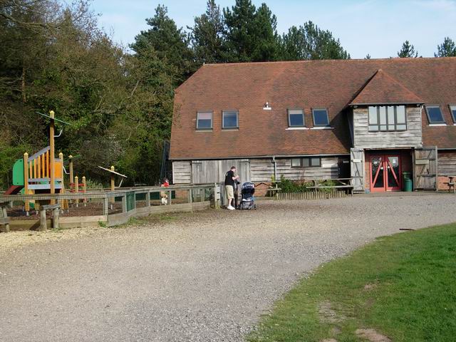
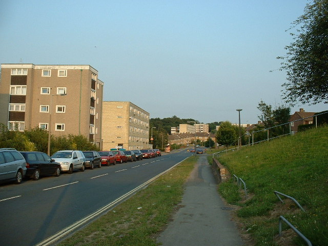
Dummer's Copse Images

Images are sourced within 2km of 50.935933/-1.343917 or Grid Reference SU4615. Thanks to Geograph Open Source API. All images are credited.

M27 gantry East of Moorgreen Road bridge
M27 gantry
East of Moorgreen Road bridge
High Street High Street (B3035) heading down to the A27
High Street
High Street (B3035) heading down to the A27
Chalk Hill Chalk Hill junction with West End Road
Chalk Hill
Chalk Hill junction with West End Road
Bitterne Sports Ground Bitterne Sports Ground by Wynter Road
Bitterne Sports Ground
Bitterne Sports Ground by Wynter Road
Atalantic Park View Atalantic Park View leading to Townhill Way
Atalantic Park View
Atalantic Park View leading to Townhill Way
2016: a year on Geograph (Day 55) I was stumped for a photo today until I passed The Ageas (née Rose) Bowl. <span class="nowrap"><a title="https://en.wikipedia.org/wiki/Rose_Bowl_(cricket_ground)" rel="nofollow ugc noopener" href="https://en.wikipedia.org/wiki/Rose_Bowl_(cricket_ground)">Link</a><img style="margin-left:2px;" alt="External link" title="External link - shift click to open in new window" src="https://s1.geograph.org.uk/img/external.png" width="10" height="10"/></span>
2016: a year on Geograph (Day 55)
I was stumped for a photo today until I passed The Ageas (née Rose) Bowl. LinkExternal link
Southampton International Airport Southampton International Airport, formerly known as Southampton (Eastleigh), is just outside the city in the borough of Eastleigh. It is easily accessible  from junction 5 of the M27 and there is a rail station, Southampton Airport Parkway, adjacent to the terminal building.
Southampton International Airport
Southampton International Airport, formerly known as Southampton (Eastleigh), is just outside the city in the borough of Eastleigh. It is easily accessible from junction 5 of the M27 and there is a rail station, Southampton Airport Parkway, adjacent to the terminal building.
Flybe Planes at Southampton Airport Southampton International Airport, formerly known as Southampton (Eastleigh), is just outside the city in the borough of Eastleigh. It is easily accessible  from junction 5 of the M27 and there is a rail station, Southampton Airport Parkway, adjacent to the terminal building.
Flybe Planes at Southampton Airport
Southampton International Airport, formerly known as Southampton (Eastleigh), is just outside the city in the borough of Eastleigh. It is easily accessible from junction 5 of the M27 and there is a rail station, Southampton Airport Parkway, adjacent to the terminal building.
Refuelling at Southampton Airport Southampton International Airport, formerly known as Southampton (Eastleigh), is just outside the city in the borough of Eastleigh. It is easily accessible  from junction 5 of the M27 and there is a rail station, Southampton Airport Parkway, adjacent to the terminal building.
Refuelling at Southampton Airport
Southampton International Airport, formerly known as Southampton (Eastleigh), is just outside the city in the borough of Eastleigh. It is easily accessible from junction 5 of the M27 and there is a rail station, Southampton Airport Parkway, adjacent to the terminal building.
Taxiway, Southampton International Airport Southampton International Airport, formerly known as Southampton (Eastleigh), is just outside the city in the borough of Eastleigh. It is easily accessible  from junction 5 of the M27 and there is a rail station, Southampton Airport Parkway, adjacent to the terminal building.
Taxiway, Southampton International Airport
Southampton International Airport, formerly known as Southampton (Eastleigh), is just outside the city in the borough of Eastleigh. It is easily accessible from junction 5 of the M27 and there is a rail station, Southampton Airport Parkway, adjacent to the terminal building.
Aeroplane Queuing Area, Southampton Airport Flybe Bombardier Dash 8 Q400, G-JEDU, awaits clearance to move to the runway in preparation for take-off.
Aeroplane Queuing Area, Southampton Airport
Flybe Bombardier Dash 8 Q400, G-JEDU, awaits clearance to move to the runway in preparation for take-off.
Runway at Southampton Airport Blue Islands ATR 72-212A aircraft, G-ISLI, on the runway at Southampton after arriving from the Channel Islands.
Runway at Southampton Airport
Blue Islands ATR 72-212A aircraft, G-ISLI, on the runway at Southampton after arriving from the Channel Islands.
Take Off from Southampton Flybe Bombardier Dash 8 Q400, G-JEDU, takes off from the runway at Southampton Airport.
Take Off from Southampton
Flybe Bombardier Dash 8 Q400, G-JEDU, takes off from the runway at Southampton Airport.
Mansbridge Aerial photograph of suburban housing taken shortly after take-off from Southampton Airport.
Mansbridge
Aerial photograph of suburban housing taken shortly after take-off from Southampton Airport.
Courtesy Bus at Southampton Airport Southampton International Airport, formerly known as Southampton (Eastleigh), is just outside the city in the borough of Eastleigh. It is easily accessible  from junction 5 of the M27 and there is a rail station, Southampton Airport Parkway, adjacent to the terminal building.
Courtesy Bus at Southampton Airport
Southampton International Airport, formerly known as Southampton (Eastleigh), is just outside the city in the borough of Eastleigh. It is easily accessible from junction 5 of the M27 and there is a rail station, Southampton Airport Parkway, adjacent to the terminal building.
Roddington Forge
Roddington Forge
Oaktree Park
Oaktree Park
Mousehole Lane Heading from Bitterne towards Bitterne Park. There are blocks of flats on the land to the left, on what for many years was the site of post-war pre-fabs.
Mousehole Lane
Heading from Bitterne towards Bitterne Park. There are blocks of flats on the land to the left, on what for many years was the site of post-war pre-fabs.
Show me another place!

Dummer's Copse is located at Grid Ref: SU4615 (Lat: 50.935933, Lng: -1.343917)

Administrative County: Hampshire

District: Eastleigh

Police Authority: Hampshire

What 3 Words

///bright.fumes.fats. Near West End, Hampshire

Related Wikis

Eastleigh (UK Parliament constituency)

Eastleigh is a constituency represented in the House of Commons of the UK Parliament since 2019 by Paul Holmes, a Conservative. == Constituency profile... ==

Chartwell Green

Chartwell Green is a suburb of Southampton, England, although it falls outside the formal city boundary. Instead, Chartwell Green is part of the West...

Itchen Valley Country Park

Itchen Valley Country Park is a country park in West End, Hampshire, England. As the name suggests, the River Itchen runs through the park, which covers...

Gaters Mill

Gaters Mill is a complex of buildings on the River Itchen in the civil parish of West End, Hampshire. The complex forms part of the Gaters Mill & Romill...

Townhill Park House

Townhill Park House is a Grade II listed former manor house between the neighbouring housing estates of Townhill Park in Southampton and Chartwell Green...

The Gregg School

The Gregg School is a non-selective independent secondary day school for boys and girls in Townhill Park, Southampton, Hampshire, UK, with an associated...

Townhill Park

Townhill Park is a suburb of Southampton, England, bordering Swaythling, Bitterne Park and West End. It is built on land which once belonged to the house...

St James' Church, West End

St James' Church in West End, Hampshire is an Anglican parish church in the Borough of Eastleigh. The church building is grade II listed. == History... ==

Nearby Amenities

Located within 500m of 50.935933,-1.343917
Barrier: kissing_gate
Lat/Long: 50.9343903/-1.3449332
Odbl: clean
Lat/Long: 50.9353093/-1.34052
Crossing
Crossing: unmarked
Crossing Island: no
Crossing Markings: no
Tactile Paving: yes
Lat/Long: 50.9344371/-1.3494059
Barrier: bollard
Motor Vehicle: no
Lat/Long: 50.9343947/-1.3482553
Kerb: raised
Lat/Long: 50.9352934/-1.3481012
Post Box
Brand: Royal Mail
Brand Wikidata: Q638098
Collection Plate: CP7D
Collection Times: Mo-Fr 09:00; Sa 07:00
Operator: Royal Mail
Operator Wikidata: Q638098
Post Box Type: lamp
Ref: SO30 616D
Royal Cypher: EIIR
Royal Cypher Wikidata: Q33102113
Lat/Long: 50.9390099/-1.3396669
Post Box
Collection Times: Mo-Fr 09:00, Sa 07:00
Ref: SO30 613
Royal Cypher: EIIR
Royal Cypher Wikidata: Q33102113
Lat/Long: 50.9353626/-1.3474705
Post Box
Created By: Merkaartor 0.12
Ref: SO18 142
Lat/Long: 50.933357/-1.3496659
Bus Stop
Barnsland
Bus: yes
Naptan AtcoCode: 1900HA030389
Naptan Bearing: S
Naptan CommonName: Barnsland
Naptan NaptanCode: hamdapgm
Naptan PlusbusZoneRef: SOTON
Naptan Street: Swaythling Road
Naptan Verified: no
Public Transport: platform
Source: naptan_import
Lat/Long: 50.9322005/-1.3467631
Bus Stop
Barnsland
Bus: yes
Naptan AtcoCode: 1900HA030390
Naptan Bearing: NW
Naptan CommonName: Barnsland
Naptan NaptanCode: hamdapdt
Naptan PlusbusZoneRef: SOTON
Naptan Street: Swaythling Road
Naptan Verified: no
Public Transport: platform
Source: naptan_import
Lat/Long: 50.9325235/-1.3471058
Bus Stop
Allington Lane Roundabout
Bus: yes
Naptan AtcoCode: 1900HA030450
Naptan Bearing: N
Naptan CommonName: Allington Lane Roundabout
Naptan Crossing: Wylye Close
Naptan NaptanCode: hamdampm
Naptan PlusbusZoneRef: SOTON
Naptan Street: Townhill Way
Naptan Verified: no
Public Transport: platform
Source: naptan_import
Lat/Long: 50.9338077/-1.3495298
Bus Stop
Allington Lane Roundabout
Bus: yes
Naptan AtcoCode: 1900HA030451
Naptan Bearing: S
Naptan CommonName: Allington Lane Roundabout
Naptan Crossing: Arun Road
Naptan NaptanCode: hamdampw
Naptan PlusbusZoneRef: SOTON
Naptan Street: Townhill Way
Naptan Verified: no
Public Transport: platform
Source: naptan_import
Lat/Long: 50.9335557/-1.3495049
Crossing
Crossing: unmarked
Crossing Island: no
Crossing Markings: no
Tactile Paving: yes
Lat/Long: 50.9341853/-1.3493323
Barrier: cycle_barrier
Lat/Long: 50.9329162/-1.3471395
Applegreen
Brand: Applegreen
Brand Wikidata: Q7178908
Check Date: 2022-12-26
Note: This convenience store has a Costa Express outlet facility
Shop: convenience
Lat/Long: 50.9338788/-1.3485883
Noexit: yes
Lat/Long: 50.9348039/-1.349575
Crossing
Crossing: unmarked
Crossing Island: yes
Crossing Markings: no
Tactile Paving: yes
Lat/Long: 50.935426/-1.3489615
Barrier: kissing_gate
When Open: always
Lat/Long: 50.9343709/-1.3384281
Barrier: kissing_gate
Lat/Long: 50.9341695/-1.3467904
Fast Food
Subway
Addr City: West End, Southampton
Addr Housenumber: 93
Addr Postcode: SO30 3AG
Addr Street: Swaythling Road
Brand: Subway
Brand Wikidata: Q244457
Brand Wikipedia: en:Subway (restaurant)
Check Date: 2022-12-26
Contact Website: https://restaurants.subway.com/united-kingdom/en/southampton/swaythling-road
Cuisine: sandwich
Drive Through: no
Opening Hours: Mo-Su 07:00-21:00
Outdoor Seating: no
Smoking: no
Takeaway: yes
Lat/Long: 50.9339453/-1.3483489
Atm
NoteMachine
Brand: NoteMachine
Brand Wikidata: Q104368525
Check Date: 2022-12-26
Drive Through: no
Fee: no
Opening Hours: 24/7
Operator: NoteMachine
Operator Short: NMATM
Operator Wikidata: Q104368525
Short Name: NMATM
Lat/Long: 50.9339343/-1.3482884
Toilets
Changing Table: yes
Description: This WC can be used by males, females, disabled people and for baby changing.
Lat/Long: 50.9338506/-1.3486223
Speed Camera
Active: yes
Note: Variable Speed Limit
Type: fixed
Lat/Long: 50.935568/-1.3387029
Bench
Backrest: yes
Lat/Long: 50.935084/-1.3481042
Generator Method: photovoltaic
Generator Output Electricity: yes
Generator Source: solar
Generator Type: solar_photovoltaic_panel
Location: roof
Power: generator
Lat/Long: 50.9336889/-1.3499123
Crossing
Crossing: unmarked
Crossing Island: yes
Crossing Markings: no
Tactile Paving: yes
Lat/Long: 50.9323963/-1.3469316
Crossing
Crossing: unmarked
Crossing Island: no
Crossing Markings: no
Tactile Paving: yes
Lat/Long: 50.9342623/-1.3488812
Crossing
Crossing: unmarked
Crossing Island: no
Crossing Markings: no
Tactile Paving: yes
Lat/Long: 50.9344913/-1.3490669
Emergency Bay
Lat/Long: 50.9359585/-1.3467357
Crossing
Crossing: unmarked
Crossing Island: no
Crossing Markings: no
Tactile Paving: yes
Lat/Long: 50.9341654/-1.3492161
Crossing
Crossing: unmarked
Crossing Island: no
Crossing Markings: no
Tactile Paving: yes
Lat/Long: 50.9343655/-1.349444
Crossing
Crossing: unmarked
Crossing Island: no
Crossing Markings: no
Tactile Paving: yes
Lat/Long: 50.9345137/-1.3491834
Crossing
Crossing: unmarked
Crossing Island: no
Crossing Markings: no
Tactile Paving: yes
Lat/Long: 50.9343254/-1.3488461
Bench: yes
Leisure: picnic_table
Lat/Long: 50.9340997/-1.3486163
Bench: yes
Leisure: picnic_table
Lat/Long: 50.9340899/-1.3486854
Bench: yes
Leisure: picnic_table
Lat/Long: 50.9341269/-1.3486703
Speed Camera
Maxspeed: 70 mph
Type: fixed
Lat/Long: 50.9352479/-1.3411425
The data included in this document is from www.openstreetmap.org. The data is made available under ODbL.

Have you been to Dummer's Copse?

Leave your review of Dummer's Copse below (or comments, questions and feedback).