Dragons Green

Settlement in Sussex Horsham

England

Dragons Green

Shipley Mill and Church A nicely restored windmill, used as the fictional home of TV's Jonathan Creek.
Shipley Mill and Church Credit: Robin Webster

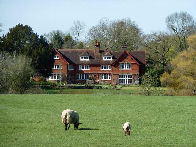
Dragon's Green is a small village located in the county of Sussex, England. Situated amidst the picturesque countryside, it is renowned for its natural beauty and tranquil atmosphere. The village is characterized by its charming thatched-roof cottages, quaint gardens filled with vibrant flowers, and narrow winding lanes that add to its idyllic appeal.

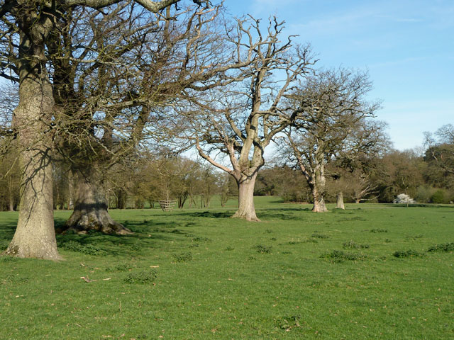
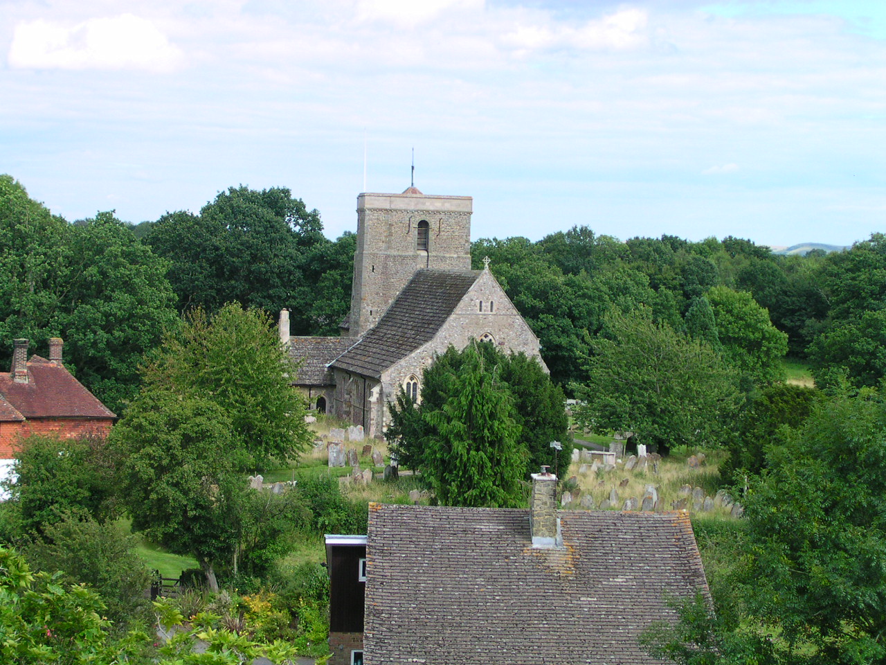
The origins of Dragon's Green can be traced back to medieval times, and the village still retains much of its historical charm. The centerpiece of the village is the village green, a spacious open area surrounded by ancient oak trees, where villagers often gather for community events and festivities.

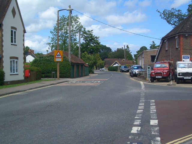
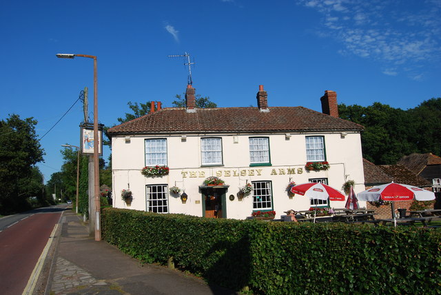
Despite its small size, Dragon's Green boasts a close-knit community that takes pride in preserving its heritage. The village is home to a handful of local businesses, including a traditional pub known for its warm hospitality and delicious food. Additionally, a small village shop provides essential amenities for residents and visitors alike.

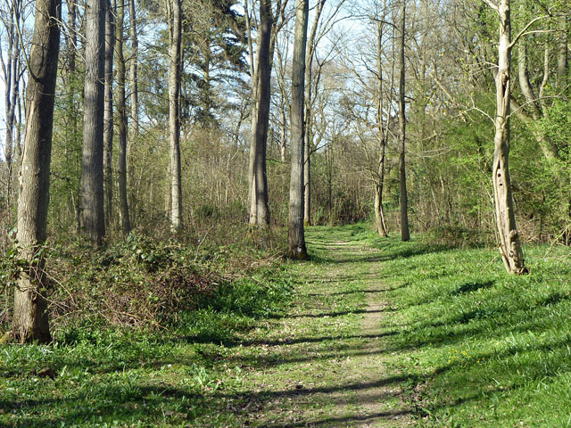
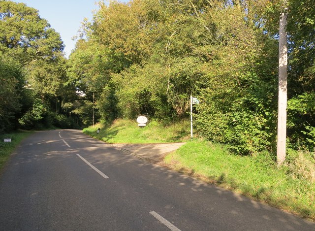
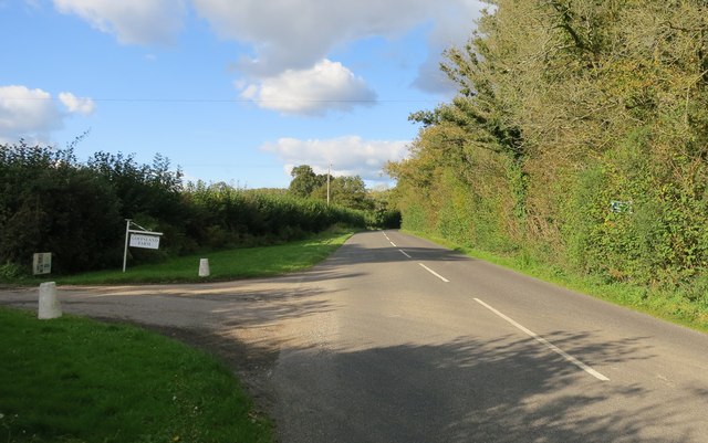
Surrounded by rolling hills and verdant meadows, Dragon's Green offers numerous opportunities for outdoor activities. The village is in close proximity to several walking and cycling trails, allowing visitors to explore the stunning countryside. Nature enthusiasts can also enjoy birdwatching and wildlife spotting in the nearby nature reserves.

While Dragon's Green may be a tranquil haven, it is conveniently located just a short drive away from larger towns and cities, ensuring residents have access to modern amenities and services. Overall, Dragon's Green is a quintessential English village that encapsulates the charm and beauty of the Sussex countryside.

If you have any feedback on the listing, please let us know in the comments section below.

Dragons Green Images

Images are sourced within 2km of 50.995114/-0.376912 or Grid Reference TQ1423. Thanks to Geograph Open Source API. All images are credited.

Shipley Mill and Church A nicely restored windmill, used as the fictional home of TV's Jonathan Creek.
Shipley Mill and Church
A nicely restored windmill, used as the fictional home of TV's Jonathan Creek.
Skew-whiff water trough Not much use now, but how did it get like this?
Skew-whiff water trough
Not much use now, but how did it get like this?
St Cuthman's and the lamb of God The establishment is a "retreat" run by the Roman Catholic Church, but advertised as open to all denominations or none.
St Cuthman's and the lamb of God
The establishment is a "retreat" run by the Roman Catholic Church, but advertised as open to all denominations or none.
Memorial trees by former Coolham airfield Most of the trees along the path and several more behind the viewpoint are memorials to those who died working out of Coolham A.L.G. Airfield in spring 1944. The end of the airfield is on the right, although there is no sign of it now, apart from the arrangement of fence lines and rights-of-way around a large level area. This was a temporary airfield for D-day purposes, A.L.G. standing for Advanced Landing Ground. The dead were eight from the Polish Air Force and seven from the RAF.
Memorial trees by former Coolham airfield
Most of the trees along the path and several more behind the viewpoint are memorials to those who died working out of Coolham A.L.G. Airfield in spring 1944. The end of the airfield is on the right, although there is no sign of it now, apart from the arrangement of fence lines and rights-of-way around a large level area. This was a temporary airfield for D-day purposes, A.L.G. standing for Advanced Landing Ground. The dead were eight from the Polish Air Force and seven from the RAF.
Permissive footpath, Church Wood One of the several public-spirited actions of the Knepp Castle Estate. This leads from the public footpath to Red Lane. There are other permissive paths in the small wood.
Permissive footpath, Church Wood
One of the several public-spirited actions of the Knepp Castle Estate. This leads from the public footpath to Red Lane. There are other permissive paths in the small wood.
Row of oaks, Knepp Castle parkland A public footpath runs along the row. In front of the blooming blackthorn on the right is a fingerpost directing walkers along the castle approach drive.
Row of oaks, Knepp Castle parkland
A public footpath runs along the row. In front of the blooming blackthorn on the right is a fingerpost directing walkers along the castle approach drive.
Belloc's windmill, Shipley, West Sussex The windmill was restored by poet, essayist and parliamentarian, Hilaire Belloc. It was recently sold to new owners who wish to cease access to the public.
Belloc's windmill, Shipley, West Sussex
The windmill was restored by poet, essayist and parliamentarian, Hilaire Belloc. It was recently sold to new owners who wish to cease access to the public.
Pound Farm south of Shipley
Lane junctions at Pound Corner Swallows Lane, Pound Lane and Countryman Lane meet here with the farm road to Hammer Farm on the left.
Lane junctions at Pound Corner
Swallows Lane, Pound Lane and Countryman Lane meet here with the farm road to Hammer Farm on the left.
Post Box Coolham crossroads Post Box RH13 130 Coolham
Post Box Coolham crossroads
Post Box RH13 130 Coolham
Coolham Crossroads Coolham Road towards Brooks Green at the Coolham Crossroads
Coolham Crossroads
Coolham Road towards Brooks Green at the Coolham Crossroads
A272 at Coolham Towards West Grinstead and Cowfold
A272 at Coolham
Towards West Grinstead and Cowfold
Bench Cut Mark On The Selsey Arms Public House
Bench Cut Mark
On The Selsey Arms Public House
The Selsey Arms, Coolham For some information on this pub see <span class="nowrap"><a title="http://www.horshampub.co.uk/selsey-arms.php" rel="nofollow ugc noopener" href="http://www.horshampub.co.uk/selsey-arms.php">Link</a><img style="margin-left:2px;" alt="External link" title="External link - shift click to open in new window" src="https://s1.geograph.org.uk/img/external.png" width="10" height="10"/></span> .
The Selsey Arms, Coolham
For some information on this pub see LinkExternal link .
Post Box RH13 24 Shipley Paygate
Post Box
RH13 24 Shipley Paygate
Post Box RH12 186 The Countryman on Countryman Lane.
Post Box
RH12 186 The Countryman on Countryman Lane.
Bridleway BW2815/2 Off Shipley Road through Brick kiln farm to A24.
Bridleway BW2815/2
Off Shipley Road through Brick kiln farm to A24.
Bridleway BW1894 Off Shipley Road through Goffsland Farm (sign is almost hidden in the hedgerow)
Bridleway BW1894
Off Shipley Road through Goffsland Farm (sign is almost hidden in the hedgerow)
Show me another place!

Dragons Green is located at Grid Ref: TQ1423 (Lat: 50.995114, Lng: -0.376912)

Administrative County: West Sussex

District: Horsham

Police Authority: Sussex

What 3 Words

///crunch.birthdays.shape. Near Southwater, West Sussex

Related Wikis

Dragon's Green

Dragon's Green is a hamlet in the civil parish of Shipley, and the Horsham district of West Sussex, England. The hamlet is 5 miles (8 km) south from the...

Shipley, West Sussex

Shipley is a village and civil parish in the Horsham District of West Sussex, England. It lies just off the A272 road 6 miles (10 kilometres) north-east...

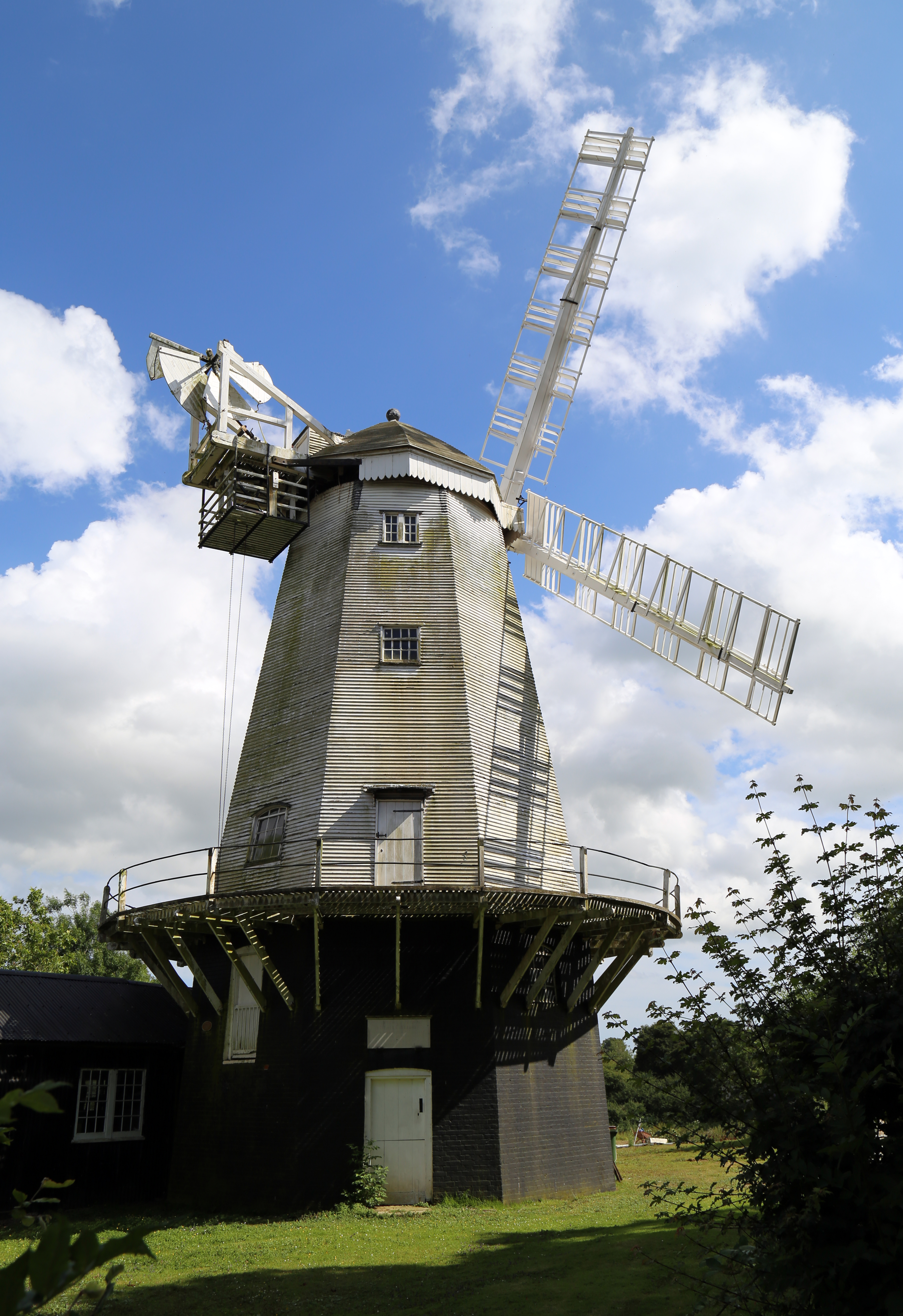
King's Mill, Shipley

King's Mill or Vincent's Mill, Shipley, West Sussex, England, is a smock mill built in 1879. == History == King's Mill was built in 1879 for Friend Martin...

St Mary's Church, Shipley

The Church of St Mary the Virgin is an Anglican church in the village of Shipley, in West Sussex, England. It is in the Diocese of Chichester. Built in...

Nearby Amenities

Located within 500m of 50.995114,-0.376912
Dragons Green
Place: hamlet
Wikidata: Q5305056
Lat/Long: 50.9977206/-0.373049
Sailor's Cross
Place: locality
Lat/Long: 50.9951554/-0.3723656
Scolliers Crossways
Place: locality
Lat/Long: 50.9956368/-0.3791986
Walter Budd
Historic: memorial
Memorial: cross
Lat/Long: 50.9993818/-0.3775153
Addr Housename: Korea Villas
Lat/Long: 50.9992415/-0.3764005
Dragons Farm
Place: farm
Lat/Long: 50.9964881/-0.3761612
Post Box
Brand: Royal Mail
Collection Times: Mo-Fr 16:00; Sa 09:30
Note: Collection plate seems to have been cut to fit, chopping off the reference
Operator: Royal Mail
Operator Wikidata: Q638098
Post Box Mounting: brick_wall
Post Box Type: wall
Ref: no
Royal Cypher: VR
Royal Cypher Wikidata: Q33102356
Lat/Long: 50.9973452/-0.372556
Butterstocks Farm
Place: farm
Lat/Long: 50.9923321/-0.3806854
Durrance Manor
Place: isolated_dwelling
Wikidata: Q26637110
Lat/Long: 50.9922565/-0.3795958
Public Bookcase
Booth: K6
Disused Amenity: telephone
Man Made: telephone_box
Public Bookcase Type: phone_box
Lat/Long: 50.9966288/-0.3725045
The data included in this document is from www.openstreetmap.org. The data is made available under ODbL.

Have you been to Dragons Green?

Leave your review of Dragons Green below (or comments, questions and feedback).