Downside

Settlement in Surrey Elmbridge

England

Downside

Mill Road next to the River Mole
Mill Road next to the River Mole Credit: James Emmans

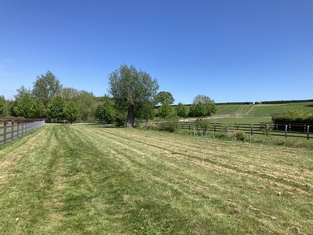
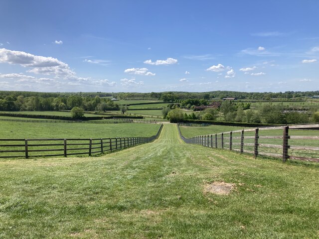
Downside is a small village located in the county of Surrey, England. Situated approximately 20 miles south-west of London, it falls within the Mole Valley district. The village is surrounded by picturesque countryside and offers a tranquil and peaceful setting for its residents.

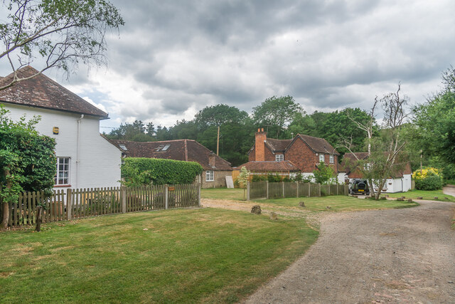
Downside has a population of around 500 people, making it a close-knit community where neighbors often know each other. The village is known for its charming and well-preserved architecture, with many period properties dating back to the 18th and 19th centuries. The village center features a few local amenities, including a post office, a village hall, and a traditional pub, creating a focal point for socializing.

The village is also home to St. Martha's Church, which sits on a hill overlooking the surrounding countryside. This historic church dates back to the 12th century and attracts visitors for its stunning views and architectural beauty.

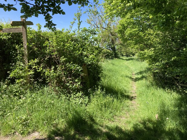
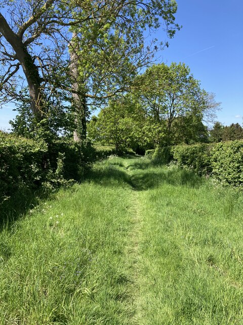
The surrounding area offers plenty of opportunities for outdoor activities and exploration. The North Downs Way, a long-distance footpath, passes through Downside, providing access to scenic walks and hikes. Additionally, nearby areas such as Box Hill and Ranmore Common offer further options for outdoor enthusiasts.

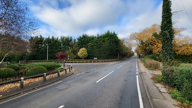
Transport links to Downside are convenient, with the village being located just off the A25 road. The nearest train station is in the neighboring village of West Humble, providing regular services to London and other nearby towns.

Overall, Downside offers a charming and idyllic living environment, combining rural tranquility with easy access to amenities and transportation links.

If you have any feedback on the listing, please let us know in the comments section below.

Downside Images

Images are sourced within 2km of 51.310242/-0.408847 or Grid Reference TQ1158. Thanks to Geograph Open Source API. All images are credited.

Mill Road next to the River Mole
Riverside houses on Mill Road The path is used as part of the new walking resource website route 'coblea two'.

Sloways <span class="nowrap"><a title="https://beta.slowways.org/Route/Coblea/9006" rel="nofollow ugc noopener" href="https://beta.slowways.org/Route/Coblea/9006">Link</a><img style="margin-left:2px;" alt="External link" title="External link - shift click to open in new window" src="https://s1.geograph.org.uk/img/external.png" width="10" height="10"/></span>
Riverside houses on Mill Road
The path is used as part of the new walking resource website route 'coblea two'. Sloways LinkExternal link
Grass verge along Tilt Road Cobham
Railway bridge on Stoke Road The A245 going over the 'New Guildford Line' (1885)
Railway bridge on Stoke Road
The A245 going over the 'New Guildford Line' (1885)
Chelsea Football Club The main entrance to the training grounds on Stoke Road, Stoke D'Abernon.
Chelsea Football Club
The main entrance to the training grounds on Stoke Road, Stoke D'Abernon.
Footpath near Chasemore Farm Footpath Esher 81/Leatherhead 600 near Chasemore Farm. The true line of the right of way passes through the paddock to the left (which, given the footpath was diverted out of the farm some while ago, suggests a lack of foresight). The stream, on the right, is the borough boundary between Elmbridge and Mole Valley — save that the boundary actually follows the old, meandering course of the stream which would twice have crossed this lower part of the field (this is why the footpath has two numbers).
Footpath near Chasemore Farm
Footpath Esher 81/Leatherhead 600 near Chasemore Farm. The true line of the right of way passes through the paddock to the left (which, given the footpath was diverted out of the farm some while ago, suggests a lack of foresight). The stream, on the right, is the borough boundary between Elmbridge and Mole Valley — save that the boundary actually follows the old, meandering course of the stream which would twice have crossed this lower part of the field (this is why the footpath has two numbers).
Chasemore Farm from footpath 1 Footpath Leatherhead 1 descends between horse paddocks towards a bridge over a stream marking the boundary between Mole Valley district and Elmbridge borough. Beyond is Chasemore Farm.
Chasemore Farm from footpath 1
Footpath Leatherhead 1 descends between horse paddocks towards a bridge over a stream marking the boundary between Mole Valley district and Elmbridge borough. Beyond is Chasemore Farm.
Stents Lane near Bookham Lodge Stents Lane at the junction between footpaths Leatherhead 1 and 6.  Footpath 6 here follows Stents Lane.
Stents Lane near Bookham Lodge
Stents Lane at the junction between footpaths Leatherhead 1 and 6. Footpath 6 here follows Stents Lane.
Stents Lane Footpath Leatherhead 6 here follows the course of Stents Lane behind <a href="https://www.geograph.org.uk/photo/676464">TQ1257 : Bookham Lodge</a>..
Stents Lane
Footpath Leatherhead 6 here follows the course of Stents Lane behind TQ1257 : Bookham Lodge..
Track across paddocks Track between paddocks on Chasemore Farm.
Track across paddocks
Track between paddocks on Chasemore Farm.
Paddock Paddock on Chasemore Farm.
Paddock
Paddock on Chasemore Farm.
Pond One of a number of ponds in Great Bookham Common.
Pond
One of a number of ponds in Great Bookham Common.
Great Bookham Common Path in Great Bookham Common.
Great Bookham Common
Path in Great Bookham Common.
Common Road Track in Little Bookham Common.
Common Road
Track in Little Bookham Common.
Five Halls and Ivy Cottage Houses on the edge of Little Bookham Common.
Five Halls and Ivy Cottage
Houses on the edge of Little Bookham Common.
Ivy Cottage House on the edge of Little Bookham Common.
Ivy Cottage
House on the edge of Little Bookham Common.
Footpath 115 from Banks Common to Effingham Common What a difference a decade can make: <a href="https://www.geograph.org.uk/photo/4423266">TQ1156 : Footpath from Mornshill woods and Banks Common</a>. The footpath has been fenced in for some years, and neither the highway authority (which is responsible for the surface) nor the occupier (who is responsible for maintaining the hedge on the right of the path) appears to have done anything in that time. The consequence is that the path now is nearly impassable, and a narrow, muddy defile in winter.
Footpath 115 from Banks Common to Effingham Common
What a difference a decade can make: TQ1156 : Footpath from Mornshill woods and Banks Common. The footpath has been fenced in for some years, and neither the highway authority (which is responsible for the surface) nor the occupier (who is responsible for maintaining the hedge on the right of the path) appears to have done anything in that time. The consequence is that the path now is nearly impassable, and a narrow, muddy defile in winter.
Cobham & Stoke D'Abernon railway station
Show me another place!

Downside is located at Grid Ref: TQ1158 (Lat: 51.310242, Lng: -0.408847)

Administrative County: Surrey

District: Elmbridge

Police Authority: Surrey

What 3 Words

///verbs.rigid.anyway. Near Cobham, Surrey

Nearby Locations

Downside

Related Wikis

Downside, Surrey

Downside is a small village in the English county of Surrey, in the local government district of Elmbridge, centred on Downside Common which is 18 miles...

Cobham MSA

Cobham services is a motorway service area on the M25 motorway in Surrey between junctions 9 and 10. It is operated by Extra MSA and was opened for business...

Cobham Park

Cobham Park is a set of about 22 apartments in and around a converted country mansion and associated lawn, gardens, fields and woodlands in the mainly...

Hatchford

Hatchford is a hamlet in the English county of Surrey outside the town of Cobham (its former civil and ecclesiastical parish); it traditionally includes...

Nearby Amenities

Located within 500m of 51.310242,-0.408847
Pub
The Cricketers
Addr City: Cobham
Addr Postcode: KT11 3NX
Addr Street: Downside Common
Addr Suburb: Downside
Fhrs Id: 632902
Toilets: yes
Toilets Access: customers
Wikidata: Q26582377
Lat/Long: 51.3119537/-0.4108014
Bus Stop
Middleton Road
Naptan AtcoCode: 40004405174A
Naptan Bearing: W
Naptan CommonName: Middleton Road
Naptan Indicator: Just after
Naptan Landmark: Middleton Road
Naptan NaptanCode: suragtmp
Naptan Street: Downside Common Road
Naptan Verified: no
Public Transport: platform
Source: naptan_import
Lat/Long: 51.310413/-0.4080855
Downside
Place: village
Lat/Long: 51.3113733/-0.4081727
Turning Circle
Lat/Long: 51.3093399/-0.4077503
Turning Circle
Lat/Long: 51.3096051/-0.4091774
Motorway Junction
Cobham Services
Lat/Long: 51.3075086/-0.4124859
Street Lamp
Lamp Model: Urbis ZX3
Lamp Type: SON
Source: Mapillary (2019-02-15)
Lat/Long: 51.3079158/-0.4145166
Street Lamp
Lamp Model: Urbis ZX3
Lamp Type: SON
Source: Mapillary (2019-02-15)
Lat/Long: 51.3080449/-0.4150423
Traffic Sign: variable_message
Variable Message Model: AMI
Lat/Long: 51.3081156/-0.415127
Traffic Sign: variable_message
Variable Message Model: AMI
Lat/Long: 51.3081471/-0.4151044
Traffic Sign: variable_message
Variable Message Model: AMI
Lat/Long: 51.3081785/-0.415082
Traffic Sign: variable_message
Variable Message Model: AMI
Lat/Long: 51.3082036/-0.415064
Traffic Sign: variable_message
Variable Message Model: MS2
Lat/Long: 51.3082638/-0.4150209
Traffic Sign: variable_message
Variable Message Model: AMI
Lat/Long: 51.3058148/-0.4085863
Traffic Sign: variable_message
Variable Message Model: AMI
Lat/Long: 51.3059054/-0.4085957
Phone
Emergency: phone
Operator: National Highways
Operator Wikidata: Q5760006
Lat/Long: 51.3066568/-0.4075741
Traffic Sign: variable_message
Variable Message Model: AMI
Lat/Long: 51.3066313/-0.4083431
Traffic Sign: variable_message
Variable Message Model: AMI
Lat/Long: 51.3066584/-0.4083305
Traffic Sign: variable_message
Variable Message Model: AMI
Lat/Long: 51.3066879/-0.4083167
Traffic Sign: variable_message
Variable Message Model: AMI
Lat/Long: 51.3067164/-0.4083034
Traffic Sign: variable_message
Variable Message Model: AMI
Lat/Long: 51.3060253/-0.4090516
Traffic Sign: variable_message
Variable Message Model: AMI
Lat/Long: 51.306032/-0.4092675
Phone
Emergency: phone
Operator: National Highways
Operator Wikidata: Q5760006
Lat/Long: 51.3064709/-0.4088384
Traffic Sign: variable_message
Variable Message Model: AMI
Lat/Long: 51.3065525/-0.4083799
Traffic Sign: variable_message
Variable Message Model: AMI
Lat/Long: 51.3065218/-0.4083943
Traffic Sign: variable_message
Variable Message Model: AMI
Lat/Long: 51.3064886/-0.4084098
Traffic Sign: variable_message
Variable Message Model: AMI
Lat/Long: 51.3064581/-0.408424
Traffic Sign: variable_message
Variable Message Model: MS2
Lat/Long: 51.3067941/-0.4082671
Traffic Sign: variable_message
Variable Message Model: MS2
Lat/Long: 51.3063808/-0.4084602
Post Box
Collection Times: Mo-Fr 16:00; Sa 07:00
Operator: Royal Mail
Post Box Type: pillar
Ref: KT11 118
Royal Cypher: EIIR
Royal Cypher Wikidata: Q33102113
Lat/Long: 51.3106728/-0.4094888
Bench
Backrest: yes
Lat/Long: 51.3104296/-0.4073598
Board Type: notice
Information: board
Tourism: information
Lat/Long: 51.3106509/-0.4094117
Defibrillator
Access: yes
Emergency: defibrillator
Indoor: no
Lat/Long: 51.3105288/-0.4094728
Drinking Water: no
Handle: lever
Heritage: 2
Heritage Operator: Historic England
Historic: yes
Inscription: THIS PUMP|WAS ERECTED & THE|WATER BROUGHT|FROM A DISTANCE|FOR THE SUPPLY|& COMFORT OF THE|COTTAGERS ON|DOWNSIDE|COMMON COBHAM|BY|HARVEY COMBE ESQR|1858.
Listed Status: Grade II
Man Made: water_well
Mechanical Driver: manual
Pump: manual
Pump Status: locked
Ref GB Nhle: 1030210
Lat/Long: 51.3108685/-0.4064479
Bench
Backrest: no
Material: wood
Lat/Long: 51.3123481/-0.4088759
Bench
Backrest: yes
Material: wood
Lat/Long: 51.3116106/-0.4091839
Barrier: stile
Material: wood
Step Count: 2
Stile: stepover
Lat/Long: 51.3085003/-0.4140659
Social Club
Downside Sports & Social Club
Access: private
Addr City: Cobham
Addr Postcode: KT11 3NU
Addr Street: Downside Common Road
Addr Substreet: The Island
Addr Suburb: Downside
Fhrs Id: 572474
Lat/Long: 51.3111367/-0.4092273
The data included in this document is from www.openstreetmap.org. The data is made available under ODbL.

Have you been to Downside?

Leave your review of Downside below (or comments, questions and feedback).