Apesdown Copse
Wood, Forest in Hampshire
England
Apesdown Copse
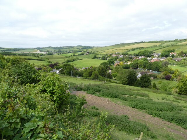
Apesdown Copse is a picturesque woodland located in Hampshire, England. Covering an area of approximately 100 acres, it is a serene and tranquil environment that attracts visitors from near and far. The copse is situated in the northern part of Hampshire, nestled between the towns of Winchester and Basingstoke.
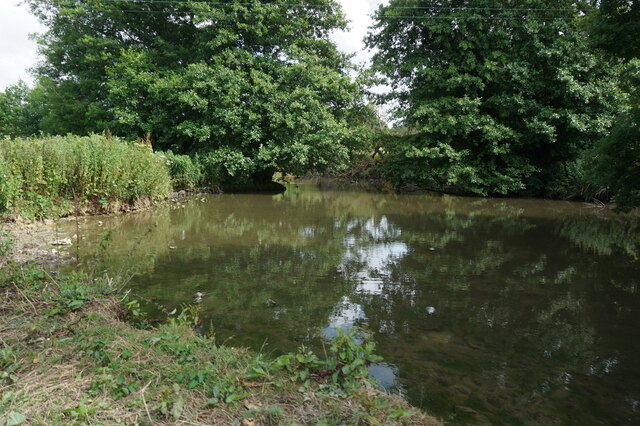
The woodland is known for its diverse and rich flora and fauna. It features a mix of deciduous and coniferous trees, including oak, beech, and pine, which provide a dense canopy that creates a shaded and cool atmosphere. The forest floor is carpeted with an array of wildflowers, ferns, and mosses, adding to the natural beauty of the copse.
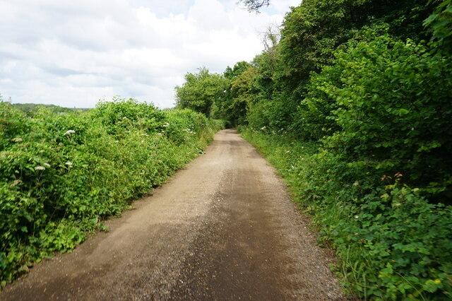
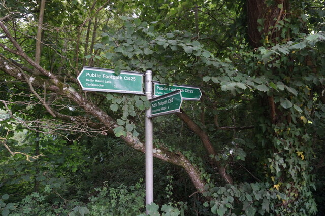
Apesdown Copse offers a variety of walking trails, ranging from easy strolls to more challenging hikes. Visitors can explore the network of paths that wind through the woodland, allowing them to immerse themselves in nature and appreciate the peaceful surroundings. Along the way, they may encounter various wildlife species, such as deer, badgers, and a wide variety of bird species.
The copse is also home to a number of historical features, including ancient earthworks and remnants of medieval settlements. These archaeological sites provide insight into the rich history of the area and offer a unique experience for history enthusiasts.
Apesdown Copse is a popular destination for nature lovers, hikers, and those seeking a tranquil retreat. Its natural beauty, diverse ecosystem, and historical significance make it a must-visit location for anyone exploring the Hampshire countryside.
If you have any feedback on the listing, please let us know in the comments section below.
Apesdown Copse Images
Images are sourced within 2km of 50.685616/-1.360549 or Grid Reference SZ4587. Thanks to Geograph Open Source API. All images are credited.


Apesdown Copse is located at Grid Ref: SZ4587 (Lat: 50.685616, Lng: -1.360549)
Unitary Authority: Isle of Wight
Police Authority: Hampshire
What 3 Words
///impose.faded.fidgeted. Near Shalfleet, Isle of Wight
Nearby Locations
Related Wikis

Apesdown
Apesdown is a hamlet on the Isle of Wight towards the west in an area known as West Wight. It is situated on the B3401 road between Carisbrooke and Calbourne...
Watchingwell Halt railway station
Watchingwell Halt, was an intermediate station on the Freshwater, Yarmouth and Newport Railway, situated near the hamlet of Upper Watchingwell, that started...

Rowridge Valley
Rowridge Valley is a 39.8-hectare (98-acre) Site of Special Scientific Interest (SSSI) that is 2 km (1.2 mi) east of the village of Calbourne and just...
Rowridge
Rowridge is a hamlet on the Isle of Wight towards the west in an area known as West Wight. It is the location of the Rowridge transmitting station, a 149...
Nearby Amenities
Located within 500m of 50.685616,-1.360549Have you been to Apesdown Copse?
Leave your review of Apesdown Copse below (or comments, questions and feedback).