Elmtree Plantation

Wood, Forest in Berkshire Vale of White Horse

England

Elmtree Plantation

Stileway Road Stileway Road (track) bridleway heading up towards Oldfield Farm
Stileway Road Credit: Shaun Ferguson

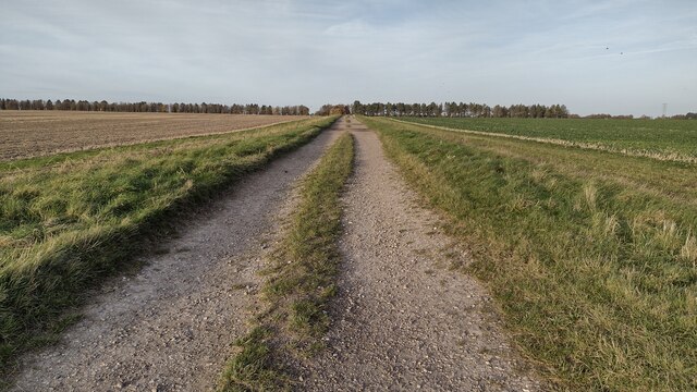
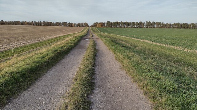
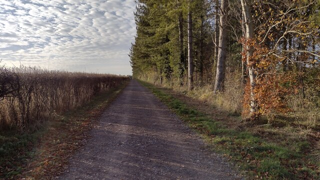
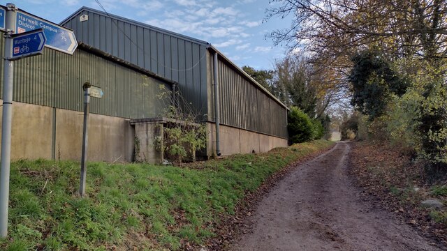
Elmtree Plantation is a scenic woodland area located in Berkshire, England. Situated in the heart of the county, this plantation covers an expansive area of lush greenery and is well-known for its diverse range of tree species. The plantation is predominantly composed of deciduous trees, such as oak, beech, and maple, which create a stunning display of colors during the autumn season.

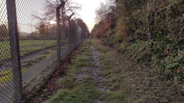
Elmtree Plantation offers a tranquil escape from the bustling city life, providing visitors with an opportunity to immerse themselves in the beauty of nature. The woodland is crisscrossed with well-maintained walking trails, allowing visitors to explore the area at their own pace. These trails lead to picturesque spots, including a serene pond and a small stream that meanders through the plantation.

The plantation is also home to a rich variety of wildlife. Birdwatchers can revel in the chance to spot rare and migratory species, while nature enthusiasts can encounter small mammals and reptiles that call this woodland their home. Elmtree Plantation is a paradise for photographers, offering numerous opportunities to capture the exquisite beauty of nature.

Visitors to Elmtree Plantation can enjoy a picnic in the designated areas, surrounded by the peaceful ambiance of the woodland. The plantation is easily accessible, with ample parking available for visitors. It is also wheelchair-friendly, ensuring that everyone can enjoy the natural wonders of this breathtaking woodland.

Elmtree Plantation is a beloved destination for both locals and tourists alike, offering a serene and captivating experience for those seeking solace in nature's embrace.

If you have any feedback on the listing, please let us know in the comments section below.

Elmtree Plantation Images

Images are sourced within 2km of 51.581472/-1.3481463 or Grid Reference SU4587. Thanks to Geograph Open Source API. All images are credited.

Stileway Road Stileway Road (track) bridleway heading up towards Oldfield Farm
Stileway Road
Stileway Road (track) bridleway heading up towards Oldfield Farm
Stileway Road Stileway Road (track) bridleway heading up towards Oldfield Farm
Stileway Road
Stileway Road (track) bridleway heading up towards Oldfield Farm
Perimeter Bridleway Perimeter bridleway heading to Stileway Road
Perimeter Bridleway
Perimeter bridleway heading to Stileway Road
Icknield Greenway Icknield Greenway Restricted Byway heading to Ginge Brook
Icknield Greenway
Icknield Greenway Restricted Byway heading to Ginge Brook
Tree Lined Way Tree lined way (Designated traffic free cycle route) to East Ginge
Tree Lined Way
Tree lined way (Designated traffic free cycle route) to East Ginge
Route 544 to Harwell Campus National Cycle Network Route 544 to Harwell Campus for a short stretch on the bridleway to The Ridgeway
Route 544 to Harwell Campus
National Cycle Network Route 544 to Harwell Campus for a short stretch on the bridleway to The Ridgeway
Bridleway heading to Ardington Bridleway between the fields heading to Ardington
Bridleway heading to Ardington
Bridleway between the fields heading to Ardington
Bridleway to Ardington Bridleway to Ardington nearing the byway to head on past the tree covered Roundabout Hill
Bridleway to Ardington
Bridleway to Ardington nearing the byway to head on past the tree covered Roundabout Hill
Ginge Brook Ginge Brook with a major construction of a bridge (compared to the John Walton 2013 image) carrying the Icknield Greenway Byway
Ginge Brook
Ginge Brook with a major construction of a bridge (compared to the John Walton 2013 image) carrying the Icknield Greenway Byway
An endangered species? This week, we've heard of the £20 pint <span class="nowrap"><a title="https://www.itv.com/news/2022-09-05/are-we-about-to-see-the-price-of-a-pint-hit-20" rel="nofollow ugc noopener" href="https://www.itv.com/news/2022-09-05/are-we-about-to-see-the-price-of-a-pint-hit-20">Link</a><img style="margin-left:2px;" alt="External link" title="External link - shift click to open in new window" src="https://s1.geograph.org.uk/img/external.png" width="10" height="10"/></span> Surely that will mean the end for the noble British pub, like this one at East Hendred
An endangered species?
This week, we've heard of the £20 pint LinkExternal link Surely that will mean the end for the noble British pub, like this one at East Hendred
Traffic jam in West Hendred
St Augustine's of Canterbury, East Hendred: early September 2022
Scutchamer's Knob
Scutchamer's Knob
West Hendred Church, Oxfordshire Holy Trinity Church
West Hendred Church, Oxfordshire
Holy Trinity Church
St Augustine's of Canterbury: East Hendred The church is situated in the eastern half of the grid square, near the eastern edge. This view was taken from south west of the church.
St Augustine's of Canterbury: East Hendred
The church is situated in the eastern half of the grid square, near the eastern edge. This view was taken from south west of the church.
Typical Residential Street in East Hendred This village scene is situated in the eastern half of the grid square and the view was taken from west of the church. This village has many thatched cottages.
Typical Residential Street in East Hendred
This village scene is situated in the eastern half of the grid square and the view was taken from west of the church. This village has many thatched cottages.
East Hendred Village This picturesque village in the middle of farmland, won the prize for the best kept village in Berkshire in 1973 and Oxfordshire in 1974. The pub is situated inside the triangular road in the north western corner of the grid square. Most of this square is farmland, with most of the village being in the adjacent grid square.
East Hendred Village
This picturesque village in the middle of farmland, won the prize for the best kept village in Berkshire in 1973 and Oxfordshire in 1974. The pub is situated inside the triangular road in the north western corner of the grid square. Most of this square is farmland, with most of the village being in the adjacent grid square.
Trees in East Hendred This scene in the village is to be found in the western half of the square, near Hendred House. The driveway to Hendred House has trees lined on either side of it. The wooded area belongs to the Hendred House and farm.
Trees in East Hendred
This scene in the village is to be found in the western half of the square, near Hendred House. The driveway to Hendred House has trees lined on either side of it. The wooded area belongs to the Hendred House and farm.
Show me another place!

Elmtree Plantation is located at Grid Ref: SU4587 (Lat: 51.581472, Lng: -1.3481463)

Administrative County: Oxfordshire

District: Vale of White Horse

Police Authority: Thames Valley

What 3 Words

///marmalade.merely.fearfully. Near Harwell, Oxfordshire

Nearby Locations

Elmtree Plantation

Related Wikis

West Ginge

West Ginge is a hamlet within the civil parish of Ardington in the English county of Oxfordshire (formerly Berkshire), 3.9 miles (6.3 km) by road to the...

Holy Trinity Monastery, East Hendred

Holy Trinity Monastery, East Hendred was briefly a convent of contemplative Benedictine nuns situated in the Vale of White Horse, Oxfordshire, from 2004...

East Hendred

East Hendred is a village and civil parish about 4 miles (6.4 km) east of Wantage in the Vale of White Horse and a similar distance west of Didcot. The...

Champs Chapel Museum of East Hendred

The Champs Chapel Museum of East Hendred is a local village museum housed in the former Chapel of Jesus of Bethlehem, built in 1453 by Carthusian monks...

PLUTO reactor

PLUTO was a materials testing nuclear reactor housed at the Atomic Energy Research Establishment, a former Royal Air Force airfield at Harwell, Oxfordshire...

Mammalian Genetics Unit

The Mammalian Genetics Unit was a genetics and genomics research institute in Oxfordshire. == History == Earlier research on the same site at the Radiobiology...

The Ridgeway

The Ridgeway is a ridgeway or ancient trackway described as Britain's oldest road. The section clearly identified as an ancient trackway extends from Wiltshire...

DIDO (nuclear reactor)

DIDO was a materials testing nuclear reactor at the Atomic Energy Research Establishment at Harwell, Oxfordshire in the United Kingdom. It used enriched...

Have you been to Elmtree Plantation?

Leave your review of Elmtree Plantation below (or comments, questions and feedback).