Burleigh Wood

Wood, Forest in Oxfordshire West Oxfordshire

England

Burleigh Wood

Old Bridge Marker on Hanborough Bridge Bridge Marker set in the north parapet of Hanborough Bridge, River Evenlode, on the B4095 Main Road. On the boundary of Hanborough and Bladon parishes.

Milestone Society National ID: OX_HANBLA01br
Old Bridge Marker on Hanborough Bridge Credit: Roadside Relics

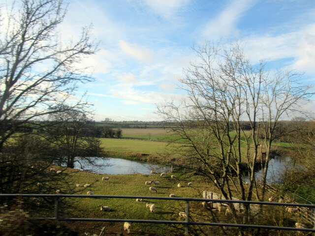
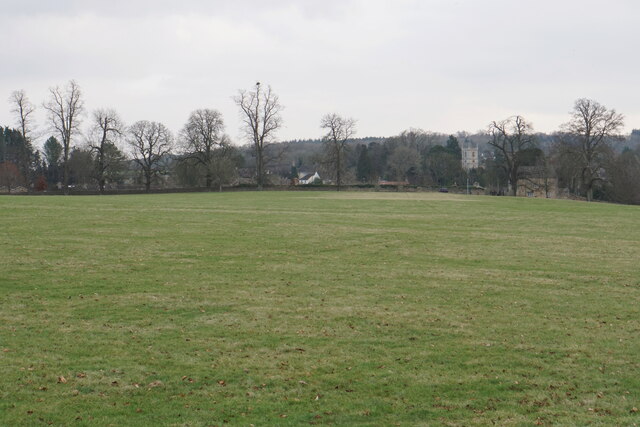
Burleigh Wood is a picturesque woodland located in Oxfordshire, England. Covering an area of approximately 100 acres, it is a popular destination for nature enthusiasts and outdoor lovers. The wood is characterized by its diverse range of trees, including oak, beech, and birch, which create a rich canopy that provides shade and shelter for numerous species of wildlife.

The wood is intersected by well-maintained footpaths, allowing visitors to explore its tranquil beauty at their own pace. These paths lead to various points of interest, such as a small stream that meanders through the wood, adding to its peaceful ambiance. Additionally, there are several clearings within the forest, where visitors can rest, have picnics, or simply admire the surrounding natural beauty.

Burleigh Wood is teeming with wildlife, making it a haven for birdwatchers and nature photographers. The wood is home to a diverse range of bird species, including woodpeckers, owls, and various songbirds. Small mammals such as foxes, rabbits, and squirrels can also be spotted throughout the woodland.

The wood is open to the public throughout the year, with no entrance fee. It is managed by a local conservation group, which ensures its preservation and protection. Visitors are encouraged to respect the natural environment and follow designated trails to minimize any impact on the delicate ecosystem.

Burleigh Wood offers a peaceful and enchanting escape from the hustle and bustle of everyday life. Whether you are seeking solitude, wildlife encounters, or simply a stroll through stunning natural surroundings, Burleigh Wood is a must-visit destination in Oxfordshire.

If you have any feedback on the listing, please let us know in the comments section below.

Burleigh Wood Images

Images are sourced within 2km of 51.818793/-1.3573504 or Grid Reference SP4413. Thanks to Geograph Open Source API. All images are credited.

Old Bridge Marker on Hanborough Bridge Bridge Marker set in the north parapet of Hanborough Bridge, River Evenlode, on the B4095 Main Road. On the boundary of Hanborough and Bladon parishes.

Milestone Society National ID: OX_HANBLA01br
Old Bridge Marker on Hanborough Bridge
Bridge Marker set in the north parapet of Hanborough Bridge, River Evenlode, on the B4095 Main Road. On the boundary of Hanborough and Bladon parishes. Milestone Society National ID: OX_HANBLA01br
Stream near Mill Farm Hanborough
Gnarled trees in High Park The park allows trees to get old.
Gnarled trees in High Park
The park allows trees to get old.
Woodland track in Blenheim Park This track is private and not open to the public.
Woodland track in Blenheim Park
This track is private and not open to the public.
Path in Blenheim Park A public footpath leads to near this point, but you cannot continue on this part without paying for entrance to the park, not that anybody was checking.
Path in Blenheim Park
A public footpath leads to near this point, but you cannot continue on this part without paying for entrance to the park, not that anybody was checking.
Trees by Bladon Bridge Landscaping in Blenheim Park has used the River Glyme to create a series of lakes, of which this is one.
Trees by Bladon Bridge
Landscaping in Blenheim Park has used the River Glyme to create a series of lakes, of which this is one.
Bladon Bridge A grand bridge over the landscaped River Glyme in Blenheim Park. The road doesn't go to Bladon.
Bladon Bridge
A grand bridge over the landscaped River Glyme in Blenheim Park. The road doesn't go to Bladon.
Bladon from Blenheim Park In winter lighting. The tower of St Martin's Church stands out.
Bladon from Blenheim Park
In winter lighting. The tower of St Martin's Church stands out.
Hanborough railway station, Oxfordshire Opened in 1853 as "Handborough" by the Oxford, Worcester & Wolverhampton Railway, later part of the Great Western Railway, on the line from Oxford to Worcester. The name was changed to "Hanborough"  in 1992.
View south east towards Yarnton Junction and Oxford. Compare with <a href="https://www.geograph.org.uk/photo/4021348">SP4314 : Hanborough railway station, Oxfordshire, 2014</a> - The former north-bound platform to the right has disappeared into the undergrowth but the taller trees have been cut down. A new booking office on the left was opened in 2019.
Hanborough railway station, Oxfordshire
Opened in 1853 as "Handborough" by the Oxford, Worcester & Wolverhampton Railway, later part of the Great Western Railway, on the line from Oxford to Worcester. The name was changed to "Hanborough" in 1992. View south east towards Yarnton Junction and Oxford. Compare with SP4314 : Hanborough railway station, Oxfordshire, 2014 - The former north-bound platform to the right has disappeared into the undergrowth but the taller trees have been cut down. A new booking office on the left was opened in 2019.
Grand Cascade Blenheim
River Glyme from Bladon Bridge
Dried-out dew pond in Blenheim Park This was formerly used as a water jump in the horse trials, see e.g. <a href="https://www.geograph.org.uk/photo/6732116">SP4415 : Cross-country fence 6A and B at Blenheim Horse Trials</a> but in 2022 it is dry and not part of the course at all.
Dried-out dew pond in Blenheim Park
This was formerly used as a water jump in the horse trials, see e.g. SP4415 : Cross-country fence 6A and B at Blenheim Horse Trials but in 2022 it is dry and not part of the course at all.
Cross-country course at Blenheim Horse Trials One of the two points at which the cross-country course crosses the River Glyme.
Cross-country course at Blenheim Horse Trials
One of the two points at which the cross-country course crosses the River Glyme.
Horseshoe sculptures by the River Glyme The New Bridge of 1773 in the background is Grade I listed.
Horseshoe sculptures by the River Glyme
The New Bridge of 1773 in the background is Grade I listed.
Lakeside bar by the River Glyme
Cross-country course at Blenheim Horse Trials The view back from the opposite side of the river is at <a href="https://www.geograph.org.uk/photo/7349701">SP4415 : Cross-country course at Blenheim Horse Trials</a>

Out of shot to the left, a small team of frogmen are based throughout the running of the cross-country phase, not only in case of rider and/or horse falling in the river, but also to shepherd away wandering swans!
Cross-country course at Blenheim Horse Trials
The view back from the opposite side of the river is at SP4415 : Cross-country course at Blenheim Horse Trials Out of shot to the left, a small team of frogmen are based throughout the running of the cross-country phase, not only in case of rider and/or horse falling in the river, but also to shepherd away wandering swans!
On the cross-country course at Blenheim Lucy Jackson and Dassett Showman on the four-star short course.
On the cross-country course at Blenheim
Lucy Jackson and Dassett Showman on the four-star short course.
Painted Buses at the Museum The Oxford Bus Museum is next to Long Hanborough Station.
The museum is closed today. These very convincing looking buses are actually paintings on the garage roller door. The real ones are inside. <a href="https://www.geograph.org.uk/photo/5157199">SP4314 : Oxford Bus Museum</a>
Painted Buses at the Museum
The Oxford Bus Museum is next to Long Hanborough Station. The museum is closed today. These very convincing looking buses are actually paintings on the garage roller door. The real ones are inside. SP4314 : Oxford Bus Museum
Show me another place!

Burleigh Wood is located at Grid Ref: SP4413 (Lat: 51.818793, Lng: -1.3573504)

Administrative County: Oxfordshire

District: West Oxfordshire

Police Authority: Thames Valley

What 3 Words

///plod.premature.passes. Near Woodstock, Oxfordshire

Nearby Locations

Burleigh Wood

Related Wikis

Hanborough railway station

Hanborough railway station is a railway station in the village of Long Hanborough in Oxfordshire, England, serving the village and surrounding district...

Oxford Bus Museum

The Oxford Bus Museum is a transport museum at Long Hanborough, West Oxfordshire, England, about 4 miles (6.4 km) northeast of Witney and 7 miles (11 km...

Hanborough

Hanborough is a civil parish in West Oxfordshire. The parish includes the villages of Church Hanborough (Ordnance Survey grid reference SP4212) and Long...

St Martin's Church, Bladon

St Martin's Church in Bladon near Woodstock, Oxfordshire, England, is the Church of England parish church of Bladon-with-Woodstock. It is also the mother...

River Glyme

The River Glyme is a river in Oxfordshire, England. It is a tributary of the River Evenlode. It rises about 1 mile (1.6 km) east of Chipping Norton, and...

Bladon

Bladon is a village and civil parish on the River Glyme about 6+1⁄2 miles (10.5 km) northwest of Oxford, Oxfordshire, England. It is where Sir Winston...

The Bell Inn, Long Hanborough

The Bell Inn, Long Hanborough is a well-established Grade II listedrestaurant and public house in the village of Long Hanborough, Oxfordshire, England...

Blenheim Park

Blenheim Park is a 224.3-hectare (554-acre) biological Site of Special Scientific Interest on the outskirts of Woodstock in Oxfordshire. It occupies most...

Nearby Amenities

Located within 500m of 51.818793,-1.3573504
Barrier: stile
Lat/Long: 51.8198711/-1.3521059
Barrier: stile
Source: survey
Lat/Long: 51.821471/-1.3546555
The data included in this document is from www.openstreetmap.org. The data is made available under ODbL.

Have you been to Burleigh Wood?

Leave your review of Burleigh Wood below (or comments, questions and feedback).