Black Wood

Wood, Forest in Yorkshire

England

Black Wood
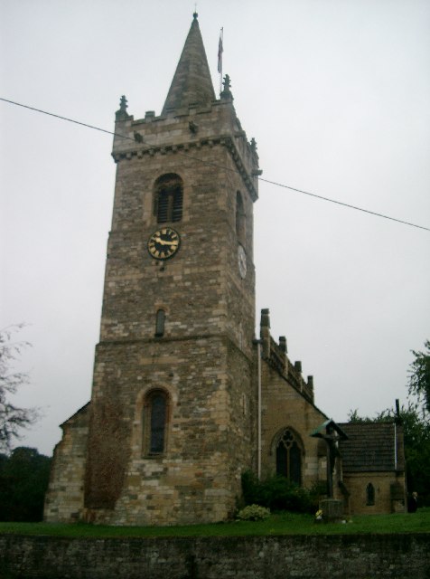
All Saints' Church, Bramham The parish church of Bramham.
All Saints' Church, Bramham Credit: John Davidson

Black Wood is a dense forest located in the county of Yorkshire, England. Spread over a vast area, it is known for its striking beauty and rich biodiversity. The forest is nestled in a hilly region, filled with ancient oak and beech trees that create a captivating and mysterious ambiance.

The woodland floor is carpeted with a lush green carpet of moss, ferns, and wildflowers, providing a haven for a diverse range of plant species. The forest is home to several rare and protected plants, including the delicate Lady's Slipper Orchid and the vibrant Wood Anemone. These plants thrive in the damp and shaded conditions provided by the thick tree canopy.

Black Wood is also a sanctuary for a variety of wildlife. The dense foliage and secluded corners provide an ideal habitat for many species of birds, such as owls, woodpeckers, and nightingales. Visitors to the forest may also spot deer, foxes, and squirrels, adding to the enchantment of the woodland experience.

The forest offers numerous walking trails that allow visitors to immerse themselves in its natural splendor. These paths wind through towering trees and alongside babbling brooks, offering a serene and peaceful escape from the outside world. The forest is a popular destination for nature enthusiasts, hikers, and photographers, who are drawn to its picturesque landscapes and unique flora and fauna.

Overall, Black Wood in Yorkshire is a captivating forest that offers a tranquil retreat for those seeking to connect with nature. Its breathtaking beauty and abundant wildlife make it a must-visit destination for anyone exploring the region.

If you have any feedback on the listing, please let us know in the comments section below.

Black Wood Images

Images are sourced within 2km of 53.877515/-1.3274235 or Grid Reference SE4442. Thanks to Geograph Open Source API. All images are credited.

All Saints' Church, Bramham The parish church of Bramham.
All Saints' Church, Bramham
The parish church of Bramham.
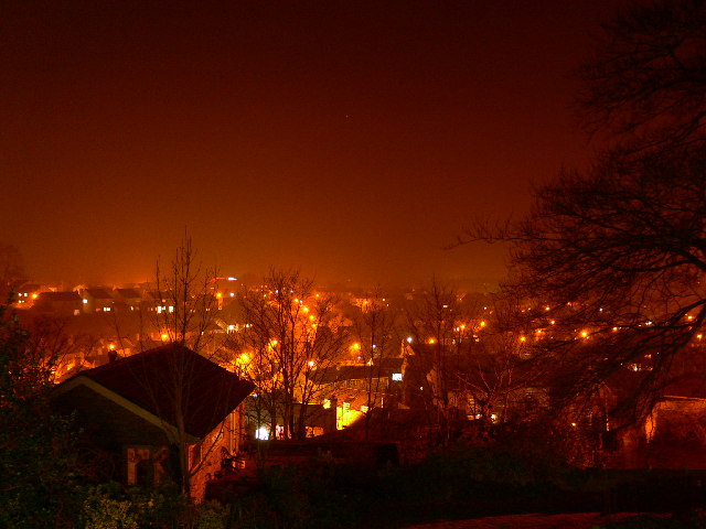
Bramham at Night Photograph from the top of Almshouse Hill showing the valley in which Bramham lies. Also visible is the A1 at the top of the far hill.
Bramham at Night
Photograph from the top of Almshouse Hill showing the valley in which Bramham lies. Also visible is the A1 at the top of the far hill.
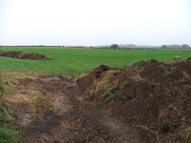
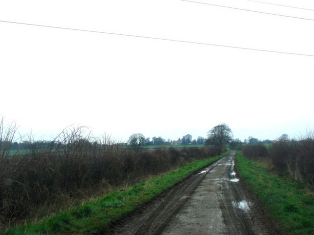
Farmland W of Bramham Park. Looking S from Headley Lane.
Farmland W of Bramham Park.
Looking S from Headley Lane.
A64 Tadcaster Junction Junction for Tadcaster off the A64.
A64 Tadcaster Junction
Junction for Tadcaster off the A64.
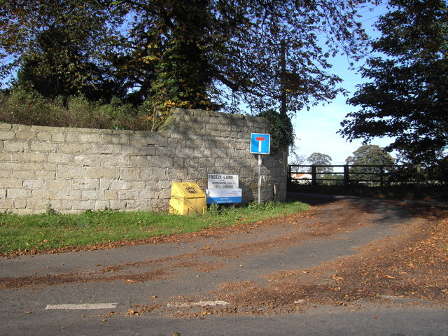
Freely Lane Bramham, near Bramham Lodge.
Freely Lane
Bramham, near Bramham Lodge.
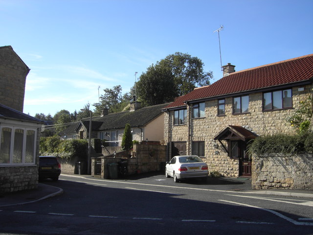
Back Street Bramham
Back Street
Bramham
Roman Crossroads Looking SE from Rudgate with York Lane crossing it. This junction is close to the Smaws Quarry landfill site. The vehicle on the other side of Rudgate is employed continually on road cleaning duty - and not very successfully by the look of things.
Roman Crossroads
Looking SE from Rudgate with York Lane crossing it. This junction is close to the Smaws Quarry landfill site. The vehicle on the other side of Rudgate is employed continually on road cleaning duty - and not very successfully by the look of things.
Landfill Site west of Tadcaster This is the northern end of a large landfill site that now occupies the sites of Smaws Quarry and Robshaw Hole. View from Rudgate.
Landfill Site west of Tadcaster
This is the northern end of a large landfill site that now occupies the sites of Smaws Quarry and Robshaw Hole. View from Rudgate.
Rudgate, Roman Road Rudgate is a short stretch of roman road cutting the corner off the A659 and thus saving a trip into Tadcaster.
Rudgate, Roman Road
Rudgate is a short stretch of roman road cutting the corner off the A659 and thus saving a trip into Tadcaster.
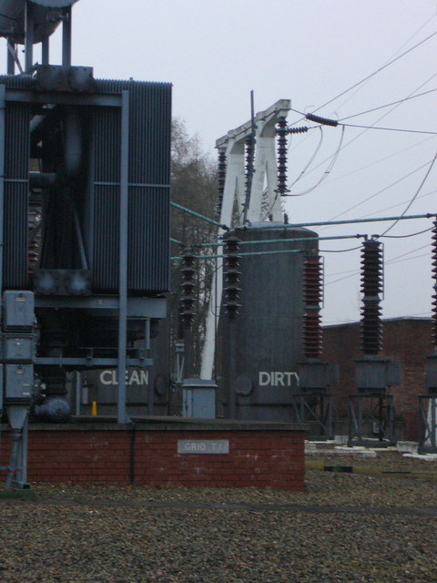
Bramham Electricity Sub-station The tanks labelled "clean" and "dirty" are for the oil used in the circuit breakers.
Bramham Electricity Sub-station
The tanks labelled "clean" and "dirty" are for the oil used in the circuit breakers.
Estate cottages Gardeners' cottages for the Toulston Lodge estate. The "big house" itself now houses Tadcaster Grammar School.
Estate cottages
Gardeners' cottages for the Toulston Lodge estate. The "big house" itself now houses Tadcaster Grammar School.
Headley Lane, Bramham Moor
New York Farm
New York Farm
Wise Warren Farm
Wise Warren Farm
Track over Oglethorpe Hills
Headley Hall
Headley Hall
Headley Cottages
Headley Cottages
Tadcaster Grammar School, HGV entrance
Show me another place!

Black Wood is located at Grid Ref: SE4442 (Lat: 53.877515, Lng: -1.3274235)

Division: West Riding

Unitary Authority: Leeds

Police Authority: West Yorkshire

What 3 Words

///huts.deeds.fidgeting. Near Bramham, West Yorkshire

Related Wikis

Bramham cum Oglethorpe

Bramham cum Oglethorpe is a civil parish forming part of the City of Leeds in the English county of West Yorkshire. The main settlement in the parish is...

Tadcaster Grammar School

Tadcaster Grammar School founded in 1557, is a coeducational secondary school and sixth form located near Tadcaster, North Yorkshire, England, educating...

Bramham Moor Aerodrome

Bramham Moor Aerodrome, (later known as RAF Tadcaster), was a First World War era military airfield near to the village of Bramham, West Yorkshire, England...

Bramham, West Yorkshire

Bramham is a village in the civil parish of Bramham cum Oglethorpe in the City of Leeds metropolitan borough, West Yorkshire, England. It sits in the Wetherby...

Nearby Amenities

Located within 500m of 53.877515,-1.3274235
Power: pole
Source: Bing
Lat/Long: 53.878915/-1.3329829
Location Transition: yes
Power: tower
Source: Bing
Lat/Long: 53.8786814/-1.3328233
Power: pole
Source: Bing
Lat/Long: 53.8793416/-1.3216035
Power: pole
Source: Bing
Lat/Long: 53.8750124/-1.3237828
Power: pole
Source: Bing
Lat/Long: 53.8774253/-1.3223814
Power: pole
Source: Bing
Lat/Long: 53.8768149/-1.3227542
Power: pole
Source: Bing
Lat/Long: 53.8755989/-1.3234355
Power: pole
Source: Bing
Lat/Long: 53.8800516/-1.3215003
Power: pole
Source: Bing
Lat/Long: 53.8762252/-1.3230854
Power: pole
Source: Bing
Lat/Long: 53.8740035/-1.324389
Power: pole
Source: Bing
Lat/Long: 53.8785907/-1.3217229
Power: pole
Source: Bing
Lat/Long: 53.8780246/-1.3220233
Location Transition: yes
Power: pole
Source: Bing
Lat/Long: 53.8735426/-1.3246676
Power: pole
Source: Bing
Lat/Long: 53.8745142/-1.3240779
The data included in this document is from www.openstreetmap.org. The data is made available under ODbL.

Have you been to Black Wood?

Leave your review of Black Wood below (or comments, questions and feedback).