Bowler's Plantation

Wood, Forest in Derbyshire Bolsover

England

Bowler's Plantation

Hardwick Old Hall Viewed from the gardens of Hardwick Hall.
Hardwick Old Hall Credit: Rod Allday

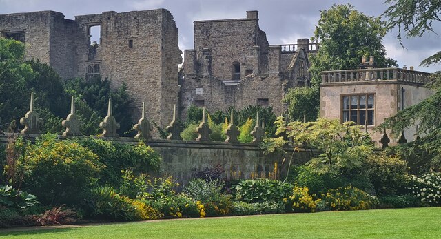
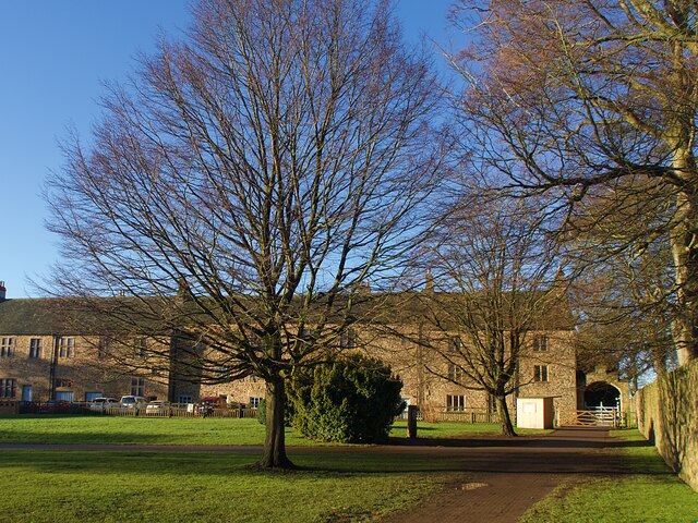
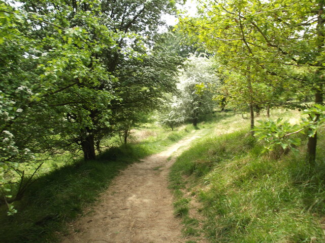
Bowler's Plantation is a picturesque woodland located in Derbyshire, England. Situated in the heart of the county, this enchanting forest covers an area of approximately 50 acres and is a haven for nature enthusiasts and outdoor adventurers alike.

The plantation is primarily populated by a variety of deciduous trees, including oak, beech, and birch, which create a stunning display of vibrant colors during the autumn months. The dense foliage provides a sanctuary for a diverse range of wildlife, such as squirrels, deer, and a plethora of bird species.

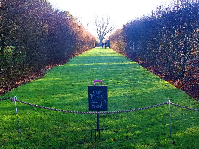
Visitors to Bowler's Plantation can explore the numerous walking trails that wind their way through the woodland, offering peaceful and tranquil surroundings. The paths are well-maintained, making it accessible for individuals of all ages and abilities to enjoy. Along the way, there are several benches strategically placed, inviting visitors to sit and soak in the serene ambiance of the forest.

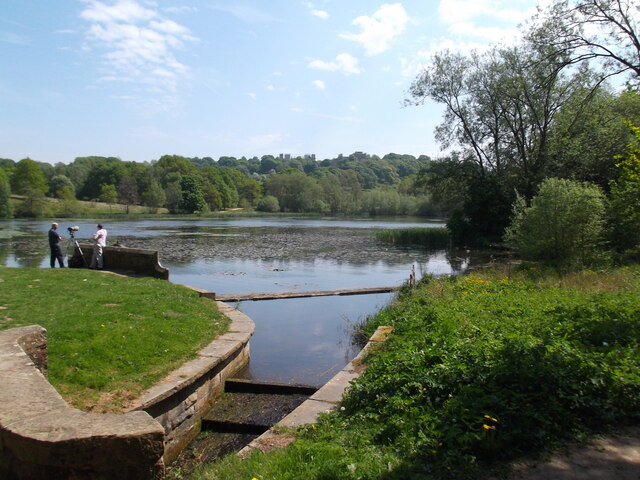
The plantation is also home to a small lake, adding to its scenic charm. The glistening water reflects the surrounding trees, creating a mesmerizing spectacle. Fishing is allowed in the lake, providing anglers with an opportunity to catch a variety of freshwater fish species.

Bowler's Plantation offers something for everyone, whether it be a leisurely stroll, birdwatching, or simply a place to relax and unwind in nature's embrace. Its enchanting beauty and peaceful atmosphere make it a must-visit destination in Derbyshire for those seeking a respite from the hustle and bustle of everyday life.

If you have any feedback on the listing, please let us know in the comments section below.

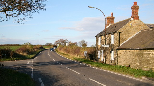
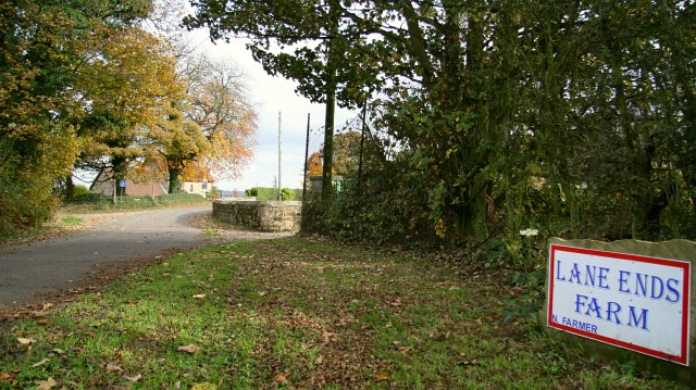
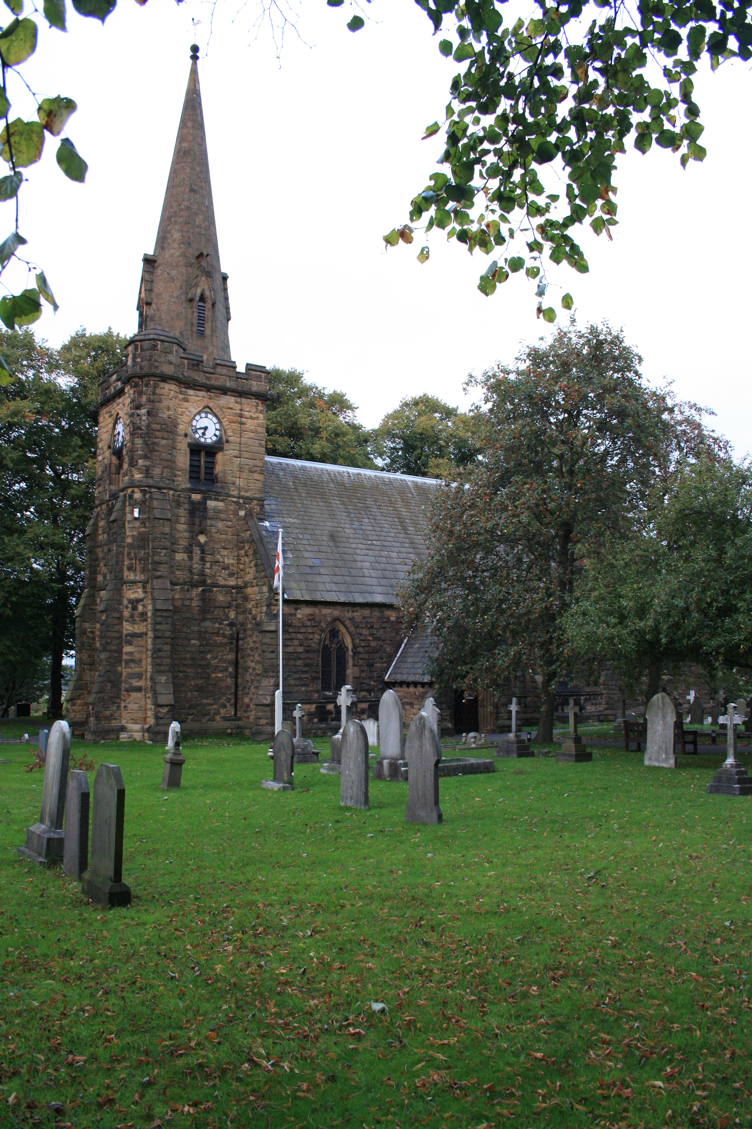
Bowler's Plantation Images

Images are sourced within 2km of 53.17036/-1.3388727 or Grid Reference SK4463. Thanks to Geograph Open Source API. All images are credited.

Hardwick Old Hall Viewed from the gardens of Hardwick Hall.
Hardwick Old Hall
Viewed from the gardens of Hardwick Hall.
Cottages at Hardwick Hall Some of the original buildings outside the garden walls have recently been converted to holiday accommodation.
Cottages at Hardwick Hall
Some of the original buildings outside the garden walls have recently been converted to holiday accommodation.
Grassed garden path in Hardwick Hall  Grassed walkways divide the walled garden at Hardwick into quarters. At the time of this visit in early January they were out of use to allow the grass to recover.
Grassed garden path in Hardwick Hall
Grassed walkways divide the walled garden at Hardwick into quarters. At the time of this visit in early January they were out of use to allow the grass to recover.
Parking and industrial units in Holmewood Industrial Estate
Hardwick View Road A circular road providing access to Holmewood Industrial Estate.
Hardwick View Road
A circular road providing access to Holmewood Industrial Estate.
Hardwick View Road A circular road providing access to Holmewood Industrial Estate. Despite the name, Hardwick Hall cannot be seen from here.
Hardwick View Road
A circular road providing access to Holmewood Industrial Estate. Despite the name, Hardwick Hall cannot be seen from here.
The Great Pond, Hardwick Estate
Tree-lined path through the park
A busy day at Hardwick Hall
M1 at Deep Lane overbridge
M1 near Stainsby
M1 near Stainsby
Hardwick Old Hall The south facade of the shell of the old hall
Hardwick Old Hall
The south facade of the shell of the old hall
Great Pond Part of Hardwick Park, showing some autumn mellowness.
Great Pond
Part of Hardwick Park, showing some autumn mellowness.
Footbridge and culvert by the M1 A stream emerges from a culvert under the M1, where it is crossed by a footbridge, before flowing into the river Doe Lea.
Footbridge and culvert by the M1
A stream emerges from a culvert under the M1, where it is crossed by a footbridge, before flowing into the river Doe Lea.
Stainsby Mill, Mill Lane, Stainsby, Derbyshire Working Victorian watermill on the Hardwick Estate.
Stainsby Mill, Mill Lane, Stainsby, Derbyshire
Working Victorian watermill on the Hardwick Estate.
West side buildings, stable yard, Hardwick Hall
Hardwick Old Hall, Hardwick Hall Estate The ruins of Hardwick Old Hall are situated 200 metres south west of Hardwick (New) Hall. 

Bess of Hardwick bought the house in 1538 when her brother James, the former owner, died. She moved into it in 1584 and, later, built the bigger and more elaborate new house (Hardwick Hall) next to it. The fabric of the Old Hall largely dates from between 1587 when Bess began to re-model the early 16th century house and 1597 when she moved into the New Hall although recent examination of the ruins has concluded that its south and west walls predate Bess's campaign of building in the 1580s and may have belonged to the previous house. 

Bess did not completely abandon the Old Hall in favour of her New Hall; instead, the two were intended to complement each other, like two wings of one building.  She used both houses until her death in 1608 and some rooms in the Old Hall remained habitable until the end of the 18th century. The structure of the Old Hall survives to varying degrees; the west wing survives more or less to its original height but the north face of the east wing and all but the ground floor of the centre were partially dismantled the Old Hall in the 1750s to provide stone for Chatsworth House. Serious degradation of the west wing set in during the early 19th century when lead was removed from the roof. Gradually, as no major building work was carried out, much of the structure became unstable and eventually ruinous. The Hardwick estate was eventually transferred to the National Trust in 1959, and the Ministry of Works took on the guardianship of the Old Hall, carrying out a major programme of stabilisation.

Hardwick Old Hall is administered by English Heritage on behalf of the National Trust and is open to the public <span class="nowrap"><a title="http://www.english-heritage.org.uk/visit/places/hardwick-old-hall/" rel="nofollow ugc noopener" href="http://www.english-heritage.org.uk/visit/places/hardwick-old-hall/">Link</a><img style="margin-left:2px;" alt="External link" title="External link - shift click to open in new window" src="https://s1.geograph.org.uk/img/external.png" width="10" height="10"/></span>  . Like the new hall, it is a Grade I listed building (List entry Number: 1015889 <span class="nowrap"><a title="https://historicengland.org.uk/listing/the-list/list-entry/1015889" rel="nofollow ugc noopener" href="https://historicengland.org.uk/listing/the-list/list-entry/1015889">Link</a><img style="margin-left:2px;" alt="External link" title="External link - shift click to open in new window" src="https://s1.geograph.org.uk/img/external.png" width="10" height="10"/></span>  Historic England).

<span class="nowrap"><a title="http://pastscape.org.uk/hob.aspx?hob_id=316097" rel="nofollow ugc noopener" href="http://pastscape.org.uk/hob.aspx?hob_id=316097">Link</a><img style="margin-left:2px;" alt="External link" title="External link - shift click to open in new window" src="https://s1.geograph.org.uk/img/external.png" width="10" height="10"/></span>  Pastscape (Historic England) 
<span class="nowrap"><a title="http://www.victoriacountyhistory.ac.uk/explore/items/hardwick-old-hall-history-and-architecture" rel="nofollow ugc noopener" href="http://www.victoriacountyhistory.ac.uk/explore/items/hardwick-old-hall-history-and-architecture">Link</a><img style="margin-left:2px;" alt="External link" title="External link - shift click to open in new window" src="https://s1.geograph.org.uk/img/external.png" width="10" height="10"/></span>  Victoria County History
Hardwick Old Hall, Hardwick Hall Estate
The ruins of Hardwick Old Hall are situated 200 metres south west of Hardwick (New) Hall. Bess of Hardwick bought the house in 1538 when her brother James, the former owner, died. She moved into it in 1584 and, later, built the bigger and more elaborate new house (Hardwick Hall) next to it. The fabric of the Old Hall largely dates from between 1587 when Bess began to re-model the early 16th century house and 1597 when she moved into the New Hall although recent examination of the ruins has concluded that its south and west walls predate Bess's campaign of building in the 1580s and may have belonged to the previous house. Bess did not completely abandon the Old Hall in favour of her New Hall; instead, the two were intended to complement each other, like two wings of one building. She used both houses until her death in 1608 and some rooms in the Old Hall remained habitable until the end of the 18th century. The structure of the Old Hall survives to varying degrees; the west wing survives more or less to its original height but the north face of the east wing and all but the ground floor of the centre were partially dismantled the Old Hall in the 1750s to provide stone for Chatsworth House. Serious degradation of the west wing set in during the early 19th century when lead was removed from the roof. Gradually, as no major building work was carried out, much of the structure became unstable and eventually ruinous. The Hardwick estate was eventually transferred to the National Trust in 1959, and the Ministry of Works took on the guardianship of the Old Hall, carrying out a major programme of stabilisation. Hardwick Old Hall is administered by English Heritage on behalf of the National Trust and is open to the public LinkExternal link . Like the new hall, it is a Grade I listed building (List entry Number: 1015889 LinkExternal link Historic England). LinkExternal link Pastscape (Historic England) LinkExternal link Victoria County History
Conduit House south of Old Hardwick Hall According to <a href="https://www.geograph.org.uk/photo/3047945">SK4663 : Conduit House</a> this used to supply water to the old hall.
Conduit House south of Old Hardwick Hall
According to SK4663 : Conduit House this used to supply water to the old hall.
Show me another place!

Bowler's Plantation is located at Grid Ref: SK4463 (Lat: 53.17036, Lng: -1.3388727)

Administrative County: Derbyshire

District: Bolsover

Police Authority: Derbyshire

What 3 Words

///nozzle.paying.triathlon. Near Pilsley, Derbyshire

Related Wikis

Blackwell Rural District

Blackwell was a rural district in Derbyshire, England from 1894 to 1974. It was created under the Local Government Act 1894 based on that part of the...

Astwith

Astwith is a village in Derbyshire, England. Astwith is in the parish of Ault Hucknall. For many decades it was a part of the manor of Stainsby, which...

Hardstoft

Hardstoft is a hamlet in Derbyshire, England. It is located four miles east of Clay Cross, on the B6039 road. The Mexican Eagle Petroleum Company found...

Common End, Derbyshire

Common End is a place noted on an Ordnance Survey map of Derbyshire, England. It is located eight miles south-east of Chesterfield, and just north of Astwith...

Heath and Holmewood

Heath and Holmewood, formerly just Heath is a civil parish forming part of the district of North East Derbyshire, in the county of Derbyshire, England...

Stainsby, Derbyshire

Stainsby is a small village in Derbyshire, England. It is near Chesterfield and Bolsover, and the villages of Heath and Doe Lea. The village population...

Stainsby Mill

Stainsby Mill is a 19th-century flour watermill in Doe Lea, Chesterfield, Derbyshire, England. The mill, which has been restored to full working order...

Pilsley railway station

Pilsley railway station is a disused station which served the village of Pilsley in Derbyshire, England. It was on the Great Central Main Line. The station...

Nearby Amenities

Located within 500m of 53.17036,-1.3388727
Astwith
Is In: Derbyshire, England, UK
Place: village
Wikidata: Q4811792
Lat/Long: 53.1725362/-1.341916
Post Box
Collection Times: Mo-Fr 16:00; Sa 08:30
Post Box Type: lamp
Ref: S45 196
Royal Cypher: EIIR
Royal Cypher Wikidata: Q33102113
Lat/Long: 53.1719703/-1.342448
Bench
Lat/Long: 53.171959/-1.3424093
Ele: 167.1536865
Lat/Long: 53.1682443/-1.3332162
Ele: 167.6342773
Lat/Long: 53.1673694/-1.3354323
Ele: 165.7116699
Lat/Long: 53.1682575/-1.3331736
Barrier: stile
Steps: 1
Stile: stepover
Lat/Long: 53.1670181/-1.3360304
Ele: 158
Information: board
Tourism: information
Lat/Long: 53.1719484/-1.3423681
Barrier: stile
Steps: 1
Stile: stepover
Lat/Long: 53.1699261/-1.342612
Source: Bing and view from path
Lat/Long: 53.1672635/-1.3421722
Barrier: stile
Steps: 1
Stile: stepover
Lat/Long: 53.1678971/-1.3363029
Barrier: stile
Steps: 1
Stile: stepover
Lat/Long: 53.1712734/-1.3385446
Information: route_marker
Tourism: information
Lat/Long: 53.1730627/-1.3426722
Information: route_marker
Tourism: information
Lat/Long: 53.1716918/-1.342189
Information: route_marker
Tourism: information
Lat/Long: 53.1672071/-1.3435381
Information: route_marker
Tourism: information
Lat/Long: 53.1722478/-1.34214
The data included in this document is from www.openstreetmap.org. The data is made available under ODbL.

Have you been to Bowler's Plantation?

Leave your review of Bowler's Plantation below (or comments, questions and feedback).