Barton Stacey Belt
Wood, Forest in Hampshire Test Valley
England
Barton Stacey Belt

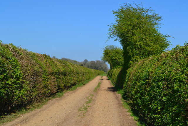
Barton Stacey Belt is a picturesque woodland area located in the county of Hampshire, England. Covering an expansive area of land, the belt is characterized by its dense forest and thriving woodlands. It is a popular destination for nature enthusiasts and those seeking tranquility amidst nature's beauty.
The woodland is home to a diverse range of flora and fauna, making it a haven for wildlife. Ancient trees, including oak, beech, and birch, dominate the landscape, creating a majestic canopy that provides shade and shelter for the woodland floor. The forest floor is adorned with a carpet of wildflowers, ferns, and mosses, adding to the area's natural charm.
Visitors to Barton Stacey Belt can enjoy a variety of activities. Numerous walking trails wind through the woodland, allowing nature enthusiasts to explore its hidden gems. The trails vary in difficulty, catering to both casual strollers and avid hikers. Birdwatchers can also indulge in their passion, as the woodland is home to a wide array of bird species, including woodpeckers, owls, and buzzards.
The area is well-maintained, with designated picnic areas and benches available for visitors to relax and soak in the peaceful atmosphere. The forest also offers educational opportunities, with guided tours and workshops organized to educate visitors about the importance of conservation and the preservation of natural habitats.
Overall, Barton Stacey Belt in Hampshire is a captivating woodland retreat, offering a sanctuary for both nature enthusiasts and those seeking solace in the beauty of the natural world.
If you have any feedback on the listing, please let us know in the comments section below.
Barton Stacey Belt Images
Images are sourced within 2km of 51.132552/-1.3739067 or Grid Reference SU4337. Thanks to Geograph Open Source API. All images are credited.


Barton Stacey Belt is located at Grid Ref: SU4337 (Lat: 51.132552, Lng: -1.3739067)
Administrative County: Hampshire
District: Test Valley
Police Authority: Hampshire
What 3 Words
///label.shadow.awakening. Near Kings Worthy, Hampshire
Nearby Locations
Related Wikis

Crawley, Hampshire
Crawley is a small village in Hampshire, England. It is a few miles from the county town (and former capital) of Winchester. It is a civil parish within...

Chilbolton Down
Chilbolten Down is a hamlet in the civil parish of Chilbolton in Hampshire, England. Its nearest town is Stockbridge, which lies approximately 3.4 miles...
South Wonston
South Wonston is a village on the outskirts of the City of Winchester district of Hampshire, England. The population of the parish of South Wonston was...
Naomi House Children's Hospice
Naomi House and Jacksplace are the hospices for children and young people in the Wessex region. The hospices are located at Sutton Scotney, near Winchester...

Sutton Scotney
Sutton Scotney is a village in Hampshire, England, north of Winchester in the civil parish of Wonston. It lies alongside the River Dever and is now bypassed...
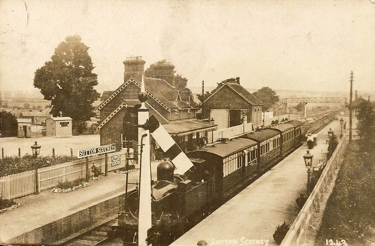
Sutton Scotney railway station
Sutton Scotney railway station is a disused station which served the village of Sutton Scotney a few miles north of Winchester on the Didcot, Newbury and...

Barton Stacey
Barton Stacey is a village and undulating civil parish, which includes the hamlets of Bransbury, Newton Stacey, Drayton and Cocum, in the Test Valley district...

Newton Stacey
Newton Stacey is a hamlet in the Barton Stacey civil parish in the Test Valley district of Hampshire, England. Its nearest town is Stockbridge, which lies...
Have you been to Barton Stacey Belt?
Leave your review of Barton Stacey Belt below (or comments, questions and feedback).