Anthony's Quarry Wood

Wood, Forest in Yorkshire

England

Anthony's Quarry Wood

In a bamboo field south of Royd Moor Only sky above us.
In a bamboo field south of Royd Moor Credit: Neil Theasby

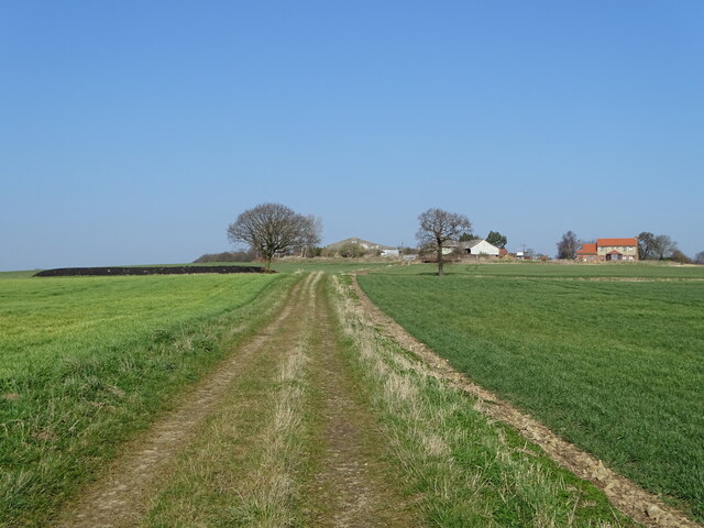
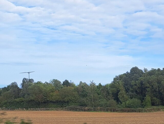
Anthony's Quarry Wood is a picturesque woodland located in Yorkshire, England. Covering an area of approximately 20 acres, it is nestled in the heart of the countryside, offering visitors a tranquil and serene environment to explore.

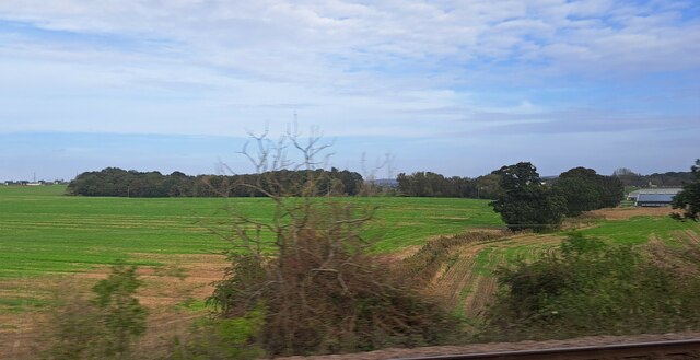
The wood is characterized by its diverse range of tree species, including oak, beech, ash, and birch, which create a vibrant and colorful canopy throughout the year. The forest floor is adorned with an array of wildflowers, adding to the natural beauty of the surroundings.

There are several well-maintained trails that wind through the wood, providing opportunities for leisurely walks and hikes. These paths offer visitors a chance to immerse themselves in nature, while also providing access to the various points of interest within the woodland.

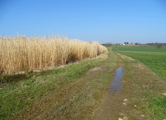
One of the main attractions of Anthony's Quarry Wood is an old quarry site, which has now transformed into a small lake. Surrounded by lush vegetation and towering trees, this serene body of water attracts a variety of wildlife, including ducks, swans, and other waterfowl.

The wood also offers a haven for birdwatchers, with a wide range of species making it their home. Visitors may catch glimpses of woodpeckers, owls, and various songbirds as they explore the woodland.

Overall, Anthony's Quarry Wood provides a peaceful and natural retreat, allowing visitors to escape the hustle and bustle of everyday life. Whether it's a leisurely stroll, birdwatching, or simply enjoying the beauty of nature, this woodland offers something for everyone.

If you have any feedback on the listing, please let us know in the comments section below.

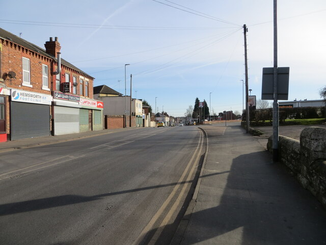
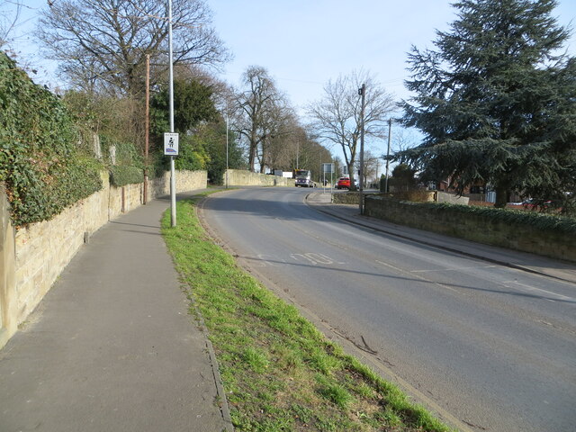
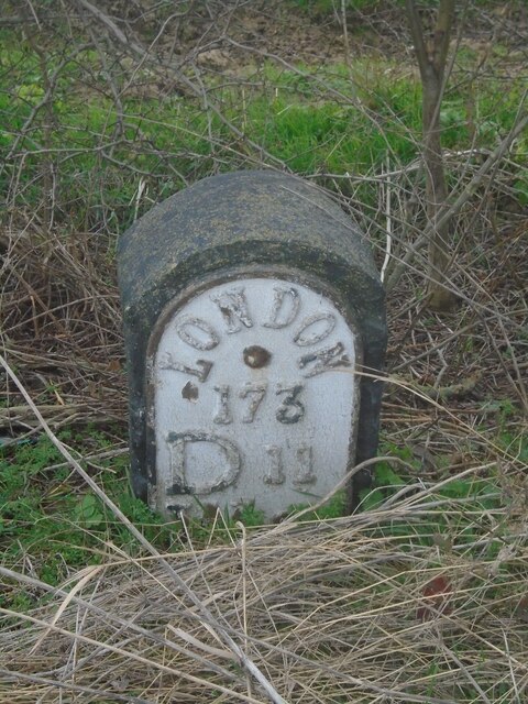
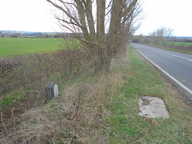
Anthony's Quarry Wood Images

Images are sourced within 2km of 53.6256/-1.3398558 or Grid Reference SE4314. Thanks to Geograph Open Source API. All images are credited.

In a bamboo field south of Royd Moor Only sky above us.
In a bamboo field south of Royd Moor
Only sky above us.
Bamboo grove with Royd Moor Farm ahead
The farmhouse, Royd Moor Farm
Marsh Lea Grove, Hemsworth
St Helen's Church, Hemsworth The church was largely rebuilt by John Loughborough Pearson between 1865 and 1867, retaining some medieval fabric. It is built in sandstone, the roof of the nave is tiled, and elsewhere are stone slate roofs. The church consists of a nave, north and south aisles, a south porch, a chancel with a south chapel and a north vestry, and a west tower. The tower has four stages, it contains a three-light west window, and has a plain parapet. The east window is large, with five lights, Decorated tracery, and a hood mould. (Wikipedia)
St Helen's Church, Hemsworth
The church was largely rebuilt by John Loughborough Pearson between 1865 and 1867, retaining some medieval fabric. It is built in sandstone, the roof of the nave is tiled, and elsewhere are stone slate roofs. The church consists of a nave, north and south aisles, a south porch, a chancel with a south chapel and a north vestry, and a west tower. The tower has four stages, it contains a three-light west window, and has a plain parapet. The east window is large, with five lights, Decorated tracery, and a hood mould. (Wikipedia)
On Bullenshaw Road, Hemsworth Looking to Kirkby Road with Hemsworth Community Centre on the left.
On Bullenshaw Road, Hemsworth
Looking to Kirkby Road with Hemsworth Community Centre on the left.
Hemsworth Hardware Store on Kirkby Road
On the track to Royd Moor Farm
Old milepost The town of Hemsworth is now by-passed but this is one of 2 mileposts from the Barnsley to Pontefract tollroad (1825-1870) on the original route.  It is on Station Road near Lowfield Road.   Grade II Listed 1226647.
Old milepost
The town of Hemsworth is now by-passed but this is one of 2 mileposts from the Barnsley to Pontefract tollroad (1825-1870) on the original route. It is on Station Road near Lowfield Road. Grade II Listed 1226647.
Old milepost This milepost from the Barnsley to Pontefract tollroad is near the bus stop on the A628 in Ackworth just north of the roundabout with the A638. It is known that it was painted in 2005.  Most of the mileposts on this route do not have a backing stone so this one, larger than the casting, is probably a 20C addition.  This post is the only one of those remaining that is not 'Listed'.
Old milepost
This milepost from the Barnsley to Pontefract tollroad is near the bus stop on the A628 in Ackworth just north of the roundabout with the A638. It is known that it was painted in 2005. Most of the mileposts on this route do not have a backing stone so this one, larger than the casting, is probably a 20C addition. This post is the only one of those remaining that is not 'Listed'.
Market Street, Hemsworth Looking south-eastward.
Market Street, Hemsworth
Looking south-eastward.
Station Road, Hemsworth Looking eastward.
Station Road, Hemsworth
Looking eastward.
Old milestone One of the three remaining plated milestones from the 11.7 miles Red House (north of Doncaster) to Crofton (east of Wakefield) tollroad first enacted in 1741.  Although difficult to spot in summer as it is down a banking it is behind a British Telecom cover in the verge.  When first found several years  ago there was a crack in the top of the stone but it was repaired with cement and painted black.   Now the lettering needs sprucing up.  W 9 is below D 11.  The plate is held on by two rivets.
Old milestone
One of the three remaining plated milestones from the 11.7 miles Red House (north of Doncaster) to Crofton (east of Wakefield) tollroad first enacted in 1741. Although difficult to spot in summer as it is down a banking it is behind a British Telecom cover in the verge. When first found several years ago there was a crack in the top of the stone but it was repaired with cement and painted black. Now the lettering needs sprucing up. W 9 is below D 11. The plate is held on by two rivets.
Old milestone The position of the milestone in relation to the British Telecom cover and the hill down and under the railway bridge.   The hill down Doncaster Road towards Ackworth is steeper than it looks in this photograph.
Old milestone
The position of the milestone in relation to the British Telecom cover and the hill down and under the railway bridge. The hill down Doncaster Road towards Ackworth is steeper than it looks in this photograph.
Low Field, from the railway The fenced-off area projecting forward from the trees into the field marks where Lowfield Road turns to tunnel under the A628 Hemsworth Bypass, which runs along the line of trees.
Low Field, from the railway
The fenced-off area projecting forward from the trees into the field marks where Lowfield Road turns to tunnel under the A628 Hemsworth Bypass, which runs along the line of trees.
Kinsley Common, from the railway On the extreme right, about to flash out of the picture, are some of the buildings of Hemsworth Turkey Farms on Hoyle Mill Road.
Kinsley Common, from the railway
On the extreme right, about to flash out of the picture, are some of the buildings of Hemsworth Turkey Farms on Hoyle Mill Road.
Hemsworth bus station A small, somewhat basic facility attached to the side of a Tesco superstore in the town centre.
Hemsworth bus station
A small, somewhat basic facility attached to the side of a Tesco superstore in the town centre.
Church of St Helen, Hemsworth The Church of England establishment (if you'll forgive the unintentional pun) in the town, in a prominent place above the town centre.
Church of St Helen, Hemsworth
The Church of England establishment (if you'll forgive the unintentional pun) in the town, in a prominent place above the town centre.
Show me another place!

Anthony's Quarry Wood is located at Grid Ref: SE4314 (Lat: 53.6256, Lng: -1.3398558)

Division: West Riding

Unitary Authority: Wakefield

Police Authority: West Yorkshire

What 3 Words

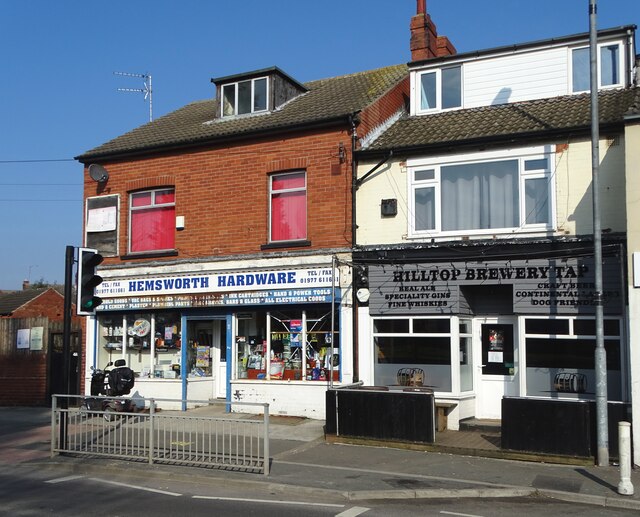
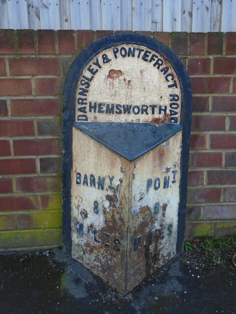
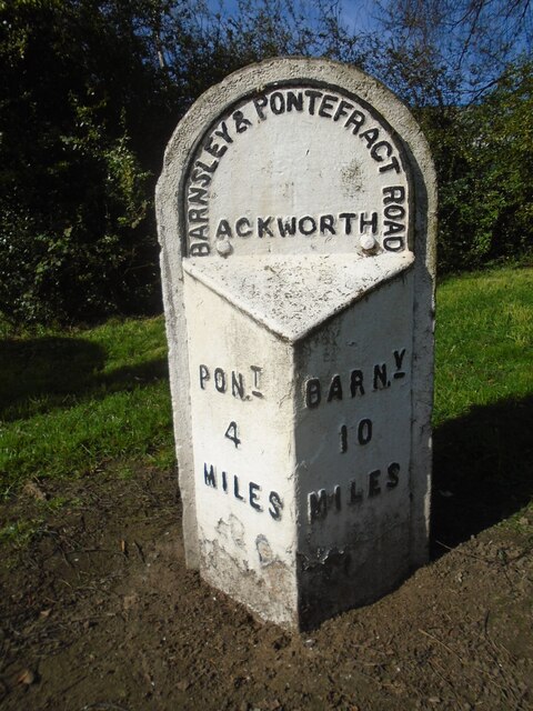
///motoring.refilled.cable. Near Hemsworth, West Yorkshire

Related Wikis

Hemsworth railway station

Hemsworth railway station served the town of Hemsworth, West Yorkshire, England from 1866 to 1967 on the West Riding and Grimsby Railway. == History... ==

Oakfield Park School

Oakfield Park School (formerly OakTree School) is a coeducational special school in Ackworth, West Yorkshire, England.In early 2000s Oakfield Tree School...

Outwood Academy Hemsworth

Outwood Academy Hemsworth, known previously as Hemsworth Arts and Community Academy and Hemsworth Arts and Community College, is a mixed secondary school...

Hemsworth Rural District

Hemsworth was, from 1894 to 1974, a rural district in the West Riding of Yorkshire, England. == Creation == The district was formed by the Local Government...

Hemsworth (UK Parliament constituency)

Hemsworth is a constituency in West Yorkshire represented in the House of Commons since 1996 by Jon Trickett of the Labour Party.Further to the completion...

Ackworth, West Yorkshire

Ackworth is a village and civil parish in the metropolitan borough of Wakefield, West Yorkshire, England. It stands between Pontefract, Barnsley and Doncaster...

Kinsley Greyhound Stadium

Kinsley greyhound stadium is a Greyhound Board of Great Britain regulated greyhound racing stadium situated in Kinsley, West Yorkshire, England. It was...

Hemsworth

Hemsworth is a town and civil parish in the City of Wakefield, West Yorkshire, England. Historically within the West Riding of Yorkshire and had a population...

Nearby Amenities

Located within 500m of 53.6256,-1.3398558
Bus Stop
Pontefract Road Royd Moor Lane
Local Ref: 45017900
Naptan AtcoCode: 450017900
Naptan Bearing: SW
Naptan CommonName: Pontefract Road Royd Moor Lane
Naptan Crossing: Nr-At Royd Moor Lane
Naptan Indicator: Stop 45017900
Naptan Landmark: Adj Hemsworh Marsh
Naptan PlusbusZoneRef: LEEDS
Naptan ShortCommonName: Royd Moor Lane
Naptan Street: Pontefract Road
Naptan Verified: no
Source: naptan_import
Lat/Long: 53.623071/-1.3431047
Pontefract Road Hemsworth Marsh
Local Ref: 45050572
Naptan AtcoCode: 450050572
Naptan Bearing: NE
Naptan BusStopType: CUS
Naptan CommonName: Pontefract Road Hemsworth Marsh
Naptan Indicator: Stop 45050572
Naptan PlusbusZoneRef: LEEDS
Naptan ShortCommonName: Royd Moor Lane
Naptan Street: Pontefract Road
Naptan Verified: no
Source: naptan_import
Lat/Long: 53.6231257/-1.3432399
Power: pole
Lat/Long: 53.6217512/-1.336136
Power: pole
Lat/Long: 53.6230624/-1.3372861
Power: pole
Lat/Long: 53.6252103/-1.3396313
Power: pole
Lat/Long: 53.6263045/-1.3412059
Power: pole
Lat/Long: 53.627385/-1.3427472
The data included in this document is from www.openstreetmap.org. The data is made available under ODbL.

Have you been to Anthony's Quarry Wood?

Leave your review of Anthony's Quarry Wood below (or comments, questions and feedback).