Barn Copse

Wood, Forest in Hampshire Winchester

England

Barn Copse

Beechwood Crescent, looking west Do high hedges make good neighbours, as fences are supposed to?
Beechwood Crescent, looking west Credit: Christine Johnstone

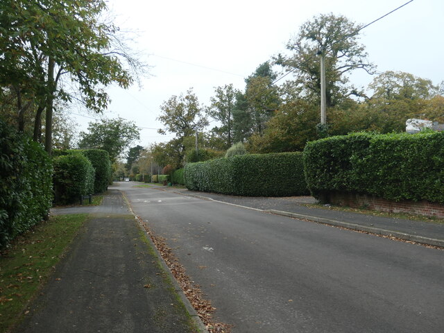
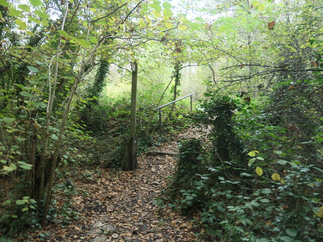
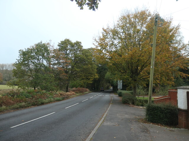
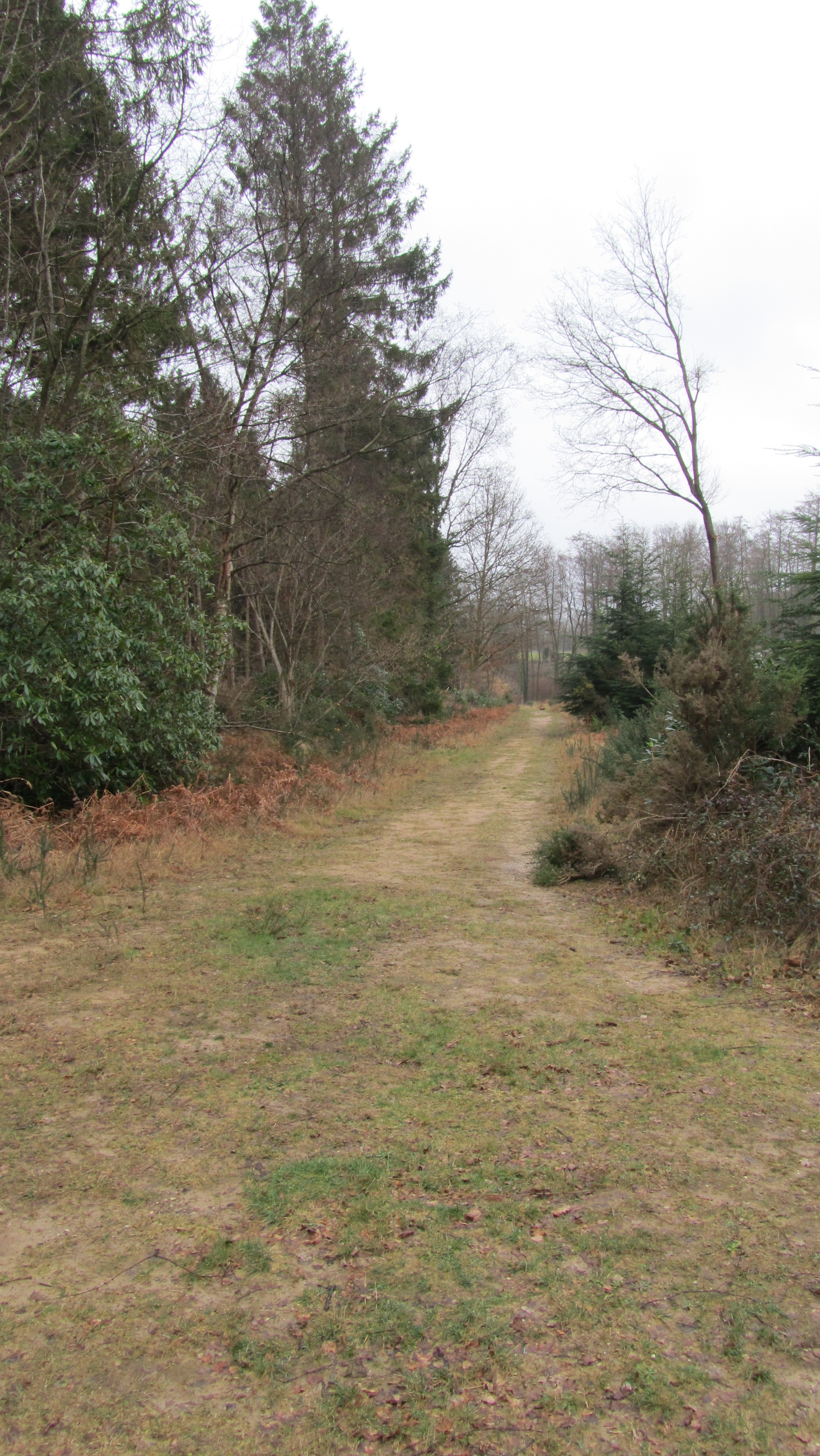
Barn Copse is a stunning woodland area located in Hampshire, England. Covering an area of approximately 100 acres, it is a captivating mix of ancient woodland and newer plantation. Situated near the village of Ramsdell, Barn Copse is a popular destination for nature enthusiasts, hikers, and birdwatchers.

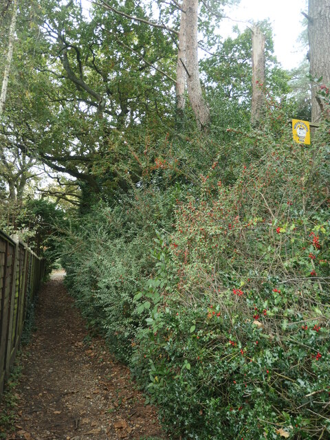
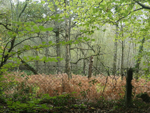
The woodland is characterized by its diverse range of tree species, including oak, beech, ash, and birch. The older section of the copse boasts majestic, towering trees that have stood for centuries, creating a breathtaking canopy overhead. The forest floor is covered in a rich carpet of wildflowers, ferns, and mosses, adding to the enchanting atmosphere.

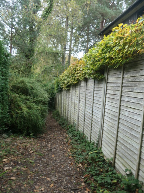
Wandering through Barn Copse, visitors can enjoy the peace and tranquility of nature, with only the sounds of birdsong and rustling leaves to accompany them. The copse is home to a wide variety of bird species, including woodpeckers, owls, and numerous songbirds. It is also a haven for other wildlife, such as deer, foxes, and squirrels.

There are several well-marked trails throughout the woodland, allowing visitors to explore its beauty at their own pace. These trails lead to secluded clearings, hidden streams, and picturesque viewpoints. The copse is particularly stunning in autumn when the leaves change color, creating a vibrant tapestry of red, orange, and gold.

Barn Copse provides a perfect escape from the hustle and bustle of everyday life, offering visitors a chance to connect with nature and experience the true beauty of Hampshire's woodlands.

If you have any feedback on the listing, please let us know in the comments section below.

Barn Copse Images

Images are sourced within 2km of 51.009636/-1.3872363 or Grid Reference SU4323. Thanks to Geograph Open Source API. All images are credited.

Beechwood Crescent, looking west Do high hedges make good neighbours, as fences are supposed to?
Beechwood Crescent, looking west
Do high hedges make good neighbours, as fences are supposed to?
Neighbourhood Watch sign, off Beechwood Crescent Alongside the public footpath heading north-west to Hook Crescent.
Neighbourhood Watch sign, off Beechwood Crescent
Alongside the public footpath heading north-west to Hook Crescent.
Public footpath with signpost and waymark At the southern end of Hook Crescent.
Public footpath with signpost and waymark
At the southern end of Hook Crescent.
Public footpath from Hook Crescent to Hook Road Dropping north-westwards between woodland and a back garden.
Public footpath from Hook Crescent to Hook Road
Dropping north-westwards between woodland and a back garden.
Woodland south of Hook Road With an autumnal carpet of dead bracken.
Woodland south of Hook Road
With an autumnal carpet of dead bracken.
Steps up to Hook Road The northern end of the public footpath from Hook Crescent.
Steps up to Hook Road
The northern end of the public footpath from Hook Crescent.
Small bridge on Hook Road The road crosses a small stream, a tributary of Monks Brook.
Small bridge on Hook Road
The road crosses a small stream, a tributary of Monks Brook.
Polluted woodland stream, south of Hook Road A nameless tributary of Monks Brook, seen from the road bridge.
Polluted woodland stream, south of Hook Road
A nameless tributary of Monks Brook, seen from the road bridge.
Signs at a bend on Hook Road At the eastern end of Broadgate.
Signs at a bend on Hook Road
At the eastern end of Broadgate.
Sheep grazing near Broadgate On the north side of Hook Road, at the eastern edge of the village.
Sheep grazing near Broadgate
On the north side of Hook Road, at the eastern edge of the village.
Autumn trees along Hook Road At the eastern end of Broadgate.
Autumn trees along Hook Road
At the eastern end of Broadgate.
Public bridleway from Hook Road to Hursley Road Heading north-east.
Public bridleway from Hook Road to Hursley Road
Heading north-east.
Field south-west of Hawstead Farm Looking north from the public bridleway. About 75 metres above sea level.
Field south-west of Hawstead Farm
Looking north from the public bridleway. About 75 metres above sea level.
Fenced ponds, south-west of Hawstead Farm Not shown on the 1:25,000 OS map which was revised in 2010.
Fenced ponds, south-west of Hawstead Farm
Not shown on the 1:25,000 OS map which was revised in 2010.
Farm track, near Hawstead Farm Heading westwards from the public bridleway.
Farm track, near Hawstead Farm
Heading westwards from the public bridleway.
Fenced ponds from the east Stepping down a hillside. Not sure of their purpose.
Fenced ponds from the east
Stepping down a hillside. Not sure of their purpose.
Private gated track into Hocombe Upper Plantation The gate appears to be out-of-use.
Private gated track into Hocombe Upper Plantation
The gate appears to be out-of-use.
Left for the Egg Shed, right for the public footpath Waymarked bridleway and footpath junction near Hawstead Farm.
Left for the Egg Shed, right for the public footpath
Waymarked bridleway and footpath junction near Hawstead Farm.
Show me another place!

Barn Copse is located at Grid Ref: SU4323 (Lat: 51.009636, Lng: -1.3872363)

Administrative County: Hampshire

District: Winchester

Police Authority: Hampshire

What 3 Words

///guises.sweetened.ketchup. Near Compton, Hampshire

Related Wikis

Hocombe Mead

Hocombe Mead is a 8.3-hectare (21-acre) Local Nature Reserve in Eastleigh in Hampshire. It is owned by Eastleigh Borough Council and managed by Eastleigh...

Hiltingbury

Hiltingbury is an area within the Borough of Eastleigh in Hampshire, England. There are two electoral wards representing Hiltingbury, returning a total...

Hursley

Hursley is a village and civil parish in Hampshire, England with a population of around 900 in 2011. It is located roughly midway between Romsey and Winchester...

Cranbury Park

Cranbury Park is a stately home and country estate situated in the parish of Hursley, Winchester, England. It was formerly the home to Sir Isaac Newton...

The Quarters, Hursley Park

The Quarters is a cricket ground located off Hursley Park Road in the grounds of the former Hursley Park Estate at Hursley, Hampshire, England. Set in...

Ratlake Meadows

Ratlake Meadows is a 4.2-hectare (10-acre) biological Site of Special Scientific Interest north of Chandler's Ford in Hampshire.These unimproved meadows...

Trodds Copse

Trodds Copse (grid reference SU417224) is a 25.23 hectare biological Site of Special Scientific Interest (SSSI), in central Hampshire, notified in 1989...

IBM Hursley

IBM Hursley is a research and development laboratory belonging to International Business Machines in the village of Hursley, Hampshire, England. Established...

Nearby Amenities

Located within 500m of 51.009636,-1.3872363
Barrier: kissing_gate
Bicycle: no
Foot: yes
Lat/Long: 51.0108203/-1.3812335
Barrier: kissing_gate
Bicycle: no
Foot: yes
Lat/Long: 51.0113269/-1.3838683
Barrier: kissing_gate
Bicycle: no
Foot: yes
Lat/Long: 51.0114642/-1.3857008
Power: tower
Source: bing
Lat/Long: 51.010643/-1.3898666
Power: tower
Source: bing
Lat/Long: 51.0114539/-1.3842473
Power: tower
Source: bing
Lat/Long: 51.0101645/-1.3928761
Power: tower
Source: bing
Lat/Long: 51.011912/-1.3812513
Barrier: kissing_gate
Bicycle: no
Foot: yes
Lat/Long: 51.0091192/-1.3809672
Barrier: kissing_gate
Bicycle: no
Foot: yes
Lat/Long: 51.0107774/-1.3810123
Barrier: kissing_gate
Bicycle: no
Foot: yes
Lat/Long: 51.0112778/-1.3868651
Barrier: cattle_grid
Bicycle: no
Lat/Long: 51.011318/-1.3869714
Barrier: kissing_gate
Bicycle: no
Foot: yes
Lat/Long: 51.0114734/-1.3842259
Barrier: cattle_grid
Bicycle: no
Lat/Long: 51.0130799/-1.3893755
Ladwell
Access: private
Ele: 96
Man Made: survey_point
Natural: peak
Place: locality
Source: Trig point - height from OS 6" / 19th C rounded to nearest metre
Survey Point Purpose: both
Survey Point Structure: pillar
Lat/Long: 51.0116764/-1.3908941
Power: pole
Lat/Long: 51.0102142/-1.3932976
Power: pole
Lat/Long: 51.0109146/-1.392391
Power: pole
Lat/Long: 51.0131041/-1.3893494
Power: pole
Lat/Long: 51.0113348/-1.3913959
Power: pole
Lat/Long: 51.0106986/-1.3918734
Power: pole
Lat/Long: 51.0066566/-1.3917339
Power: pole
Lat/Long: 51.0062786/-1.3883543
Power: pole
Lat/Long: 51.0064305/-1.389513
Power: pole
Lat/Long: 51.0065385/-1.3906127
Power: pole
Lat/Long: 51.0067478/-1.3926834
Power: pole
Lat/Long: 51.007541/-1.3924956
Power: pole
Lat/Long: 51.0083544/-1.3923562
Power: pole
Lat/Long: 51.0091409/-1.3921845
Power: pole
Lat/Long: 51.0099206/-1.3920182
Power: pole
Lat/Long: 51.0124215/-1.3902748
Natural: spring
Lat/Long: 51.0082792/-1.3901818
Natural: spring
Lat/Long: 51.0101919/-1.3872781
Barrier: stile
Lat/Long: 51.0105791/-1.3897922
Ladwell
Place: hamlet
Lat/Long: 51.0135203/-1.3903936
The data included in this document is from www.openstreetmap.org. The data is made available under ODbL.

Have you been to Barn Copse?

Leave your review of Barn Copse below (or comments, questions and feedback).