Carnfield Wood

Wood, Forest in Derbyshire Bolsover

England

Carnfield Wood

Roundabout on Birchwood Lane In South Normanton
Roundabout on Birchwood Lane Credit: Neil Theasby

Carnfield Wood is a picturesque woodland located in Derbyshire, England. Nestled in the heart of the county, it covers an area of approximately 100 acres and is surrounded by rolling hills and meadows. The wood is known for its diverse range of tree species, including oak, beech, birch, and pine, creating a rich and vibrant ecosystem.

The woodland is a popular destination for nature enthusiasts and walkers, offering a tranquil escape from the hustle and bustle of city life. There are several well-maintained footpaths that wind their way through the wood, providing visitors with the opportunity to explore its beauty at their own pace. Along these paths, one can discover a variety of wildlife, such as deer, rabbits, and a plethora of bird species.

Carnfield Wood also has historical significance, with remnants of an ancient Roman road passing through its borders. This adds an element of intrigue and fascination for history buffs who can imagine the footsteps of those who once traveled these paths centuries ago.

In addition to its natural and historical attractions, the wood is home to a small but charming picnic area, complete with benches and tables, where visitors can relax and enjoy the serene surroundings. It's an ideal spot for families and friends to come together and appreciate the beauty of nature.

Carnfield Wood truly offers a delightful experience for nature lovers, history enthusiasts, and anyone seeking a peaceful retreat in the heart of Derbyshire.

If you have any feedback on the listing, please let us know in the comments section below.

Carnfield Wood Images

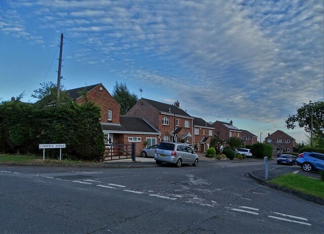
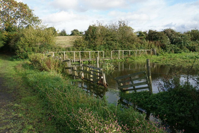
Images are sourced within 2km of 53.096319/-1.3589291 or Grid Reference SK4355. Thanks to Geograph Open Source API. All images are credited.

Roundabout on Birchwood Lane In South Normanton
Roundabout on Birchwood Lane
In South Normanton
Cornfield Avenue, Normanton Common
Crossroads Tavern A pub towards the eastern end of Alfreton's High Street. It is situated on a crossroads.
Crossroads Tavern
A pub towards the eastern end of Alfreton's High Street. It is situated on a crossroads.
High Street, Alfreton The traffic is not always as busy as this.
High Street, Alfreton
The traffic is not always as busy as this.
Institute Lane, Alfreton Now part of the pedestrianised precinct.
Institute Lane, Alfreton
Now part of the pedestrianised precinct.
Bus station in Alfreton
Alfreton Cemetery
Alfreton Cemetery
Alfreton Cemetery
Alfreton Cemetery
Crane hire depot The western end of Meadow Lane Industrial Estate. You can see the cranes from the surrounding countryside in the valley of Alfreton Brook.
Crane hire depot
The western end of Meadow Lane Industrial Estate. You can see the cranes from the surrounding countryside in the valley of Alfreton Brook.
Alfreton Sewage Treatment Works A necessary facility sited by Alfreton Brook.
Alfreton Sewage Treatment Works
A necessary facility sited by Alfreton Brook.
The valley of Alfreton Brook The line of the brook is clear, flowing from left to right. Alfreton is beyond the trees to the right, with the crane hire depot standing tall.
The valley of Alfreton Brook
The line of the brook is clear, flowing from left to right. Alfreton is beyond the trees to the right, with the crane hire depot standing tall.
Path to South Normanton The path is crossing former industrial land, I think probably related to the former Blackwell Colliery.
Path to South Normanton
The path is crossing former industrial land, I think probably related to the former Blackwell Colliery.
Tree plantation near Normanton Brook Rewilding of former industrial land.
Tree plantation near Normanton Brook
Rewilding of former industrial land.
Path to South Normanton The path is crossing former industrial land. The former Blackwell Colliery can be seen straight ahead. The land on the right is owned by EPC, an explosives manufacturer.
Path to South Normanton
The path is crossing former industrial land. The former Blackwell Colliery can be seen straight ahead. The land on the right is owned by EPC, an explosives manufacturer.
Harvested field near Blackwell The plant in the valley bottom is the site of the former Blackwell Colliery. You can also see the tower of St Werburgh's, Blackwell in the trees behind.
Harvested field near Blackwell
The plant in the valley bottom is the site of the former Blackwell Colliery. You can also see the tower of St Werburgh's, Blackwell in the trees behind.
Harvested field near Blackwell Looking down the valley of Normanton Brook.
Harvested field near Blackwell
Looking down the valley of Normanton Brook.
Path to South Normanton Passing along the edge of a hilltop plantation.
Path to South Normanton
Passing along the edge of a hilltop plantation.
Flooded corner of a field This corner appears to be almost permanently flooded as the public footpath on the far side requires a boardwalk to make it passable. In practice, most people cut across the field to the right and avoid this part.
Flooded corner of a field
This corner appears to be almost permanently flooded as the public footpath on the far side requires a boardwalk to make it passable. In practice, most people cut across the field to the right and avoid this part.
Show me another place!

Carnfield Wood is located at Grid Ref: SK4355 (Lat: 53.096319, Lng: -1.3589291)

Administrative County: Derbyshire

District: Bolsover

Police Authority: Derbyshire

What 3 Words

///slice.ships.beans. Near Alfreton, Derbyshire

Nearby Locations

Carnfield Wood

Related Wikis

Carnfield Hall

Carnfield Hall is a privately owned country house located at South Normanton, near Alfreton in Derbyshire, England. It is a Grade II* listed building...

Alfreton railway station

Alfreton railway station serves the town of Alfreton in Derbyshire, England. The station is on the Erewash Valley Line 18+1⁄4 miles (29.4 km) north of...

South Normanton F.C.

South Normanton Football Club was a football club based in South Normanton, Derbyshire. == History == The club was formed as a feeder club of South Normanton...

South Normanton Athletic F.C.

South Normanton Athletic Football Club is a football club based in South Normanton, near Alfreton, Derbyshire, England. They play at Lees Lane. == History... ==

Nearby Amenities

Located within 500m of 53.096319,-1.3589291
Bench
Lat/Long: 53.1003893/-1.3606847
Ele: 140
Note: No gate any more
Lat/Long: 53.1001515/-1.3562894
Ele: 134
Lat/Long: 53.100258/-1.3589025
Ele: 133
Lat/Long: 53.1003021/-1.3594084
Ele: 129
Lat/Long: 53.1004125/-1.3606764
Parking
Fee: no
Note: Layby
Parking: surface
Source: survey
Lat/Long: 53.0926671/-1.3621645
Generator Method: photovoltaic
Generator Output Electricity: yes
Generator Source: solar
Generator Type: solar_photovoltaic_panel
Location: roof
Power: generator
Lat/Long: 53.0999712/-1.3545822
The data included in this document is from www.openstreetmap.org. The data is made available under ODbL.

Have you been to Carnfield Wood?

Leave your review of Carnfield Wood below (or comments, questions and feedback).