Cuckoo Bushes

Wood, Forest in Hampshire Eastleigh

England

Cuckoo Bushes

Crusaders Way, Chandler's Ford With Zionshill Copse on the left / south side and a 1990s housing estate on the right / north side.
Crusaders Way, Chandler's Ford Credit: Christine Johnstone

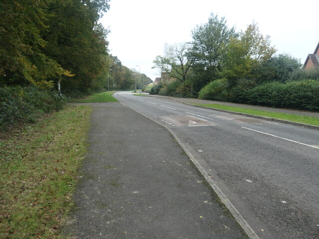
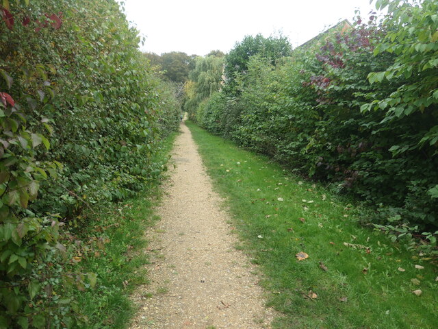
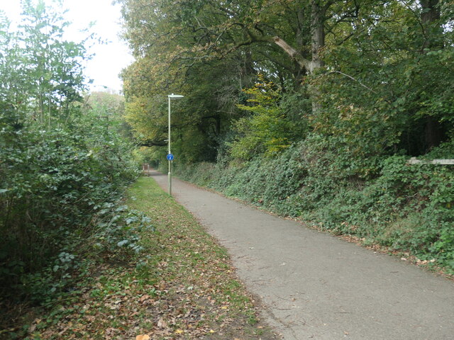
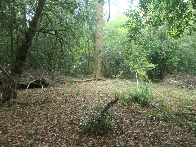
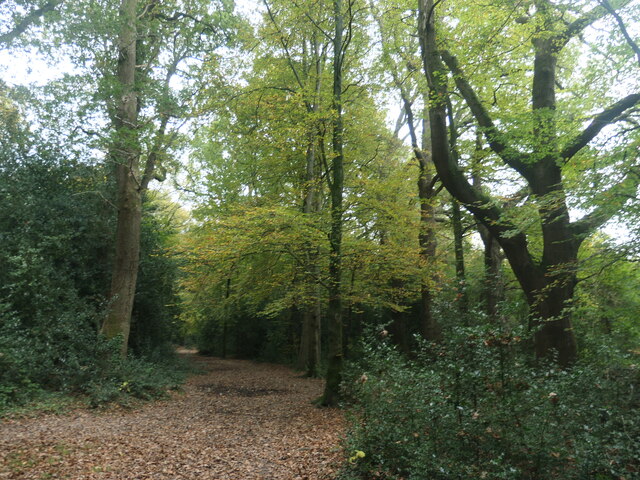
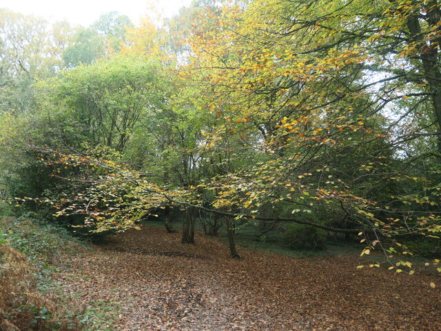
Cuckoo Bushes is a charming wood located in the county of Hampshire, England. Nestled within the expansive New Forest, it is a hidden gem for nature enthusiasts and those seeking solace in the great outdoors. Spanning an area of approximately 200 acres, Cuckoo Bushes is a diverse and ecologically rich forest.

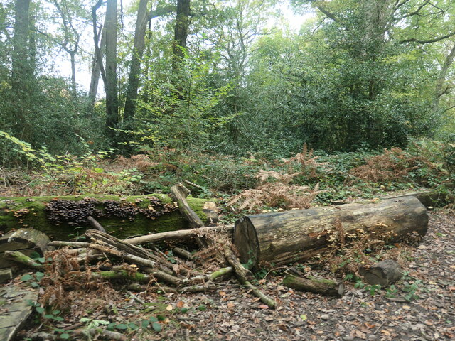
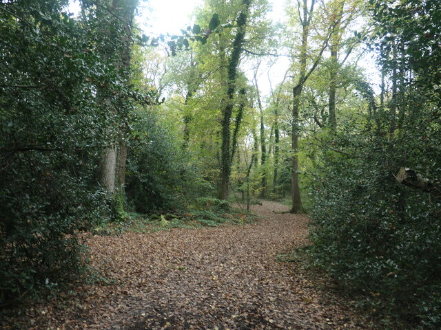
The wood is known for its ancient oak and beech trees, some of which are believed to be over 500 years old. These majestic giants create a canopy that provides shade and shelter for a variety of flora and fauna. Walking through the wood, visitors can encounter a tapestry of wildflowers, including bluebells, primroses, and violets, which bring color and vibrancy to the forest floor.

Cuckoo Bushes is also home to a plethora of wildlife. Birdwatchers can delight in the sight of woodpeckers, nuthatches, and tawny owls, while lucky visitors may even catch a glimpse of the elusive cuckoo, giving the wood its name. The forest is also frequented by deer, foxes, and badgers, adding to the enchanting atmosphere of the wood.

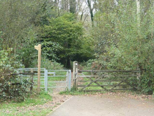
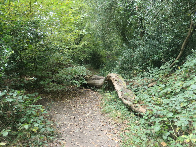
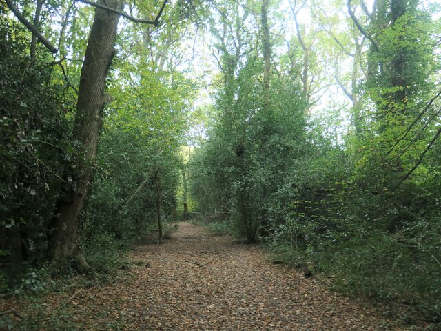
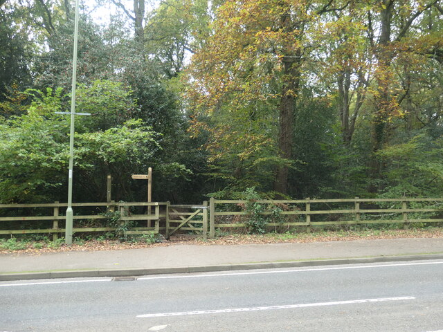
For outdoor enthusiasts, Cuckoo Bushes offers various recreational activities. The wood is crisscrossed with well-maintained footpaths, allowing visitors to explore its beauty at their own pace. There are also designated picnic spots, where families and friends can gather to enjoy a leisurely meal amidst the tranquil surroundings.

Overall, Cuckoo Bushes in Hampshire is a captivating woodland retreat that offers a respite from the hustle and bustle of everyday life. Whether one is seeking a peaceful walk, a chance to connect with nature, or a glimpse into the New Forest's rich biodiversity, Cuckoo Bushes provides an ideal setting for all.

If you have any feedback on the listing, please let us know in the comments section below.

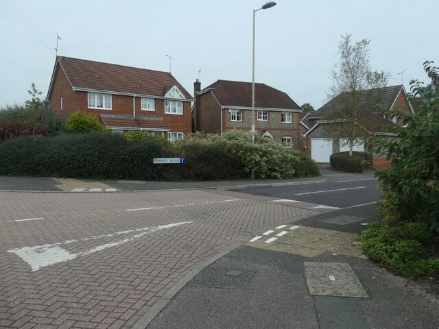
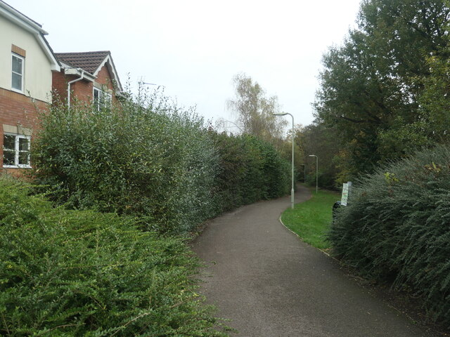
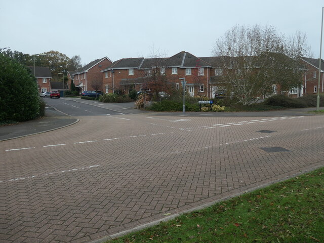
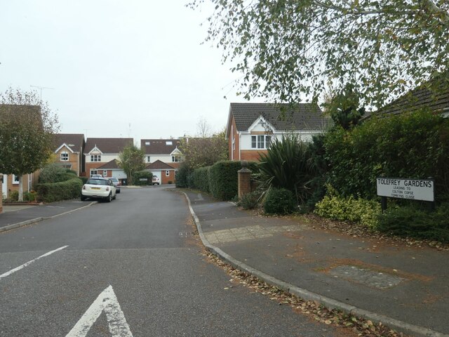
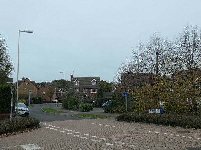
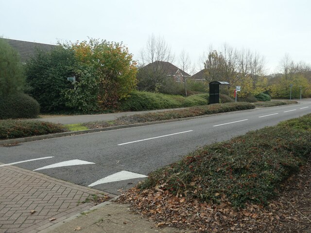
Cuckoo Bushes Images

Images are sourced within 2km of 50.994937/-1.3896384 or Grid Reference SU4221. Thanks to Geograph Open Source API. All images are credited.

Crusaders Way, Chandler's Ford With Zionshill Copse on the left / south side and a 1990s housing estate on the right / north side.
Crusaders Way, Chandler's Ford
With Zionshill Copse on the left / south side and a 1990s housing estate on the right / north side.
Logs and fungi, Zionshill Copse Part of Valley Park local nature reserve, on the western edge of Chandler's Ford.
Logs and fungi, Zionshill Copse
Part of Valley Park local nature reserve, on the western edge of Chandler's Ford.
Path through Zionshill Copse The copse is part of Valley Park local nature reserve, on the western edge of Chandler's Ford.
Path through Zionshill Copse
The copse is part of Valley Park local nature reserve, on the western edge of Chandler's Ford.
An entrance to Zionshill Copse On the west side of Sky's Wood Road. The copse is part of Valley Park local nature reserve, on the western edge of Chandler's Ford.
An entrance to Zionshill Copse
On the west side of Sky's Wood Road. The copse is part of Valley Park local nature reserve, on the western edge of Chandler's Ford.
Houses on the north side of Harvest Road Part of a large housing development on the western edge of Chandler's Ford.
Houses on the north side of Harvest Road
Part of a large housing development on the western edge of Chandler's Ford.
Path heading east from Sky's Wood Road Cutting across a large loop in the road, which is the main thoroughfare in a housing development on the western edge of Chandler's Ford.
Path heading east from Sky's Wood Road
Cutting across a large loop in the road, which is the main thoroughfare in a housing development on the western edge of Chandler's Ford.
Terraced houses, Jack Close Off Sky's Wood Road. Part of a housing development on the west side of Chandler's Ford.
Terraced houses, Jack Close
Off Sky's Wood Road. Part of a housing development on the west side of Chandler's Ford.
Tolefrey Gardens Off Sky's Wood Road. Part of a housing development on the west side of Chandler's Ford.
Tolefrey Gardens
Off Sky's Wood Road. Part of a housing development on the west side of Chandler's Ford.
Morgan le Fey Drive, western edge of Chandler's Ford Named after a powerful enchantress in the Arthurian legends.
Morgan le Fey Drive, western edge of Chandler's Ford
Named after a powerful enchantress in the Arthurian legends.
Sky's Wood Road, western edge of Chandler's Ford The main thoroughfare through a large-ish housing development.
Sky's Wood Road, western edge of Chandler's Ford
The main thoroughfare through a large-ish housing development.
Public footpath between Merlin Way and Catmint Close On the western edge of Chandler's Ford. Heading north-east from Sky's Wood Road towards Knight Wood.
Public footpath between Merlin Way and Catmint Close
On the western edge of Chandler's Ford. Heading north-east from Sky's Wood Road towards Knight Wood.
Footpath and cycleway behind Merlin Way Heading north towards Flexford Road, on the western edge of Chandler's ford.
Footpath and cycleway behind Merlin Way
Heading north towards Flexford Road, on the western edge of Chandler's ford.
Fallen leaves, Knight Wood Part of the Valley Park Woodlands local nature reserve.
Fallen leaves, Knight Wood
Part of the Valley Park Woodlands local nature reserve.
Tree fallen across a path, Knight Wood With an informal detour through the shrubbery. Knight Wood is part of the Valley Park Woodlands local nature reserve.
Tree fallen across a path, Knight Wood
With an informal detour through the shrubbery. Knight Wood is part of the Valley Park Woodlands local nature reserve.
Path heading eastwards in Knight Wood Part of the Valley Park local nature reserve on the western side of Chandler's Ford.
Path heading eastwards in Knight Wood
Part of the Valley Park local nature reserve on the western side of Chandler's Ford.
Public footpath entering Knight Wood On the western side of Knightwood Road.
Public footpath entering Knight Wood
On the western side of Knightwood Road.
Public footpath in Knight Wood Open access woodland on the east side of Knightwood Road, Chandler's Ford.
Public footpath in Knight Wood
Open access woodland on the east side of Knightwood Road, Chandler's Ford.
Autumn colour, Knight Wood, Chandler's Ford Along a public footpath crossing the open access woodland.
Autumn colour, Knight Wood, Chandler's Ford
Along a public footpath crossing the open access woodland.
Show me another place!

Cuckoo Bushes is located at Grid Ref: SU4221 (Lat: 50.994937, Lng: -1.3896384)

Administrative County: Hampshire

District: Eastleigh

Police Authority: Hampshire

What 3 Words

///rotate.exist.bonds. Near Eastleigh, Hampshire

Related Wikis

Hiltingbury

Hiltingbury is an area within the Borough of Eastleigh in Hampshire, England. There are two electoral wards representing Hiltingbury, returning a total...

Hocombe Mead

Hocombe Mead is a 8.3-hectare (21-acre) Local Nature Reserve in Eastleigh in Hampshire. It is owned by Eastleigh Borough Council and managed by Eastleigh...

Flexford Nature Reserve

Flexford Nature Reserve is a 18-hectare (44-acre) nature reserve in Chandler's Ford in Hampshire. It is managed by the Hampshire and Isle of Wight Wildlife...

Valley Park, Chandler's Ford

Valley Park is a civil parish and a new town in the Test Valley district of Hampshire, England. The part of the parish is called Knightwood. == History... ==

Trodds Copse

Trodds Copse (grid reference SU417224) is a 25.23 hectare biological Site of Special Scientific Interest (SSSI), in central Hampshire, notified in 1989...

Knightwood

Knightwood is a small village in Chandler's Ford which is in Hampshire, England. It is in the civil parish of Valley Park. It is roughly 6 miles north...

Chandler's Ford railway station

Chandler's Ford railway station serves the Chandler's Ford area of Eastleigh in Hampshire, England. It is on the Eastleigh to Romsey Line, 75 miles 25...

Chandler's Ford shooting

The Chandler's Ford shooting (codenamed Operation Hurlock by the police) was the shooting of armed robbers in the town of Chandler's Ford, Hampshire, in...

Nearby Amenities

Located within 500m of 50.994937,-1.3896384
Turning Circle
Lat/Long: 50.9937601/-1.3840846
Barrier: bollard
Bicycle: yes
Foot: yes
Motor Vehicle: no
Lat/Long: 50.9914691/-1.3914599
Turning Circle
Lat/Long: 50.991631/-1.3880521
Turning Circle
Lat/Long: 50.9920964/-1.3853426
Turning Circle
Lat/Long: 50.9932044/-1.3867976
Turning Circle
Lat/Long: 50.9934952/-1.385716
Turning Circle
Lat/Long: 50.9936064/-1.3849631
Turning Circle
Lat/Long: 50.9967963/-1.3925231
Turning Circle
Lat/Long: 50.9947563/-1.3919124
Turning Circle
Lat/Long: 50.9931132/-1.3938932
Turning Circle
Lat/Long: 50.9926408/-1.393775
Turning Circle
Lat/Long: 50.9983531/-1.3924173
Turning Circle
Lat/Long: 50.996842/-1.394392
Turning Circle
Lat/Long: 50.9975664/-1.3926057
Bus Stop
Hiltingbury School
Bus: yes
Naptan AtcoCode: 1900HA030050
Naptan Bearing: E
Naptan CommonName: Hiltingbury School
Naptan Crossing: Ashdown Road
Naptan NaptanCode: hamawjda
Naptan Street: Hiltingbury Road
Naptan Verified: no
Public Transport: platform
Source: naptan_import
Lat/Long: 50.9987801/-1.386348
Bus Stop
Linden Grove
Bus: yes
Naptan AtcoCode: 1900HA030057
Naptan Bearing: N
Naptan CommonName: Linden Grove
Naptan Crossing: Linden Grove
Naptan NaptanCode: hamawjtd
Naptan Street: Park Road
Naptan Verified: no
Public Transport: platform
Source: naptan_import
Lat/Long: 50.9946574/-1.3835273
Bus Stop
Linden Grove
Bus: yes
Naptan AtcoCode: 1900HA030058
Naptan Bearing: S
Naptan CommonName: Linden Grove
Naptan Crossing: Paulson Close
Naptan NaptanCode: hamawjtp
Naptan Street: Park Road
Naptan Verified: no
Public Transport: platform
Source: naptan_import
Lat/Long: 50.9938156/-1.3832672
Bus Stop
Ramalley Lane
Bus: yes
Naptan AtcoCode: 1900HA030026
Naptan Bearing: N
Naptan CommonName: Ramalley Lane
Naptan Crossing: Common Road
Naptan NaptanCode: hamawgmg
Naptan Street: Hursley Road
Naptan Verified: no
Public Transport: platform
Source: naptan_import
Lat/Long: 50.9920004/-1.3897535
Bus Stop
Ramalley Lane
Bus: yes
Naptan AtcoCode: 1900HA030027
Naptan Bearing: N
Naptan CommonName: Ramalley Lane
Naptan Crossing: Common Road
Naptan NaptanCode: hamawgmp
Naptan Street: Hursley Road
Naptan Verified: no
Public Transport: platform
Source: naptan_import
Lat/Long: 50.992171/-1.3896943
Bus Stop
Leigh House Hospital
Naptan AtcoCode: 1900HA030028
Naptan Bearing: SE
Naptan CommonName: Leigh House Hospital
Naptan Crossing: Cuckoo Bushes Lane
Naptan Landmark: Leigh House Hospital
Naptan NaptanCode: hamawgdj
Naptan Street: Hursley Road
Naptan Verified: no
Source: naptan_import
Lat/Long: 50.9946133/-1.3907167
Bus Stop
Leigh House Hospital
Naptan AtcoCode: 1900HA030029
Naptan Bearing: NW
Naptan CommonName: Leigh House Hospital
Naptan Crossing: Cuckoo Bushes Lane
Naptan NaptanCode: hamawgap
Naptan Street: Hursley Road
Naptan Verified: no
Source: naptan_import
Lat/Long: 50.9947759/-1.3908571
Bus Stop
Hursley Road
Naptan AtcoCode: 1900HA030030
Naptan Bearing: E
Naptan CommonName: Hursley Road
Naptan Crossing: Lauriston Drive
Naptan NaptanCode: hamawdmg
Naptan Street: North Millers Dale
Naptan Verified: no
Source: naptan_import
Lat/Long: 50.9972824/-1.3921211
Bus Stop
North Millers Dale
Naptan AtcoCode: 1900HA030031
Naptan Bearing: N
Naptan CommonName: North Millers Dale
Naptan NaptanCode: hamawdwa
Naptan Street: Hursley Road
Naptan Verified: no
Source: naptan_import
Lat/Long: 50.9976397/-1.3916461
Bus Stop
North Millers Dale
Naptan AtcoCode: 1900HA030032
Naptan Bearing: S
Naptan CommonName: North Millers Dale
Naptan Crossing: Cranborne Gardens
Naptan NaptanCode: hamawdwg
Naptan Street: Hursley Road
Naptan Verified: no
Source: naptan_import
Lat/Long: 50.9978461/-1.3915722
Bus Stop
Hiltingbury Farm House
Naptan AtcoCode: 1900HA030033
Naptan Bearing: S
Naptan CommonName: Hiltingbury Farm House
Naptan Crossing: Drummond Way
Naptan NaptanCode: hamawdgj
Naptan Street: North Millers Dale
Naptan Verified: no
Source: naptan_import
Lat/Long: 50.9956804/-1.3935955
Bus Stop
Hiltingbury Farm House
Naptan AtcoCode: 1900HA030034
Naptan Bearing: N
Naptan CommonName: Hiltingbury Farm House
Naptan Crossing: Drummond Way
Naptan NaptanCode: hamawdgd
Naptan Street: North Millers Dale
Naptan Verified: no
Source: naptan_import
Lat/Long: 50.9954202/-1.3937129
Bus Stop
Flexford Nature Reserve
Naptan AtcoCode: 1900HA030035
Naptan Bearing: N
Naptan CommonName: Flexford Nature Reserve
Naptan Crossing: North Millers Dale
Naptan NaptanCode: hamawapw
Naptan Street: Weavers Place
Naptan Verified: no
Source: naptan_import
Lat/Long: 50.9956128/-1.3961614
Bus Stop
Flexford Nature Reserve
Naptan AtcoCode: 1900HA030036
Naptan Bearing: S
Naptan CommonName: Flexford Nature Reserve
Naptan Crossing: North Millers Dale
Naptan NaptanCode: hamawata
Naptan Street: Weavers Place
Naptan Verified: no
Source: naptan_import
Lat/Long: 50.9958125/-1.3960561
Bus Stop
Hiltingbury Recreation Ground
Naptan AtcoCode: 1900HA030041
Naptan Bearing: E
Naptan CommonName: Hiltingbury Recreation Ground
Naptan NaptanCode: hamawgdt
Naptan Street: Hiltingbury Road
Naptan Verified: no
Source: naptan_import
Lat/Long: 50.9993716/-1.390591
Pub
The Hiltonbury Farmhouse
Website: http://www.ilykepubs.co.uk/farmhouse/
Wikidata: Q26405776
Lat/Long: 50.9954677/-1.3941591
Traffic Signals
Crossing: traffic_signals
Crossing Ref: pelican
Lat/Long: 50.9969843/-1.3914315
Barrier: cycle_barrier
Foot: yes
Lat/Long: 50.9954955/-1.3858424
Barrier: lift_gate
Lat/Long: 50.9931839/-1.3897819
Turning Circle
Lat/Long: 50.9946478/-1.3827336
Post Box
Collection Plate: CP1
Collection Times: Mo-Fr 17:00; Sa 11:30
Operator: Royal Mail
Post Box Type: pillar
Ref: SO53 709
Royal Cypher: EIIR
Royal Cypher Wikidata: Q33102113
Lat/Long: 50.9972773/-1.3921714
Millers Dale North
Place: suburb
Lat/Long: 50.9951878/-1.394419
Barrier: kissing_gate
Lat/Long: 50.991933/-1.3936076
Post Box
Collection Plate: CP1D
Collection Times: Mo-Fr 09:00; Sa 07:00
Operator: Royal Mail
Operator Wikidata: Q638098
Post Box Type: wall
Ref: SO53 138D
Royal Cypher: GVIR
Royal Cypher Wikidata: Q33102169
Lat/Long: 50.9918893/-1.3894871
Barrier: kissing_gate
Bicycle: yes
Foot: yes
Lat/Long: 50.9989495/-1.3875578
Noexit: yes
Lat/Long: 50.9969984/-1.3950786
Kindergarten
Yellow Dot
Lat/Long: 50.9957172/-1.3946414
Generator Method: photovoltaic
Generator Output Electricity: yes
Generator Source: solar
Generator Type: solar_photovoltaic_panel
Location: roof
Power: generator
Lat/Long: 50.9921602/-1.3941908
Generator Method: photovoltaic
Generator Output Electricity: yes
Generator Source: solar
Generator Type: solar_photovoltaic_panel
Location: roof
Power: generator
Lat/Long: 50.9962169/-1.3963741
Generator Method: photovoltaic
Generator Output Electricity: yes
Generator Source: solar
Generator Type: solar_photovoltaic_panel
Location: roof
Power: generator
Lat/Long: 50.9944511/-1.3950303
Generator Method: photovoltaic
Generator Output Electricity: yes
Generator Source: solar
Generator Type: solar_photovoltaic_panel
Location: roof
Power: generator
Lat/Long: 50.9948613/-1.3934881
Generator Method: photovoltaic
Generator Output Electricity: yes
Generator Source: solar
Generator Type: solar_photovoltaic_panel
Location: roof
Power: generator
Lat/Long: 50.9959729/-1.3928537
Barrier: kissing_gate
Foot: yes
Lat/Long: 50.9913923/-1.3922728
Barrier: kissing_gate
Lat/Long: 50.9915793/-1.3914067
Information: board
Tourism: information
Lat/Long: 50.9916033/-1.39158
Entrance: yes
Lat/Long: 50.997476/-1.3855531
Waste Basket
Waste: trash
Lat/Long: 50.9977994/-1.3854154
Defibrillator
Emergency: defibrillator
Ref GB The Circuit: B2505767-3C50-4F46-8012-AD26010C5C7B
Lat/Long: 50.997521/-1.3855294
Bench
Backrest: yes
Lat/Long: 50.9978163/-1.3859576
Waste Basket
Waste: trash
Lat/Long: 50.9978422/-1.3859412
Backrest: no
Covered: no
Leisure: picnic_table
Lat/Long: 50.9977356/-1.3855409
Waste Basket
Waste: trash
Lat/Long: 50.9978621/-1.385271
Backrest: no
Covered: no
Leisure: picnic_table
Lat/Long: 50.9977529/-1.3855057
Entrance: yes
Lat/Long: 50.9968367/-1.3856521
Bench
Backrest: yes
Lat/Long: 50.9974724/-1.3860328
Bench
Lat/Long: 50.9979161/-1.3861065
Waste Basket
Waste: trash
Lat/Long: 50.9979042/-1.3860868
The data included in this document is from www.openstreetmap.org. The data is made available under ODbL.

Have you been to Cuckoo Bushes?

Leave your review of Cuckoo Bushes below (or comments, questions and feedback).