Cricket Copse

Wood, Forest in Hampshire Eastleigh

England

Cricket Copse

Autumn trees outside Potters Heron Hotel
Autumn trees outside Potters Heron Hotel Credit: John Firth

Cricket Copse is a picturesque woodland located in Hampshire, England. Covering an area of approximately 50 acres, this enchanting forest is a haven for nature enthusiasts and outdoor lovers. The copse is situated within the South Downs National Park, adding to its natural beauty and providing a diverse range of flora and fauna.

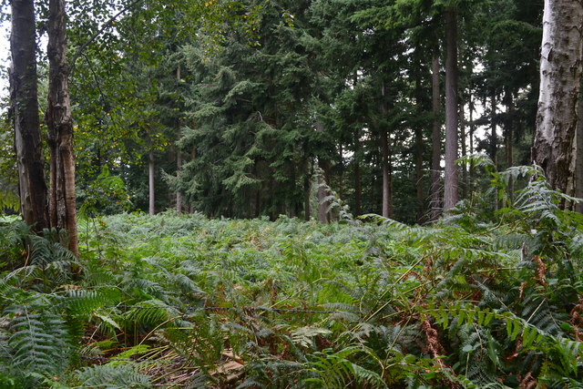
The woodland is characterized by its dense canopy of trees, including oak, beech, and ash, which provide a rich habitat for a variety of wildlife. Visitors to Cricket Copse can expect to spot a myriad of bird species, such as woodpeckers, owls, and songbirds, as well as small mammals like foxes, rabbits, and squirrels.

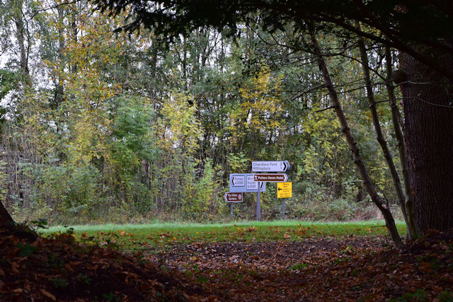
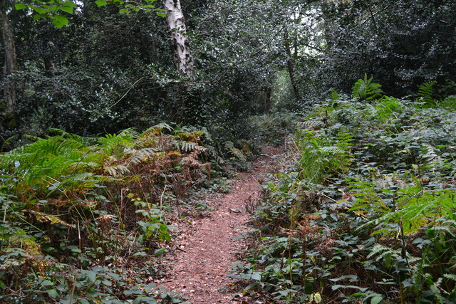
This tranquil forest is crisscrossed by a network of walking trails, allowing visitors to explore its natural wonders at their own pace. The paths wind through ancient woodland, offering glimpses of wildflowers, moss-covered tree trunks, and babbling brooks. The copse is particularly renowned for its vibrant display of bluebells in the spring, creating a magical carpet of color.

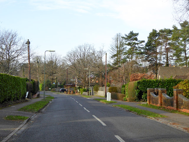
Cricket Copse is a popular destination for outdoor activities such as hiking, birdwatching, and photography. The peaceful atmosphere and stunning scenery make it an ideal spot for picnics or simply immersing oneself in nature. The copse is easily accessible by car and is conveniently located near several charming villages, where visitors can find amenities such as cafes and shops.

Overall, Cricket Copse in Hampshire is a captivating woodland that offers a tranquil escape from the hustle and bustle of everyday life. Its serene beauty, diverse wildlife, and well-maintained trails make it a must-visit destination for nature enthusiasts and those seeking a peaceful retreat.

If you have any feedback on the listing, please let us know in the comments section below.

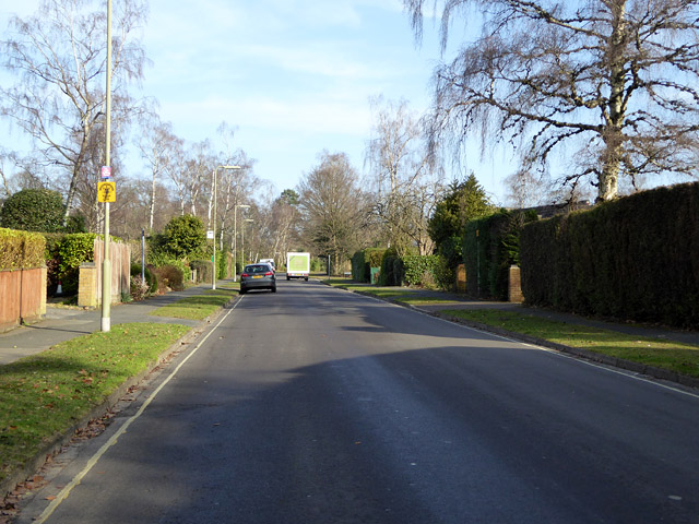
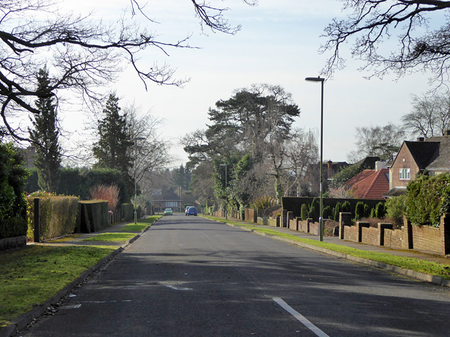
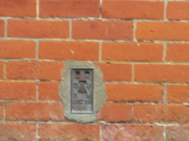
Cricket Copse Images

Images are sourced within 2km of 50.99783/-1.3925361 or Grid Reference SU4222. Thanks to Geograph Open Source API. All images are credited.

Autumn trees outside Potters Heron Hotel
Road signs through the trees From Potters Heron Hotel
Road signs through the trees
From Potters Heron Hotel
Chandler's Ford railway station, Hampshire Opened in 1847 on the London & South Western Railway's line from Eastleigh to Romsey, this station closed in 1969. It was rebuilt and reopened in 2003.
View north west towards Romsey. The original station's main building was to the right of the line, rather than the left. The disused eastbound platform can also be seen on the right.
Chandler's Ford railway station, Hampshire
Opened in 1847 on the London & South Western Railway's line from Eastleigh to Romsey, this station closed in 1969. It was rebuilt and reopened in 2003. View north west towards Romsey. The original station's main building was to the right of the line, rather than the left. The disused eastbound platform can also be seen on the right.
Corner of a clearing in Hocombe Upper Plantation
Footpath in Hocombe Upper Plantation
Midhurst Court, Chandler's Ford A little infilling development.
Midhurst Court, Chandler's Ford
A little infilling development.
Valley Road, Chandler's Ford Looking west.
Valley Road, Chandler's Ford
Looking west.
Monks Brook Looking upstream.
Monks Brook
Looking upstream.
Nichol Road, Hiltingbury, Chandler's Ford Looking north.
Nichol Road, Hiltingbury, Chandler's Ford
Looking north.
Marlborough Road,  Hiltingbury, Chandler's Ford Looking south.
Marlborough Road, Hiltingbury, Chandler's Ford
Looking south.
Kingsway in Chandlers Ford Looking southward.
Kingsway in Chandlers Ford
Looking southward.
The Church of St Edward the Confessor at Chandlers Ford Viewed from the east.
The Church of St Edward the Confessor at Chandlers Ford
Viewed from the east.
Ordnance Survey Flush Bracket G5239 This bracket can be found on the wall of Chandlers Ford Infant School.
For more detail see : <span class="nowrap"><a title="http://www.bench-marks.org.uk/bm12939" rel="nofollow ugc noopener" href="http://www.bench-marks.org.uk/bm12939">Link</a><img style="margin-left:2px;" alt="External link" title="External link - shift click to open in new window" src="https://s1.geograph.org.uk/img/external.png" width="10" height="10"/></span>
Ordnance Survey Flush Bracket G5239
This bracket can be found on the wall of Chandlers Ford Infant School. For more detail see : LinkExternal link
Ordnance Survey Flush Bracket 2790 This can be found on the wall of a house -private flats - in Winchester Road, Chandlers Ford.
For more detail see : <span class="nowrap"><a title="http://www.bench-marks.org.uk/bm10491" rel="nofollow ugc noopener" href="http://www.bench-marks.org.uk/bm10491">Link</a><img style="margin-left:2px;" alt="External link" title="External link - shift click to open in new window" src="https://s1.geograph.org.uk/img/external.png" width="10" height="10"/></span>
Ordnance Survey Flush Bracket 2790
This can be found on the wall of a house -private flats - in Winchester Road, Chandlers Ford. For more detail see : LinkExternal link
Nail Look, Chandler's Ford Nail salon at 1 Bournemouth Road.
Nail Look, Chandler's Ford
Nail salon at 1 Bournemouth Road.
Single track line towards Chandler's Ford railway station From Bournemouth Road bridge. <a title="https://www.geograph.org.uk/photo/5478025" href="https://www.geograph.org.uk/photo/5478025">Link</a>
Single track line towards Chandler's Ford railway station
From Bournemouth Road bridge. Link
Maya Fine Indian Dining, Chandler's Ford Indian cuisine restaurant and takeaway at 5 Bournemouth Road.
Maya Fine Indian Dining, Chandler's Ford
Indian cuisine restaurant and takeaway at 5 Bournemouth Road.
King George VI pillarbox, Bournemouth Road, Chandler's Ford  On the west side of the B3043 Bournemouth Road, near a row of shops.
King George VI pillarbox, Bournemouth Road, Chandler's Ford
On the west side of the B3043 Bournemouth Road, near a row of shops.
Show me another place!

Cricket Copse is located at Grid Ref: SU4222 (Lat: 50.99783, Lng: -1.3925361)

Administrative County: Hampshire

District: Eastleigh

Police Authority: Hampshire

What 3 Words

///winks.cubes.plants. Near North Baddesley, Hampshire

Nearby Locations

Cricket Copse

Related Wikis

Hocombe Mead

Hocombe Mead is a 8.3-hectare (21-acre) Local Nature Reserve in Eastleigh in Hampshire. It is owned by Eastleigh Borough Council and managed by Eastleigh...

Hiltingbury

Hiltingbury is an area within the Borough of Eastleigh in Hampshire, England. There are two electoral wards representing Hiltingbury, returning a total...

Flexford Nature Reserve

Flexford Nature Reserve is a 18-hectare (44-acre) nature reserve in Chandler's Ford in Hampshire. It is managed by the Hampshire and Isle of Wight Wildlife...

Trodds Copse

Trodds Copse (grid reference SU417224) is a 25.23 hectare biological Site of Special Scientific Interest (SSSI), in central Hampshire, notified in 1989...

Valley Park, Chandler's Ford

Valley Park is a civil parish and a new town in the Test Valley district of Hampshire, England. The part of the parish is called Knightwood. == History... ==

Knightwood

Knightwood is a small village in Chandler's Ford which is in Hampshire, England. It is in the civil parish of Valley Park. It is roughly 6 miles north...

Chandler's Ford railway station

Chandler's Ford railway station serves the Chandler's Ford area of Eastleigh in Hampshire, England. It is on the Eastleigh to Romsey Line, 75 miles 25...

Chandler's Ford shooting

The Chandler's Ford shooting (codenamed Operation Hurlock by the police) was the shooting of armed robbers in the town of Chandler's Ford, Hampshire, in...

Nearby Amenities

Located within 500m of 50.99783,-1.3925361
Traffic Signals
Bicycle: yes
Crossing: traffic_signals
Lat/Long: 50.9992486/-1.3918847
Turning Circle
Lat/Long: 50.9967963/-1.3925231
Turning Circle
Lat/Long: 50.9947563/-1.3919124
Turning Circle
Lat/Long: 50.9988467/-1.3933842
Turning Circle
Lat/Long: 50.9983531/-1.3924173
Turning Circle
Lat/Long: 50.996842/-1.394392
Turning Circle
Lat/Long: 50.9975664/-1.3926057
Atm
Tesco Express
Lat/Long: 50.9996875/-1.3874171
Addr City: Eastleigh
Addr Country: GB
Addr Housename: Junction of
Addr Postcode: SO53 5QY
Addr Street: Ashdown Road / Sycamore Avenue
Addr Suburb: Chandler's Ford
Old Phone: +44 2380 261493
Removed Amenity: telephone
Lat/Long: 51.0000551/-1.3873409
Bus Stop
Ashdown Road Post Office
Bus: yes
Naptan AtcoCode: 1900HA030048
Naptan Bearing: N
Naptan CommonName: Ashdown Road Post Office
Naptan Crossing: Richmond Close
Naptan NaptanCode: hamawgwj
Naptan Street: Ashdown Road
Naptan Verified: no
Public Transport: platform
Source: naptan_import
Lat/Long: 50.9998042/-1.3877613
Bus Stop
Ashdown Road Post Office
Bus: yes
Naptan AtcoCode: 1900HA030049
Naptan Bearing: S
Naptan CommonName: Ashdown Road Post Office
Naptan Crossing: Sycamore Avenue
Naptan NaptanCode: hamawgwg
Naptan Street: Ashdown Road
Naptan Verified: no
Public Transport: platform
Source: naptan_import
Lat/Long: 50.9996231/-1.387677
Bus Stop
Hiltingbury School
Bus: yes
Naptan AtcoCode: 1900HA030050
Naptan Bearing: E
Naptan CommonName: Hiltingbury School
Naptan Crossing: Ashdown Road
Naptan NaptanCode: hamawjda
Naptan Street: Hiltingbury Road
Naptan Verified: no
Public Transport: platform
Source: naptan_import
Lat/Long: 50.9987801/-1.386348
Bus Stop
Leigh House Hospital
Naptan AtcoCode: 1900HA030028
Naptan Bearing: SE
Naptan CommonName: Leigh House Hospital
Naptan Crossing: Cuckoo Bushes Lane
Naptan Landmark: Leigh House Hospital
Naptan NaptanCode: hamawgdj
Naptan Street: Hursley Road
Naptan Verified: no
Source: naptan_import
Lat/Long: 50.9946133/-1.3907167
Bus Stop
Leigh House Hospital
Naptan AtcoCode: 1900HA030029
Naptan Bearing: NW
Naptan CommonName: Leigh House Hospital
Naptan Crossing: Cuckoo Bushes Lane
Naptan NaptanCode: hamawgap
Naptan Street: Hursley Road
Naptan Verified: no
Source: naptan_import
Lat/Long: 50.9947759/-1.3908571
Bus Stop
Hursley Road
Naptan AtcoCode: 1900HA030030
Naptan Bearing: E
Naptan CommonName: Hursley Road
Naptan Crossing: Lauriston Drive
Naptan NaptanCode: hamawdmg
Naptan Street: North Millers Dale
Naptan Verified: no
Source: naptan_import
Lat/Long: 50.9972824/-1.3921211
Bus Stop
North Millers Dale
Naptan AtcoCode: 1900HA030031
Naptan Bearing: N
Naptan CommonName: North Millers Dale
Naptan NaptanCode: hamawdwa
Naptan Street: Hursley Road
Naptan Verified: no
Source: naptan_import
Lat/Long: 50.9976397/-1.3916461
Bus Stop
North Millers Dale
Naptan AtcoCode: 1900HA030032
Naptan Bearing: S
Naptan CommonName: North Millers Dale
Naptan Crossing: Cranborne Gardens
Naptan NaptanCode: hamawdwg
Naptan Street: Hursley Road
Naptan Verified: no
Source: naptan_import
Lat/Long: 50.9978461/-1.3915722
Bus Stop
Hiltingbury Farm House
Naptan AtcoCode: 1900HA030033
Naptan Bearing: S
Naptan CommonName: Hiltingbury Farm House
Naptan Crossing: Drummond Way
Naptan NaptanCode: hamawdgj
Naptan Street: North Millers Dale
Naptan Verified: no
Source: naptan_import
Lat/Long: 50.9956804/-1.3935955
Bus Stop
Hiltingbury Farm House
Naptan AtcoCode: 1900HA030034
Naptan Bearing: N
Naptan CommonName: Hiltingbury Farm House
Naptan Crossing: Drummond Way
Naptan NaptanCode: hamawdgd
Naptan Street: North Millers Dale
Naptan Verified: no
Source: naptan_import
Lat/Long: 50.9954202/-1.3937129
Bus Stop
Flexford Nature Reserve
Naptan AtcoCode: 1900HA030035
Naptan Bearing: N
Naptan CommonName: Flexford Nature Reserve
Naptan Crossing: North Millers Dale
Naptan NaptanCode: hamawapw
Naptan Street: Weavers Place
Naptan Verified: no
Source: naptan_import
Lat/Long: 50.9956128/-1.3961614
Bus Stop
Flexford Nature Reserve
Naptan AtcoCode: 1900HA030036
Naptan Bearing: S
Naptan CommonName: Flexford Nature Reserve
Naptan Crossing: North Millers Dale
Naptan NaptanCode: hamawata
Naptan Street: Weavers Place
Naptan Verified: no
Source: naptan_import
Lat/Long: 50.9958125/-1.3960561
Bus Stop
Ashbridge Rise
Naptan AtcoCode: 1900HA030037
Naptan Bearing: SE
Naptan CommonName: Asbridge Rise
Naptan Crossing: Baddesley Road
Naptan NaptanCode: hamawamt
Naptan Street: North Millers Dale
Naptan Verified: no
Source: naptan_import
Lat/Long: 50.9975508/-1.3970483
Bus Stop
Ashbridge Rise
Bus: yes
Naptan AtcoCode: 1900HA030038
Naptan Bearing: NW
Naptan CommonName: Asbridge Rise
Naptan Crossing: Baddesley Road
Naptan NaptanCode: hamawamg
Naptan Street: North Millers Dale
Naptan Verified: no
Public Transport: platform
Source: naptan_import
Lat/Long: 50.9975152/-1.39712
Bus Stop
Baddesley Bridge
Naptan AtcoCode: 1900HA030039
Naptan Bearing: N
Naptan CommonName: Baddesley Bridge
Naptan NaptanCode: hamatwtj
Naptan Street: Baddesley Road
Naptan Verified: no
Source: naptan_import
Lat/Long: 50.9965541/-1.3990847
Bus Stop
Hiltingbury Recreation Ground
Naptan AtcoCode: 1900HA030041
Naptan Bearing: E
Naptan CommonName: Hiltingbury Recreation Ground
Naptan NaptanCode: hamawgdt
Naptan Street: Hiltingbury Road
Naptan Verified: no
Source: naptan_import
Lat/Long: 50.9993716/-1.390591
Bus Stop
Baddesley Road Traffic Lights
Naptan AtcoCode: 1900HA100019
Naptan Bearing: N
Naptan CommonName: Baddesley Road Traffic Lights
Naptan Crossing: Baddesley Road
Naptan NaptanCode: hamawdmj
Naptan Street: Hursley Road
Naptan Verified: no
Source: naptan_import
Lat/Long: 50.9997911/-1.3920741
Bus Stop
Hursley Road
Naptan AtcoCode: 1900HAA19696
Naptan Bearing: W
Naptan CommonName: Hursley Road
Naptan Crossing: Hursley Road
Naptan NaptanCode: hamjgmgp
Naptan Street: Baddesley Road
Naptan Verified: no
Source: naptan_import
Lat/Long: 50.9992563/-1.3925379
Pub
The Hiltonbury Farmhouse
Website: http://www.ilykepubs.co.uk/farmhouse/
Wikidata: Q26405776
Lat/Long: 50.9954677/-1.3941591
Traffic Signals
Crossing: traffic_signals
Crossing Ref: pelican
Lat/Long: 50.9969843/-1.3914315
Post Box
Collection Plate: CP1D
Collection Times: Mo-Fr 09:00; Sa 07:00
Operator: Royal Mail
Post Box Type: pillar
Ref: SO53 354D
Royal Cypher: EIIR
Royal Cypher Wikidata: Q33102113
Lat/Long: 50.9991975/-1.3961256
Tesco Express
Addr Housenumber: 8-12
Addr Postcode: SO53 5RD
Addr Street: Ashdown Road
Brand: Tesco Express
Brand Wikidata: Q98456772
Contact Website: https://www.tesco.com/store-locator/eastleigh/8-12-ashdown-rd
Fhrs Id: 128971
Shop: convenience
Lat/Long: 50.9996738/-1.3872913
Post Box
Collection Plate: CP1
Collection Times: Mo-Fr 17:00; Sa 11:30
Operator: Royal Mail
Post Box Type: pillar
Ref: SO53 709
Royal Cypher: EIIR
Royal Cypher Wikidata: Q33102113
Lat/Long: 50.9972773/-1.3921714
Barrier: cycle_barrier
Bicycle: no
Foot: yes
Lat/Long: 51.0004611/-1.3959659
Millers Dale North
Place: suburb
Lat/Long: 50.9951878/-1.394419
Hook
Place: suburb
Lat/Long: 51.0010692/-1.3958565
Post Box
Collection Plate: CP8
Collection Times: Mo-Fr 17:00; Sa 11:30
Operator: Royal Mail
Operator Wikidata: Q638098
Post Box Type: pillar
Ref: SO53 574
Royal Cypher: EIIR
Royal Cypher Wikidata: Q33102113
Lat/Long: 50.9995721/-1.3874858
Barrier: kissing_gate
Bicycle: yes
Foot: yes
Lat/Long: 50.9989495/-1.3875578
Noexit: yes
Lat/Long: 50.9969984/-1.3950786
Kindergarten
Yellow Dot
Lat/Long: 50.9957172/-1.3946414
Generator Method: photovoltaic
Generator Output Electricity: yes
Generator Source: solar
Generator Type: solar_photovoltaic_panel
Location: roof
Power: generator
Lat/Long: 50.9962169/-1.3963741
Generator Method: photovoltaic
Generator Output Electricity: yes
Generator Source: solar
Generator Type: solar_photovoltaic_panel
Location: roof
Power: generator
Lat/Long: 50.9944511/-1.3950303
Generator Method: photovoltaic
Generator Output Electricity: yes
Generator Source: solar
Generator Type: solar_photovoltaic_panel
Location: roof
Power: generator
Lat/Long: 50.9948613/-1.3934881
Generator Method: photovoltaic
Generator Output Electricity: yes
Generator Source: solar
Generator Type: solar_photovoltaic_panel
Location: roof
Power: generator
Lat/Long: 50.9959729/-1.3928537
Barrier: kissing_gate
Lat/Long: 50.9962633/-1.3989022
Entrance: yes
Lat/Long: 50.997476/-1.3855531
Waste Basket
Waste: trash
Lat/Long: 50.9977994/-1.3854154
Defibrillator
Emergency: defibrillator
Ref GB The Circuit: B2505767-3C50-4F46-8012-AD26010C5C7B
Lat/Long: 50.997521/-1.3855294
Bench
Backrest: yes
Lat/Long: 50.9978163/-1.3859576
Waste Basket
Waste: trash
Lat/Long: 50.9978422/-1.3859412
Backrest: no
Covered: no
Leisure: picnic_table
Lat/Long: 50.9977356/-1.3855409
Backrest: no
Covered: no
Leisure: picnic_table
Lat/Long: 50.9977529/-1.3855057
Entrance: yes
Lat/Long: 50.9968367/-1.3856521
Bench
Backrest: yes
Lat/Long: 50.9974724/-1.3860328
Bench
Lat/Long: 50.9979161/-1.3861065
Waste Basket
Waste: trash
Lat/Long: 50.9979042/-1.3860868
The data included in this document is from www.openstreetmap.org. The data is made available under ODbL.

Have you been to Cricket Copse?

Leave your review of Cricket Copse below (or comments, questions and feedback).