Valley Park

Wood, Forest in Hampshire Test Valley

England

Valley Park

Crusaders Way, Chandler's Ford With Zionshill Copse on the left / south side and a 1990s housing estate on the right / north side.
Crusaders Way, Chandler's Ford Credit: Christine Johnstone

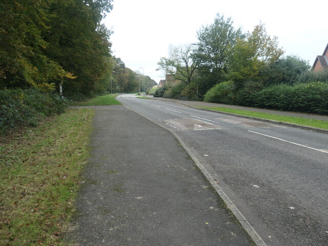
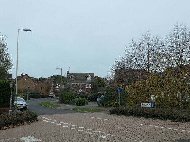
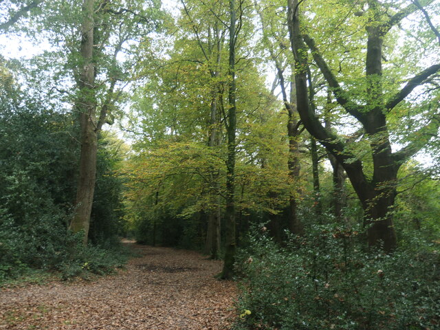
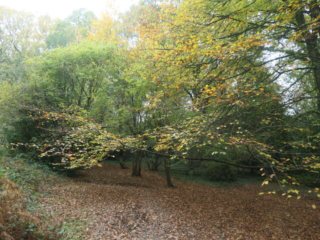
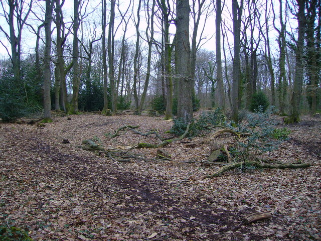
Valley Park, located in Hampshire, England, is a picturesque woodland area known for its serene beauty and diverse ecosystem. Spread across a sprawling area, this forested region is a haven for nature enthusiasts and offers a peaceful retreat from the bustling city life.

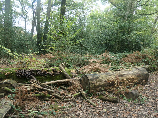
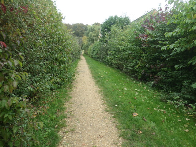
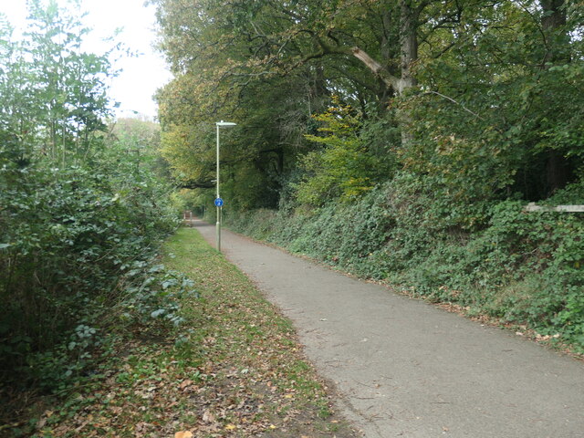
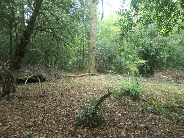
The woodland in Valley Park is home to a wide variety of trees, including oak, beech, and pine, creating a rich tapestry of colors throughout the seasons. The forest floor is adorned with an array of wildflowers, adding to the natural charm of the area. The dense foliage provides a habitat for various wildlife species, such as deer, foxes, and a variety of bird species, making it a popular spot for birdwatchers.

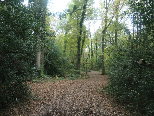
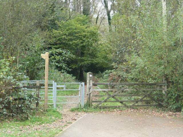
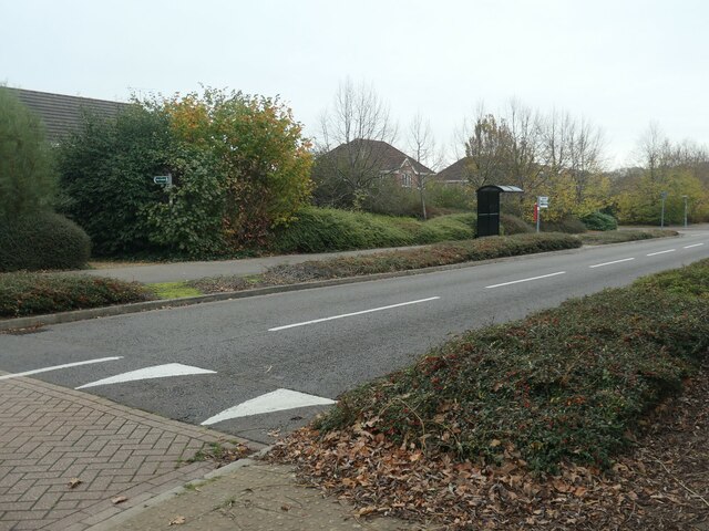
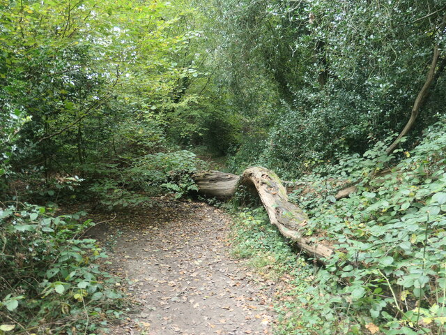
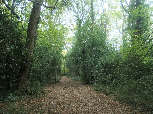
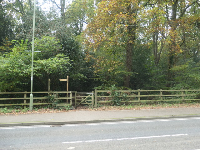
Traversing through Valley Park, visitors will find a network of well-maintained walking trails, allowing them to explore the forest at their own pace. These trails wind their way through the woods, offering stunning vistas of the surrounding countryside and glimpses of hidden streams and small ponds.

In addition to its natural beauty, Valley Park also offers recreational facilities for visitors. There are designated picnic areas and open spaces where families and friends can enjoy a leisurely day out. The forest is also equipped with well-marked cycling trails, catering to the needs of cycling enthusiasts.

Valley Park, Hampshire, with its enchanting woodland, abundant wildlife, and recreational amenities, is a cherished destination for nature lovers and outdoor enthusiasts alike. Whether one seeks solitude in nature's embrace or an adventurous day out, this forested haven has something to offer for everyone.

If you have any feedback on the listing, please let us know in the comments section below.
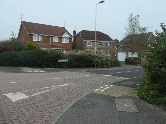
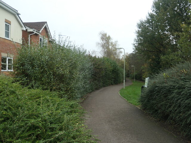
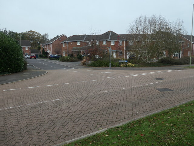
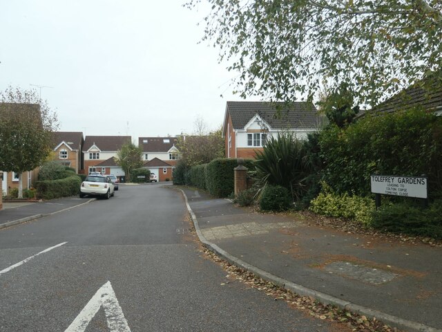
Valley Park Images

Images are sourced within 2km of 50.985003/-1.3953532 or Grid Reference SU4220. Thanks to Geograph Open Source API. All images are credited.

Crusaders Way, Chandler's Ford With Zionshill Copse on the left / south side and a 1990s housing estate on the right / north side.
Crusaders Way, Chandler's Ford
With Zionshill Copse on the left / south side and a 1990s housing estate on the right / north side.
Logs and fungi, Zionshill Copse Part of Valley Park local nature reserve, on the western edge of Chandler's Ford.
Logs and fungi, Zionshill Copse
Part of Valley Park local nature reserve, on the western edge of Chandler's Ford.
Path through Zionshill Copse The copse is part of Valley Park local nature reserve, on the western edge of Chandler's Ford.
Path through Zionshill Copse
The copse is part of Valley Park local nature reserve, on the western edge of Chandler's Ford.
An entrance to Zionshill Copse On the west side of Sky's Wood Road. The copse is part of Valley Park local nature reserve, on the western edge of Chandler's Ford.
An entrance to Zionshill Copse
On the west side of Sky's Wood Road. The copse is part of Valley Park local nature reserve, on the western edge of Chandler's Ford.
Houses on the north side of Harvest Road Part of a large housing development on the western edge of Chandler's Ford.
Houses on the north side of Harvest Road
Part of a large housing development on the western edge of Chandler's Ford.
Path heading east from Sky's Wood Road Cutting across a large loop in the road, which is the main thoroughfare in a housing development on the western edge of Chandler's Ford.
Path heading east from Sky's Wood Road
Cutting across a large loop in the road, which is the main thoroughfare in a housing development on the western edge of Chandler's Ford.
Terraced houses, Jack Close Off Sky's Wood Road. Part of a housing development on the west side of Chandler's Ford.
Terraced houses, Jack Close
Off Sky's Wood Road. Part of a housing development on the west side of Chandler's Ford.
Tolefrey Gardens Off Sky's Wood Road. Part of a housing development on the west side of Chandler's Ford.
Tolefrey Gardens
Off Sky's Wood Road. Part of a housing development on the west side of Chandler's Ford.
Morgan le Fey Drive, western edge of Chandler's Ford Named after a powerful enchantress in the Arthurian legends.
Morgan le Fey Drive, western edge of Chandler's Ford
Named after a powerful enchantress in the Arthurian legends.
Sky's Wood Road, western edge of Chandler's Ford The main thoroughfare through a large-ish housing development.
Sky's Wood Road, western edge of Chandler's Ford
The main thoroughfare through a large-ish housing development.
Public footpath between Merlin Way and Catmint Close On the western edge of Chandler's Ford. Heading north-east from Sky's Wood Road towards Knight Wood.
Public footpath between Merlin Way and Catmint Close
On the western edge of Chandler's Ford. Heading north-east from Sky's Wood Road towards Knight Wood.
Footpath and cycleway behind Merlin Way Heading north towards Flexford Road, on the western edge of Chandler's ford.
Footpath and cycleway behind Merlin Way
Heading north towards Flexford Road, on the western edge of Chandler's ford.
Fallen leaves, Knight Wood Part of the Valley Park Woodlands local nature reserve.
Fallen leaves, Knight Wood
Part of the Valley Park Woodlands local nature reserve.
Tree fallen across a path, Knight Wood With an informal detour through the shrubbery. Knight Wood is part of the Valley Park Woodlands local nature reserve.
Tree fallen across a path, Knight Wood
With an informal detour through the shrubbery. Knight Wood is part of the Valley Park Woodlands local nature reserve.
Path heading eastwards in Knight Wood Part of the Valley Park local nature reserve on the western side of Chandler's Ford.
Path heading eastwards in Knight Wood
Part of the Valley Park local nature reserve on the western side of Chandler's Ford.
Public footpath entering Knight Wood On the western side of Knightwood Road.
Public footpath entering Knight Wood
On the western side of Knightwood Road.
Public footpath in Knight Wood Open access woodland on the east side of Knightwood Road, Chandler's Ford.
Public footpath in Knight Wood
Open access woodland on the east side of Knightwood Road, Chandler's Ford.
Autumn colour, Knight Wood, Chandler's Ford Along a public footpath crossing the open access woodland.
Autumn colour, Knight Wood, Chandler's Ford
Along a public footpath crossing the open access woodland.
Show me another place!

Valley Park is located at Grid Ref: SU4220 (Lat: 50.985003, Lng: -1.3953532)

Administrative County: Hampshire

District: Test Valley

Police Authority: Hampshire

What 3 Words

///scores.thing.smile. Near North Baddesley, Hampshire

Related Wikis

Valley Park, Chandler's Ford

Valley Park is a civil parish and a new town in the Test Valley district of Hampshire, England. The part of the parish is called Knightwood. == History... ==

Knightwood

Knightwood is a small village in Chandler's Ford which is in Hampshire, England. It is in the civil parish of Valley Park. It is roughly 6 miles north...

Flexford Nature Reserve

Flexford Nature Reserve is a 18-hectare (44-acre) nature reserve in Chandler's Ford in Hampshire. It is managed by the Hampshire and Isle of Wight Wildlife...

Chandler's Ford railway station

Chandler's Ford railway station serves the Chandler's Ford area of Eastleigh in Hampshire, England. It is on the Eastleigh to Romsey Line, 75 miles 25...

Valley Park Woodlands

Valley Park Woodlands is a 24.8-hectare (61-acre) Local Nature Reserve in Chandler's Ford in Hampshire. It is owned and managed by Test Valley Borough...

Chandler's Ford shooting

The Chandler's Ford shooting (codenamed Operation Hurlock by the police) was the shooting of armed robbers in the town of Chandler's Ford, Hampshire, in...

Chandler's Ford

Chandler's Ford (originally The Ford and historically Chandlersford) is a largely residential area and civil parish in the Borough of Eastleigh in Hampshire...

Baddesley Preceptory

Baddesley Preceptory was a preceptory of the Knights Hospitaller at North Baddesley in Hampshire, England. The preceptory was founded at Godsfield but...

Nearby Amenities

Located within 500m of 50.985003,-1.3953532
Odbl: clean
Lat/Long: 50.9832396/-1.3997217
Odbl: clean
Lat/Long: 50.9831045/-1.3998419
Odbl: clean
Lat/Long: 50.9830072/-1.3998934
Odbl: clean
Lat/Long: 50.9828775/-1.3999535
Odbl: clean
Lat/Long: 50.9827857/-1.3999535
Odbl: clean
Lat/Long: 50.9827533/-1.3999535
Odbl: clean
Lat/Long: 50.9826614/-1.3999964
Odbl: clean
Lat/Long: 50.9825858/-1.4000908
Odbl: clean
Lat/Long: 50.9825533/-1.4002024
Odbl: clean
Lat/Long: 50.982629/-1.4002968
Odbl: clean
Lat/Long: 50.98271/-1.4003912
Odbl: clean
Lat/Long: 50.9827641/-1.4004341
Odbl: clean
Lat/Long: 50.9828559/-1.4005114
Odbl: clean
Lat/Long: 50.98425/-1.3999964
Odbl: clean
Lat/Long: 50.9841636/-1.3998419
Odbl: clean
Lat/Long: 50.9840879/-1.3996874
Odbl: clean
Lat/Long: 50.9840825/-1.3995415
Odbl: clean
Lat/Long: 50.9841636/-1.3994642
Odbl: clean
Lat/Long: 50.9842824/-1.3994642
Odbl: clean
Lat/Long: 50.9843797/-1.4003054
Odbl: clean
Lat/Long: 50.9843851/-1.4004684
Odbl: clean
Lat/Long: 50.9844013/-1.4006573
Odbl: clean
Lat/Long: 50.9844013/-1.4007688
Odbl: clean
Lat/Long: 50.9844013/-1.400992
Odbl: clean
Lat/Long: 50.9843743/-1.4008203
Odbl: clean
Lat/Long: 50.9843527/-1.4006401
Odbl: clean
Lat/Long: 50.9842932/-1.4004341
Odbl: clean
Lat/Long: 50.9842824/-1.4002024
Post Box
Collection Plate: CP1
Collection Times: Mo-Fr 16:00; Sa 11:30
Operator: Royal Mail
Operator Wikidata: Q638098
Post Box Type: lamp
Ref: SO53 796
Royal Cypher: EIIR
Royal Cypher Wikidata: Q33102113
Lat/Long: 50.9847077/-1.4004354
Bus Stop
Kelburn Close
Bus: yes
Naptan AtcoCode: 1900HA030022
Naptan Bearing: N
Naptan CommonName: Kelburn Close
Naptan Crossing: Kelburn Close
Naptan NaptanCode: hamawgjd
Naptan Street: Sutherlands Way
Naptan Verified: no
Public Transport: platform
Source: naptan_import
Tactile Paving: no
Lat/Long: 50.9882278/-1.3905724
Bus Stop
Stinchar Drive
Bus: yes
Naptan AtcoCode: 1900HA100011
Naptan Bearing: W
Naptan CommonName: Stinchar Drive
Naptan NaptanCode: hamawapa
Naptan Street: Wicklow Drive
Naptan Verified: no
Public Transport: platform
Source: naptan_import
Lat/Long: 50.9818854/-1.3969948
Bus Stop
Stinchar Drive
Bus: yes
Naptan AtcoCode: 1900HA100012
Naptan Bearing: E
Naptan CommonName: Stinchar Drive
Naptan Crossing: Stinchar Drive
Naptan NaptanCode: hamawatw
Naptan Street: Wicklow Drive
Naptan Verified: no
Public Transport: platform
Source: naptan_import
Lat/Long: 50.982194/-1.3958084
Bus Stop
Lambourn Square
Bus: yes
Naptan AtcoCode: 1900HA100013
Naptan Bearing: S
Naptan CommonName: Lambourn Square
Naptan Crossing: Lambourn Square
Naptan NaptanCode: hamawdga
Naptan Street: Wicklow Drive
Naptan Verified: no
Public Transport: platform
Source: naptan_import
Lat/Long: 50.9829501/-1.3942173
Bus Stop
Alderwood Ave
Bus: yes
Naptan AtcoCode: 1900HA100015
Naptan Bearing: W
Naptan CommonName: Alderwood Ave
Naptan Crossing: Alderwood Avenue
Naptan NaptanCode: hamawapg
Naptan Street: Shannon Way
Naptan Verified: no
Public Transport: platform
Source: naptan_import
Lat/Long: 50.9844744/-1.396833
Bus Stop
Alderwood Ave
Bus: yes
Naptan AtcoCode: 1900HA100016
Naptan Bearing: E
Naptan CommonName: Alderwood Ave
Naptan Crossing: Alderwood Avenue
Naptan NaptanCode: hamawamp
Naptan Street: Shannon Way
Naptan Verified: no
Public Transport: platform
Source: naptan_import
Lat/Long: 50.9846295/-1.3972584
Bus Stop
Wood End Way
Bus: yes
Naptan AtcoCode: 1900HAA09251
Naptan Bearing: E
Naptan CommonName: Wood End Way
Naptan Crossing: Wood End Way
Naptan NaptanCode: hamjdjdg
Naptan Street: Skyswood Road
Naptan Verified: no
Public Transport: platform
Source: naptan_import
Lat/Long: 50.9847094/-1.4005626
Bus Stop
Wood End Way
Bus: yes
Naptan AtcoCode: 1900HAA09252
Naptan Bearing: W
Naptan CommonName: Wood End Way
Naptan Crossing: Opp Wood End Way
Naptan NaptanCode: hamjdjdj
Naptan Street: Skys Wood Road
Naptan Verified: no
Public Transport: platform
Source: naptan_import
Lat/Long: 50.9845889/-1.4016042
Bus Stop
Knightwood Road
Bus: yes
Naptan AtcoCode: 1900HAA09350
Naptan Bearing: SE
Naptan CommonName: Knightwood Road
Naptan NaptanCode: hamjdpaj
Naptan Street: Knightwood Road
Naptan Verified: no
Public Transport: platform
Source: naptan_import
Lat/Long: 50.9868064/-1.3995957
Bus Stop
Knightwood Road
Bus: yes
Naptan AtcoCode: 1900HAA19697
Naptan Bearing: NW
Naptan BusStopType: CUS
Naptan CommonName: Knightwood Road
Naptan NaptanCode: hamjgmgt
Naptan Street: Knightwood Road
Naptan Verified: no
Public Transport: platform
Source: naptan_import
Lat/Long: 50.9867556/-1.3997527
Bus Stop
Lambourn Square
Bus: yes
Naptan AtcoCode: 1900HAA19698
Naptan Bearing: N
Naptan CommonName: Lambourn Square
Naptan Crossing: Lambourn Square
Naptan NaptanCode: hamjgmgw
Naptan Street: Wicklow Drive
Naptan Verified: no
Public Transport: platform
Source: naptan_import
Lat/Long: 50.9830764/-1.3942868
Power: pole
Lat/Long: 50.9869985/-1.3903626
Power: pole
Lat/Long: 50.9847547/-1.3910485
Power: pole
Lat/Long: 50.9855852/-1.3907936
Power: pole
Lat/Long: 50.9830537/-1.3924366
Source: Bing
Traffic Calming: table
Lat/Long: 50.9872523/-1.3939165
Traffic Calming: table
Lat/Long: 50.986231/-1.3932113
Source: Bing
Traffic Calming: table
Lat/Long: 50.9872679/-1.3935576
Traffic Calming: table
Lat/Long: 50.9865087/-1.3922111
Traffic Calming: table
Lat/Long: 50.9821945/-1.3942137
Traffic Calming: table
Lat/Long: 50.9818566/-1.3943392
Noexit: yes
Lat/Long: 50.9820417/-1.3959923
Traffic Calming: table
Lat/Long: 50.9812705/-1.3964111
Source: Bing
Traffic Calming: table
Lat/Long: 50.9814017/-1.3948636
Crossing
Lat/Long: 50.9846738/-1.3994149
Bench
Backrest: yes
Material: wood
Seats: 3
Lat/Long: 50.9888728/-1.3959649
Post Box
Collection Plate: CP7
Collection Times: Mo-Fr 16:00; Sa 11:00
Operator: Royal Mail
Operator Wikidata: Q638098
Post Box Type: lamp
Ref: SO53 766
Royal Cypher: EIIR
Royal Cypher Wikidata: Q33102113
Lat/Long: 50.9836441/-1.3937324
Post Box
Collection Plate: CP7D
Collection Times: Mo-Fr 09:00; Sa 07:00
Operator: Royal Mail
Operator Wikidata: Q638098
Post Box Type: lamp
Ref: SO53 739D
Royal Cypher: EIIR
Royal Cypher Wikidata: Q33102113
Lat/Long: 50.987721/-1.3900148
Brendoncare Knightwood Care Home
Phone: +442380247000
Social Facility: assisted_living
Website: https://www.brendoncare.org.uk/care/our-care-homes/knightwood
Lat/Long: 50.9854986/-1.3985212
Crossing
Lat/Long: 50.9849044/-1.3990222
Crossing
Lat/Long: 50.9848918/-1.3991318
Access: private
Bicycle: no
Depth: 0.5
Foot: no
Ford: yes
Horse: no
Motor Vehicle: private
Lat/Long: 50.9861977/-1.3901467
Bench
Backrest: yes
Lat/Long: 50.988485/-1.3947561
Bench
Backrest: yes
Lat/Long: 50.9882596/-1.3935357
Badger's Copse
Place: locality
Lat/Long: 50.9874567/-1.3972983
Ramalley Piece
Place: locality
Lat/Long: 50.9887937/-1.3986795
Crossing
Lat/Long: 50.9878766/-1.4004542
Leisure: picnic_table
Material: wood
Lat/Long: 50.9826554/-1.3953758
Tourism: picnic_site
Lat/Long: 50.9827939/-1.3958385
Playground: structure
Lat/Long: 50.9828508/-1.3960429
Playground: structure
Lat/Long: 50.9890237/-1.3960579
Leisure: picnic_table
Lit: no
Material: wood
Lat/Long: 50.9889803/-1.3959533
Addr Housenumber: 10
Addr Postcode: SO53 4LN
Addr Street: Wood End Way
Lat/Long: 50.9852497/-1.4008858
The data included in this document is from www.openstreetmap.org. The data is made available under ODbL.

Have you been to Valley Park?

Leave your review of Valley Park below (or comments, questions and feedback).