Dormston

Settlement in Worcestershire Wychavon

England

Dormston

Quiet country road Quiet country road near Stock Wood.
Quiet country road Credit: Philip Halling

Dormston is a small village located in the county of Worcestershire, England. Situated approximately 3 miles northeast of the town of Droitwich Spa, Dormston is surrounded by beautiful countryside and offers a peaceful and rural setting.

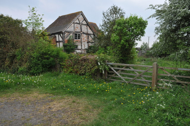
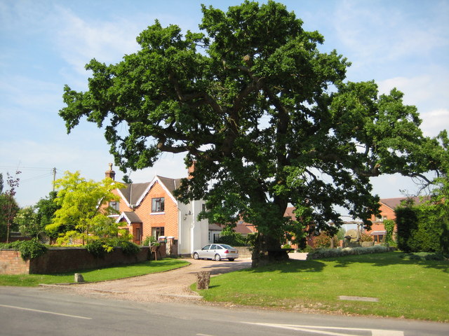
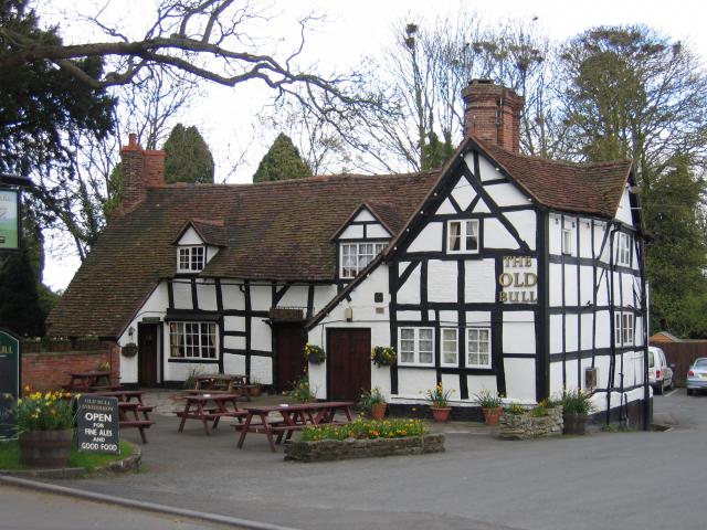
The village is home to a tight-knit community, with a population of around 600 residents. It is known for its charming and picturesque houses, many of which date back to the 17th and 18th centuries. The architecture in Dormston showcases a mix of traditional English styles, including timber-framed cottages and stone-built houses.

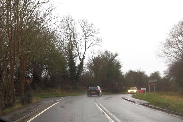
Dormston is well-connected to nearby towns and cities, with good transportation links. The M5 motorway is easily accessible, providing convenient access to Birmingham and Worcester. The village also benefits from regular bus services, connecting residents to neighboring towns.

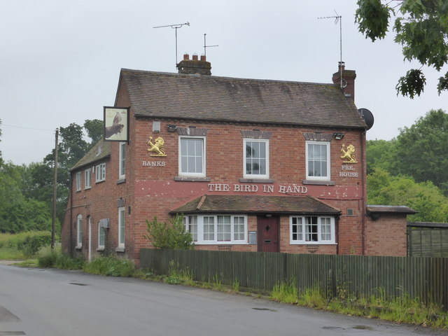
Despite its small size, Dormston offers a range of amenities to its residents. These include a local pub, The Dormston Village Inn, which serves traditional pub food and offers a friendly atmosphere. Additionally, there is a village hall that hosts various community events and activities throughout the year.

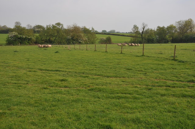
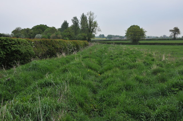
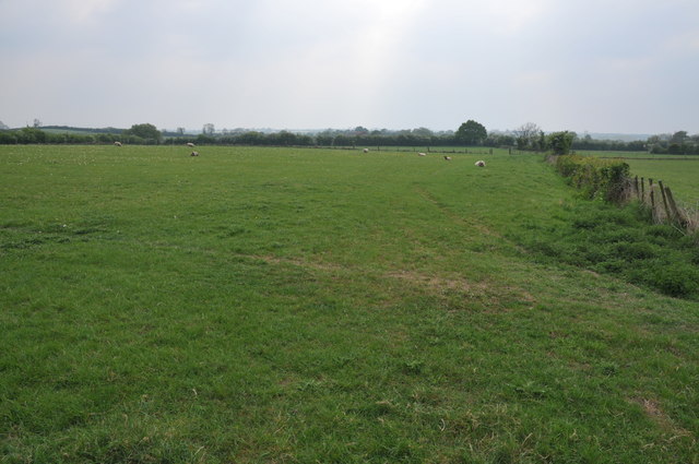
For outdoor enthusiasts, Dormston is surrounded by rolling countryside, providing ample opportunities for walking, cycling, and exploring nature. The nearby Droitwich Canal and River Salwarpe offer scenic routes for leisurely walks.

In conclusion, Dormston is a charming and quiet village with a strong sense of community. Its beautiful architecture, convenient location, and access to nature make it an attractive place to live for those seeking a rural lifestyle.

If you have any feedback on the listing, please let us know in the comments section below.
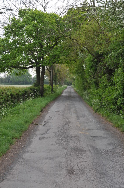
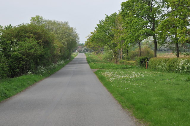
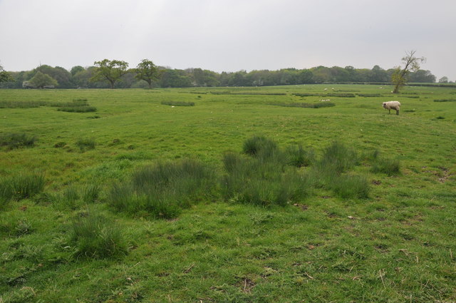
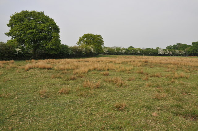
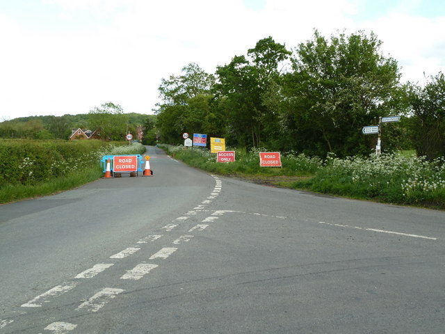
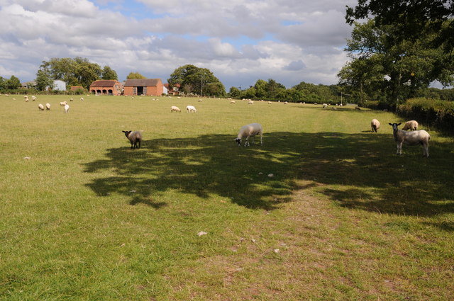
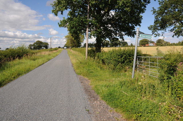
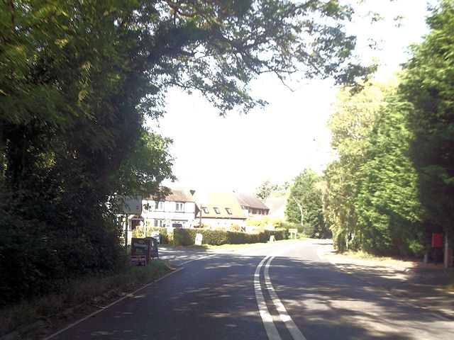
Dormston Images

Images are sourced within 2km of 52.215453/-2.019508 or Grid Reference SO9857. Thanks to Geograph Open Source API. All images are credited.

Quiet country road Quiet country road near Stock Wood.
Quiet country road
Quiet country road near Stock Wood.
Country road near Stock Green This road approaches a t-junction in a small hamlet which is not named on the OS map.
Country road near Stock Green
This road approaches a t-junction in a small hamlet which is not named on the OS map.
Farmland beside Grafton Wood On the far side of this field the Wychavon Way passes beside the Grafton Wood.
Farmland beside Grafton Wood
On the far side of this field the Wychavon Way passes beside the Grafton Wood.
Farmland near Stock Green At present this field is dry however the reeds suggest this field normally lies wet.
Farmland near Stock Green
At present this field is dry however the reeds suggest this field normally lies wet.
Bridleway to Upper Kite's Wood This bridleway passes Upper Kite's Wood and joins the Wychavon Way.
Bridleway to Upper Kite's Wood
This bridleway passes Upper Kite's Wood and joins the Wychavon Way.
Sheep near Cockshot Farm Sheep near Cockshot Farm near Kington.
Sheep near Cockshot Farm
Sheep near Cockshot Farm near Kington.
Old cottage at Dormston An old cottage in a sorry state beside the road to Dormston
Old cottage at Dormston
An old cottage in a sorry state beside the road to Dormston
Dovecot at Dormston Dovecot viewed from the road in Dormston.
Dovecot at Dormston
Dovecot viewed from the road in Dormston.
Bridleway at Dormston Bridleway from Dormston to Stock Green.
Bridleway at Dormston
Bridleway from Dormston to Stock Green.
The edge of Stock Green A road junction on the edge of Hollow Court but the signs proclaim this to be Stock Green. The road to the right goes to Grafton Flyford and Himbleton. The road ahead was closed for sewer works.
The edge of Stock Green
A road junction on the edge of Hollow Court but the signs proclaim this to be Stock Green. The road to the right goes to Grafton Flyford and Himbleton. The road ahead was closed for sewer works.
Sheep and Hill Top Farm Sheep in a field with Hill Top Farm in the background.
Sheep and Hill Top Farm
Sheep in a field with Hill Top Farm in the background.
Footpath to Hill Top Farm Two footpaths cross farmland to the right one of which leads to Hill Top Farm.
Footpath to Hill Top Farm
Two footpaths cross farmland to the right one of which leads to Hill Top Farm.
Kington turning from A422 at Flyford Flavell
Cockshot Lane junction with A422
A422 approaching Dormston turning
Kington turning off A422
Another closed public house - Stock Green The Bird in Hand is closed but still furnished. It doesn't look like anybody is living there either.
Another closed public house - Stock Green
The Bird in Hand is closed but still furnished. It doesn't look like anybody is living there either.
Farmland at Inkberrow Sheep in a field near Inkberrow.
Farmland at Inkberrow
Sheep in a field near Inkberrow.
Show me another place!

Dormston is located at Grid Ref: SO9857 (Lat: 52.215453, Lng: -2.019508)

Administrative County: Worcestershire

District: Wychavon

Police Authority: West Mercia

What 3 Words

///learn.villager.look. Near Kington, Worcestershire

Nearby Locations

Town's End Dormston

Related Wikis

Dormston

Dormston is a village and civil parish in Worcestershire about 3 miles (4.8 km) south of Redditch. == Name == Dormston's toponym has evolved from Deormodesealdtune...

Kington, Worcestershire

Kington is a village in Worcestershire, England, situated near to Flyford Flavell. == History == The earliest known recording of Kington in the Domesday...

Little Inkberrow

Little Inkberrow is a village in Worcestershire, England. Ralph Ardern inherited the Worcestershire manor of Little Inkberrow between 1382 (the death...

Grafton Wood

Grafton Wood is a nature reserve near the village of Grafton Flyford, about 6 miles (9.7 km) east of Worcester, in Worcestershire, England. == Description... ==

Grafton Flyford

Grafton Flyford is a village about 6 miles (9.7 km) east of Worcester, in Worcestershire, England. It neighbours Stock Green, with the large farm house...

Flyford Flavell

Flyford Flavell is a village in Worcestershire , it has a traditional pub in the centre of the village adjacent to the village green and a first school...

Inkberrow

Inkberrow is a village in Worcestershire, England, often thought to be the model for Ambridge, the setting of BBC Radio 4's long-running series The Archers...

Sporting Club Inkberrow F.C.

Sporting Club Inkberrow Football Club is a football club based in Inkberrow, England. They are currently members of the Hellenic League Division One and...

Nearby Amenities

Located within 500m of 52.215453,-2.019508
Dormston Phone Box
Naptan AtcoCode: 2000G675001
Naptan Bearing: NE
Naptan BusStopType: CUS
Naptan CommonName: Dormston Phone Box
Naptan Indicator: Adj
Naptan Landmark: church
Naptan NaptanCode: wocdajat
Naptan Street: Dormston Lane
Naptan Verified: no
Source: naptan_import
Lat/Long: 52.2155633/-2.019189
Post Box
Fixme: Need to go back and see if is still there.
Post Box Type: lamp
Ref: WR7 163
Source: memory;bing
Source Ref: conjecture
Lat/Long: 52.2131763/-2.0246468
Dormston
Place: village
Source: OS NEW POPULAR HISTORIC
Wikidata: Q2012100
Lat/Long: 52.2154312/-2.0193811
Dormston Manor
Power: pole
Transformer: distribution
Voltage Primary: 11000
Lat/Long: 52.2149812/-2.0182791
Power: pole
Lat/Long: 52.214687/-2.0190664
Power: pole
Lat/Long: 52.2143641/-2.0198657
Power: pole
Lat/Long: 52.2139762/-2.0208782
Power: pole
Lat/Long: 52.2159541/-2.0228416
Dormston North
Power: pole
Transformer: distribution
Voltage Primary: 11000
Lat/Long: 52.2174487/-2.0233539
Power: pole
Lat/Long: 52.2166853/-2.0233861
Dormston Lane
Power: pole
Transformer: distribution
Voltage Primary: 11000
Lat/Long: 52.2152359/-2.0221482
Power: pole
Lat/Long: 52.2146558/-2.0215045
Power: pole
Lat/Long: 52.2142992/-2.0216306
Power: pole
Lat/Long: 52.2135908/-2.0218626
Power: pole
Lat/Long: 52.2131726/-2.0229515
Power: pole
Lat/Long: 52.2128628/-2.0237468
Power: pole
Lat/Long: 52.2139705/-2.0260683
Power: pole
Lat/Long: 52.2142392/-2.026476
Power: pole
Lat/Long: 52.2136426/-2.0255855
Moat Farm Dormston
Power: pole
Transformer: distribution
Voltage Primary: 11000
Lat/Long: 52.2133558/-2.0252227
Power: pole
Lat/Long: 52.2129807/-2.0247439
Power: pole
Lat/Long: 52.2126438/-2.0243148
Power: pole
Lat/Long: 52.2124441/-2.0248311
The data included in this document is from www.openstreetmap.org. The data is made available under ODbL.

Have you been to Dormston?

Leave your review of Dormston below (or comments, questions and feedback).