Castles Copse

Wood, Forest in Oxfordshire West Oxfordshire

England

Castles Copse

Primroses beside the lane These wide verges are often a good place for wildflowers.
Primroses beside the lane Credit: Des Blenkinsopp

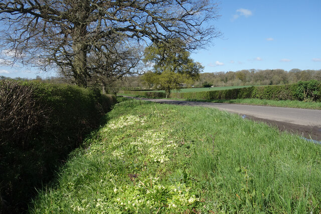
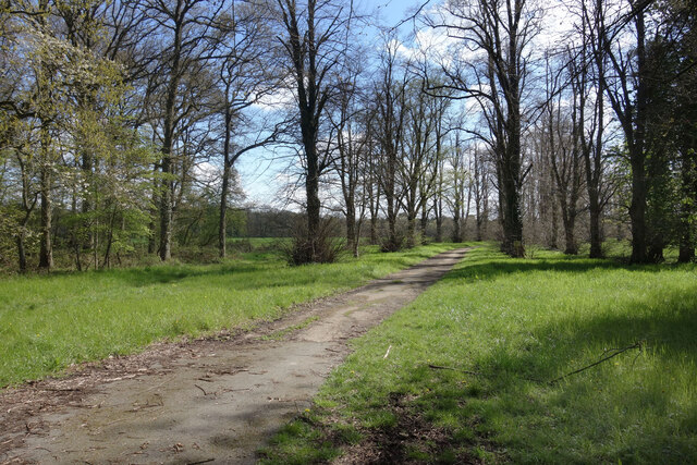
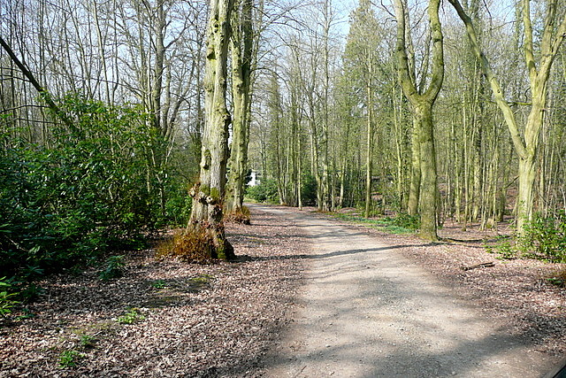
Castles Copse is a picturesque woodland located in Oxfordshire, England. Stretching over an area of approximately 50 acres, this enchanting forest is nestled within the heart of the Oxfordshire countryside. The copse gets its name from the ancient castle ruins that can be found within its boundaries.

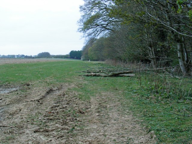
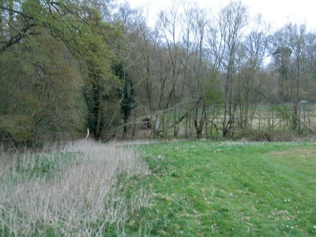
The woodland is characterized by its dense and diverse vegetation. Towering oak and beech trees dominate the landscape, creating a canopy that filters the sunlight, casting beautiful shadows on the forest floor. The forest is also home to a variety of flora, including bluebells, wild garlic, and primroses, which add vibrant splashes of color to the green surroundings during springtime.

The copse is a haven for wildlife enthusiasts, offering a sanctuary for numerous species of birds, mammals, and insects. Visitors may be lucky enough to spot buzzards soaring high above the treetops or catch a glimpse of a deer gracefully navigating through the undergrowth.

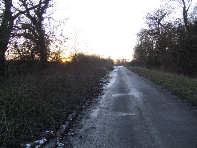
Trails and footpaths wind their way through the woodland, providing visitors with the opportunity to explore its natural beauty. The paths take visitors past the castle ruins, adding a touch of historical intrigue to the experience. These ruins are remnants of a medieval castle, thought to have been constructed in the 12th century.

Castles Copse offers a peaceful escape from the hustle and bustle of everyday life. With its serene atmosphere, stunning scenery, and historical significance, it is a must-visit destination for nature lovers and history enthusiasts alike.

If you have any feedback on the listing, please let us know in the comments section below.

Castles Copse Images

Images are sourced within 2km of 51.797508/-1.4080148 or Grid Reference SP4011. Thanks to Geograph Open Source API. All images are credited.

Primroses beside the lane These wide verges are often a good place for wildflowers.
Primroses beside the lane
These wide verges are often a good place for wildflowers.
Entrance to Eynsham Hall Park On the west side of Cuckoo Lane, this smart gateway and drive lead into the park around a former country house which is now a hotel.
Entrance to Eynsham Hall Park
On the west side of Cuckoo Lane, this smart gateway and drive lead into the park around a former country house which is now a hotel.
Old Drive to Freeland House On the other side of Cuckoo Lane from the very smart drive leading to Eynsham Hall <a href="https://www.geograph.org.uk/photo/7467291">SP4012 : Entrance to Eynsham Hall Park</a> this much more rustic but still surfaced track leads to Freeland House in SP4112, another former country house which is now a care home.
Old Drive to Freeland House
On the other side of Cuckoo Lane from the very smart drive leading to Eynsham Hall SP4012 : Entrance to Eynsham Hall Park this much more rustic but still surfaced track leads to Freeland House in SP4112, another former country house which is now a care home.
Cuckoo Lane, North Leigh Just in North Leigh, the map shows the parish boundary with Freeland is along the hedge on the right of the road.
Cuckoo Lane, North Leigh
Just in North Leigh, the map shows the parish boundary with Freeland is along the hedge on the right of the road.
Old A40 at sunset Blocked off at both ends so it sees nothing more than foot traffic.
Old A40 at sunset
Blocked off at both ends so it sees nothing more than foot traffic.
Lodgehill Clump Part of Eynsham Hall Park.
Lodgehill Clump
Part of Eynsham Hall Park.
The edge of the estate The woodland on the left is part of Eynsham Hall.
The edge of the estate
The woodland on the left is part of Eynsham Hall.
A40 at Whitehouse Farm
A40 old and new alignments at Salutation Farm
Middle Lodge One of the properties within the estate with a track leading to the hall.
Middle Lodge
One of the properties within the estate with a track leading to the hall.
Towards the Lodge One of the estate roads.
Towards the Lodge
One of the estate roads.
Eynsham Hall This was built in 1780 as a Georgian House and rebuilt as a Jacobean style mansion in 1906.  It is now used as a conference centre and wedding venue.  It is grade II listed.
Eynsham Hall
This was built in 1780 as a Georgian House and rebuilt as a Jacobean style mansion in 1906. It is now used as a conference centre and wedding venue. It is grade II listed.
Eynsham Hall This was built in 1780 as a Georgian House and rebuilt as a Jacobean style mansion in 1906.  It is now used as a conference centre and wedding venue.  It is grade II listed.
It is an imposing building, especially when arriving along the main drive with the sun directly in your eyes.
Eynsham Hall
This was built in 1780 as a Georgian House and rebuilt as a Jacobean style mansion in 1906. It is now used as a conference centre and wedding venue. It is grade II listed. It is an imposing building, especially when arriving along the main drive with the sun directly in your eyes.
Approaching Eynsham Hall This was built in 1780 as a Georgian House and rebuilt as a Jacobean style mansion in 1906.  It is now used as a conference centre and wedding venue.  It is grade II listed.
It is an imposing building, especially when arriving along the main drive with the sun directly in your eyes.
Approaching Eynsham Hall
This was built in 1780 as a Georgian House and rebuilt as a Jacobean style mansion in 1906. It is now used as a conference centre and wedding venue. It is grade II listed. It is an imposing building, especially when arriving along the main drive with the sun directly in your eyes.
Eynsham Hall Park These are the grounds just off the main approach road from the north.
Eynsham Hall Park
These are the grounds just off the main approach road from the north.
Eynsham Hall Now a hotel, it was previously the regional police training school
Eynsham Hall
Now a hotel, it was previously the regional police training school
Eynsham Hall
Eynsham Hall
Eynsham Hall The terrace
Eynsham Hall
The terrace
Show me another place!

Castles Copse is located at Grid Ref: SP4011 (Lat: 51.797508, Lng: -1.4080148)

Administrative County: Oxfordshire

District: West Oxfordshire

Police Authority: Thames Valley

What 3 Words

///cube.sorry.highly. Near Eynsham, Oxfordshire

Nearby Locations

Castles Copse

Related Wikis

Tilgarsley

Tilgarsley was a village in Oxfordshire. It was recorded as existing in 1279 and was abandoned before 1350 as a result of the Black Death. It is thought...

Church Hanborough

Church Hanborough is a village in Hanborough civil parish about 5 miles (8 km) northeast of Witney in Oxfordshire. == Manor == The Domesday Book of 1086...
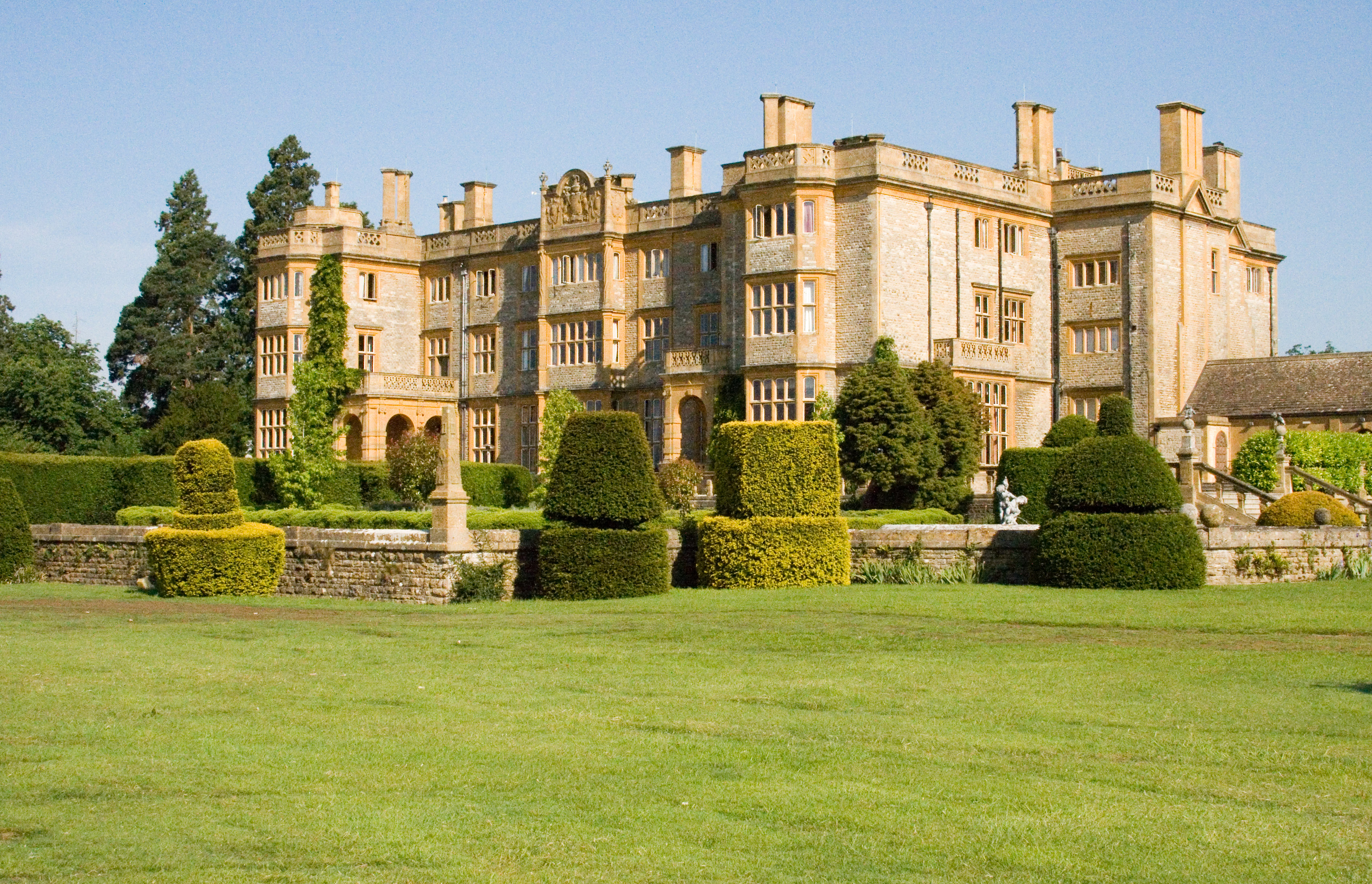
Eynsham Hall

Eynsham Hall (known commercially as Estelle Manor) is a Grade II listed mansion near North Leigh in Oxfordshire, England. The original house dating from...

Freeland, Oxfordshire

Freeland is a village and civil parish about 4 miles (6.4 km) northeast of Witney in Oxfordshire. The 2021 Census recorded the parish population as 1,490...

Barnard Gate

Barnard Gate is a hamlet about 3 miles (4.8 km) east of Witney in Oxfordshire. It has a public house, the Boot Inn. == References ==

North Leigh F.C.

North Leigh Football Club is a football club based in North Leigh, Oxfordshire, England. They are currently members of the Southern League Division One...

Bartholomew School

Bartholomew School is a secondary school with academy status which is situated in the village of Eynsham, West Oxfordshire, England. In the 2016/17 school...

North Leigh

North Leigh is a village and civil parish about 3 miles (5 km) northeast of Witney in Oxfordshire. The parish includes the hamlet of East End and since...

Nearby Amenities

Located within 500m of 51.797508,-1.4080148
Barrier: stile
Bicycle: no
Foot: yes
Material: wood
Stile: stepover
Lat/Long: 51.7987256/-1.4073437
Barrier: stile
Bicycle: no
Foot: yes
Material: wood
Stile: stepover
Lat/Long: 51.7988227/-1.4073942
Note: Path seems to end here where it joins a farm track. Fence direct ahead. ROW problem?
Lat/Long: 51.799195/-1.4050062
Power: pole
Source: Bing
Lat/Long: 51.799584/-1.4029239
Power: pole
Source: Bing
Lat/Long: 51.7965584/-1.4031572
Power: pole
Source: Bing
Lat/Long: 51.7983616/-1.4031787
Power: pole
Source: Bing
Lat/Long: 51.7999788/-1.4020843
Power: pole
Source: Bing
Lat/Long: 51.7977611/-1.4031679
Power: pole
Source: Bing
Lat/Long: 51.7990616/-1.4032243
Power: pole
Source: Bing
Lat/Long: 51.7959265/-1.4031518
Power: pole
Source: Bing
Lat/Long: 51.7946456/-1.4104556
Power: pole
Source: Bing
Lat/Long: 51.7941878/-1.4087685
Power: pole
Source: Bing
Lat/Long: 51.7944068/-1.4096107
The data included in this document is from www.openstreetmap.org. The data is made available under ODbL.

Have you been to Castles Copse?

Leave your review of Castles Copse below (or comments, questions and feedback).