Buck's Copse

Wood, Forest in Berkshire

England

Buck's Copse

M4 Crossing nr Wickham Looking west from bridge over the M4 near Wickham.
M4 Crossing nr Wickham Credit: Chris Shaw

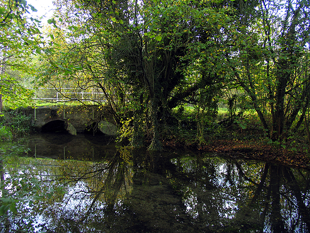
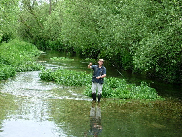
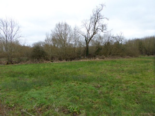
Buck's Copse is a picturesque woodland located in the county of Berkshire, England. Covering an area of approximately 50 acres, this enchanting copse is known for its dense forest and diverse range of flora and fauna.

The woodland is predominantly made up of native broadleaf trees, including oak, beech, and ash, creating a rich and varied habitat for wildlife. The thick canopy allows only dappled sunlight to filter through, creating a mystical atmosphere that attracts both nature enthusiasts and photographers alike.

Within Buck's Copse, there are several well-maintained footpaths that wind their way through the trees, offering visitors the opportunity to explore the woodland and immerse themselves in its natural beauty. These paths are dotted with wooden benches, providing the perfect spot for a peaceful rest or to observe the local wildlife.

The copse is also home to a variety of wildlife species, including deer, foxes, badgers, and a plethora of bird species. Birdwatchers can delight in spotting woodpeckers, owls, and various songbirds. The copse is particularly renowned for being a nesting site for the rare and elusive nightingale, attracting bird enthusiasts from far and wide.

Buck's Copse is a haven for nature lovers, offering a tranquil escape from the hustle and bustle of daily life. Whether one is seeking a leisurely walk, a quiet picnic spot, or simply a place to connect with nature, this woodland in Berkshire provides the perfect setting for a memorable and rejuvenating experience.

If you have any feedback on the listing, please let us know in the comments section below.
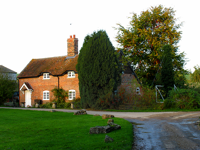
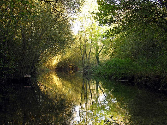
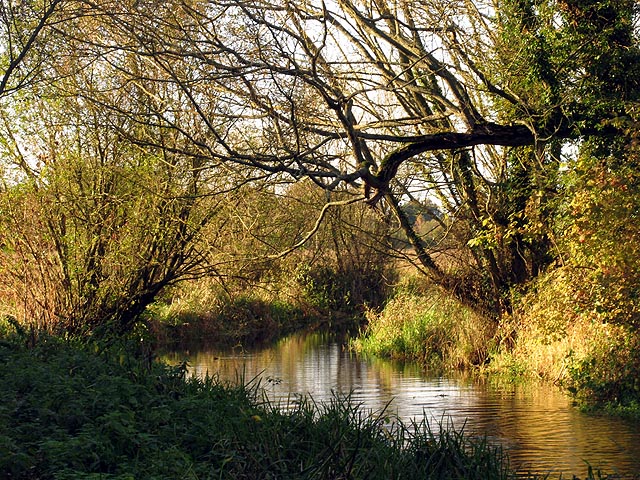
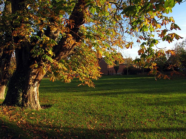
Buck's Copse Images

Images are sourced within 2km of 51.451097/-1.4206634 or Grid Reference SU4072. Thanks to Geograph Open Source API. All images are credited.

M4 Crossing nr Wickham Looking west from bridge over the M4 near Wickham.
M4 Crossing nr Wickham
Looking west from bridge over the M4 near Wickham.
Wickham Village Looking East from the Five Bells PH
Wickham Village
Looking East from the Five Bells PH
Byway and Elton Lane at Elton Farm The byway splits at this point with the left turn being the Lambourn Valley Way and the right fork becomes Elton track. This is in the south eastern section of the square.
Byway and Elton Lane at Elton Farm
The byway splits at this point with the left turn being the Lambourn Valley Way and the right fork becomes Elton track. This is in the south eastern section of the square.
Reflections on the River Lambourn This section of the river is in the north eastern corner of the square. There are two bridges that take one over the Lambourn to Elton Farm, in the next square. This is a view of the section on the eastern side of the bridge.
Reflections on the River Lambourn
This section of the river is in the north eastern corner of the square. There are two bridges that take one over the Lambourn to Elton Farm, in the next square. This is a view of the section on the eastern side of the bridge.
The Lambourn River at Elton Farm This section of the river on the western side of the first bridge is in the north eastern section of the square.
The Lambourn River at Elton Farm
This section of the river on the western side of the first bridge is in the north eastern section of the square.
Chestnut Tree at Weston Court This square is mostly farmland. Weston Court and Farm is situated in the western half of the square. Weston Court buildings at the entrance are seen in the background of this picture.
Chestnut Tree at Weston Court
This square is mostly farmland. Weston Court and Farm is situated in the western half of the square. Weston Court buildings at the entrance are seen in the background of this picture.
Bridge over the Lambourn The bridge reflected in the Lambourn River in the autumn. The bridge is in the north eastern section of the square. This view looks more or less west, towards the eastern side of the bridge
Bridge over the Lambourn
The bridge reflected in the Lambourn River in the autumn. The bridge is in the north eastern section of the square. This view looks more or less west, towards the eastern side of the bridge
Fishing on the River Lambourn
Newly sown wheat, Wickfield Looking across to the avenue leading southwards away from Oakhanger House and the adjoining copse, Blindman's Border.
Newly sown wheat, Wickfield
Looking across to the avenue leading southwards away from Oakhanger House and the adjoining copse, Blindman's Border.
Farmland, Wickfield Looking east towards the notched edge of Scroggin's Copse.
Farmland, Wickfield
Looking east towards the notched edge of Scroggin's Copse.
Farmland, Wickfield Several patches of this vibrant yellow wild form of mustard line the field edges around here and would seem to have been planted deliberately. Blindman's Border is the copse.
Farmland, Wickfield
Several patches of this vibrant yellow wild form of mustard line the field edges around here and would seem to have been planted deliberately. Blindman's Border is the copse.
Farmland, Wickfield Looking up to the bridge where the B4000 crosses the M4.
Farmland, Wickfield
Looking up to the bridge where the B4000 crosses the M4.
Farmland beside Scroggin's Copse On the eastern side of a small valley that drops down to the hamlet of Weston.
Farmland beside Scroggin's Copse
On the eastern side of a small valley that drops down to the hamlet of Weston.
Farmland beside Scroggin's Copse A large field of rape sandwiched between the M4 and the various woods.
Farmland beside Scroggin's Copse
A large field of rape sandwiched between the M4 and the various woods.
The school, Wickham Wickham and Welford C. of E. Primary School.
The school, Wickham
Wickham and Welford C. of E. Primary School.
Stained glass, Wickham church A nativity scene above the altar.
Stained glass, Wickham church
A nativity scene above the altar.
St Swithun's, Wickham The church has a saxon tower. The rest was rebuilt in the 19th century.
St Swithun's, Wickham
The church has a saxon tower. The rest was rebuilt in the 19th century.
Cottages, Wickham On Church Hill. The third one along is the old post office.
Cottages, Wickham
On Church Hill. The third one along is the old post office.
Show me another place!

Buck's Copse is located at Grid Ref: SU4072 (Lat: 51.451097, Lng: -1.4206634)

Unitary Authority: West Berkshire

Police Authority: Thames Valley

What 3 Words

///differ.entertainer.marketing. Near Welford, Berkshire

Related Wikis

Welford Park

Welford Park is a country house and estate in the village of Welford in the English county of Berkshire, situated 5.2 miles northwest of Newbury and 10...

Welford, Berkshire

Welford is a rural village and civil parish in West Berkshire, England occupying both sides of the valley of the River Lambourn north-west of Newbury and...

Welford Park railway station

Welford Park railway station was a railway station in Welford, Berkshire, UK, on the Lambourn Valley Railway. == History == The station opened on 2 April...

Weston, Berkshire

Weston is a village in the civil parish of Welford in the English county of Berkshire. == History == The Domesday book recorded that Weston was a manor...

Wickham, Berkshire

Wickham is a village about 5.5 miles (8.9 km) north-west of Newbury, Berkshire, England. The M4 motorway passes just north of it. It is in the civil parish...

Easton Farm Meadow

Easton Farm Meadow is a 1.6-hectare (4.0-acre) biological Site of Special Scientific Interest in Easton, west of Boxford in Berkshire. It is in the North...

Sole Common Pond

Sole Common Pond is a 3-hectare (7.4-acre) nature reserve south-west of Boxford in Berkshire in Berkshire. It is managed by the Berkshire, Buckinghamshire...
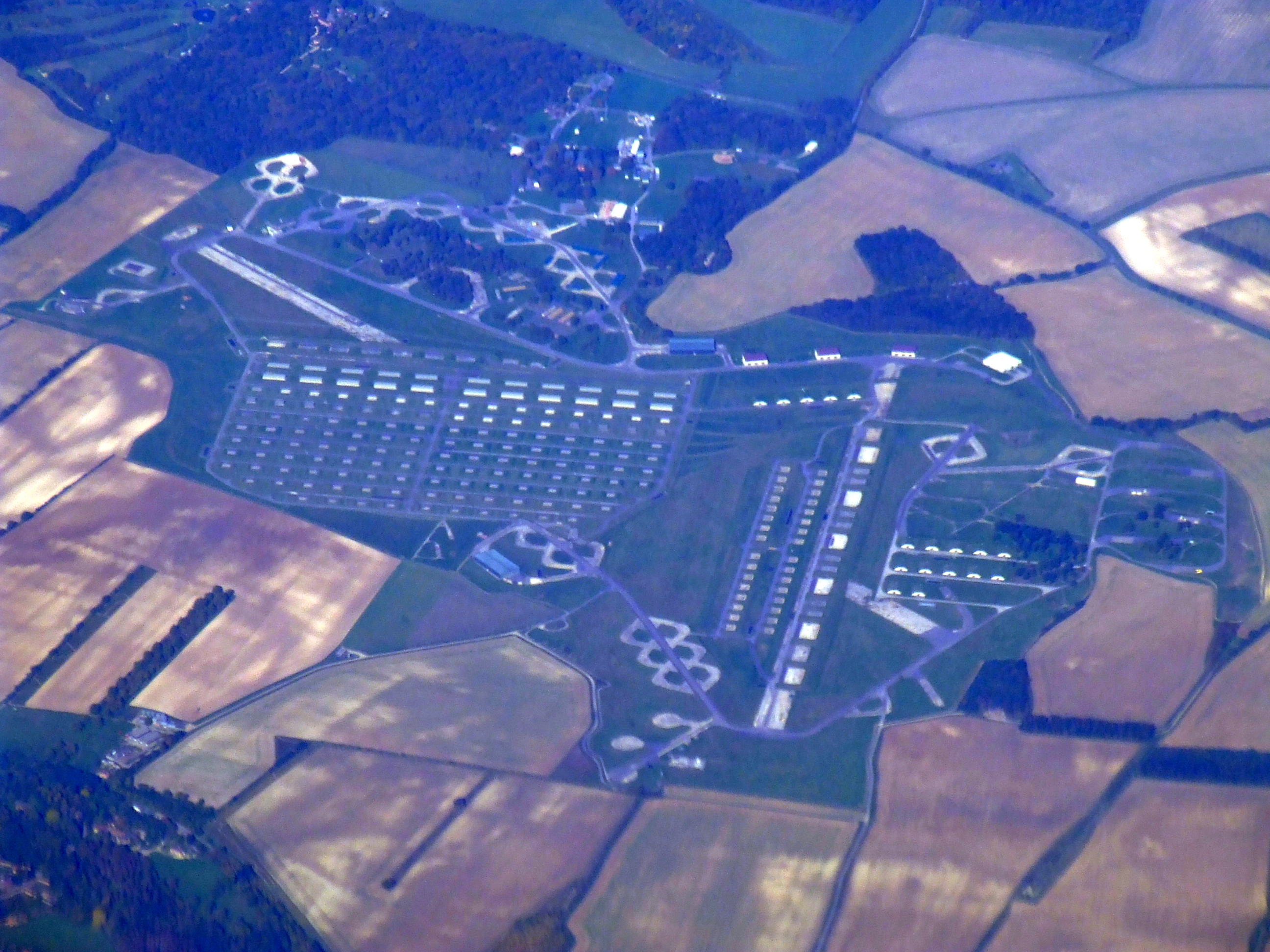
RAF Welford

Royal Air Force Welford or more simply RAF Welford is an active Royal Air Force station in Berkshire, England. The station is located approximately 6 miles...

Nearby Amenities

Located within 500m of 51.451097,-1.4206634
Phone
Check Date: 2022-12-20
Emergency: phone
Ref: 2993A
Lat/Long: 51.4489436/-1.4171522
Phone
Emergency: phone
Ref: 2993B
Lat/Long: 51.4492333/-1.4172588
Barrier: stile
Lat/Long: 51.4517809/-1.418725
Historic: memorial
Memorial: war_memorial
Lat/Long: 51.4523947/-1.4202505
Power: pole
Source: Bing
Lat/Long: 51.4475614/-1.4189502
Power: pole
Source: Bing
Lat/Long: 51.4477854/-1.4179203
Power: pole
Source: Bing
Lat/Long: 51.4482452/-1.4158603
Power: pole
Source: Bing
Lat/Long: 51.4473424/-1.4199963
Power: pole
Source: Bing
Lat/Long: 51.4480111/-1.4168796
Power: pole
Source: Bing
Lat/Long: 51.447105/-1.4210692
Barrier: kissing_gate
Lat/Long: 51.4541671/-1.4177846
The data included in this document is from www.openstreetmap.org. The data is made available under ODbL.

Have you been to Buck's Copse?

Leave your review of Buck's Copse below (or comments, questions and feedback).