Hady Plantation

Wood, Forest in Derbyshire Chesterfield

England

Hady Plantation

Chesterfield Parish Church A view of Chesterfield Parish Church taken with a wide angle lens.
Chesterfield Parish Church Credit: Mr S Mudgey

Hady Plantation is a picturesque woodland area located in Derbyshire, England. Situated in the district of Chesterfield, this vast forest is known for its tranquil and serene atmosphere, making it a popular destination for nature enthusiasts.

Covering an extensive area of lush greenery, Hady Plantation is home to various species of trees, including oak, beech, and birch, which provide a dense canopy and create a stunning visual spectacle throughout the year. The forest floor is adorned with a carpet of vibrant wildflowers and mosses, adding to the natural beauty of the surroundings.

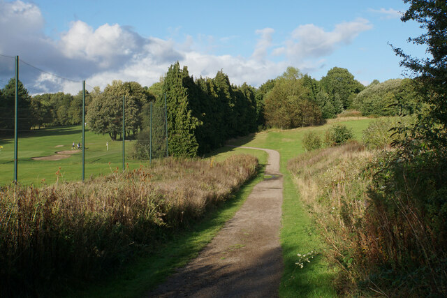
The plantation offers numerous walking trails and paths that wind through the woods, allowing visitors to explore its enchanting landscape. These trails are well-maintained and provide an opportunity for hikers and walkers to immerse themselves in the peaceful ambiance while enjoying the sights and sounds of nature. The plantation is also a haven for birdwatchers, as it attracts a wide variety of bird species, including robins, woodpeckers, and owls.

Hady Plantation is known for its rich biodiversity, with several animals calling it their home. Squirrels, deer, and rabbits can often be spotted darting through the undergrowth, while the occasional glimpse of a fox or badger adds to the excitement of encountering wildlife in its natural habitat.

Overall, Hady Plantation in Derbyshire is a haven for those seeking solace in nature. Its stunning woodland, diverse wildlife, and well-maintained trails make it an ideal destination for anyone looking to reconnect with the great outdoors.

If you have any feedback on the listing, please let us know in the comments section below.

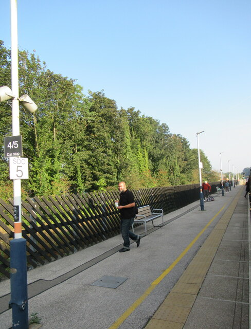
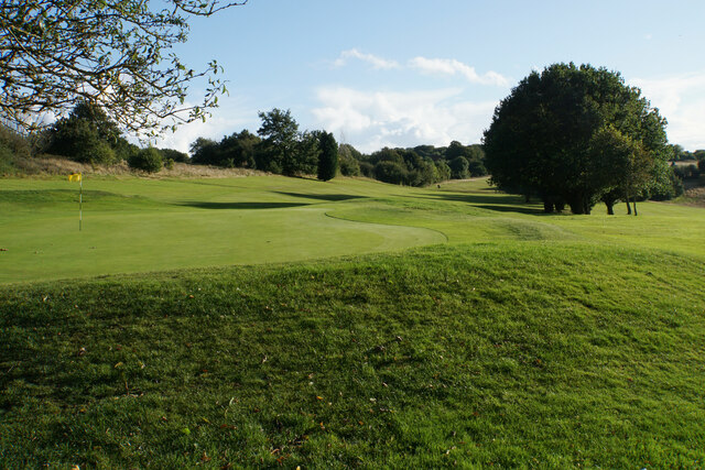
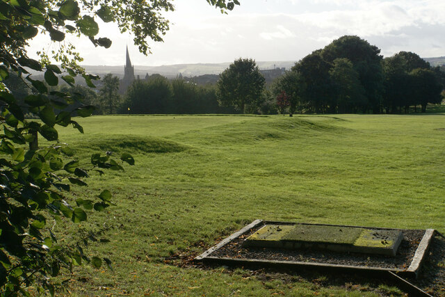
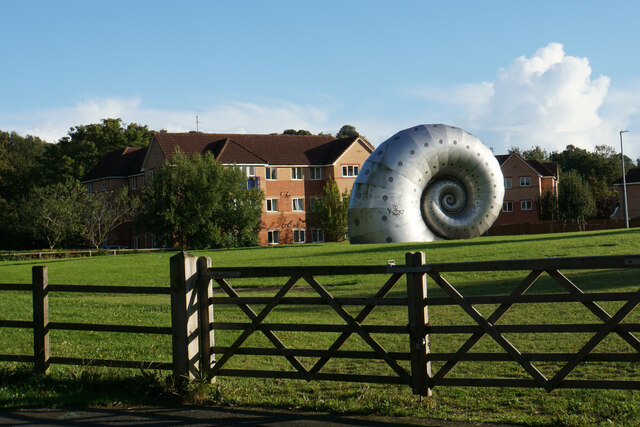
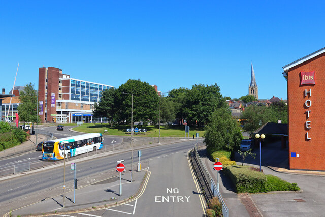
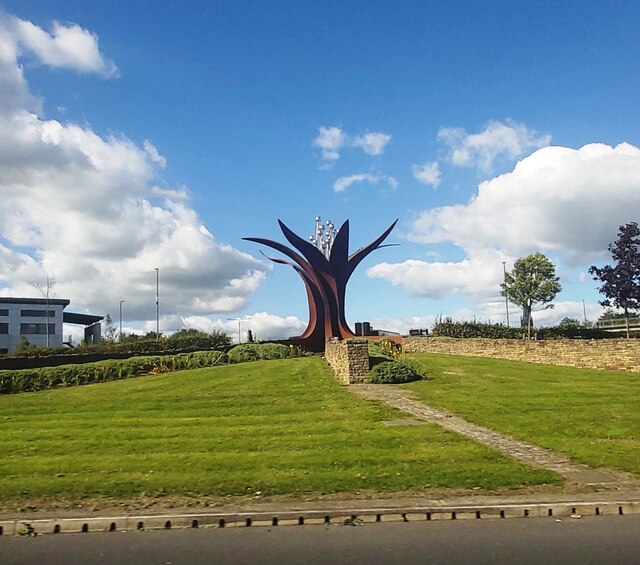
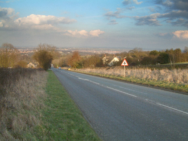
Hady Plantation Images

Images are sourced within 2km of 53.22781/-1.4002886 or Grid Reference SK4070. Thanks to Geograph Open Source API. All images are credited.

Chesterfield Parish Church A view of Chesterfield Parish Church taken with a wide angle lens.
Chesterfield Parish Church
A view of Chesterfield Parish Church taken with a wide angle lens.
Chesterfield station
Freightliner 70020 passing through Chesterfield Station
Tapton Park Golf Course As seen from the Trans Pennine Trail which crosses the course.
Tapton Park Golf Course
As seen from the Trans Pennine Trail which crosses the course.
Trans Pennine Trail in Tapton Park Golf Course There is a steady climb ahead. The fence to the left marks off a driving range.
Trans Pennine Trail in Tapton Park Golf Course
There is a steady climb ahead. The fence to the left marks off a driving range.
Tapton Park Golf Course There is a view of Chesterfield's twisted spire.
Tapton Park Golf Course
There is a view of Chesterfield's twisted spire.
The Snail A striking sculpture by Liz Lemon on former industrial land. It is viewed here from Crow Lane.
The Snail
A striking sculpture by Liz Lemon on former industrial land. It is viewed here from Crow Lane.
The A61 passing through Chesterfield The building on the right is the Chesterfield Hotel which is due for demolition. The large block straight ahead is Chesterfield College.
The A61 passing through Chesterfield
The building on the right is the Chesterfield Hotel which is due for demolition. The large block straight ahead is Chesterfield College.
Chesterfield Roundabout Main road in Chesterfield.
Chesterfield Roundabout
Main road in Chesterfield.
Tail end of  Midland Pullman HST 43049 was deputising for the train's regular blue locomotive. (Partnered with leading blue locomotive 43046 Geoff Drury.) 

Leaving Chesterfield after a day trip from Doncaster to Torquay and Paignton.
Tail end of Midland Pullman HST
43049 was deputising for the train's regular blue locomotive. (Partnered with leading blue locomotive 43046 Geoff Drury.) Leaving Chesterfield after a day trip from Doncaster to Torquay and Paignton.
Crosscountry HST 253 051 (43384) Held at Chesterfield on delayed Leeds - Plymouth service that was subsequently terminated at Derby.
Crosscountry HST 253 051 (43384)
Held at Chesterfield on delayed Leeds - Plymouth service that was subsequently terminated at Derby.
Horns Bridge Roundabout - Chesterfield
St. Mary and All Saints Church, Chesterfield
Former William and Glyn's Bank, Chesterfield Built 1907 <span class="nowrap"><a title="https://historicengland.org.uk/listing/the-list/list-entry/1088294?section=official-list-entry" rel="nofollow ugc noopener" href="https://historicengland.org.uk/listing/the-list/list-entry/1088294?section=official-list-entry">Link</a><img style="margin-left:2px;" alt="External link" title="External link - shift click to open in new window" src="https://s1.geograph.org.uk/img/external.png" width="10" height="10"/></span>
Former William and Glyn's Bank, Chesterfield
Built 1907 LinkExternal link
The east end of Burlington Street, Chesterfield
Chesterfield Visitor Information Centre
Church of St Mary and All Saints, Chesterfield Largely of the thirteenth and fourteenth centuries <span class="nowrap"><a title="https://historicengland.org.uk/listing/the-list/list-entry/1334708?section=official-list-entry" rel="nofollow ugc noopener" href="https://historicengland.org.uk/listing/the-list/list-entry/1334708?section=official-list-entry">Link</a><img style="margin-left:2px;" alt="External link" title="External link - shift click to open in new window" src="https://s1.geograph.org.uk/img/external.png" width="10" height="10"/></span>
Church of St Mary and All Saints, Chesterfield
Largely of the thirteenth and fourteenth centuries LinkExternal link
The Crooked Spire, Chesterfield
Show me another place!

Hady Plantation is located at Grid Ref: SK4070 (Lat: 53.22781, Lng: -1.4002886)

Administrative County: Derbyshire

District: Chesterfield

Police Authority: Derbyshire

What 3 Words

///grew.drove.link. Near Chesterfield, Derbyshire

Nearby Locations

Hady Plantation Calow

Related Wikis

Chesterfield Royal Hospital

Chesterfield Royal Hospital is an acute general hospital in Chesterfield, Derbyshire. It is managed by the Chesterfield Royal Hospital NHS Foundation Trust...

Hasland

Hasland is a suburb of Chesterfield in the Borough of Chesterfield in Derbyshire, England. Hasland is located south of Spital, east of Birdholme and north...

Chesterfield Royal Hospital NHS Foundation Trust

Chesterfield Royal Hospital NHS Foundation Trust became a NHS Foundation Trust in January 2005, providing health services at the Chesterfield Royal Hospital...

A632 road

The A632 is a major road in Derbyshire and Nottinghamshire, England. It starts in Matlock (53.1347°N 1.5485°W / 53.1347; -1.5485 (A632 road (western...

Nearby Amenities

Located within 500m of 53.22781,-1.4002886
Bus Stop
Bus: yes
Public Transport: platform
Lat/Long: 53.2254027/-1.3970713
Barrier: stile
Steps: 2
Stile: stepover
Lat/Long: 53.2259063/-1.396376
Bus Stop
Bus: yes
Public Transport: platform
Lat/Long: 53.2242572/-1.3992085
Bus Stop
Bus: yes
Public Transport: platform
Lat/Long: 53.224473/-1.3991484
Bus Stop
Bus: yes
Public Transport: platform
Lat/Long: 53.2258861/-1.3966765
Post Box
Collection Times: Mo-Fr 09:00; Sa 07:00
Post Box Type: lamp
Ref: S41 372
Royal Cypher: EIIR
Royal Cypher Wikidata: Q33102113
Lat/Long: 53.2271964/-1.3979982
Bus Stop
Bus: yes
Public Transport: platform
Lat/Long: 53.2272734/-1.3979296
Bus Stop
Bus: yes
Naptan AtcoCode: 1000DHHL2909
Naptan NaptanCode: dbsapama
Public Transport: platform
Lat/Long: 53.2275406/-1.3984789
Turning Circle
Turning Circle: hammer
Lat/Long: 53.2314255/-1.4020749
Turning Circle
Lat/Long: 53.2281294/-1.4063049
Turning Circle
Lat/Long: 53.2280359/-1.403352
Turning Circle
Lat/Long: 53.2278787/-1.4022576
Barrier: stile
Foot: yes
Steps: 1
Stile: stepover
Lat/Long: 53.2273824/-1.3978659
Leisure: playground
Wheelchair: limited
Lat/Long: 53.2286589/-1.3983596
Barrier: cycle_barrier
Lat/Long: 53.2272128/-1.3979535
Turning Circle
Turning Circle: hammer
Lat/Long: 53.2300841/-1.4006884
Turning Circle
Turning Circle: hammer
Lat/Long: 53.2290583/-1.3989643
Turning Circle
Turning Circle: hammer
Lat/Long: 53.2287462/-1.3991607
Turning Circle
Lat/Long: 53.2296653/-1.3992601
Ele: 121.0107422
Information: board
Tourism: information
Lat/Long: 53.2316991/-1.4030668
Bench
Ele: 95.5360107
Lat/Long: 53.228504/-1.3986466
Ele: 109.7154541
Lat/Long: 53.2302191/-1.4033687
Ele: 91.4503174
Lat/Long: 53.2283618/-1.3967437
Ele: 93.6134033
Lat/Long: 53.2283502/-1.3968275
Ele: 105.3894043
Lat/Long: 53.2286173/-1.4013406
Ele: 106.3507080
Lat/Long: 53.2288384/-1.4020518
Barrier: cycle_barrier
Lat/Long: 53.22854/-1.4000688
Bus Stop
Bus: yes
Ele: 76.3098145
Public Transport: platform
Lat/Long: 53.2272919/-1.4027576
Bus Stop
Bus: yes
Ele: 79.9146729
Public Transport: platform
Lat/Long: 53.2267909/-1.4001397
Bus Stop
Bus: yes
Ele: 77.9920654
Public Transport: platform
Lat/Long: 53.2268631/-1.3998822
Bus Stop
Bus: yes
Ele: 79.9146729
Public Transport: platform
Lat/Long: 53.2258917/-1.3975112
Bus Stop
Bus: yes
Naptan AtcoCode: 1000DSSL2421
Naptan NaptanCode: dbsdjdjm
Public Transport: platform
Lat/Long: 53.2271634/-1.4027897
Bus Stop
Bus: yes
Ele: 78.7131348
Public Transport: platform
Lat/Long: 53.2275006/-1.4055417
Bus Stop
Bus: yes
Ele: 76.0694580
Public Transport: platform
Lat/Long: 53.2275199/-1.4045922
Ele: 80
Lat/Long: 53.2268425/-1.3995492
Post Box
Brand: Royal Mail
Brand Wikidata: Q638098
Brand Wikipedia: en:Royal Mail
Collection Times: Mo-Fr 09:00; Sa 07:00
Operator: Royal Mail
Operator Wikidata: Q638098
Post Box Type: lamp
Ref: S41 247
Royal Cypher: EIIR
Royal Cypher Wikidata: Q33102113
Lat/Long: 53.2275915/-1.4053897
Bus Stop
Bus: yes
Ele: 107.3120117
Naptan AtcoCode: 1000DHHLK172
Naptan NaptanCode: dbsamwgp
Public Transport: platform
Wheelchair: yes
Lat/Long: 53.2297435/-1.4012773
Ele: 107.0000000
Lat/Long: 53.2296781/-1.406721
Ele: 107.0000000
Lat/Long: 53.2293782/-1.40332
Bus Stop
Bus: yes
Naptan AtcoCode: 1000DHHH2327
Naptan NaptanCode: dbsgadta
Public Transport: platform
Wheelchair: yes
Lat/Long: 53.2298725/-1.401642
Generator Method: photovoltaic
Generator Output Electricity: yes
Generator Source: solar
Generator Type: solar_photovoltaic_panel
Location: roof
Power: generator
Lat/Long: 53.2272384/-1.4072981
Generator Method: photovoltaic
Generator Output Electricity: yes
Generator Source: solar
Generator Type: solar_photovoltaic_panel
Location: roof
Power: generator
Lat/Long: 53.2272971/-1.4051369
Generator Method: photovoltaic
Generator Output Electricity: yes
Generator Source: solar
Generator Type: solar_photovoltaic_panel
Location: roof
Power: generator
Lat/Long: 53.2272971/-1.4052281
Generator Method: photovoltaic
Generator Output Electricity: yes
Generator Source: solar
Generator Type: solar_photovoltaic_panel
Location: roof
Power: generator
Lat/Long: 53.2273099/-1.4055097
Generator Method: photovoltaic
Generator Output Electricity: yes
Generator Source: solar
Generator Type: solar_photovoltaic_panel
Location: roof
Power: generator
Lat/Long: 53.2267532/-1.4011727
Generator Method: photovoltaic
Generator Output Electricity: yes
Generator Source: solar
Generator Type: solar_photovoltaic_panel
Location: roof
Power: generator
Lat/Long: 53.2280859/-1.3980882
Generator Method: photovoltaic
Generator Output Electricity: yes
Generator Source: solar
Generator Type: solar_photovoltaic_panel
Location: roof
Power: generator
Lat/Long: 53.2280361/-1.3980265
Generator Method: photovoltaic
Generator Output Electricity: yes
Generator Source: solar
Generator Type: solar_photovoltaic_panel
Location: roof
Power: generator
Lat/Long: 53.2285804/-1.3990833
Generator Method: photovoltaic
Generator Output Electricity: yes
Generator Source: solar
Generator Type: solar_photovoltaic_panel
Location: roof
Power: generator
Lat/Long: 53.2294523/-1.3998397
Generator Method: photovoltaic
Generator Output Electricity: yes
Generator Source: solar
Generator Type: solar_photovoltaic_panel
Location: roof
Power: generator
Lat/Long: 53.2309262/-1.4015724
Generator Method: photovoltaic
Generator Output Electricity: yes
Generator Source: solar
Generator Type: solar_photovoltaic_panel
Location: roof
Power: generator
Lat/Long: 53.2310402/-1.4008777
Generator Method: photovoltaic
Generator Output Electricity: yes
Generator Source: solar
Generator Type: solar_photovoltaic_panel
Location: roof
Power: generator
Lat/Long: 53.2258668/-1.3977341
Generator Method: photovoltaic
Generator Output Electricity: yes
Generator Source: solar
Generator Type: solar_photovoltaic_panel
Location: roof
Power: generator
Lat/Long: 53.2256259/-1.3971414
Generator Method: photovoltaic
Generator Output Electricity: yes
Generator Source: solar
Generator Type: solar_photovoltaic_panel
Location: roof
Power: generator
Lat/Long: 53.2237456/-1.4003627
Hady
Place: village
Lat/Long: 53.2300973/-1.4004135
Power: tower
Lat/Long: 53.2241562/-1.3970393
Power: tower
Lat/Long: 53.2262309/-1.4002472
Power: tower
Lat/Long: 53.2263224/-1.405621
Noexit: yes
Note: Doesn't join track below
Lat/Long: 53.2282914/-1.3966684
Ele: 109.4750977
Lat/Long: 53.2300994/-1.4032891
The data included in this document is from www.openstreetmap.org. The data is made available under ODbL.

Have you been to Hady Plantation?

Leave your review of Hady Plantation below (or comments, questions and feedback).