Park Clump

Wood, Forest in Hampshire Test Valley

England

Park Clump

The River Test between Chilbolton and Wherwell From the B3420 Winchester Road bridge.
The River Test between Chilbolton and Wherwell Credit: JThomas

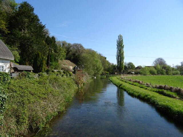
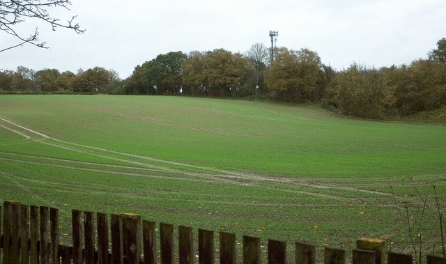
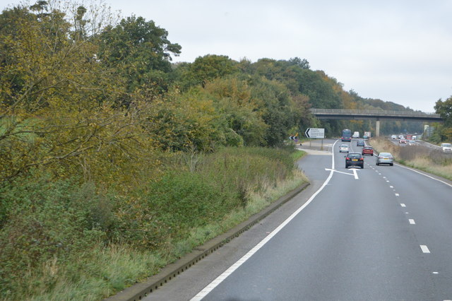
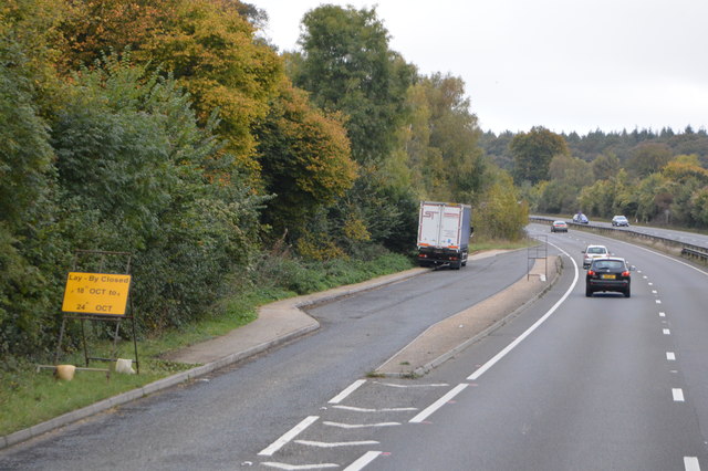
Park Clump is a picturesque woodland located in Hampshire, England. Situated within the New Forest National Park, it covers an area of approximately 20 acres. The forest is characterized by its dense vegetation, towering trees, and diverse array of wildlife.

The woodland is predominantly composed of oak and beech trees, which provide a stunning canopy that filters sunlight and creates a serene atmosphere. Other tree species, such as birch and holly, can also be found throughout the forest, adding to its rich biodiversity.

Park Clump is a popular destination for nature enthusiasts, hikers, and birdwatchers. The woodland offers a tranquil setting for leisurely walks and exploration, with a network of well-maintained trails that wind through the forest. These trails provide opportunities for visitors to immerse themselves in the natural beauty of the area, observe the local flora and fauna, and enjoy the peaceful ambiance.

The forest is home to an abundance of wildlife, including deer, squirrels, rabbits, and a variety of bird species. Birdwatchers can spot woodpeckers, owls, and numerous songbirds among the trees. The diverse ecosystem of Park Clump also supports a wide range of insects, including butterflies and dragonflies, which add to the area's natural charm.

With its tranquil ambiance, stunning scenery, and thriving wildlife, Park Clump is a hidden gem within Hampshire's woodlands. Whether for a leisurely stroll, birdwatching, or simply escaping the hustle and bustle of everyday life, this forest offers a peaceful retreat for nature lovers and outdoor enthusiasts.

If you have any feedback on the listing, please let us know in the comments section below.

Park Clump Images

Images are sourced within 2km of 51.18201/-1.4305081 or Grid Reference SU3942. Thanks to Geograph Open Source API. All images are credited.

The River Test between Chilbolton and Wherwell From the B3420 Winchester Road bridge.
The River Test between Chilbolton and Wherwell
From the B3420 Winchester Road bridge.
Thatched cottages on the B3048, Wherwell
Winchester Road (B3420)
River Test, Wherwell Beside the B3048.
River Test, Wherwell
Beside the B3048.
Longparish Road (B3048) Out of Wherwell towards Longparish.
Longparish Road (B3048)
Out of Wherwell towards Longparish.
Cowdown Lane Looking east along Cowdown Lane past the entrance to the nursery.
Cowdown Lane
Looking east along Cowdown Lane past the entrance to the nursery.
Cowdown Lane A curve around the grassland fields on Cowdown Lane, looking west. A pylon stands proudly on the hill beyond.
Cowdown Lane
A curve around the grassland fields on Cowdown Lane, looking west. A pylon stands proudly on the hill beyond.
Farmland north of Cowdown Lane A farmed field to the north of Cowdown Lane, looking over to Cowdown Solar Farm.
Farmland north of Cowdown Lane
A farmed field to the north of Cowdown Lane, looking over to Cowdown Solar Farm.
Cowdown Day Nursery Looking down the drive of Cowdown Day Nursery from Cowdown Lane.
Cowdown Day Nursery
Looking down the drive of Cowdown Day Nursery from Cowdown Lane.
Field by the A303 And by The Buck services, from the edge of which this was taken. The mast is shown more clearly in <a href="https://www.geograph.org.uk/photo/4071515">SU4143 : Mobile phone mast hiding in the countryside</a>. The field is crossed by Longparish footpath 21. Its crop, possibly of winter wheat, is having a damp time of it. But things look worse because I accidentally switched the speed on the camera from Auto to 1/4000, and have just spent a while trying to compensate for this. Sorry!
Field by the A303
And by The Buck services, from the edge of which this was taken. The mast is shown more clearly in SU4143 : Mobile phone mast hiding in the countryside. The field is crossed by Longparish footpath 21. Its crop, possibly of winter wheat, is having a damp time of it. But things look worse because I accidentally switched the speed on the camera from Auto to 1/4000, and have just spent a while trying to compensate for this. Sorry!
New house, Watermeadow Cottage
The Buck Services, A303 The A303 is a main trunk road running 92 miles between Basingstoke and Honiton. Along with the A30 and M3 it forms a major route between London and the South West. Much of the road is dual carriageway, but some stretches remain single and prone to congestion.

Wikipedia: <span class="nowrap"><a title="http://en.wikipedia.org/wiki/A303_road" rel="nofollow ugc noopener" href="http://en.wikipedia.org/wiki/A303_road">Link</a><img style="margin-left:2px;" alt="External link" title="External link - shift click to open in new window" src="https://s1.geograph.org.uk/img/external.png" width="10" height="10"/></span>
The Buck Services, A303
The A303 is a main trunk road running 92 miles between Basingstoke and Honiton. Along with the A30 and M3 it forms a major route between London and the South West. Much of the road is dual carriageway, but some stretches remain single and prone to congestion. Wikipedia: LinkExternal link
B3048 overbridge, A303 The A303 is a main trunk road running 92 miles between Basingstoke and Honiton. Along with the A30 and M3 it forms a major route between London and the South West. Much of the road is dual carriageway, but some stretches remain single and prone to congestion.

Wikipedia: <span class="nowrap"><a title="http://en.wikipedia.org/wiki/A303_road" rel="nofollow ugc noopener" href="http://en.wikipedia.org/wiki/A303_road">Link</a><img style="margin-left:2px;" alt="External link" title="External link - shift click to open in new window" src="https://s1.geograph.org.uk/img/external.png" width="10" height="10"/></span>
B3048 overbridge, A303
The A303 is a main trunk road running 92 miles between Basingstoke and Honiton. Along with the A30 and M3 it forms a major route between London and the South West. Much of the road is dual carriageway, but some stretches remain single and prone to congestion. Wikipedia: LinkExternal link
B3048 turning, A303 The A303 is a main trunk road running 92 miles between Basingstoke and Honiton. Along with the A30 and M3 it forms a major route between London and the South West. Much of the road is dual carriageway, but some stretches remain single and prone to congestion.

Wikipedia: <span class="nowrap"><a title="http://en.wikipedia.org/wiki/A303_road" rel="nofollow ugc noopener" href="http://en.wikipedia.org/wiki/A303_road">Link</a><img style="margin-left:2px;" alt="External link" title="External link - shift click to open in new window" src="https://s1.geograph.org.uk/img/external.png" width="10" height="10"/></span>
B3048 turning, A303
The A303 is a main trunk road running 92 miles between Basingstoke and Honiton. Along with the A30 and M3 it forms a major route between London and the South West. Much of the road is dual carriageway, but some stretches remain single and prone to congestion. Wikipedia: LinkExternal link
B3048 Bridge, A303 The A303 is a main trunk road running 92 miles between Basingstoke and Honiton. Along with the A30 and M3 it forms a major route between London and the South West. Much of the road is dual carriageway, but some stretches remain single and prone to congestion.

Wikipedia: <span class="nowrap"><a title="http://en.wikipedia.org/wiki/A303_road" rel="nofollow ugc noopener" href="http://en.wikipedia.org/wiki/A303_road">Link</a><img style="margin-left:2px;" alt="External link" title="External link - shift click to open in new window" src="https://s1.geograph.org.uk/img/external.png" width="10" height="10"/></span>
B3048 Bridge, A303
The A303 is a main trunk road running 92 miles between Basingstoke and Honiton. Along with the A30 and M3 it forms a major route between London and the South West. Much of the road is dual carriageway, but some stretches remain single and prone to congestion. Wikipedia: LinkExternal link
Services by the A303 The A303 is a main trunk road running 92 miles between Basingstoke and Honiton. Along with the A30 and M3 it forms a major route between London and the South West. Much of the road is dual carriageway, but some stretches remain single and prone to congestion.

Wikipedia: <span class="nowrap"><a title="http://en.wikipedia.org/wiki/A303_road" rel="nofollow ugc noopener" href="http://en.wikipedia.org/wiki/A303_road">Link</a><img style="margin-left:2px;" alt="External link" title="External link - shift click to open in new window" src="https://s1.geograph.org.uk/img/external.png" width="10" height="10"/></span>
Services by the A303
The A303 is a main trunk road running 92 miles between Basingstoke and Honiton. Along with the A30 and M3 it forms a major route between London and the South West. Much of the road is dual carriageway, but some stretches remain single and prone to congestion. Wikipedia: LinkExternal link
A303, westbound The A303 is a main trunk road running 92 miles between Basingstoke and Honiton. Along with the A30 and M3 it forms a major route between London and the South West. Much of the road is dual carriageway, but some stretches remain single and prone to congestion.

Wikipedia: <span class="nowrap"><a title="http://en.wikipedia.org/wiki/A303_road" rel="nofollow ugc noopener" href="http://en.wikipedia.org/wiki/A303_road">Link</a><img style="margin-left:2px;" alt="External link" title="External link - shift click to open in new window" src="https://s1.geograph.org.uk/img/external.png" width="10" height="10"/></span>
A303, westbound
The A303 is a main trunk road running 92 miles between Basingstoke and Honiton. Along with the A30 and M3 it forms a major route between London and the South West. Much of the road is dual carriageway, but some stretches remain single and prone to congestion. Wikipedia: LinkExternal link
Layby, A303 The A303 is a main trunk road running 92 miles between Basingstoke and Honiton. Along with the A30 and M3 it forms a major route between London and the South West. Much of the road is dual carriageway, but some stretches remain single and prone to congestion.

Wikipedia: <span class="nowrap"><a title="http://en.wikipedia.org/wiki/A303_road" rel="nofollow ugc noopener" href="http://en.wikipedia.org/wiki/A303_road">Link</a><img style="margin-left:2px;" alt="External link" title="External link - shift click to open in new window" src="https://s1.geograph.org.uk/img/external.png" width="10" height="10"/></span>
Layby, A303
The A303 is a main trunk road running 92 miles between Basingstoke and Honiton. Along with the A30 and M3 it forms a major route between London and the South West. Much of the road is dual carriageway, but some stretches remain single and prone to congestion. Wikipedia: LinkExternal link
Show me another place!

Park Clump is located at Grid Ref: SU3942 (Lat: 51.18201, Lng: -1.4305081)

Administrative County: Hampshire

District: Test Valley

Police Authority: Hampshire

What 3 Words

///zapped.vibrate.typified. Near Andover, Hampshire

Related Wikis

South Harewood

South Harewood is a hamlet and civil parish in the Test Valley district of Hampshire, England. At the 2011 Census the population according to the Post...

North West Hampshire (UK Parliament constituency)

North West Hampshire is a constituency represented in the House of Commons of the UK Parliament since 2015 by Conservative Kit Malthouse, who served as...

Longparish railway station

Longparish railway station served the village of Longparish, Hampshire, England from 1885 to 1956 on the Fullerton to Hurstbourne Line. == History == The...

Bransbury Common

Bransbury Common is a 158.6-hectare (392-acre) biological Site of Special Scientific Interest south-east of Andover in Hampshire. It is a Nature Conservation...

Wherwell Abbey

Wherwell Abbey was an abbey of Benedictine nuns in Wherwell, Hampshire, England. == Foundation == The nunnery was founded about 986 by Ælfthryth, the widow...

Wherwell

Wherwell is a village on the River Test in Hampshire, England. The name may derive from its bubbling springs resulting in the Middle Ages place name...

Wherwell Wood

Wherwell Wood is a hamlet in the civil parish of Wherwell in the Test Valley district of Hampshire, England. It lies approximately 2.7 miles (4.4 km) south...

Dead Man's Plack

Dead Man's Plack is a Grade-II listed 19th-century monument to Æthelwald, Ealdorman of East Anglia, who, according to legend, was killed in 963 near the...

Nearby Amenities

Located within 500m of 51.18201,-1.4305081
Odbl: clean
Lat/Long: 51.1808655/-1.4361988
Man Made: water_well
Lat/Long: 51.1827619/-1.4349096
Park Clump
Place: locality
Lat/Long: 51.1819536/-1.4305395
Adders Corner
Place: locality
Lat/Long: 51.1825456/-1.4279425
Patchington Copse
Place: locality
Lat/Long: 51.1822496/-1.4239132
Barrier: bollard
Lat/Long: 51.1831323/-1.426869
The data included in this document is from www.openstreetmap.org. The data is made available under ODbL.

Have you been to Park Clump?

Leave your review of Park Clump below (or comments, questions and feedback).