Severals Copse

Wood, Forest in Hampshire Test Valley

England

Severals Copse

Country lane, Ibthorpe, Hampshire
Country lane, Ibthorpe, Hampshire Credit: Oswald Bertram

Severals Copse is a picturesque woodland area located in Hampshire, England. Covering an area of approximately 50 acres, it is known for its natural beauty and diverse ecosystem. The copse is situated near the village of Buriton, just a few miles south of Petersfield.

The woodland is predominantly composed of deciduous trees, including oak, beech, and birch, which create a vibrant and colorful canopy throughout the year. These trees offer a haven for a wide variety of flora and fauna, making Severals Copse an important habitat for wildlife in the region.

Walking through Severals Copse, visitors can enjoy a network of well-maintained footpaths and trails that meander through the woods. These paths provide opportunities for hikers and nature enthusiasts to explore the area and immerse themselves in its tranquility. The copse is also a popular destination for birdwatchers, as it attracts a range of bird species such as woodpeckers, thrushes, and warblers.

In addition to its natural beauty, Severals Copse has historical significance. It is believed to have been an ancient woodland, with evidence of human activity dating back to the Neolithic period. The copse is also home to a small Iron Age fort, known as Castle Hill, which provides a glimpse into the area's rich past.

Overall, Severals Copse offers a peaceful retreat for those seeking to connect with nature and explore the beauty of Hampshire's woodlands. Whether it's enjoying a leisurely stroll or observing the local wildlife, visitors to Severals Copse are sure to be captivated by its charm and serenity.

If you have any feedback on the listing, please let us know in the comments section below.

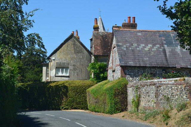
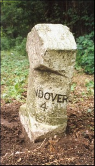
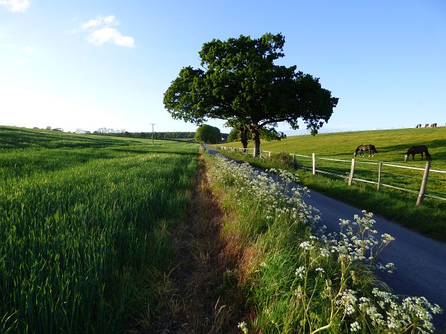
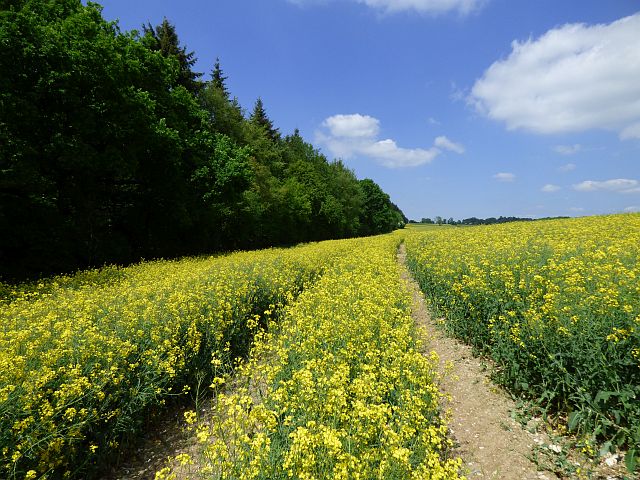
Severals Copse Images

Images are sourced within 2km of 51.268594/-1.4532332 or Grid Reference SU3852. Thanks to Geograph Open Source API. All images are credited.

Country lane, Ibthorpe, Hampshire
Thatched cottages, Hurstbourne Tarrant, Hampshire
Church Street, Hurstbourne Tarrant, Hampshire
Tollgate Cottage, Hurstbourne Tarrant, Hampshire House, once 3 cottages. C16 timber-framed building at right-angles to the roadway, with a set-back extension at the east side of the late C18, of brick and flint: thatched roof. 1 storey and attic, 1.3 windows. ½-hipped roof to the west cross-wing, with catslide to a western outshot, hipped at the east end, 3 eyebrow dormers. Exposed framing to the older part, with rendered infill, the rendered wall continuing into part of the main block, which is mainly of horizontal flint panels, with brick quoins, verticals, cambered arches, and cement plinth. Casements. Boarded door in a plain frame. 

(Source:Historic England)
Tollgate Cottage, Hurstbourne Tarrant, Hampshire
House, once 3 cottages. C16 timber-framed building at right-angles to the roadway, with a set-back extension at the east side of the late C18, of brick and flint: thatched roof. 1 storey and attic, 1.3 windows. ½-hipped roof to the west cross-wing, with catslide to a western outshot, hipped at the east end, 3 eyebrow dormers. Exposed framing to the older part, with rendered infill, the rendered wall continuing into part of the main block, which is mainly of horizontal flint panels, with brick quoins, verticals, cambered arches, and cement plinth. Casements. Boarded door in a plain frame. (Source:Historic England)
River Swift at Hurstbourne Tarrant Completely without water at the end of August.
River Swift at Hurstbourne Tarrant
Completely without water at the end of August.
George and Dragon, Hurstbourne Tarrant
Track opposite Valley Farm
St Peter's church, Hurstbourne Tarrant
Primary School, Hurstbourne Tarrant
Entering Hurstbourne Tarrant on Stoke Road
Old Milestone by the A343, Bourne Park, Hurstbourne Tarrant parish Carved stone post by the A343, in parish of HURSTBOURNE TARRANT (TEST VALLEY District), Bourne Park, on grass verge in front of woodland, on West side of road. Newbury waist, erected by the Andover & Chilton Pond turnpike trust in the 19th century. 

Inscription reads:-
: NEWBURY / 12 : : SARUM / 21 : : OXFORD / 38 : : ANDOVER / 4 :
Carved benchmark on front lower.  

Milestone Society National ID: HA_NEAN12.
Old Milestone by the A343, Bourne Park, Hurstbourne Tarrant parish
Carved stone post by the A343, in parish of HURSTBOURNE TARRANT (TEST VALLEY District), Bourne Park, on grass verge in front of woodland, on West side of road. Newbury waist, erected by the Andover & Chilton Pond turnpike trust in the 19th century. Inscription reads:- : NEWBURY / 12 : : SARUM / 21 : : OXFORD / 38 : : ANDOVER / 4 : Carved benchmark on front lower. Milestone Society National ID: HA_NEAN12.
Farmland, Hurstbourne Tarrant A spring-sown cereal crop beside a footpath off the B3048.
Farmland, Hurstbourne Tarrant
A spring-sown cereal crop beside a footpath off the B3048.
Pasture, St Mary Bourne Looking across the Bourne valley from a footpath at Stokehill.
Pasture, St Mary Bourne
Looking across the Bourne valley from a footpath at Stokehill.
Farmland, St Mary Bourne A crop of wheat beside the restricted byway to the west of Stokehill.
Farmland, St Mary Bourne
A crop of wheat beside the restricted byway to the west of Stokehill.
Road and farmland, St Mary Bourne Barley and horses beside the approach to Frenches Farm, a public footpath.
Road and farmland, St Mary Bourne
Barley and horses beside the approach to Frenches Farm, a public footpath.
Farmland, Hurstbourne Tarrant The A343 passes between the two fields.
Farmland, Hurstbourne Tarrant
The A343 passes between the two fields.
Farmland, Hurstbourne Tarrant Oil-seed rape and the eastern edge of Blagden Copse.
Farmland, Hurstbourne Tarrant
Oil-seed rape and the eastern edge of Blagden Copse.
Old Milestone near Prosperous Farm, Hurstbourne Tarrant Carved stone post West of the A343, in parish of HURSTBOURNE TARRANT (TEST VALLEY District), near Prosperous Farm, by the UC road, on West side of road. Newbury waist, erected by the Andover & Chilton Pond turnpike trust in the 19th century. 

Inscription reads:-
: (NEWBURY / 10) : : SARUM / 24 : : (ANDOVER / 6) :

Milestone Society National ID: HA_NEAN10.
Old Milestone near Prosperous Farm, Hurstbourne Tarrant
Carved stone post West of the A343, in parish of HURSTBOURNE TARRANT (TEST VALLEY District), near Prosperous Farm, by the UC road, on West side of road. Newbury waist, erected by the Andover & Chilton Pond turnpike trust in the 19th century. Inscription reads:- : (NEWBURY / 10) : : SARUM / 24 : : (ANDOVER / 6) : Milestone Society National ID: HA_NEAN10.
Show me another place!

Severals Copse is located at Grid Ref: SU3852 (Lat: 51.268594, Lng: -1.4532332)

Administrative County: Hampshire

District: Test Valley

Police Authority: Hampshire

What 3 Words

///bulges.tint.makeovers. Near Andover, Hampshire

Related Wikis

Hurstbourne Tarrant

Hurstbourne Tarrant is a village and civil parish in Hampshire, England. It lies to the north of the county in the Test Valley. The Tarrant part of the...

Ibthorpe

Ibthorpe is a village in Hampshire, England. Ibthorpe is in the civil parish of Hurstbourne Tarrant. == Name == Ibthorpe is named after "Ibbaprop" which...

Stoke, Basingstoke and Deane

Stoke is a small village in northwest Hampshire. At the 2011 Census the population of the village was included in the civil parish of St Mary Bourne....

Little London, Andover, Hampshire

Little London is a hamlet and civil parish which lies 3.5 miles north of Andover in Hampshire, England. The hamlet is in the parish of Smannell (where...

Pill Heath

Pill Heath is a hamlet in the civil parish of Tangley situated in the North Wessex Downs Area of Outstanding Natural Beauty in the Test Valley district...

Wildhern

Wildhern is a small village and civil parish in the Test Valley district of Hampshire, England. It is in the civil parish of Tangley. Its nearest town...

Smannell

Smannell is a village in Hampshire, England, located two miles north-east of Andover. It lies in the parish of Smannell and Enham Alamein. At the 2011...

Upton, north Test Valley

Upton is a hamlet in Hampshire, located approximately 7 miles north of Andover. It has a population of approximately 250. The River Swift, a winterbourne...

Nearby Amenities

Located within 500m of 51.268594,-1.4532332
Severals Copse
Natural: wood
Lat/Long: 51.2685354/-1.4487237
Great Wallop Hill
Ele: 190
Natural: peak
Lat/Long: 51.2666956/-1.4500773
The data included in this document is from www.openstreetmap.org. The data is made available under ODbL.

Have you been to Severals Copse?

Leave your review of Severals Copse below (or comments, questions and feedback).