Burnt Hurst Coppice

Wood, Forest in Warwickshire Rugby

England

Burnt Hurst Coppice

Wappenbury Hall The tree lined lane to Eathorpe.
Wappenbury Hall Credit: Ian Rob

Burnt Hurst Coppice is a picturesque woodland located in Warwickshire, England. Spanning an area of approximately 50 acres, it is a prominent feature of the county's natural landscape. The coppice is situated near the village of Burnt Hurst, which is known for its rich history and charming rural ambiance.

The woodland is primarily composed of a diverse range of deciduous trees, including oak, ash, birch, and beech. These trees form a dense canopy, creating a shaded and serene environment. The forest floor is covered with a carpet of wildflowers, ferns, and mosses, adding to the beauty and biodiversity of the area.

Burnt Hurst Coppice is not only visually appealing but also serves as an important habitat for various wildlife species. It provides a sanctuary for a variety of bird species, such as woodpeckers, warblers, and owls. The woodland is also home to small mammals like squirrels, rabbits, and badgers.

The coppice has a network of well-maintained footpaths, allowing visitors to explore the woodland and experience its natural wonders. It is a popular destination for nature enthusiasts, hikers, and photographers who are drawn to its tranquil atmosphere and stunning vistas.

In addition to its natural beauty, Burnt Hurst Coppice has historical significance. The woodland has been managed for centuries through the traditional practice of coppicing, which involves periodically cutting down trees to encourage new growth. This sustainable forestry method has been used to produce timber and firewood, contributing to the local economy and maintaining the health of the woodland.

Overall, Burnt Hurst Coppice is a captivating woodland that combines natural beauty, biodiversity, and historical value. It offers a peaceful retreat for nature lovers and serves as a valuable ecological and cultural asset to Warwickshire.

If you have any feedback on the listing, please let us know in the comments section below.

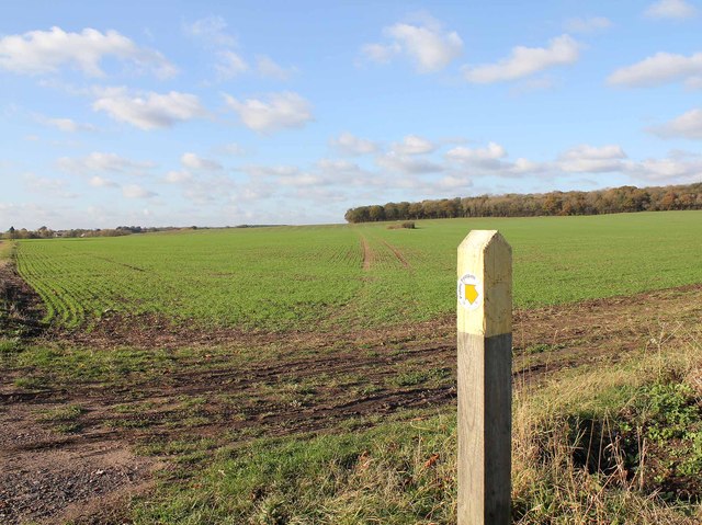
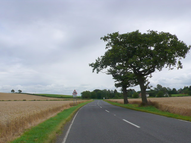
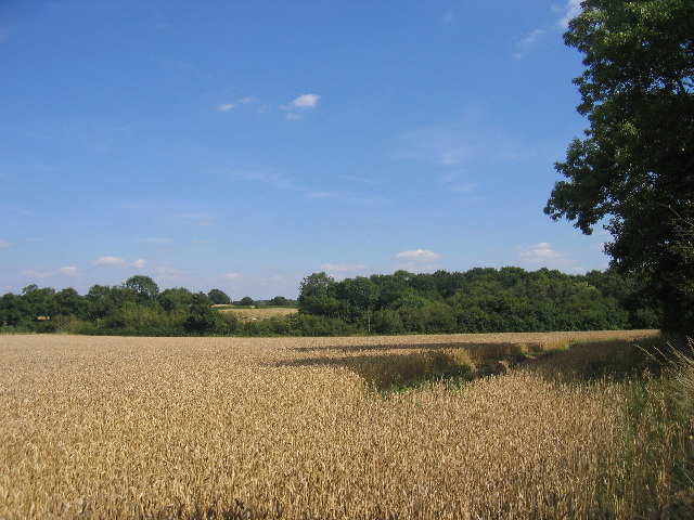
Burnt Hurst Coppice Images

Images are sourced within 2km of 52.339014/-1.4424681 or Grid Reference SP3871. Thanks to Geograph Open Source API. All images are credited.

Wappenbury Hall The tree lined lane to Eathorpe.
Wappenbury Hall
The tree lined lane to Eathorpe.
Footpath to Bubbenhall The footpath to Bubbenhall from Wappenbury heads NW towards Wappenbury Wood, from the B4453 road to Weston-under-Wetherley.
Footpath to Bubbenhall
The footpath to Bubbenhall from Wappenbury heads NW towards Wappenbury Wood, from the B4453 road to Weston-under-Wetherley.
B4453 Looking towards the Wappenbury junction from the road to Weston under Wetherly. The houses of Wappenbury can just be seen on the right. The road has a French feel to it with a distinct lack of hedgerows and fences.
B4453
Looking towards the Wappenbury junction from the road to Weston under Wetherly. The houses of Wappenbury can just be seen on the right. The road has a French feel to it with a distinct lack of hedgerows and fences.
Farm buildings by the road from Wappenbury to Eathorpe
Bull  and Butcher Look at an old map of Warwickshire, and it is shown as a sparsely populated forest and heath. No large forests survive, but there is a patch work of small woods and farmland. Here an arable field next to an oak wood hosts a decaying trig pillar.
Bull and Butcher
Look at an old map of Warwickshire, and it is shown as a sparsely populated forest and heath. No large forests survive, but there is a patch work of small woods and farmland. Here an arable field next to an oak wood hosts a decaying trig pillar.
End of Paget's Lane, Bubbenhall The point, in the SW corner of the square, where Paget's lane ceases to be a public road and forks into two private roads serving a number of farms.
End of Paget's Lane, Bubbenhall
The point, in the SW corner of the square, where Paget's lane ceases to be a public road and forks into two private roads serving a number of farms.
Quarry near Bubbenhall The workings of the quarry seen across the fields from the road in the SW corner of the square.
Quarry near Bubbenhall
The workings of the quarry seen across the fields from the road in the SW corner of the square.
The Old Bull and Butcher One of the few buildings on this square, seen looking South East along the Coventry - Oxford road.
The Old Bull and Butcher
One of the few buildings on this square, seen looking South East along the Coventry - Oxford road.
Burnthurst Looking south from Burnthurst lane towards Princethorpe Great Wood.
Burnthurst
Looking south from Burnthurst lane towards Princethorpe Great Wood.
Footpath from Burnthurst to Bull & Butcher The footpath runs between along the side of the field adjacent to the hedge.
Footpath from Burnthurst to Bull & Butcher
The footpath runs between along the side of the field adjacent to the hedge.
Burnthurst With Burnthurst Farmhouse lurking behind the hedgerow.
Burnthurst
With Burnthurst Farmhouse lurking behind the hedgerow.
Burnthurst With the edge of Princethorpe Great Wood on the right.
Burnthurst
With the edge of Princethorpe Great Wood on the right.
Entrance to Princethorpe College These houses are at the start of the drive leading to Princethorpe college.  The flagpole on top of the tower at the college, actually in the next square, can just be seen over the house roof.
Entrance to Princethorpe College
These houses are at the start of the drive leading to Princethorpe college. The flagpole on top of the tower at the college, actually in the next square, can just be seen over the house roof.
The Woodhouse Hotel Formerly Wood farm, this is now a popular venue for family occasions.
The Woodhouse Hotel
Formerly Wood farm, this is now a popular venue for family occasions.
Burnt Hurst Wood Seen from beside the footpath (actually a Green Lane at this point near Shrubs Lodge) which links Bubbenhall and Princethorpe.
Burnt Hurst Wood
Seen from beside the footpath (actually a Green Lane at this point near Shrubs Lodge) which links Bubbenhall and Princethorpe.
Footpath from Bubbenhall to Wappenbury Looking NW back along the path towards Weston Fields Farm and Bubbenhall as the footpath runs straight past the edge of Wappenbury Wood and across open farmland.
Footpath from Bubbenhall to Wappenbury
Looking NW back along the path towards Weston Fields Farm and Bubbenhall as the footpath runs straight past the edge of Wappenbury Wood and across open farmland.
Footpath towards Wappenbury Wood The footpath from Hill Farm seen as it heads NNW across the fields and towards Wappenbury Wood, thence to Bubbenhall.
Footpath towards Wappenbury Wood
The footpath from Hill Farm seen as it heads NNW across the fields and towards Wappenbury Wood, thence to Bubbenhall.
Hill Farm outbuildings. Clearly equipped for dairy farming, but not currently in use for such.
Hill Farm outbuildings.
Clearly equipped for dairy farming, but not currently in use for such.
Show me another place!

Burnt Hurst Coppice is located at Grid Ref: SP3871 (Lat: 52.339014, Lng: -1.4424681)

Administrative County: Warwickshire

District: Rugby

Police Authority: Warwickshire

What 3 Words

///plodding.dips.invisible. Near Ryton on Dunsmore, Warwickshire

Related Wikis

Ryton Pools Country Park

Ryton Pools Country Park is a country park one mile (1.6 km) south west of the village of Ryton on Dunsmore in Warwickshire, England. The park occupies...

Princethorpe College

Princethorpe College is a Catholic independent day school located in Princethorpe, near Rugby, Warwickshire, England. Princethorpe College opened in September...

National Police Library

The National Police Library in the United Kingdom is a library classed as a special library and research library. It is part of the College of Policing...

College of Policing

The College of Policing is a professional body for the police in England and Wales. It was established in 2012 to take over a number of training and development...

Bubbenhall

Bubbenhall is a village and civil parish in the Warwick district of Warwickshire, England. The village lies off the A445 road, about 5.5 miles (9 km)...

Wappenbury

Wappenbury is a small village and civil parish in the English county of Warwickshire. Located on the north bank of the River Leam Wappenbury is almost...

Princethorpe

Princethorpe is a village and civil parish in the Rugby district of Warwickshire, England. In the 2011 census the parish had a population 376, increasing...

Eathorpe

Eathorpe is a small village and civil parish five miles east of Leamington Spa, in Warwickshire, England. The parish is part of the electoral ward of Cubbington...

Nearby Amenities

Located within 500m of 52.339014,-1.4424681
Source: survey
Lat/Long: 52.3354374/-1.4424539
Barrier: lift_gate
Source: survey
Lat/Long: 52.3355079/-1.4426677
Parking
Capacity: 10
Fee: no
Surface: gravel
Lat/Long: 52.3352733/-1.4400125
Turning Loop
Lat/Long: 52.337243/-1.43737
Colour: white
Marker: post
Material: concrete
Utility: fuel
Lat/Long: 52.3357541/-1.4395799
The data included in this document is from www.openstreetmap.org. The data is made available under ODbL.

Have you been to Burnt Hurst Coppice?

Leave your review of Burnt Hurst Coppice below (or comments, questions and feedback).