Great Bursledon Copse
Wood, Forest in Hampshire New Forest
England
Great Bursledon Copse

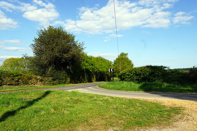
Great Bursledon Copse is a picturesque woodland located in Hampshire, England. Covering an area of approximately 200 acres, the copse is known for its natural beauty and diverse wildlife. It is situated near the village of Bursledon, within easy reach of Southampton and the surrounding areas.
The copse is predominantly made up of broadleaf trees, including oak, beech, and ash, which create a dense canopy that provides shade and shelter for a variety of flora and fauna. The forest floor is rich in wildflowers, such as bluebells and primroses, which bloom in the spring, adding vibrant colors to the woodland.
Great Bursledon Copse is a haven for wildlife, with numerous species making it their home. Birdwatchers can spot a plethora of bird species, including woodpeckers, owls, and various songbirds. The copse is also home to deer, foxes, badgers, and a range of small mammals and insects.
There are several walking trails within the copse, which allow visitors to explore the woodland's beauty at their own leisure. The paths wind through the trees, providing glimpses of the surrounding countryside and offering peaceful spots for picnics or nature observation.
Great Bursledon Copse is a popular destination for nature lovers, hikers, and families seeking a tranquil escape from the hustle and bustle of everyday life. The copse's serene atmosphere and natural charm make it a delightful place to immerse oneself in the wonders of the Hampshire countryside.
If you have any feedback on the listing, please let us know in the comments section below.
Great Bursledon Copse Images
Images are sourced within 2km of 50.877296/-1.4623142 or Grid Reference SU3708. Thanks to Geograph Open Source API. All images are credited.


Great Bursledon Copse is located at Grid Ref: SU3708 (Lat: 50.877296, Lng: -1.4623142)
Administrative County: Hampshire
District: New Forest
Police Authority: Hampshire
What 3 Words
///cheer.soil.trying. Near Marchwood, Hampshire
Nearby Locations
Related Wikis

Southampton F.C. Under-21s and Academy
Southampton F.C. Under-21s and Academy or Saints U21s and Academy is the youth organisation run by Southampton F.C. to encourage and develop young footballers...
Staplewood Campus
Staplewood Campus in Marchwood, Hampshire is the training ground of Southampton Football Club. It was the home ground of Road-Sea Southampton until 1987...

Marchwood railway station
Marchwood railway station was an intermediate station on the Totton, Hythe and Fawley Light Railway, which was built along the coast of Southampton Water...

Marchwood
Marchwood is a village and civil parish located in Hampshire, England. It lies between Totton and Hythe on the western shore of Southampton Water and directly...

New Forest Wildlife Park
The New Forest Wildlife Park (formerly The New Forest Otter, Owl and Wildlife Conservation Park) is located on the edge of The New Forest close to the...
Applemore College
Applemore College is a secondary school in Hampshire, England, situated in the village of Dibden Purlieu on the edge of the New Forest. It offers education...
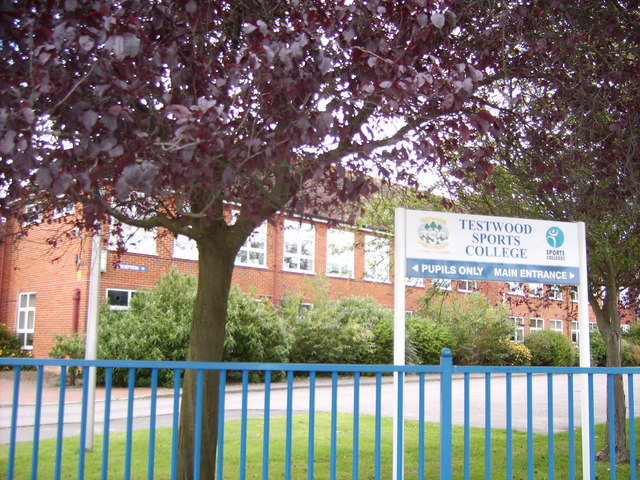
Testwood School
Testwood School (formerly Testwood Sports College) is a secondary school with academy status located in the town of Totton and Eling, England. The school...
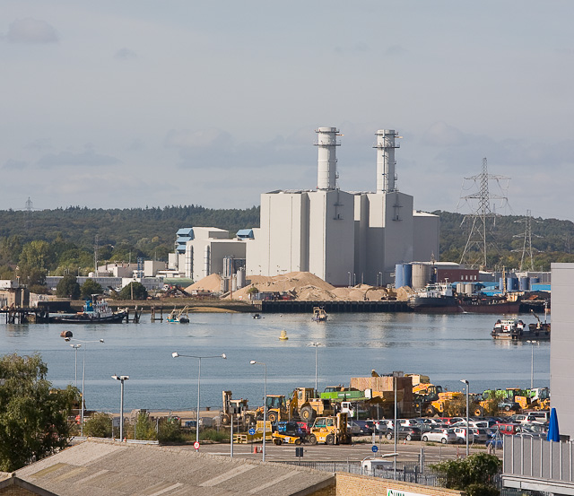
Marchwood Power Station
Marchwood Power Station is an 898.1 MW gas-fired power station in Marchwood, near Southampton, England. It is situated beside estuary of the River Test...
Nearby Amenities
Located within 500m of 50.877296,-1.4623142Have you been to Great Bursledon Copse?
Leave your review of Great Bursledon Copse below (or comments, questions and feedback).