Brampton Plantation

Wood, Forest in Yorkshire Harrogate

England

Brampton Plantation

River Ure at Boroughbridge Camping and Caravan Club Site
River Ure at Boroughbridge Camping and Caravan Club Site Credit: Sandy Gerrard

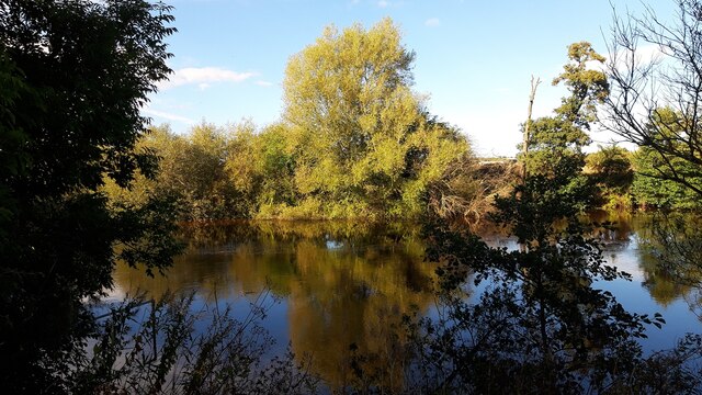
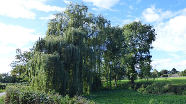
Brampton Plantation, located in the scenic region of Yorkshire, England, is a captivating woodland area encompassing an expansive forest landscape. Stretching across several acres, this enchanting plantation is renowned for its rich biodiversity and breathtaking natural beauty.

Nestled amidst the rolling hills and picturesque countryside of Yorkshire, Brampton Plantation offers a serene escape from the hustle and bustle of city life. The forest boasts an array of indigenous and exotic tree species, including oak, beech, and pine, which thrive in its fertile soil and mild climate. These towering trees create a dense canopy, providing a sheltered habitat for a diverse range of flora and fauna.

Walking through the leaf-strewn pathways of Brampton Plantation, visitors are treated to a symphony of sounds as birdsong fills the air. The forest is a haven for numerous avian species, including woodpeckers, owls, and finches. Additionally, the plantation is home to various mammals, such as deer, foxes, and squirrels, which can often be spotted scampering through the undergrowth.

The plantation also offers an idyllic setting for leisure activities and outdoor pursuits. Visitors can explore the forest's network of trails, which wind their way through the woodland, providing ample opportunities for hiking, jogging, or simply immersing oneself in nature. The plantation also features picnic areas, where families and friends can gather to enjoy a peaceful outdoor meal while surrounded by the beauty of the forest.

Brampton Plantation in Yorkshire is a true gem, offering a glimpse into the region's natural splendor and providing a tranquil retreat for those seeking solace in the great outdoors.

If you have any feedback on the listing, please let us know in the comments section below.

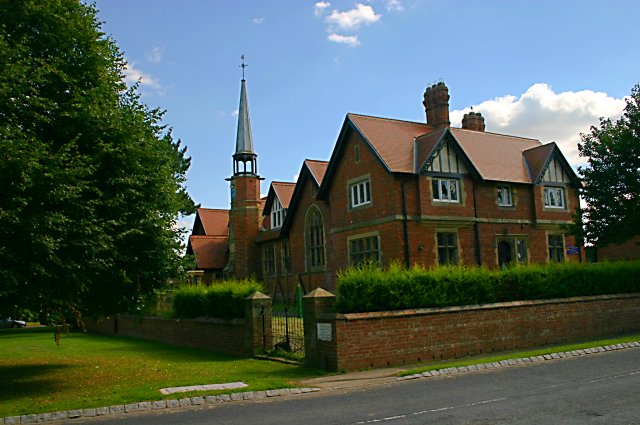
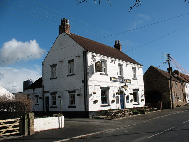
Brampton Plantation Images

Images are sourced within 2km of 54.09509/-1.4351015 or Grid Reference SE3766. Thanks to Geograph Open Source API. All images are credited.

River Ure at Boroughbridge Camping and Caravan Club Site
Weeping Willow at Roecliffe
River Ure at Roecliffe
River Ure at Roecliffe Grange
Westwick Lock
Westwick Lock
River Ure at Langthorpe The River Ure is a river in North Yorkshire, approximately 74 miles long from its source (Ure Head) to the point where it changes name to the River Ouse. It is the principal river of Wensleydale, which is the only one of the Dales named after a village rather than its river. 
Wikipedia: <span class="nowrap"><a title="http://en.wikipedia.org/wiki/River_Ure" rel="nofollow ugc noopener" href="http://en.wikipedia.org/wiki/River_Ure">Link</a><img style="margin-left:2px;" alt="External link" title="External link - shift click to open in new window" src="https://s1.geograph.org.uk/img/external.png" width="10" height="10"/></span>
River Ure at Langthorpe
The River Ure is a river in North Yorkshire, approximately 74 miles long from its source (Ure Head) to the point where it changes name to the River Ouse. It is the principal river of Wensleydale, which is the only one of the Dales named after a village rather than its river. Wikipedia: LinkExternal link
Moor Lane Three roads run parallel to each other in this area. This is definitely the quietest.
Moor Lane
Three roads run parallel to each other in this area. This is definitely the quietest.
Skelton on Ure, converted Methodist church The OS Flush Bracket S6737 is embedded in the south facing wall of the converted Methodist church.
Skelton on Ure, converted Methodist church
The OS Flush Bracket S6737 is embedded in the south facing wall of the converted Methodist church.
Skelton on Ure, converted Methodist church There is OS Flush Bracket S6737 embedded into the south facing wall of the converted Methodist church.
Skelton on Ure, converted Methodist church
There is OS Flush Bracket S6737 embedded into the south facing wall of the converted Methodist church.
Skelton on Ure, Black Lion PH The benchmark is cut across 2 courses of bricks on the left hand side of the road facing wall.
Skelton on Ure, Black Lion PH
The benchmark is cut across 2 courses of bricks on the left hand side of the road facing wall.
Skelton on Ure, closed Black Lion PH There is a benchmark cut across 2 courses of bricks on the left hand side of the road facing wall. Another closed and boarded up village pub.
Skelton on Ure, closed Black Lion PH
There is a benchmark cut across 2 courses of bricks on the left hand side of the road facing wall. Another closed and boarded up village pub.
Skelton on Ure, Christ the Consoler The benchmark is cut into the north-east facing wall, directly under a marvellous rose shaped stained glass window.
Skelton on Ure, Christ the Consoler
The benchmark is cut into the north-east facing wall, directly under a marvellous rose shaped stained glass window.
Skelton on Ure, Christ the Consoler There is a benchmark cut into the north-east facing wall, directly under the marvellous rose shaped stained glass window.
Skelton on Ure, Christ the Consoler
There is a benchmark cut into the north-east facing wall, directly under the marvellous rose shaped stained glass window.
Skelton on Ure, Christ the Consoler This is the 2nd benchmark cut into the church wall, and is on the south east facing wall.
Skelton on Ure, Christ the Consoler
This is the 2nd benchmark cut into the church wall, and is on the south east facing wall.
Skelton on Ure, Christ the Consoler There is a 2nd benchmark cut into the church wall, and this one is cut into the south east facing wall.
Skelton on Ure, Christ the Consoler
There is a 2nd benchmark cut into the church wall, and this one is cut into the south east facing wall.
Skelton on Ure, 18 Main Street The benchmark is cut into the right side of the road facing wall of this house.
Skelton on Ure, 18 Main Street
The benchmark is cut into the right side of the road facing wall of this house.
Skelton on Ure, 18 Main Street There is a benchmark cut into the right side of the road facing wall of this house. The mark is about 18 inches from ground level and is slightly damaged.
Skelton on Ure, 18 Main Street
There is a benchmark cut into the right side of the road facing wall of this house. The mark is about 18 inches from ground level and is slightly damaged.
Skelton on Ure, lodge to Newby Hall The benchmark is cut into the road facing wall of the lodge, to the left of the gates to Newby Hall.
Skelton on Ure, lodge to Newby Hall
The benchmark is cut into the road facing wall of the lodge, to the left of the gates to Newby Hall.
Show me another place!

Brampton Plantation is located at Grid Ref: SE3766 (Lat: 54.09509, Lng: -1.4351015)

Division: North Riding

Administrative County: North Yorkshire

District: Harrogate

Police Authority: North Yorkshire

What 3 Words

///body.curtail.crumple. Near Boroughbridge, North Yorkshire

Related Wikis

St Mary's Church, Roecliffe

St Mary's Church is a redundant Church of England parish church in the village of Roecliffe, North Yorkshire, England (grid reference SE375659). It is...

Roecliffe

Roecliffe is a village and civil parish in the Harrogate district of North Yorkshire, England. It is situated near the A1 road motorway which connects...

Church of Christ the Consoler

The Church of Christ the Consoler is a Victorian Gothic Revival church built in the Early English style by William Burges. It is located in the grounds...

Spectre of Newby Church

The Spectre of Newby Church (or the Newby Monk) is the name given to a figure found in a photograph taken in the Church of Christ the Consoler, on the...

Skelton-on-Ure

Skelton-on-Ure or Skelton is a village and civil parish in the district and county of North Yorkshire, England. It is situated 1.9 miles (3 km) west of...

Devil's Arrows

The Devil's Arrows are four standing stones or menhirs in an alignment approximately 660 feet (200 m) to the east of the A1(M), adjacent to Roecliffe Lane...

Langthorpe

Langthorpe is a village and civil parish in the Harrogate district of North Yorkshire, England. The population of the civil parish taken at the 2011 Census...

Westwick, North Yorkshire

Westwick is a civil parish in Harrogate district in North Yorkshire, England. It lies 3 miles (5 km) west of Boroughbridge, on the south bank of the River...

Nearby Amenities

Located within 500m of 54.09509,-1.4351015
Power: tower
Lat/Long: 54.0927781/-1.4321442
Power: tower
Lat/Long: 54.0917504/-1.4349616
Power: tower
Lat/Long: 54.0938194/-1.4293279
Brampton Hall
Place: farm
Lat/Long: 54.0941497/-1.439538
The data included in this document is from www.openstreetmap.org. The data is made available under ODbL.

Have you been to Brampton Plantation?

Leave your review of Brampton Plantation below (or comments, questions and feedback).