Cadwell Plantation

Wood, Forest in Durham

England

Cadwell Plantation

Old Waggonway, Thornley Route of an old colliery waggonway linking Cassop and Thornley.
Old Waggonway, Thornley Credit: David Robinson

Cadwell Plantation is a historic estate located in Durham, a county in the northeastern part of England. Situated in the picturesque woodlands and forests of the region, the plantation offers a serene and idyllic setting for visitors to explore.

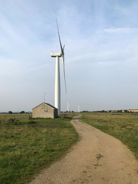
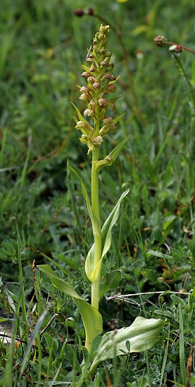
Spread across a vast expanse of land, Cadwell Plantation is known for its dense forests, which are home to a diverse range of flora and fauna. The woodlands are characterized by towering trees, including oak, beech, and pine, providing a rich and vibrant habitat for various wildlife species. Visitors can expect to encounter squirrels, birds, deer, and other woodland creatures during their visit.

The plantation offers a range of outdoor activities, making it a popular destination for nature enthusiasts and adventure seekers alike. Hiking and walking trails wind through the forest, allowing visitors to immerse themselves in the natural beauty of the surroundings. There are also designated picnic areas, where visitors can relax and enjoy a meal amidst the tranquil ambiance of the plantation.

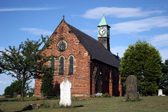
In addition to its natural attractions, Cadwell Plantation boasts a rich historical heritage. The estate dates back several centuries and has been well-preserved, with the original manor house still standing on the grounds. The plantation's historical significance is evident in its architecture and design, which reflects the traditional English countryside style.

Overall, Cadwell Plantation in Durham offers a captivating blend of natural beauty and historical charm. Whether visitors are looking to reconnect with nature, delve into the region's history, or simply enjoy a peaceful retreat, this plantation is a must-visit destination.

If you have any feedback on the listing, please let us know in the comments section below.

Cadwell Plantation Images

Images are sourced within 2km of 54.732093/-1.429743 or Grid Reference NZ3637. Thanks to Geograph Open Source API. All images are credited.

Old Waggonway, Thornley Route of an old colliery waggonway linking Cassop and Thornley.
Old Waggonway, Thornley
Route of an old colliery waggonway linking Cassop and Thornley.
Trimdon Grange Wind Farm Developed by EDF and commissioned in 2008. The small wind farm has 4 turbines that have a total capacity of 5.2 MW.
Trimdon Grange Wind Farm
Developed by EDF and commissioned in 2008. The small wind farm has 4 turbines that have a total capacity of 5.2 MW.
Aged Mineworkers' Homes Traditionally provided for ex-miners by almshouse charities such as The Durham Aged Mineworkers' Homes Association, homes like these are found throughout the Durham coalfield. With the passing of deep coal mining in County Durham, applications are no longer limited to ex-miners but are open to all retirees.
Aged Mineworkers' Homes
Traditionally provided for ex-miners by almshouse charities such as The Durham Aged Mineworkers' Homes Association, homes like these are found throughout the Durham coalfield. With the passing of deep coal mining in County Durham, applications are no longer limited to ex-miners but are open to all retirees.
Pylons & Power Lines
East Hetton Colliery Land Reclamation, Co. Durham Removal of the coal slurry waste from the bottom of Kelloe Valley.
During coal mining operations prior to 1983 at East Hetton Colliery, a dam had been constructed across the valley to retain and store the coal slurry waste that was produced from the coal washing plant.
The reclamation works required the removal of the slurry from the valley, transporting it, and mixing it with the red shale of the pit heap to remodel the contours of the existing landscape.
<a href="https://www.geograph.org.uk/photo/7341908">NZ3437 : East Hetton Colliery Land Reclamation, Co. Durham</a>
<a href="https://www.geograph.org.uk/photo/7340306">NZ3436 : East Hetton Colliery Land Reclamation, Co. Durham</a>
East Hetton Colliery Land Reclamation, Co. Durham
Removal of the coal slurry waste from the bottom of Kelloe Valley. During coal mining operations prior to 1983 at East Hetton Colliery, a dam had been constructed across the valley to retain and store the coal slurry waste that was produced from the coal washing plant. The reclamation works required the removal of the slurry from the valley, transporting it, and mixing it with the red shale of the pit heap to remodel the contours of the existing landscape. NZ3437 : East Hetton Colliery Land Reclamation, Co. Durham NZ3436 : East Hetton Colliery Land Reclamation, Co. Durham
Thornley Hall Thornley Hall near Thornley Co. Durham
Thornley Hall
Thornley Hall near Thornley Co. Durham
St. Paul's Church The parish church of Deaf Hill cum Langdale, Trimdon Station
St. Paul's Church
The parish church of Deaf Hill cum Langdale, Trimdon Station
Entrance to Wingate Quarry Local Nature reserve A disused limestone quarry now a Site of Special Scientific Interest (SSSI)
Entrance to Wingate Quarry Local Nature reserve
A disused limestone quarry now a Site of Special Scientific Interest (SSSI)
Wingate Lodge A former public house now converted to a house.
Wingate Lodge
A former public house now converted to a house.
St. Albans Church The parish church of Trimdon Grange
St. Albans Church
The parish church of Trimdon Grange
Wingate Grange Farm Situated to the West of Wingate in Co. Durham
Wingate Grange Farm
Situated to the West of Wingate in Co. Durham
Petrol Filling Station On the outskirts of Wheatley Hill on the A181 Durham to A19 road
Petrol Filling Station
On the outskirts of Wheatley Hill on the A181 Durham to A19 road
Thornley Road Where I live in Trimdon Station
Thornley Road
Where I live in Trimdon Station
Deaf Hill Primary School My dog Razz waiting for school to open
Deaf Hill Primary School
My dog Razz waiting for school to open
Copse in winter On the Kelloe to Trimdon road
Copse in winter
On the Kelloe to Trimdon road
Town Kelloe
Town Kelloe
Welcome to Wingate Quarry Information board at the entrance to Wingate Quarry Local Nature Reserve.
Welcome to Wingate Quarry
Information board at the entrance to Wingate Quarry Local Nature Reserve.
Wingate Quarry Local Nature Reserve
Show me another place!

Cadwell Plantation is located at Grid Ref: NZ3637 (Lat: 54.732093, Lng: -1.429743)

Unitary Authority: County Durham

Police Authority: Durham

What 3 Words

///acoustics.most.scuba. Near Thornley, Co. Durham

Related Wikis

Wingate Quarry

Wingate Quarry is a biological Site of Special Scientific Interest in the County Durham district of east County Durham, England. Part of the site is also...

The Bottoms (SSSI)

The Bottoms is a Site of Special Scientific Interest in County Durham, England. It lies just south of the A181 road, roughly midway between the villages...
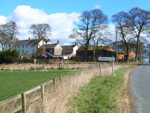
Town Kelloe Bank

Town Kelloe Bank is a Site of Special Scientific Interest in County Durham, England. It is situated to the south of The Bottoms SSSI and just north of...

Hownes Gill railway station

Hownes Gill railway station served the town of Consett, County Durham, England, from 1845 to 1858 on the Stanhope and Tyne Railway. == History == The station...

Wheatley Hill

Wheatley Hill is a village in County Durham, in England. It is situated to the west of Peterlee, near Thornley and Wingate. Until 2009 it was part of Easington...
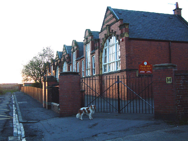
Deaf Hill

Deaf Hill is a village in County Durham, England. It is situated a short distance to the east of Trimdon Colliery. The origin of the name is not known...

Town Kelloe

Town Kelloe is a small village in County Durham, in England. It is situated a short distance to the east of Kelloe. == References == == External links... ==

Old Wingate

Old Wingate is a small village in County Durham, in England. It is situated a short distance to the west of Wingate. Most of the village was deserted in...

Nearby Amenities

Located within 500m of 54.732093,-1.429743
Parking
Lat/Long: 54.7296972/-1.4246056
Bus Stop
Wingate Arms Road End
Fixme: Confirm no physical marker, as customer request stop
Naptan AtcoCode: 13003420B
Naptan Bearing: NE
Naptan BusStopType: CUS
Naptan CommonName: Wingate Arms Road End
Naptan Indicator: north east bound
Naptan Landmark: Landmark not known
Naptan NaptanCode: durapwpw
Naptan Notes: B1278 at Wingate quary local nature reserve-salters lane ends- trimdon station- ts296nt
Naptan Street: B1278
Naptan Verified: no
Source: naptan_import
Lat/Long: 54.7293459/-1.4261324
Bus Stop
Wingate Arms Road End
Fixme: Confirm no physical marker, as customer request stop
Naptan AtcoCode: 13003420C
Naptan Bearing: SE
Naptan BusStopType: CUS
Naptan CommonName: Wingate Arms Road End
Naptan Indicator: south east bound
Naptan Landmark: Landmark not known
Naptan NaptanCode: durapwta
Naptan Notes: B1278 at Wingate quary local nature reserve-salters lane ends- trimdon station- ts296nt
Naptan Street: B1278
Naptan Verified: no
Source: naptan_import
Lat/Long: 54.7298106/-1.4255823
Bus Stop
Wingate Arms Road End
Fixme: Confirm no physical marker, as customer request stop
Naptan AtcoCode: 13003420H
Naptan Bearing: NW
Naptan BusStopType: CUS
Naptan CommonName: Wingate Arms Road End
Naptan Indicator: north west bound
Naptan Landmark: Landmark not known
Naptan NaptanCode: durapwtd
Naptan Notes: salters lane ends- trimdon station- ts296nt
Naptan Street: B1278
Naptan Verified: no
Source: naptan_import
Lat/Long: 54.7293769/-1.4250915
Barrier: kissing_gate
Lat/Long: 54.7307587/-1.4225608
Power: pole
Lat/Long: 54.7343901/-1.4283434
Power: pole
Lat/Long: 54.7350227/-1.4264256
Power: pole
Lat/Long: 54.7348818/-1.4252132
Power: pole
Lat/Long: 54.7347401/-1.4239995
Power: pole
Lat/Long: 54.7344907/-1.4234081
Kelloe Winning Colliery
Historic: mine
Resource: coal
Website: http://www.dmm.org.uk/colliery/k001.htm
Lat/Long: 54.7317573/-1.4322567
The data included in this document is from www.openstreetmap.org. The data is made available under ODbL.

Have you been to Cadwell Plantation?

Leave your review of Cadwell Plantation below (or comments, questions and feedback).