Ditton Green

Settlement in Cambridgeshire East Cambridgeshire

England

Ditton Green

Two miles to Newmarket Looking towards Newmarket on Woodditton Road. The crossroad is staggered: Stetchworth and Dullingham to the left, Cheveley to the right (out of the picture).
Two miles to Newmarket Credit: John Sutton

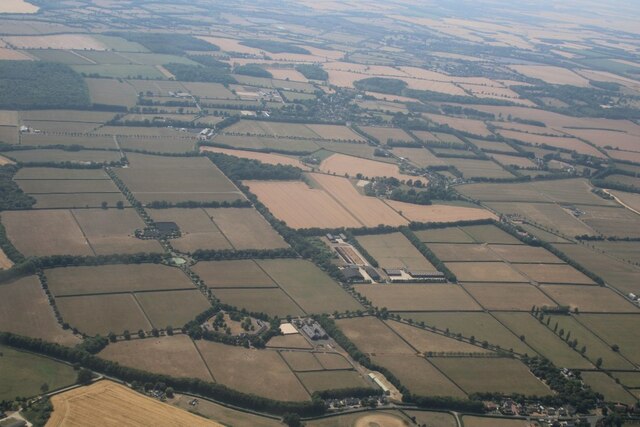
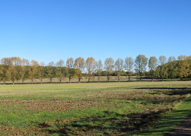
Ditton Green is a small village located in the county of Cambridgeshire, England. It is situated approximately 9 miles north of the city of Cambridge and lies within the district of South Cambridgeshire. The village is surrounded by picturesque countryside and offers a peaceful and rural setting for its residents.

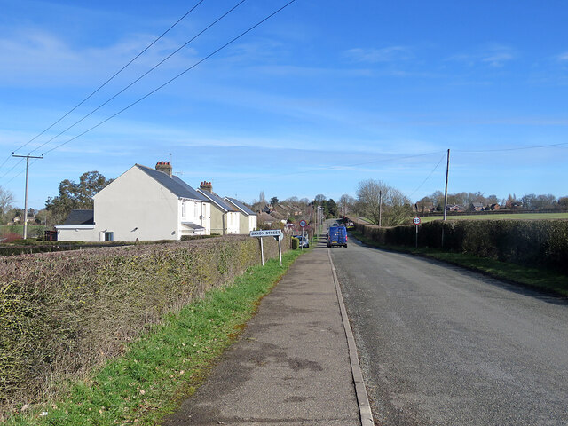
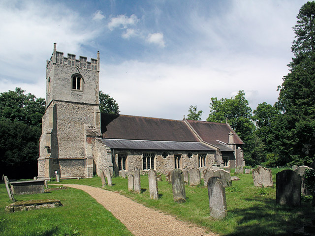
With a population of around 200 people, Ditton Green is a close-knit community that exudes a friendly and welcoming atmosphere. The village consists mainly of traditional English cottages and houses, adding to its charm and character. The architecture reflects the village's long-standing history, with some buildings dating back several centuries.

Ditton Green is well-connected to nearby towns and cities, with good transportation links. The A14 road runs close to the village, providing easy access to Cambridge, Huntingdon, and beyond. Additionally, there are regular bus services that connect Ditton Green to surrounding areas.

Although small in size, the village has a strong sense of community spirit. It has a local pub, which serves as a hub for social gatherings and events. The village also has a primary school, providing education for the local children.

The surrounding countryside offers plenty of opportunities for outdoor activities, including walking, cycling, and horse riding. The nearby River Cam is a popular spot for boating and fishing enthusiasts.

Overall, Ditton Green is a delightful village that offers a tranquil and idyllic lifestyle for its residents, with its historic charm, strong community spirit, and beautiful countryside setting.

If you have any feedback on the listing, please let us know in the comments section below.
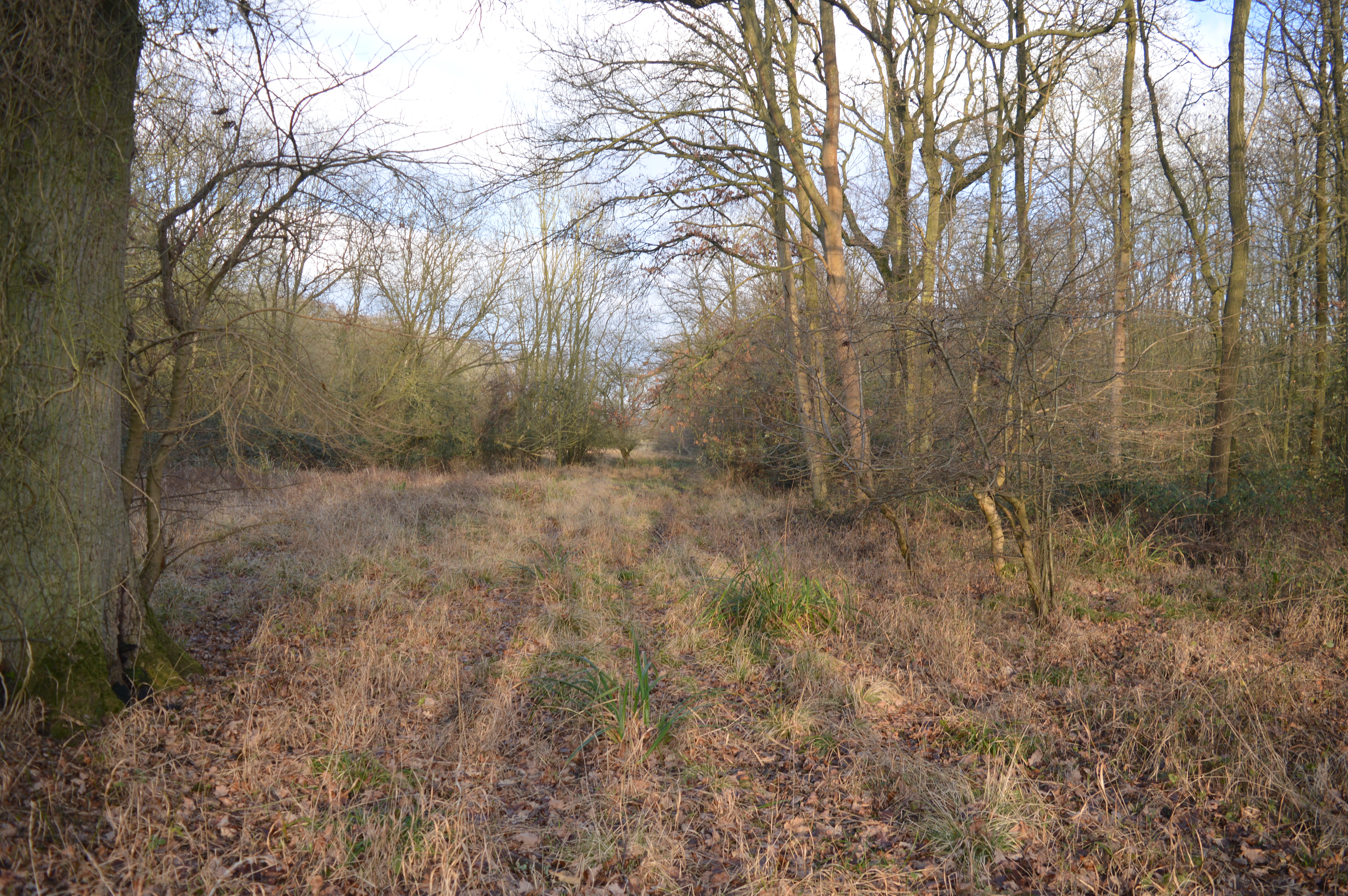
Ditton Green Images

Images are sourced within 2km of 52.197481/0.42601 or Grid Reference TL6558. Thanks to Geograph Open Source API. All images are credited.

Two miles to Newmarket Looking towards Newmarket on Woodditton Road. The crossroad is staggered: Stetchworth and Dullingham to the left, Cheveley to the right (out of the picture).
Two miles to Newmarket
Looking towards Newmarket on Woodditton Road. The crossroad is staggered: Stetchworth and Dullingham to the left, Cheveley to the right (out of the picture).
Bluebells in Basefield Wood
Field by Basefield Wood
Saxon Street and Rutland Stud, looking towards Little Ditton: aerial 2022
A fine autumn morning in East Cambridgeshire The road from Woodditton to Stetchworth.
A fine autumn morning in East Cambridgeshire
The road from Woodditton to Stetchworth.
Stetchworth Ley: barns at Ley Farm A mild and cloudless morning in October.
Stetchworth Ley: barns at Ley Farm
A mild and cloudless morning in October.
A line of trees near Stetchworth Ley The trees crossing the picture line a drain. Ditton Green water tower shows in the distance beyond them.
A line of trees near Stetchworth Ley
The trees crossing the picture line a drain. Ditton Green water tower shows in the distance beyond them.
Stetchworth Ley: footpath to Ditton Green The shadowed north-western edge of Great Chitlings Wood is on the right and Little Chitlings Wood in the distance in the centre of the picture.
Stetchworth Ley: footpath to Ditton Green
The shadowed north-western edge of Great Chitlings Wood is on the right and Little Chitlings Wood in the distance in the centre of the picture.
Autumn in East Cambridgeshire The road from Stetchworth Park Farm to Stetchworth on a mild and cloudless October morning.
Autumn in East Cambridgeshire
The road from Stetchworth Park Farm to Stetchworth on a mild and cloudless October morning.
Stetchworth Ley: Round House On the edge of Great Chitlings Wood.
Stetchworth Ley: Round House
On the edge of Great Chitlings Wood.
Towards Charcoals Wood In the gentle hills of East Cambridgeshire on a bright October morning.
Towards Charcoals Wood
In the gentle hills of East Cambridgeshire on a bright October morning.
Towards Basefield Wood A fine October view from the road from Stetchworth Park Farm to Stetchworth (right).
Towards Basefield Wood
A fine October view from the road from Stetchworth Park Farm to Stetchworth (right).
Towards Stetchworth Ley The road from Stetchworth Park Farm (where the road ends) to Stetchworth on a cloudless October morning.
Towards Stetchworth Ley
The road from Stetchworth Park Farm (where the road ends) to Stetchworth on a cloudless October morning.
Signpost near Lower Ley Farm This is where the lane to Stetchworth Ley and Stetchworth Park Farm (no through road) leaves the road from Stetchworth to Woodditton.
Signpost near Lower Ley Farm
This is where the lane to Stetchworth Ley and Stetchworth Park Farm (no through road) leaves the road from Stetchworth to Woodditton.
Stetchworth: flint and pantiles A row of cottages whose Gothick ground-floor window and door reveals suggest they might have been built early in the 19th century.
Stetchworth: flint and pantiles
A row of cottages whose Gothick ground-floor window and door reveals suggest they might have been built early in the 19th century.
Stetchworth: The Marquis of Granby A 19th-century brick pub at the corner of High Street (ahead) and Tea Kettle Lane the road to Dullingham.
Stetchworth: The Marquis of Granby
A 19th-century brick pub at the corner of High Street (ahead) and Tea Kettle Lane the road to Dullingham.
Entering Stetchworth Bright sunlight and deep shadows on a fine October morning. This is where the road from Dullingham meets Mill Lane (left) and Tea Kettle Lane (ahead).
Entering Stetchworth
Bright sunlight and deep shadows on a fine October morning. This is where the road from Dullingham meets Mill Lane (left) and Tea Kettle Lane (ahead).
Nearing Saxon Street on School Road This is the road from Woodditton. The first three houses are an early Council-built type which is found in other Cambridgeshire villages.
Nearing Saxon Street on School Road
This is the road from Woodditton. The first three houses are an early Council-built type which is found in other Cambridgeshire villages.
Show me another place!

Ditton Green is located at Grid Ref: TL6558 (Lat: 52.197481, Lng: 0.42601)

Administrative County: Cambridgeshire

District: East Cambridgeshire

Police Authority: Cambridgeshire

What 3 Words

///flop.computers.rephrase. Near Newmarket, Suffolk

Nearby Locations

Pickmore Wood Ditton Green

Related Wikis

Woodditton

Woodditton is a village and civil parish in East Cambridgeshire, England. The other settlements in the parish are Ditton Green, Little Ditton and Saxon...

Stetchworth

Stetchworth is a small village and civil parish in East Cambridgeshire, England, 3 miles (5 km) to the south of the horse-racing centre of Newmarket and...

Ten Wood

Ten Wood is a 17.7-hectare (44-acre) biological Site of Special Scientific Interest east of Burrough Green in Cambridgeshire. This ancient wood is of the...

Kirtling Tower

Kirtling Tower was a medieval castle and Tudor country house in Kirtling, Cambridgeshire, England, of which the gatehouse still remains. == History... ==

Nearby Amenities

Located within 500m of 52.197481,0.42601
Woodditton
Is In: Suffolk,England,UK
Place: village
Wikidata: Q2204023
Lat/Long: 52.1964814/0.4282671
Post Box
CB8 9 – Wood Green | Wooditton
Collection Times: Mo-Fr 16:00; Sa 10:45
Operator: Royal Mail
Post Box Type: lamp
Ref: CB8 79
Royal Cypher: EIIR
Royal Cypher Wikidata: Q33102113
Source: survey
Lat/Long: 52.1963234/0.4257726
Pub
Three Blackbirds
Lat/Long: 52.1966525/0.4261533
Bus Stop
Water Tower
Naptan AtcoCode: 0500EWOOD008
Naptan Bearing: W
Naptan BusStopType: CUS
Naptan CommonName: Water Tower
Naptan Indicator: opp
Naptan Landmark: Water Tower
Naptan NaptanCode: cmbdjmtj
Naptan ShortCommonName: Water Tower
Naptan Street: Ditton Green
Naptan Verified: no
Source: naptan_import
Lat/Long: 52.1964357/0.4227047
Bus Stop
Water Tower
Naptan AtcoCode: 0500EWOOD011
Naptan Bearing: SE
Naptan BusStopType: CUS
Naptan CommonName: Water Tower
Naptan Indicator: near
Naptan Landmark: Water Tower
Naptan NaptanCode: cmbdjmtw
Naptan ShortCommonName: Water Tower
Naptan Street: Ditton Green
Naptan Verified: no
Source: naptan_import
Lat/Long: 52.1965153/0.4227675
Bus Stop
West End
Naptan AtcoCode: 0500EWOOD012
Naptan Bearing: SW
Naptan BusStopType: CUS
Naptan CommonName: West End
Naptan Indicator: near
Naptan Landmark: West End
Naptan NaptanCode: cmbdjmwa
Naptan ShortCommonName: West End
Naptan Street: Ditton Green
Naptan Verified: no
Source: naptan_import
Lat/Long: 52.1964668/0.426438
Bus Stop
West End
Naptan AtcoCode: 0500EWOOD014
Naptan Bearing: NE
Naptan BusStopType: CUS
Naptan CommonName: West End
Naptan Indicator: opp
Naptan Landmark: West End
Naptan NaptanCode: cmbdjmwg
Naptan ShortCommonName: West End
Naptan Street: Ditton Green
Naptan Verified: no
Source: naptan_import
Lat/Long: 52.1965213/0.4264117
Bus Stop
Kirtling Road
Naptan AtcoCode: 0500EWOOD015
Naptan Bearing: W
Naptan BusStopType: CUS
Naptan CommonName: Kirtling Road
Naptan Indicator: near
Naptan Landmark: Kirtling Road
Naptan NaptanCode: cmbdjmwj
Naptan ShortCommonName: Kirtling Road
Naptan Street: Ditton Road
Naptan Verified: no
Source: naptan_import
Lat/Long: 52.1974956/0.4293171
Bus Stop
Kirtling Road
Naptan AtcoCode: 0500EWOOD016
Naptan Bearing: E
Naptan CommonName: Kirtling Road
Naptan Indicator: opp
Naptan Landmark: Kirtling Road
Naptan NaptanCode: cmbdjmwm
Naptan ShortCommonName: Kirtling Road
Naptan Street: Ditton Road
Naptan Verified: no
Source: naptan_import
Lat/Long: 52.1975873/0.4292357
Barrier: kissing_gate
Foot: yes
Lat/Long: 52.1948419/0.4204016
Power: pole
Lat/Long: 52.1977667/0.4223916
Power: pole
Lat/Long: 52.1976844/0.4238373
Power: pole
Lat/Long: 52.1979574/0.4195298
Power: pole
Lat/Long: 52.199082/0.4200128
Power: pole
Lat/Long: 52.2000132/0.430276
Power: pole
Lat/Long: 52.2003863/0.4313287
Power: pole
Lat/Long: 52.1996095/0.4291709
Power: pole
Lat/Long: 52.1975464/0.4253985
Power: pole
Lat/Long: 52.1981613/0.4264767
Power: transformer
Lat/Long: 52.1988107/0.4276113
Turning Loop
Lat/Long: 52.1971853/0.4272679
Public Bookcase
Booth: K6
Colour: red
Disused Amenity: telephone
Man Made: telephone_box
Operator: Woodditton Parish Council
Public Bookcase Type: phone_box
Lat/Long: 52.1964608/0.4264696
Waste Basket
Waste: dog_excrement
Lat/Long: 52.196465/0.4264806
Waste Basket
Waste: dog_excrement
Lat/Long: 52.1953896/0.423636
Waste Basket
Lat/Long: 52.1965956/0.4226726
Waste Basket
Lat/Long: 52.1979227/0.4299638
The data included in this document is from www.openstreetmap.org. The data is made available under ODbL.

Have you been to Ditton Green?

Leave your review of Ditton Green below (or comments, questions and feedback).