Brown's Plantation

Wood, Forest in Durham

England

Brown's Plantation

Walking party following path between fields Members of Crook and Weardale Ramblers following a public footpath between Hetton-le-Hill and High Moorsley.
Walking party following path between fields Credit: Trevor Littlewood

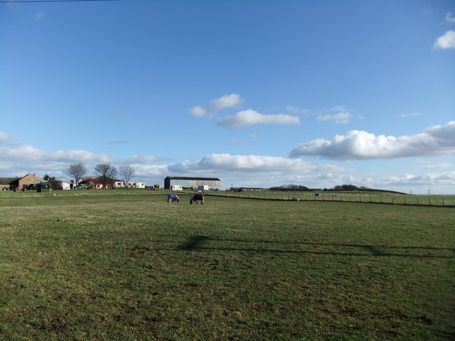
Brown's Plantation, located in Durham, is a picturesque wooded area known for its lush forest and serene ambiance. Spanning over a considerable area, this plantation is a popular destination for nature enthusiasts and hikers alike.

The plantation is predominantly covered with a diverse range of trees, including oak, beech, and pine, creating a dense forest canopy that provides a haven for numerous species of wildlife. The woodland floor is carpeted with a variety of plants, including bluebells, wild garlic, and ferns, adding to the natural beauty of the area.

Trails wind their way through the plantation, offering visitors the opportunity to explore the surroundings while immersing themselves in nature. These well-maintained paths cater to different levels of difficulty, from leisurely strolls to more challenging hikes that reward adventurers with breathtaking views.

In addition to its natural splendor, Brown's Plantation also boasts historical significance. It is named after the Brown family, who owned and managed the plantation for generations. The site is said to have served as a timber resource during the industrial revolution, supplying the local area with wood for construction and fuel.

Today, Brown's Plantation is a protected area, managed by the local authorities to preserve its ecological and historical value. Visitors can enjoy the serenity of the woodland, observe a variety of wildlife, and learn about the region's past. With its combination of natural beauty and historical significance, Brown's Plantation remains an enchanting destination for nature lovers and history enthusiasts alike.

If you have any feedback on the listing, please let us know in the comments section below.

Brown's Plantation Images

Images are sourced within 2km of 54.786362/-1.4488062 or Grid Reference NZ3543. Thanks to Geograph Open Source API. All images are credited.

Walking party following path between fields Members of Crook and Weardale Ramblers following a public footpath between Hetton-le-Hill and High Moorsley.
Walking party following path between fields
Members of Crook and Weardale Ramblers following a public footpath between Hetton-le-Hill and High Moorsley.
Children's park / play area, Haswell Plough
Footpath at High Haswell Wind Farm The start of a path which passes some of the turbines.
Footpath at High Haswell Wind Farm
The start of a path which passes some of the turbines.
Remains of a Signpost A public footpath sign which appears to have had a hard life.
Remains of a Signpost
A public footpath sign which appears to have had a hard life.
Sheep and a turbine Grazing sheep with one of the turbines at High Haswell Wind Farm in the background.
Sheep and a turbine
Grazing sheep with one of the turbines at High Haswell Wind Farm in the background.
Demolition of Bankhead Railway Station on 31st  May 1964 The "Haswell Bridge" station was located near to Salters Road, at the north end of Haswell Village and was the terminus for the Hartlepool Dock Railway. The boys on the left of the picture are sitting on the parapet wall to the tunnel that was constructed under the Hartlepool railway, to allow the Sunderland & Durham Branch railway to connect with the Haswell Colliery line. There was a railway siding off the Haswell Colliery line (west of this tunnel) which led back up at right angles to Bankhead Station.
A turntable was used at the Bankhead Station to turn locomotives and third-class passenger carriages around to make a connection between the Hartlepool and Sunderland Railways. 
Haswell Junction station (passenger terminus) on the Sunderland Railway was to the east of the Bankhead Station, where the 1st-class passengers had to disembark and be transported across to Bankhead for ongoing passage to Hartlepool (the tunnel under Salters Road was only large enough to allow the passage of third class and baggage carriages).
The railway station which replaced the Bankhead station can be seen in the background just beyond the level crossing and signal box at Station Street.
As a young boy I lived in Railway Cottages which can be seen on the extreme right of the image.

Further details of the arrangement and configuration of the railway lines at Bankhead are described in Parliamentary Papers which investigate a derailment on the colliery line/ sidings points.
Demolition of Bankhead Railway Station on 31st May 1964
The "Haswell Bridge" station was located near to Salters Road, at the north end of Haswell Village and was the terminus for the Hartlepool Dock Railway. The boys on the left of the picture are sitting on the parapet wall to the tunnel that was constructed under the Hartlepool railway, to allow the Sunderland & Durham Branch railway to connect with the Haswell Colliery line. There was a railway siding off the Haswell Colliery line (west of this tunnel) which led back up at right angles to Bankhead Station. A turntable was used at the Bankhead Station to turn locomotives and third-class passenger carriages around to make a connection between the Hartlepool and Sunderland Railways. Haswell Junction station (passenger terminus) on the Sunderland Railway was to the east of the Bankhead Station, where the 1st-class passengers had to disembark and be transported across to Bankhead for ongoing passage to Hartlepool (the tunnel under Salters Road was only large enough to allow the passage of third class and baggage carriages). The railway station which replaced the Bankhead station can be seen in the background just beyond the level crossing and signal box at Station Street. As a young boy I lived in Railway Cottages which can be seen on the extreme right of the image. Further details of the arrangement and configuration of the railway lines at Bankhead are described in Parliamentary Papers which investigate a derailment on the colliery line/ sidings points.
Red House The large, apparently Victorian house lies to the east of buildings at Elmore Grange but despite its size is virtually unmarked on OS maps at the 1:25 000 scale.
Red House
The large, apparently Victorian house lies to the east of buildings at Elmore Grange but despite its size is virtually unmarked on OS maps at the 1:25 000 scale.
Path through Elemore Wood A path heading south-west through the woodland, close to Coldwell Burn which is out of the image to the left.
Path through Elemore Wood
A path heading south-west through the woodland, close to Coldwell Burn which is out of the image to the left.
Elmside Villa across leafy crop Elmside Villa is part of the settlement at Hetton-le-Hill; it's seen in the image across rutted mud and a leafy crop from a farm road the south.
Elmside Villa across leafy crop
Elmside Villa is part of the settlement at Hetton-le-Hill; it's seen in the image across rutted mud and a leafy crop from a farm road the south.
Channelling of Coldwell Burn through woodland The burn flowing near to west through Elemore Wood, Brown's Plantation or between the two, seen from a bridge carrying a path.
Channelling of Coldwell Burn through woodland
The burn flowing near to west through Elemore Wood, Brown's Plantation or between the two, seen from a bridge carrying a path.
B1283 Durham Lane heading east
B1283 near Prospect Hill in mist
B1283 at Haswell Plough village boundary
Farm on Lily Hill
Farm on Lily Hill
Bridleway descending through avenue of trees The route is seen descending from a minor road, Elemore Lane. Out of sight it veers to the left ending up at and passing Elemore Hall School, which is a partly residential secondary school operated by County Durham for pupils who have not met with success in mainstream education.
Bridleway descending through avenue of trees
The route is seen descending from a minor road, Elemore Lane. Out of sight it veers to the left ending up at and passing Elemore Hall School, which is a partly residential secondary school operated by County Durham for pupils who have not met with success in mainstream education.
Grassed area, Littletown Littletown is a small County Durham village; Wikipedia tells that it's in the parish of Pittington and is  the site of the former Lambton Colliery.
The grassed area of the image might well be thought of as the village green; it lies just north-west of the main part of the settlement.
Grassed area, Littletown
Littletown is a small County Durham village; Wikipedia tells that it's in the parish of Pittington and is the site of the former Lambton Colliery. The grassed area of the image might well be thought of as the village green; it lies just north-west of the main part of the settlement.
Access road for Crime Rigg Quarry An unusual arrangement with the quarry road leaving the B1283 at this location then running parallel to it on its north side. Having gone perhaps a third of a kilometre to the east the road then turns to go through a tunnel under the B road to enter the extensive quarry workings all of which are on its south side.
Access road for Crime Rigg Quarry
An unusual arrangement with the quarry road leaving the B1283 at this location then running parallel to it on its north side. Having gone perhaps a third of a kilometre to the east the road then turns to go through a tunnel under the B road to enter the extensive quarry workings all of which are on its south side.
Large houses on north side of B1283 The houses are on the periphery of the village, Haswell Plough. The road sign announcing arrival at the village is in a style typical in County Durham.
Large houses on north side of B1283
The houses are on the periphery of the village, Haswell Plough. The road sign announcing arrival at the village is in a style typical in County Durham.
Show me another place!

Brown's Plantation is located at Grid Ref: NZ3543 (Lat: 54.786362, Lng: -1.4488062)

Unitary Authority: County Durham

Police Authority: Durham

What 3 Words

///reinstate.mild.tanks. Near Haswell, Co. Durham

Related Wikis

Elemore Hall

Elemore Hall is a mid-18th-century country house, now in use as a residential special school, near Pittington, County Durham, England. It is a Grade I...

Dabble Bank

Dabble Bank is a Site of Special Scientific Interest in the County Durham district of County Durham, England. It lies about 1 km west of the village of...

High Haswell

High Haswell is a village in County Durham, in England. It is situated close to Haswell, a few miles to the east of Durham. == External links == Map sources...

Pig Hill

Pig Hill is a Site of Special Scientific Interest in the County Durham district of north-east County Durham, England, situated 1 km south of the village...

Littletown, County Durham

Littletown is a village in the parish of Pittington, County Durham, England. It is situated a few miles to the east of Durham. The village was previously...

Haswell, County Durham

Haswell is a village in County Durham, in England. It is situated 6 miles (9.7 km) east of the city of Durham, 9 miles (14 km) south of the city of Sunderland...

Haswell Plough

Haswell Plough is a village in County Durham, England. It is situated between Durham and Peterlee, south of Haswell. Haswell Plough was first mentioned...

Crime Rigg and Sherburn Hill Quarries

Crime Rigg and Sherburn Hill Quarries is a Site of Special Scientific Interest in County Durham, England. It lies about 1 kilometre (0.6 mi) east of the...

Nearby Amenities

Located within 500m of 54.786362,-1.4488062
Barrier: entrance
Lat/Long: 54.7874652/-1.4533295
Fixme: ref is answer rather than numeric reference?
Marker: post
Orienteering: marker
Ref: X
Sport: orienteering
Lat/Long: 54.7895446/-1.4490715
Fixme: ref is answer rather than numeric reference?
Marker: post
Orienteering: marker
Ref: D
Sport: orienteering
Lat/Long: 54.7893373/-1.4488569
Marker: post
Note: Confirmed only letter on posts
Orienteering: marker
Ref: G
Sport: orienteering
Lat/Long: 54.7879849/-1.4499593
Barrier: stile
Lat/Long: 54.7846213/-1.4464209
Marker: post
Orienteering: marker
Ref: K
Sport: orienteering
Lat/Long: 54.7851313/-1.4465958
Barrier: bollard
Lat/Long: 54.7851571/-1.4465565
Elemore Grange Farm
Place: farm
Source Name: OS OpenData StreetView
Lat/Long: 54.7884024/-1.4548865
Marker: post
Orienteering: marker
Ref: T
Sport: orienteering
Lat/Long: 54.7873817/-1.4491171
Barrier: stile
Stile: stepover
Lat/Long: 54.7876098/-1.4487791
The data included in this document is from www.openstreetmap.org. The data is made available under ODbL.

Have you been to Brown's Plantation?

Leave your review of Brown's Plantation below (or comments, questions and feedback).