Horse Wood

Wood, Forest in Derbyshire Chesterfield

England

Horse Wood

Car park at Morrison's supermarket Chesterfield
Car park at Morrison's supermarket Chesterfield Credit: Rod Allday

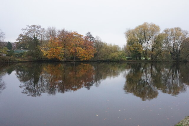
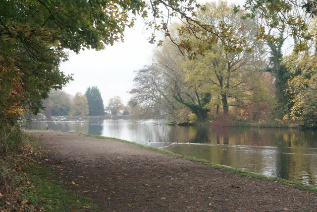
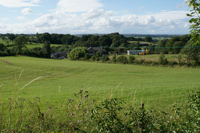
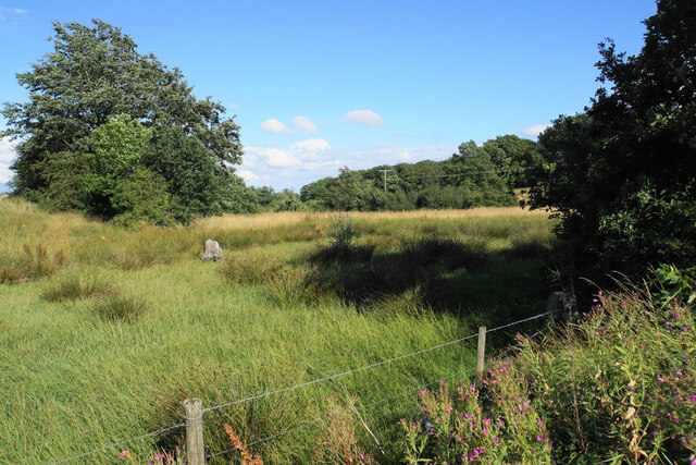
Horse Wood is a picturesque forest located in Derbyshire, England. Covering an area of approximately 100 acres, the woodland is a popular destination for nature enthusiasts, hikers, and horse riders alike.

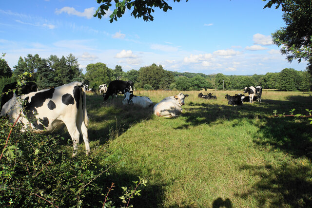
The forest is characterized by its diverse range of tree species, including oak, birch, and beech trees. The dense foliage provides a natural habitat for a variety of wildlife, such as squirrels, rabbits, and numerous bird species. Visitors to Horse Wood can often spot these animals while exploring its well-maintained trails.

The wood is crisscrossed with a network of paths, enabling visitors to easily navigate through its enchanting surroundings. These trails are suitable for both beginners and experienced hikers, offering a mix of leisurely strolls and more challenging routes.

Horse Wood is particularly renowned for its equestrian facilities. The forest boasts a dedicated horse riding trail, which allows riders to explore the woodland on horseback. This trail offers breathtaking views and a unique experience for horse enthusiasts.

Additionally, the forest is equipped with several parking areas, picnic spots, and seating areas, making it an ideal destination for families and groups to spend a day surrounded by nature.

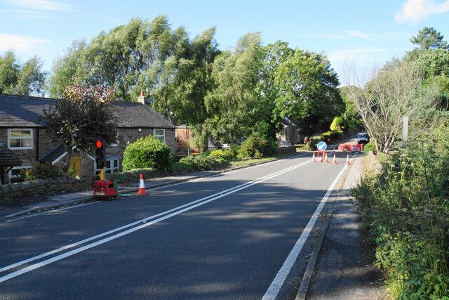
Horse Wood is easily accessible by car, with well-marked signs guiding visitors to the forest entrance. The woodland is open year-round, allowing visitors to enjoy its beauty in every season.

In conclusion, Horse Wood in Derbyshire is a captivating forest that offers a serene escape from the bustling city life. With its diverse flora and fauna, well-maintained trails, and equestrian facilities, the wood provides a delightful experience for nature lovers and outdoor enthusiasts.

If you have any feedback on the listing, please let us know in the comments section below.
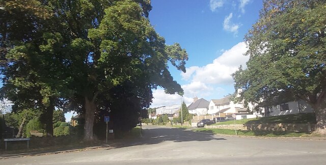
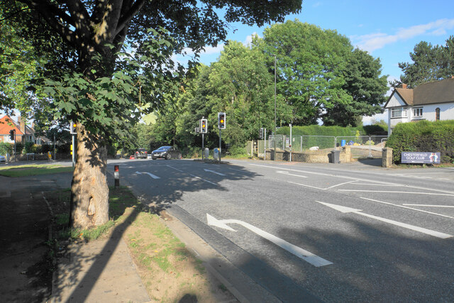
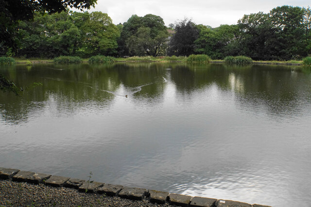
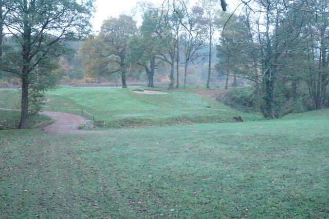
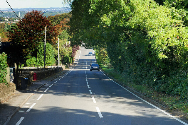
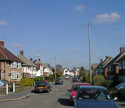
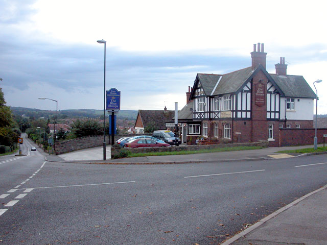
Horse Wood Images

Images are sourced within 2km of 53.224892/-1.4692307 or Grid Reference SK3569. Thanks to Geograph Open Source API. All images are credited.

Car park at Morrison's supermarket Chesterfield
The Barrel Inn - Chesterfield
Pizza Hut - Chesterfield
Chatsworth Road Medical Centre
Westbrook Drive - Brookside
Walton Dam A reservoir constructed to power a former corn mill. It is now a pleasant enclave amongst a lot of new housing in Walton.
Walton Dam
A reservoir constructed to power a former corn mill. It is now a pleasant enclave amongst a lot of new housing in Walton.
Path by Walton Dam A pleasant place for residents of Brampton and Walton, by the side of a former mill reservoir in the valley of the River Hipper. Autumn mist is still lingering into the afternoon.
Path by Walton Dam
A pleasant place for residents of Brampton and Walton, by the side of a former mill reservoir in the valley of the River Hipper. Autumn mist is still lingering into the afternoon.
Farmland below Stoneycroft Lane The farmland is on the gently rising land to the west of Chesterfield.
Farmland below Stoneycroft Lane
The farmland is on the gently rising land to the west of Chesterfield.
Rough grazing land off Stoneycroft Lane The land is sloping up to Harper Hill.
Rough grazing land off Stoneycroft Lane
The land is sloping up to Harper Hill.
Cattle by Matlock Road On the outskirts of the Chesterfield conurbation.
Cattle by Matlock Road
On the outskirts of the Chesterfield conurbation.
Roadworks on Matlock Road The A632 is down to single-lane traffic.
Roadworks on Matlock Road
The A632 is down to single-lane traffic.
St John's Church, Walton Not easily seen from Matlock Road. The main entrance is on the other side, off Walton Back Lane.
St John's Church, Walton
Not easily seen from Matlock Road. The main entrance is on the other side, off Walton Back Lane.
Matlock Road heading towards Chesterfield Passing through the suburb of Walton, most of which is to the left. A footpath which predates most of the housing crosses at this point.
Matlock Road heading towards Chesterfield
Passing through the suburb of Walton, most of which is to the left. A footpath which predates most of the housing crosses at this point.
Blue Stoops A challenging view taken directly into the sun. The pub is the only one on Matlock Road in Chesterfield, seen here from across Foljambe Avenue.
Blue Stoops
A challenging view taken directly into the sun. The pub is the only one on Matlock Road in Chesterfield, seen here from across Foljambe Avenue.
The end of Matlock Road The A632 take a left turn here, though there are not many signs to tell you. The entrance to Chesterfield Golf Club is on the right.
The end of Matlock Road
The A632 take a left turn here, though there are not many signs to tell you. The entrance to Chesterfield Golf Club is on the right.
Old Mill Pond Now a fishing pond.
Old Mill Pond
Now a fishing pond.
Footpath crossing Birdholme Brook The path is passing through the Chesterfield Golf Club course. It is viewed in fading light on a misty autumn afternoon.
Footpath crossing Birdholme Brook
The path is passing through the Chesterfield Golf Club course. It is viewed in fading light on a misty autumn afternoon.
Matlock Road, Slatepit Dale The A632 is an important (though non-primary) A-road which runs for 22½ miles between Matlock, in Derbyshire, and Cuckney, in Nottinghamshire, via Chesterfield and Bolsover.
Matlock Road, Slatepit Dale
The A632 is an important (though non-primary) A-road which runs for 22½ miles between Matlock, in Derbyshire, and Cuckney, in Nottinghamshire, via Chesterfield and Bolsover.
Show me another place!

Horse Wood is located at Grid Ref: SK3569 (Lat: 53.224892, Lng: -1.4692307)

Administrative County: Derbyshire

District: Chesterfield

Police Authority: Derbyshire

What 3 Words

///fats.superbly.bedroom. Near Walton, Derbyshire

Nearby Locations

Horse Wood

Related Wikis

Somersall Hall

Somersall Hall is a small country house near Brampton, Chesterfield, Derbyshire. It is a Grade II listed building.The Clarke family owned the estate in...

Brookfield Community School, Chesterfield

Brookfield Community School is an academy school located on Chatsworth Road (A619) in the west of Chesterfield, Derbyshire. The school's most recent Ofsted...

Brampton, Derbyshire

Brampton is a suburb in the west of Chesterfield, Derbyshire. Originally a village known as New Brampton and separate from the town, it became absorbed...

Ashgate, Derbyshire

Ashgate is an area in northeast Derbyshire, England, west of the town of Chesterfield. It is close to the town centre and local amenities. A leading place...

Walton, Chesterfield

Walton is a suburb of Chesterfield, in the Chesterfield district, in the county of Derbyshire, England. Walton extends into the neighbouring North East...

St Thomas' Church, Brampton

St Thomas’ Church, Brampton is a Grade II listed parish church in the Church of England: 150  in Brampton, Derbyshire. == History == The church was built...

Walton Hall, Chesterfield

Walton Hall is a late 18th-century country house, now a farmhouse, situated at Foljambe Avenue, Walton, Chesterfield. It is a Grade II listed building...

Holymoorside and Walton

Holymoorside and Walton is a civil parish within the North East Derbyshire district, which is in the county of Derbyshire, England. Named for its main...

Nearby Amenities

Located within 500m of 53.224892,-1.4692307
Turning Circle
Lat/Long: 53.2260388/-1.4629588
Bus Stop
Walton Back Lane
Bus: yes
Naptan AtcoCode: 1000DWWB6748
Naptan NaptanCode: dbsawpjp
Public Transport: platform
Lat/Long: 53.22145/-1.4711073
Bench
Created By: Potlatch 0.10f
Lat/Long: 53.2215271/-1.4703177
Bus Stop
Athol Close
Bus: yes
Naptan AtcoCode: 1000DWSA6745
Naptan NaptanCode: dbsdmwaw
Public Transport: platform
Lat/Long: 53.2221283/-1.4667214
Turning Circle
Lat/Long: 53.2292284/-1.4690566
Barrier: cycle_barrier
Lat/Long: 53.2254576/-1.4632449
Leisure: playground
Lat/Long: 53.2263481/-1.465028
Shelter
Somersall Park Shelter
Lat/Long: 53.22829/-1.4662545
Barrier: cycle_barrier
Lat/Long: 53.226767/-1.4637139
Post Box
Brand: Royal Mail
Brand Wikidata: Q638098
Brand Wikipedia: en:Royal Mail
Collection Times: Mo-Fr 09:00; Sa 07:00
Operator: Royal Mail
Operator Wikidata: Q638098
Post Box Type: wall
Postal Code: S40 3NB
Ref: S40 236
Royal Cypher: GVIR
Royal Cypher Wikidata: Q33102169
Lat/Long: 53.2248515/-1.4731299
Post Box
Brand: Royal Mail
Brand Wikidata: Q638098
Brand Wikipedia: en:Royal Mail
Collection Times: Mo-Fr 09:00; Sa 07:00
Operator: Royal Mail
Operator Wikidata: Q638098
Post Box Type: pillar
Ref: S40 338D
Royal Cypher: EIIR
Royal Cypher Wikidata: Q33102113
Lat/Long: 53.2255947/-1.4621359
Post Box
Brand: Royal Mail
Brand Wikidata: Q638098
Brand Wikipedia: en:Royal Mail
Collection Times: Mo-Fr 09:00; Sa 07:00
Operator: Royal Mail
Operator Wikidata: Q638098
Post Box Type: wall
Postal Code: S42 7LS
Ref: S42 377
Royal Cypher: GR
Royal Cypher Wikidata: Q33102273
Lat/Long: 53.2230681/-1.4672996
Bus Stop
Somersall Lane
Bus: yes
Ele: 102.7458496
Naptan AtcoCode: 1000DSSL6753
Naptan NaptanCode: dbsdjdtg
Public Transport: platform
Lat/Long: 53.225086/-1.4728122
Bus Stop
Yew Tree Drive
Bus: yes
Ele: 106.1103516
Public Transport: platform
Lat/Long: 53.2241385/-1.4764144
Ele: 98
Lat/Long: 53.2262517/-1.4707281
Ele: 98
Lat/Long: 53.2263641/-1.4708649
Bus Stop
Miriam Avenue North End
Bus: yes
Ele: 104.1877441
Naptan AtcoCode: 1000DSYD6752
Naptan NaptanCode: dbsdjpgm
Public Transport: platform
Lat/Long: 53.2247568/-1.4749392
Ele: 100
Lat/Long: 53.2258492/-1.4711735
Bus Stop
Somersall Close
Bus: yes
Ele: 100.8232422
Public Transport: platform
Lat/Long: 53.2281132/-1.4707415
Ele: 99
Lat/Long: 53.2268378/-1.4709239
Bench
Ele: 90.0000000
Lat/Long: 53.2280556/-1.467566
Bench
Ele: 92.0000000
Lat/Long: 53.2279994/-1.4688106
Ele: 98
Lat/Long: 53.2277965/-1.4740469
Ele: 97
Lat/Long: 53.2280047/-1.4740772
Turning Circle
Lat/Long: 53.2226776/-1.4629356
Bus Stop
Belvedere Close
Bus: yes
Naptan AtcoCode: 1000DSNR6756
Naptan NaptanCode: dbsdawmg
Public Transport: platform
Lat/Long: 53.2224692/-1.4698365
Barrier: stile
Stile: squeezer
Lat/Long: 53.2218578/-1.4696531
Bus Stop
Bus: yes
Naptan AtcoCode: 1000DWMR6741
Naptan NaptanCode: dbsdgjwm
Operator: Stagecoach
Public Transport: platform
Shelter: no
Lat/Long: 53.225193/-1.4621311
Bus Stop
Bus: yes
Naptan AtcoCode: 1000DWMV6742
Naptan NaptanCode: dbsdawta
Operator: Stagecoach
Public Transport: platform
Shelter: yes
Lat/Long: 53.2252383/-1.4623012
Bench
Lat/Long: 53.2278992/-1.4685016
Ele: 97
Lat/Long: 53.2276326/-1.4709105
Ele: 97
Lat/Long: 53.227517/-1.4709347
Bench
Ele: 96
Lat/Long: 53.2275302/-1.4687853
Bench
Ele: 96
Lat/Long: 53.2276471/-1.4683642
Bench
Ele: 94
Lat/Long: 53.227747/-1.4676239
Bench
Ele: 93
Lat/Long: 53.2280473/-1.4670365
Bench
Backrest: no
Lat/Long: 53.2270132/-1.4657947
Bench
Ele: 97
Lat/Long: 53.2269779/-1.4665055
Bench
Ele: 97
Lat/Long: 53.226888/-1.4669722
Bench
Ele: 97
Lat/Long: 53.2268591/-1.4673262
Bench
Ele: 98
Lat/Long: 53.2267579/-1.4679592
Bench
Lat/Long: 53.2273649/-1.4691555
Bench
Lat/Long: 53.2267427/-1.468606
Bench
Lat/Long: 53.2271076/-1.4692498
Bus Stop
Foxbrook Drive
Bus: yes
Naptan AtcoCode: 100000018939
Naptan NaptanCode: dbsadpad
Public Transport: platform
Shelter: no
Lat/Long: 53.2246049/-1.4633237
Bicycle Parking
Access: yes
Bicycle Parking: rack
Capacity: 4
Covered: no
Lat/Long: 53.2252963/-1.4626896
Information: board
Tourism: information
Lat/Long: 53.2271976/-1.4642128
Crossing
Crossing: uncontrolled
Lat/Long: 53.2272353/-1.4709394
Ele: 91
Lat/Long: 53.2288509/-1.4673291
Ele: 92
Lat/Long: 53.22872/-1.4676674
Ele: 92
Lat/Long: 53.2287373/-1.4676811
Ele: 100
Lat/Long: 53.2261732/-1.470467
Waste Basket
Waste: dog_excrement
Lat/Long: 53.2271298/-1.464286
Waste Basket
Waste: dog_excrement
Lat/Long: 53.2289858/-1.4672871
Bench
Backrest: yes
Lat/Long: 53.2259053/-1.4639402
Waste Basket
Lat/Long: 53.2259202/-1.4639734
Artwork Type: statue
Tourism: artwork
Lat/Long: 53.2258388/-1.4639206
Artwork Type: statue
Tourism: artwork
Lat/Long: 53.2264639/-1.4650867
One Stop
Addr City: Chesterfield
Addr Housenumber: 135-139
Addr Postcode: S40 3DD
Addr Street: Moorland View Road
Brand: One Stop
Brand Wikidata: Q65954217
Contact Website: https://www.onestop.co.uk/store?store=245db6e7-bb12-4f3b-9a3d-74895fdfe9ec
Fhrs Id: 214870
Opening Hours: 06:00-22:00
Shop: convenience
Source Addr: FHRS Open Data
Lat/Long: 53.2252928/-1.4627516
Cafe
Maggie May's
Addr City: Chesterfield
Addr Housenumber: 5
Addr Postcode: S40 3LJ
Addr Street: Breckland Road
Fhrs Id: 1049477
Old Name: 1st Class Kitchens
Source Addr: FHRS Open Data
Lat/Long: 53.2251217/-1.4627005
Studio One
Shop: hairdresser
Lat/Long: 53.2250981/-1.4628333
Post Office
Walton Post Office
Addr City: Chesterfield
Addr Country: GB
Addr Housenumber: 3
Addr Postcode: S40 3LJ
Addr Street: Breckland Road
Brand: Post Office
Brand Wikidata: Q1783168
Opening Hours: Mo-Fr 09:00-17:30; Sa 09:00-13:30
Ref Pol Id: 15532
Website: https://www.postoffice.co.uk/branch-finder/4953401/walton
Lat/Long: 53.2250826/-1.4629403
Pub
The Walton Dam Nation
Outdoor Seating: no
Pub: micropub
Real Ale: 4 or so from local breweries
Source Name: https://www.facebook.com/thewaltondamnation/
Lat/Long: 53.2250714/-1.4630256
Generator Method: photovoltaic
Generator Output Electricity: yes
Generator Source: solar
Generator Type: solar_photovoltaic_panel
Location: roof
Power: generator
Lat/Long: 53.2280443/-1.4693247
Generator Method: photovoltaic
Generator Output Electricity: yes
Generator Source: solar
Generator Type: solar_photovoltaic_panel
Location: roof
Power: generator
Lat/Long: 53.2268933/-1.4628874
Generator Method: photovoltaic
Generator Output Electricity: yes
Generator Source: solar
Generator Type: solar_photovoltaic_panel
Location: roof
Power: generator
Lat/Long: 53.226084/-1.4650332
Generator Method: photovoltaic
Generator Output Electricity: yes
Generator Source: solar
Generator Type: solar_photovoltaic_panel
Location: roof
Power: generator
Lat/Long: 53.2249423/-1.4640407
Generator Method: photovoltaic
Generator Output Electricity: yes
Generator Source: solar
Generator Type: solar_photovoltaic_panel
Location: roof
Power: generator
Lat/Long: 53.2251173/-1.4669563
Generator Method: photovoltaic
Generator Output Electricity: yes
Generator Source: solar
Generator Type: solar_photovoltaic_panel
Location: roof
Power: generator
Lat/Long: 53.2251189/-1.4670153
Generator Method: photovoltaic
Generator Output Electricity: yes
Generator Source: solar
Generator Type: solar_photovoltaic_panel
Location: roof
Power: generator
Lat/Long: 53.2256504/-1.4669724
Generator Method: photovoltaic
Generator Output Electricity: yes
Generator Source: solar
Generator Type: solar_photovoltaic_panel
Location: roof
Power: generator
Lat/Long: 53.2259266/-1.4672299
Generator Method: photovoltaic
Generator Output Electricity: yes
Generator Source: solar
Generator Type: solar_photovoltaic_panel
Location: roof
Power: generator
Lat/Long: 53.2258945/-1.4674418
Generator Method: photovoltaic
Generator Output Electricity: yes
Generator Source: solar
Generator Type: solar_photovoltaic_panel
Location: roof
Power: generator
Lat/Long: 53.2258801/-1.467356
Generator Method: photovoltaic
Generator Output Electricity: yes
Generator Source: solar
Generator Type: solar_photovoltaic_panel
Location: roof
Power: generator
Lat/Long: 53.2260021/-1.4669134
Generator Method: photovoltaic
Generator Output Electricity: yes
Generator Source: solar
Generator Type: solar_photovoltaic_panel
Location: roof
Power: generator
Lat/Long: 53.2260182/-1.4668463
Generator Method: photovoltaic
Generator Output Electricity: yes
Generator Source: solar
Generator Type: solar_photovoltaic_panel
Location: roof
Power: generator
Lat/Long: 53.2242791/-1.4671736
Generator Method: photovoltaic
Generator Output Electricity: yes
Generator Source: solar
Generator Type: solar_photovoltaic_panel
Location: roof
Power: generator
Lat/Long: 53.2243803/-1.466562
Generator Method: photovoltaic
Generator Output Electricity: yes
Generator Source: solar
Generator Type: solar_photovoltaic_panel
Location: roof
Power: generator
Lat/Long: 53.2233076/-1.4700811
Generator Method: photovoltaic
Generator Output Electricity: yes
Generator Source: solar
Generator Type: solar_photovoltaic_panel
Location: roof
Power: generator
Lat/Long: 53.2240238/-1.4703573
Generator Method: photovoltaic
Generator Output Electricity: yes
Generator Source: solar
Generator Type: solar_photovoltaic_panel
Location: roof
Power: generator
Lat/Long: 53.2244188/-1.4736967
Generator Method: photovoltaic
Generator Output Electricity: yes
Generator Source: solar
Generator Type: solar_photovoltaic_panel
Location: roof
Power: generator
Lat/Long: 53.2253405/-1.4715402
Generator Method: photovoltaic
Generator Output Electricity: yes
Generator Source: solar
Generator Type: solar_photovoltaic_panel
Location: roof
Power: generator
Lat/Long: 53.2242775/-1.47507
Generator Method: photovoltaic
Generator Output Electricity: yes
Generator Source: solar
Generator Type: solar_photovoltaic_panel
Location: roof
Power: generator
Lat/Long: 53.2243176/-1.4751585
Generator Method: photovoltaic
Generator Output Electricity: yes
Generator Source: solar
Generator Type: solar_photovoltaic_panel
Location: roof
Power: generator
Lat/Long: 53.2223569/-1.474563
Generator Method: photovoltaic
Generator Output Electricity: yes
Generator Source: solar
Generator Type: solar_photovoltaic_panel
Location: roof
Power: generator
Lat/Long: 53.2226653/-1.4742573
Generator Method: photovoltaic
Generator Output Electricity: yes
Generator Source: solar
Generator Type: solar_photovoltaic_panel
Location: roof
Power: generator
Lat/Long: 53.2226781/-1.4743163
Generator Method: photovoltaic
Generator Output Electricity: yes
Generator Source: solar
Generator Type: solar_photovoltaic_panel
Location: roof
Power: generator
Lat/Long: 53.2219946/-1.4705852
Generator Method: photovoltaic
Generator Output Electricity: yes
Generator Source: solar
Generator Type: solar_photovoltaic_panel
Location: roof
Power: generator
Lat/Long: 53.2219732/-1.4705135
Generator Method: photovoltaic
Generator Output Electricity: yes
Generator Source: solar
Generator Type: solar_photovoltaic_panel
Location: roof
Power: generator
Lat/Long: 53.2226138/-1.4697497
Generator Method: photovoltaic
Generator Output Electricity: yes
Generator Source: solar
Generator Type: solar_photovoltaic_panel
Location: roof
Power: generator
Lat/Long: 53.2226908/-1.4717935
Generator Method: photovoltaic
Generator Output Electricity: yes
Generator Source: solar
Generator Type: solar_photovoltaic_panel
Location: roof
Power: generator
Lat/Long: 53.2234488/-1.4710479
Generator Method: photovoltaic
Generator Output Electricity: yes
Generator Source: solar
Generator Type: solar_photovoltaic_panel
Location: roof
Power: generator
Lat/Long: 53.223444/-1.4710023
Generator Method: photovoltaic
Generator Output Electricity: yes
Generator Source: solar
Generator Type: solar_photovoltaic_panel
Location: roof
Power: generator
Lat/Long: 53.2209356/-1.4671023
Generator Method: photovoltaic
Generator Output Electricity: yes
Generator Source: solar
Generator Type: solar_photovoltaic_panel
Location: roof
Power: generator
Lat/Long: 53.2221288/-1.4662923
Generator Method: photovoltaic
Generator Output Electricity: yes
Generator Source: solar
Generator Type: solar_photovoltaic_panel
Location: roof
Power: generator
Lat/Long: 53.2218429/-1.4658766
Generator Method: photovoltaic
Generator Output Electricity: yes
Generator Source: solar
Generator Type: solar_photovoltaic_panel
Location: roof
Power: generator
Lat/Long: 53.2224323/-1.4662735
Generator Method: photovoltaic
Generator Output Electricity: yes
Generator Source: solar
Generator Type: solar_photovoltaic_panel
Location: roof
Power: generator
Lat/Long: 53.2224323/-1.4660214
Generator Method: photovoltaic
Generator Output Electricity: yes
Generator Source: solar
Generator Type: solar_photovoltaic_panel
Location: roof
Power: generator
Lat/Long: 53.2224644/-1.4649056
Generator Method: photovoltaic
Generator Output Electricity: yes
Generator Source: solar
Generator Type: solar_photovoltaic_panel
Location: roof
Power: generator
Lat/Long: 53.2217723/-1.4645462
Generator Method: photovoltaic
Generator Output Electricity: yes
Generator Source: solar
Generator Type: solar_photovoltaic_panel
Location: roof
Power: generator
Lat/Long: 53.2217627/-1.4645006
Generator Method: photovoltaic
Generator Output Electricity: yes
Generator Source: solar
Generator Type: solar_photovoltaic_panel
Location: roof
Power: generator
Lat/Long: 53.2216454/-1.4653508
Generator Method: photovoltaic
Generator Output Electricity: yes
Generator Source: solar
Generator Type: solar_photovoltaic_panel
Location: roof
Power: generator
Lat/Long: 53.2216502/-1.4654233
Generator Method: photovoltaic
Generator Output Electricity: yes
Generator Source: solar
Generator Type: solar_photovoltaic_panel
Location: roof
Power: generator
Lat/Long: 53.2220742/-1.4658685
Generator Method: photovoltaic
Generator Output Electricity: yes
Generator Source: solar
Generator Type: solar_photovoltaic_panel
Location: roof
Power: generator
Lat/Long: 53.2229735/-1.4628269
Generator Method: photovoltaic
Generator Output Electricity: yes
Generator Source: solar
Generator Type: solar_photovoltaic_panel
Location: roof
Power: generator
Lat/Long: 53.2229638/-1.4626713
Generator Method: photovoltaic
Generator Output Electricity: yes
Generator Source: solar
Generator Type: solar_photovoltaic_panel
Location: roof
Power: generator
Lat/Long: 53.2236351/-1.4621858
Generator Method: photovoltaic
Generator Output Electricity: yes
Generator Source: solar
Generator Type: solar_photovoltaic_panel
Location: roof
Power: generator
Lat/Long: 53.2238503/-1.4626579
Generator Method: photovoltaic
Generator Output Electricity: yes
Generator Source: solar
Generator Type: solar_photovoltaic_panel
Location: roof
Power: generator
Lat/Long: 53.2239771/-1.4620571
Generator Method: photovoltaic
Generator Output Electricity: yes
Generator Source: solar
Generator Type: solar_photovoltaic_panel
Location: roof
Power: generator
Lat/Long: 53.224157/-1.4627598
Generator Method: photovoltaic
Generator Output Electricity: yes
Generator Source: solar
Generator Type: solar_photovoltaic_panel
Location: roof
Power: generator
Lat/Long: 53.2241875/-1.4622422
Generator Method: photovoltaic
Generator Output Electricity: yes
Generator Source: solar
Generator Type: solar_photovoltaic_panel
Location: roof
Power: generator
Lat/Long: 53.2242902/-1.4622797
Generator Method: photovoltaic
Generator Output Electricity: yes
Generator Source: solar
Generator Type: solar_photovoltaic_panel
Location: roof
Power: generator
Lat/Long: 53.2242983/-1.4622288
Generator Method: photovoltaic
Generator Output Electricity: yes
Generator Source: solar
Generator Type: solar_photovoltaic_panel
Location: roof
Power: generator
Lat/Long: 53.2243882/-1.462725
Generator Method: photovoltaic
Generator Output Electricity: yes
Generator Source: solar
Generator Type: solar_photovoltaic_panel
Location: roof
Power: generator
Lat/Long: 53.2244038/-1.4625479
Generator Method: photovoltaic
Generator Output Electricity: yes
Generator Source: solar
Generator Type: solar_photovoltaic_panel
Location: roof
Power: generator
Lat/Long: 53.2246834/-1.4626105
Generator Method: photovoltaic
Generator Output Electricity: yes
Generator Source: solar
Generator Type: solar_photovoltaic_panel
Location: roof
Power: generator
Lat/Long: 53.2244428/-1.4646454
Generator Method: photovoltaic
Generator Output Electricity: yes
Generator Source: solar
Generator Type: solar_photovoltaic_panel
Location: roof
Power: generator
Lat/Long: 53.2244194/-1.4644784
Generator Method: photovoltaic
Generator Output Electricity: yes
Generator Source: solar
Generator Type: solar_photovoltaic_panel
Location: roof
Power: generator
Lat/Long: 53.2260096/-1.4622083
Bus Stop
Park Hall Avenue
Bus: yes
Naptan AtcoCode: 1000DWPH6757
Naptan NaptanCode: dbsdmtwd
Public Transport: platform
Lat/Long: 53.2226588/-1.4680856
Bus Stop
Endowood Road
Bus: yes
Naptan AtcoCode: 1000DSNR6755
Naptan NaptanCode: dbsdawmd
Public Transport: platform
Lat/Long: 53.2237444/-1.4704165
Bus Stop
Meadow View
Bus: yes
Public Transport: platform
Lat/Long: 53.2249086/-1.4708228
Bus Stop
Firvale Road
Bus: yes
Public Transport: platform
Lat/Long: 53.2242273/-1.4653062
Bus Stop
Firvale Road
Bus: yes
Public Transport: platform
Lat/Long: 53.2242317/-1.4644097
Bus Stop
Foxbrook Drive
Bus: yes
Naptan AtcoCode: 1000DWBR6744
Naptan NaptanCode: dbsdmjpw
Public Transport: platform
Shelter: no
Lat/Long: 53.2246946/-1.4633603
Bench
Backrest: yes
Material: wood
Lat/Long: 53.2278584/-1.4647606
Historic: memorial
Inscription: In Loving Memory Of Our Friend Adam Bramley. 1-6-03 - 1-5-18
Memorial: plaque
Lat/Long: 53.2278648/-1.4647564
Defibrillator
Access: yes
Defibrillator Location: On the outside wall on the corner of the café.
Emergency: defibrillator
Indoor: no
Lat/Long: 53.2251007/-1.4626607
The data included in this document is from www.openstreetmap.org. The data is made available under ODbL.

Have you been to Horse Wood?

Leave your review of Horse Wood below (or comments, questions and feedback).