South Cubbington Wood

Wood, Forest in Warwickshire Warwick

England

South Cubbington Wood

HS2 in the Leam Valley, June 2021 (1) The pink smudge on the distant hillside, half left, is a sign of the enabling works – formation of a cutting – south of South Cubbington Wood. HS2 will run across the Leam valley, hugging the land, through the field second from the camera. The view – to the left of <a href="https://www.geograph.org.uk/photo/6902795">SP3665 : HS2 in the Leam Valley, June 2021 (2)</a> – is roughly north from Welsh Road southeast of Offchurch.
HS2 in the Leam Valley, June 2021 (1) Credit: Robin Stott

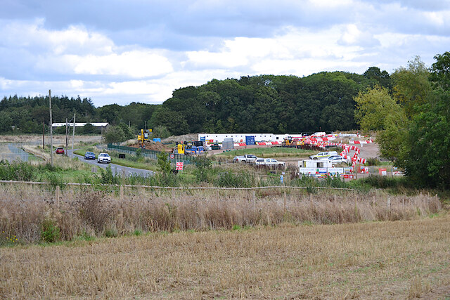
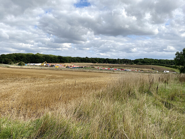
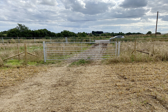
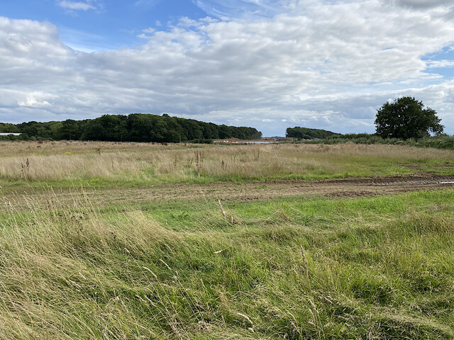
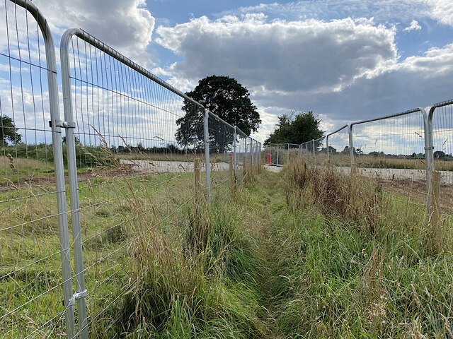
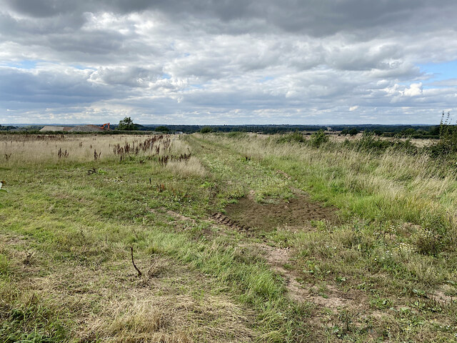
South Cubbington Wood is a charming woodland area located in Warwickshire, England. Spread over an impressive 200 acres, this forest is a haven for nature enthusiasts and outdoor lovers. The wood is situated approximately three miles west of the town of Leamington Spa and is easily accessible by foot or bicycle.

The wood is predominantly made up of broadleaf trees, including oak, ash, and beech, creating a diverse and visually appealing landscape. The dense foliage of the trees provides a cool and sheltered environment, making it an ideal place for a leisurely walk or a picnic on a warm summer's day.

Additionally, South Cubbington Wood is home to a variety of wildlife. Visitors may spot several species of birds, such as woodpeckers, owls, and thrushes, as well as small mammals like squirrels and rabbits. The wood also boasts a rich insect population, including butterflies and dragonflies.

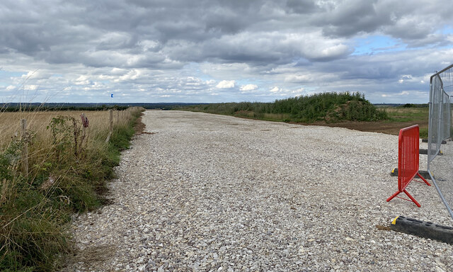
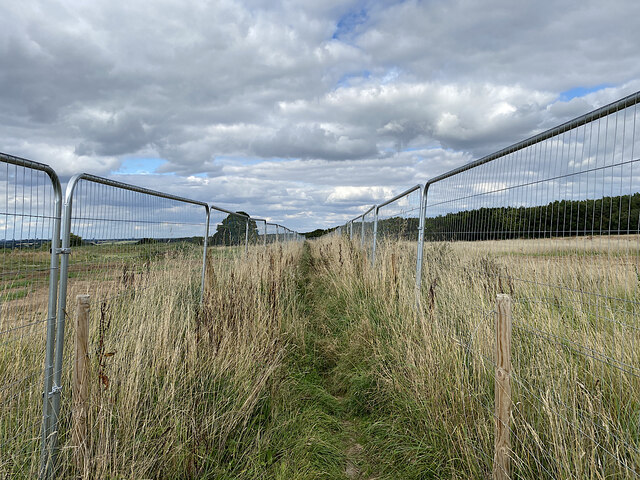
The wood is crisscrossed with a network of well-maintained pathways, allowing visitors to explore the area at their own pace. There are also several designated picnic areas and benches for visitors to rest and admire the surroundings. Interpretative signs are placed along the trails, providing information about the flora, fauna, and history of the wood.

South Cubbington Wood offers a peaceful and tranquil escape from the hustle and bustle of nearby urban areas. Its natural beauty and diverse wildlife make it a popular destination for both locals and tourists seeking a connection with nature.

If you have any feedback on the listing, please let us know in the comments section below.

South Cubbington Wood Images

Images are sourced within 2km of 52.314496/-1.4855664 or Grid Reference SP3568. Thanks to Geograph Open Source API. All images are credited.

HS2 in the Leam Valley, June 2021 (1) The pink smudge on the distant hillside, half left, is a sign of the enabling works – formation of a cutting – south of South Cubbington Wood. HS2 will run across the Leam valley, hugging the land, through the field second from the camera. The view – to the left of <a href="https://www.geograph.org.uk/photo/6902795">SP3665 : HS2 in the Leam Valley, June 2021 (2)</a> – is roughly north from Welsh Road southeast of Offchurch.
HS2 in the Leam Valley, June 2021 (1)
The pink smudge on the distant hillside, half left, is a sign of the enabling works – formation of a cutting – south of South Cubbington Wood. HS2 will run across the Leam valley, hugging the land, through the field second from the camera. The view – to the left of SP3665 : HS2 in the Leam Valley, June 2021 (2) – is roughly north from Welsh Road southeast of Offchurch.
HS2 enabling works near Cubbington, September 2021 (1) This is a foreshortened view of the contractor's compound beside the B4453 Rugby Road northeast of Cubbington village. The diverted road will cross HS2 by an overbridge; the railway will run across the middle of the photo. In the background, centre, is South Cubbington Wood. <span class="nowrap"><a title="https://assets.publishing.service.gov.uk/government/uploads/system/uploads/attachment_data/file/532882/C223-CSI-CV-DPP-030-000004-FPD.pdf" rel="nofollow ugc noopener" href="https://assets.publishing.service.gov.uk/government/uploads/system/uploads/attachment_data/file/532882/C223-CSI-CV-DPP-030-000004-FPD.pdf">Link</a><img style="margin-left:2px;" alt="External link" title="External link - shift click to open in new window" src="https://s1.geograph.org.uk/img/external.png" width="10" height="10"/></span>
HS2 enabling works near Cubbington, September 2021 (1)
This is a foreshortened view of the contractor's compound beside the B4453 Rugby Road northeast of Cubbington village. The diverted road will cross HS2 by an overbridge; the railway will run across the middle of the photo. In the background, centre, is South Cubbington Wood. LinkExternal link
HS2 enabling works near Cubbington, September 2021 (2) A wide view of the contractor's compound by the B4453 Rugby Road and work in progress. The railway will run in front of South Cubbington Wood, centre. <span class="nowrap"><a title="https://assets.publishing.service.gov.uk/government/uploads/system/uploads/attachment_data/file/532882/C223-CSI-CV-DPP-030-000004-FPD.pdf" rel="nofollow ugc noopener" href="https://assets.publishing.service.gov.uk/government/uploads/system/uploads/attachment_data/file/532882/C223-CSI-CV-DPP-030-000004-FPD.pdf">Link</a><img style="margin-left:2px;" alt="External link" title="External link - shift click to open in new window" src="https://s1.geograph.org.uk/img/external.png" width="10" height="10"/></span>
HS2 enabling works near Cubbington, September 2021 (2)
A wide view of the contractor's compound by the B4453 Rugby Road and work in progress. The railway will run in front of South Cubbington Wood, centre. LinkExternal link
HS2 enabling works near Cubbington, September 2021 (3) A foreshortened view of work in progress. It's not easy to interpret it in relation to the plans <span class="nowrap"><a title="https://assets.publishing.service.gov.uk/government/uploads/system/uploads/attachment_data/file/532882/C223-CSI-CV-DPP-030-000004-FPD.pdf" rel="nofollow ugc noopener" href="https://assets.publishing.service.gov.uk/government/uploads/system/uploads/attachment_data/file/532882/C223-CSI-CV-DPP-030-000004-FPD.pdf">Link</a><img style="margin-left:2px;" alt="External link" title="External link - shift click to open in new window" src="https://s1.geograph.org.uk/img/external.png" width="10" height="10"/></span> It's safe to say that a great deal of earth is being moved around. The gap in the woodland is the swathe cut in the winter, severing the south corner of South Cubbington Wood: <a href="https://www.geograph.org.uk/photo/6765887">SP3568 : HS2 enabling works near Cubbington, February 2021 (8)</a>. The railway will have climbed up to here after crossing the Leam valley: see <a href="https://www.geograph.org.uk/photo/6869545">SP3666 : HS2 enabling works near Offchurch, April 2021 (5)</a>.
HS2 enabling works near Cubbington, September 2021 (3)
A foreshortened view of work in progress. It's not easy to interpret it in relation to the plans LinkExternal link It's safe to say that a great deal of earth is being moved around. The gap in the woodland is the swathe cut in the winter, severing the south corner of South Cubbington Wood: SP3568 : HS2 enabling works near Cubbington, February 2021 (8). The railway will have climbed up to here after crossing the Leam valley: see SP3666 : HS2 enabling works near Offchurch, April 2021 (5).
HS2 enabling works near Cubbington, September 2021 (4) In this cropped image two large earthmoving machines are working in the swathe cut through the southern corner of South Cubbington Wood: at about the 135+000 mark on the plans <span class="nowrap"><a title="https://assets.publishing.service.gov.uk/government/uploads/system/uploads/attachment_data/file/532882/C223-CSI-CV-DPP-030-000004-FPD.pdf" rel="nofollow ugc noopener" href="https://assets.publishing.service.gov.uk/government/uploads/system/uploads/attachment_data/file/532882/C223-CSI-CV-DPP-030-000004-FPD.pdf">Link</a><img style="margin-left:2px;" alt="External link" title="External link - shift click to open in new window" src="https://s1.geograph.org.uk/img/external.png" width="10" height="10"/></span> . The railway will be in a cutting, reportedly, having climbed up from the River Leam crossing in SP3567: see <a href="https://www.geograph.org.uk/photo/6764646">SP3568 : HS2 enabling works near Cubbington, February 2021 (5)</a>. The line will head for the fenced-off ground in front of the camera. Locations are estimated.
HS2 enabling works near Cubbington, September 2021 (4)
In this cropped image two large earthmoving machines are working in the swathe cut through the southern corner of South Cubbington Wood: at about the 135+000 mark on the plans LinkExternal link . The railway will be in a cutting, reportedly, having climbed up from the River Leam crossing in SP3567: see SP3568 : HS2 enabling works near Cubbington, February 2021 (5). The line will head for the fenced-off ground in front of the camera. Locations are estimated.
HS2 enabling works near Cubbington, September 2021 (5) New fences and gates have been erected alongside the B4453 Rugby Road. This is in advance of the road being diverted to cross HS2 by an overbridge yet to be built. The stretch of footpath W130b behind the camera will be closed and will instead follow the road north to its diversion along the south side of North Cubbington Wood. <span class="nowrap"><a title="https://assets.publishing.service.gov.uk/government/uploads/system/uploads/attachment_data/file/532882/C223-CSI-CV-DPP-030-000004-FPD.pdf" rel="nofollow ugc noopener" href="https://assets.publishing.service.gov.uk/government/uploads/system/uploads/attachment_data/file/532882/C223-CSI-CV-DPP-030-000004-FPD.pdf">Link</a><img style="margin-left:2px;" alt="External link" title="External link - shift click to open in new window" src="https://s1.geograph.org.uk/img/external.png" width="10" height="10"/></span>
HS2 enabling works near Cubbington, September 2021 (5)
New fences and gates have been erected alongside the B4453 Rugby Road. This is in advance of the road being diverted to cross HS2 by an overbridge yet to be built. The stretch of footpath W130b behind the camera will be closed and will instead follow the road north to its diversion along the south side of North Cubbington Wood. LinkExternal link
HS2 enabling works near Cubbington, September 2021 (6) This is the line of the haul road parallel to the railway, which will be in a cutting across the land to the right: lots of earth to be moved! The view is northwest from footpath W130b; locations are estimated.
HS2 enabling works near Cubbington, September 2021 (6)
This is the line of the haul road parallel to the railway, which will be in a cutting across the land to the right: lots of earth to be moved! The view is northwest from footpath W130b; locations are estimated.
HS2 enabling works near Cubbington, September 2021 (7) This is farmland left uncultivated prior to the construction of HS2. The line will run somewhere to the left of the camera from the gap cut through South Cubbington Wood, just right of centre <a href="https://www.geograph.org.uk/photo/6976653">SP3568 : HS2 enabling works near Cubbington, September 2021 (4)</a>. The contractor's compound can be seen; the telephone poles mark the line of the B4453 Rugby Road, which will cross HS2 by an overbridge. On the right is the start of North Cubbington Wood.
HS2 enabling works near Cubbington, September 2021 (7)
This is farmland left uncultivated prior to the construction of HS2. The line will run somewhere to the left of the camera from the gap cut through South Cubbington Wood, just right of centre SP3568 : HS2 enabling works near Cubbington, September 2021 (4). The contractor's compound can be seen; the telephone poles mark the line of the B4453 Rugby Road, which will cross HS2 by an overbridge. On the right is the start of North Cubbington Wood.
HS2 enabling works near Cubbington, September 2021 (8) Footpath W130b is confined by fences across the area of forthcoming HS2 construction; at some point it will be closed and diverted. On the left is North Cubbington Wood, which will be untouched by the railway. Locations are estimated.
HS2 enabling works near Cubbington, September 2021 (8)
Footpath W130b is confined by fences across the area of forthcoming HS2 construction; at some point it will be closed and diverted. On the left is North Cubbington Wood, which will be untouched by the railway. Locations are estimated.
HS2 enabling works near Cubbington, September 2021 (9) Looking southwest along footpath W130b, fenced across the area of railway construction. The haul road in <a href="https://www.geograph.org.uk/photo/6981073">SP3469 : HS2 enabling works near Cubbington, September 2021 (6)</a> can be seen. When work starts the footpath will be permanently diverted. Locations are estimated.
HS2 enabling works near Cubbington, September 2021 (9)
Looking southwest along footpath W130b, fenced across the area of railway construction. The haul road in SP3469 : HS2 enabling works near Cubbington, September 2021 (6) can be seen. When work starts the footpath will be permanently diverted. Locations are estimated.
HS2 enabling works near Cubbington, September 2021 (10) This land has been fenced and left uncultivated. Somewhere in the middle distance HS2 will be in a cutting heading somewhat to the right. On the left here a solitary machine is moving earth near the Coventry Road out of Cubbington, which will be diverted to cross the railway by an overbridge. Locations are estimated. Tanner's Barn near here, shown on the 1:25 k map, appears to have been demolished in the past. <span class="nowrap"><a title="https://assets.publishing.service.gov.uk/government/uploads/system/uploads/attachment_data/file/532882/C223-CSI-CV-DPP-030-000004-FPD.pdf" rel="nofollow ugc noopener" href="https://assets.publishing.service.gov.uk/government/uploads/system/uploads/attachment_data/file/532882/C223-CSI-CV-DPP-030-000004-FPD.pdf">Link</a><img style="margin-left:2px;" alt="External link" title="External link - shift click to open in new window" src="https://s1.geograph.org.uk/img/external.png" width="10" height="10"/></span>
HS2 enabling works near Cubbington, September 2021 (10)
This land has been fenced and left uncultivated. Somewhere in the middle distance HS2 will be in a cutting heading somewhat to the right. On the left here a solitary machine is moving earth near the Coventry Road out of Cubbington, which will be diverted to cross the railway by an overbridge. Locations are estimated. Tanner's Barn near here, shown on the 1:25 k map, appears to have been demolished in the past. LinkExternal link
HS2 enabling works near Cubbington, September 2021 (11) The view is south along Coventry Road towards Cubbington: a racetrack. HS2 will come out of the skyline left of centre and cross roughly where the solitary digger is working. Coventry Road will be diverted on to an overbridge, landing somewhere here judging by the fencing, left. Note the tree stump. Locations are estimated
HS2 enabling works near Cubbington, September 2021 (11)
The view is south along Coventry Road towards Cubbington: a racetrack. HS2 will come out of the skyline left of centre and cross roughly where the solitary digger is working. Coventry Road will be diverted on to an overbridge, landing somewhere here judging by the fencing, left. Note the tree stump. Locations are estimated
HS2 enabling works near Cubbington, September 2021 (12) The fencing and land left uncultivated are the clues. HS2 will come through here on its way to Stoneleigh Business Park. The view is from Coventry Road north of the village. Locations are estimated.
HS2 enabling works near Cubbington, September 2021 (12)
The fencing and land left uncultivated are the clues. HS2 will come through here on its way to Stoneleigh Business Park. The view is from Coventry Road north of the village. Locations are estimated.
HS2 enabling works near Cubbington, September 2021 (13) A sign by the Coventry Road approaching the village warns of HS2 site N11 Gate 16. Materials will be brought to site and material will be taken away. A lone digger works atop a pile of earth or stone. The road will be diverted to an overbridge to cross the railway.
HS2 enabling works near Cubbington, September 2021 (13)
A sign by the Coventry Road approaching the village warns of HS2 site N11 Gate 16. Materials will be brought to site and material will be taken away. A lone digger works atop a pile of earth or stone. The road will be diverted to an overbridge to cross the railway.
HS2 enabling works near Cubbington, September 2021 (14) HS2 site N11 Gate 16 is by the Coventry Road north of the village.
HS2 enabling works near Cubbington, September 2021 (14)
HS2 site N11 Gate 16 is by the Coventry Road north of the village.
HS2 enabling works near Cubbington, September 2021 (15) A lone digger works atop a pile of earth and stone at site N11. The Coventry Road will be diverted on to an overbridge to cross the railway. Note the tree stump. Locations are estimated.
HS2 enabling works near Cubbington, September 2021 (15)
A lone digger works atop a pile of earth and stone at site N11. The Coventry Road will be diverted on to an overbridge to cross the railway. Note the tree stump. Locations are estimated.
Bungalows, Cubbington Road, Cubbington, Royal Leamington Spa
Cottages, corner of High View Road and Cubbington Road, Cubbington
Show me another place!

South Cubbington Wood is located at Grid Ref: SP3568 (Lat: 52.314496, Lng: -1.4855664)

Administrative County: Warwickshire

District: Warwick

Police Authority: Warwickshire

What 3 Words

///preheated.twirls.challenge. Near Royal Leamington Spa, Warwickshire

Nearby Locations

South Cubbington Wood

Related Wikis

Cubbington Pear Tree

The Cubbington Pear Tree was a wild pear tree located near Cubbington in Warwickshire, England. Around 250 years old, it was the second largest wild pear...

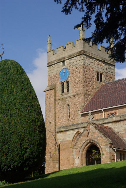
St. Mary's Church, Cubbington

St. Mary's is the parish church of Cubbington, Warwickshire, England. Denominationally it is part of the Church of England. The original church building...

Cubbington

Cubbington is a village and civil parish with a population of 3,929, adjoining the north-eastern outskirts of Leamington Spa, Warwickshire, England, approximately...

Weston under Wetherley

Weston under Wetherley, often known by locals as just Weston, is a small village and civil parish in Warwickshire, England. It is on the B4453, 4 miles...

A445 road

The A445 road is a road in Warwickshire, England. It runs between the town of Warwick and the A45, also passing through the north of Leamington Spa. The...

Eden Court, Leamington Spa

Eden Court is a high-rise residential building belonging to Warwick District Council located in Lillington, Leamington Spa, England. Construction on the...

Hunningham

Hunningham is a small village and civil parish in Warwickshire, England. It is 3 miles to the north-east of Leamington Spa, within the Radford Semele ward...

Offchurch Bury

Offchurch Bury is a manor house one mile north-west of the centre of the village of Offchurch, Warwickshire, England. It is supposed to represent the...

Nearby Amenities

Located within 500m of 52.314496,-1.4855664
Crossing
Lat/Long: 52.3139862/-1.4874855
Crossing
Lat/Long: 52.3111149/-1.4859437
Direction: both
Maxspeed: 50 mph
Traffic Sign: maxspeed
Lat/Long: 52.3170773/-1.4896499
The data included in this document is from www.openstreetmap.org. The data is made available under ODbL.

Have you been to South Cubbington Wood?

Leave your review of South Cubbington Wood below (or comments, questions and feedback).