Chalford Oaks

Wood, Forest in Oxfordshire West Oxfordshire

England

Chalford Oaks

Heythrop Manor Garden View from the Manor House at Heythrop Park.
Heythrop Manor Garden Credit: David Dixon

Chalford Oaks is a picturesque woodland located in Oxfordshire, England. Spread over an area of approximately 100 acres, this enchanting forest is a haven for nature enthusiasts and offers a tranquil escape from the bustling city life.

The forest is primarily composed of oak trees, which give it its name. These majestic trees form a dense canopy, providing shade and shelter to a diverse range of flora and fauna that call this woodland their home. Chalford Oaks is known for its rich biodiversity, with a variety of plants, flowers, and mosses thriving in the damp undergrowth.

Visitors to Chalford Oaks can enjoy a network of well-maintained trails that wind through the forest, allowing for leisurely strolls or more vigorous hikes. The paths meander past ancient trees, babbling brooks, and small clearings, providing ample opportunities for wildlife spotting and birdwatching. It is not uncommon to encounter deer, foxes, and various bird species during a visit to this woodland.

The peaceful ambiance of Chalford Oaks makes it an ideal location for those seeking solace in nature. The forest is a popular spot for meditation, yoga, and photography, with its serene landscapes and picturesque vistas providing endless inspiration. Additionally, the forest is equipped with picnic areas and benches, making it a perfect destination for a family outing or a peaceful picnic.

Chalford Oaks is easily accessible, located just a short drive from the town of Oxford. Whether one desires a peaceful walk amidst nature, a chance to observe wildlife, or simply a break from the hustle and bustle of everyday life, Chalford Oaks offers a serene sanctuary in the heart of Oxfordshire.

If you have any feedback on the listing, please let us know in the comments section below.

Chalford Oaks Images

Images are sourced within 2km of 51.940618/-1.495016 or Grid Reference SP3427. Thanks to Geograph Open Source API. All images are credited.

Heythrop Manor Garden View from the Manor House at Heythrop Park.
Heythrop Manor Garden
View from the Manor House at Heythrop Park.
Heythrop Park Manor House Heythrop Park is a Grade II* listed <span class="nowrap"><a title="https://historicengland.org.uk/listing/the-list/list-entry/1052781?section=official-list-entry" rel="nofollow ugc noopener" href="https://historicengland.org.uk/listing/the-list/list-entry/1052781?section=official-list-entry">Link</a><img style="margin-left:2px;" alt="External link" title="External link - shift click to open in new window" src="https://s1.geograph.org.uk/img/external.png" width="10" height="10"/></span> ) early 18th-century (ca1705) country house set in 400 acres of parkland approximately 1-mile southeast of the village of Heythrop in Oxfordshire. It was designed by the architect Thomas Archer in the Baroque style for Charles Talbot, 1st Duke of Shrewsbury. The original interior was gutted by a fire in 1831; it was restored and partly rebuilt in 1871 by Alfred Waterhouse. 

From 1922 until 1970 Heythrop housed a Jesuit tertiary education college, and later a training establishment. When the Jesuit college moved to London as part of the University in 1970, Heythrop Park was acquired by the National Westminster Bank which converted the house and its precincts into a staff training and conference centre. The house is now the main building of the Heythrop Park Hotel, Golf & Country Club, part of the Warner Leisure Hotels chain.
Heythrop Park Manor House
Heythrop Park is a Grade II* listed LinkExternal link ) early 18th-century (ca1705) country house set in 400 acres of parkland approximately 1-mile southeast of the village of Heythrop in Oxfordshire. It was designed by the architect Thomas Archer in the Baroque style for Charles Talbot, 1st Duke of Shrewsbury. The original interior was gutted by a fire in 1831; it was restored and partly rebuilt in 1871 by Alfred Waterhouse. From 1922 until 1970 Heythrop housed a Jesuit tertiary education college, and later a training establishment. When the Jesuit college moved to London as part of the University in 1970, Heythrop Park was acquired by the National Westminster Bank which converted the house and its precincts into a staff training and conference centre. The house is now the main building of the Heythrop Park Hotel, Golf & Country Club, part of the Warner Leisure Hotels chain.
Manor House at Heythrop Park Heythrop Park is a Grade II* listed <span class="nowrap"><a title="https://historicengland.org.uk/listing/the-list/list-entry/1052781?section=official-list-entry" rel="nofollow ugc noopener" href="https://historicengland.org.uk/listing/the-list/list-entry/1052781?section=official-list-entry">Link</a><img style="margin-left:2px;" alt="External link" title="External link - shift click to open in new window" src="https://s1.geograph.org.uk/img/external.png" width="10" height="10"/></span> ) early 18th-century (ca1705) country house set in 400 acres of parkland approximately 1-mile southeast of the village of Heythrop in Oxfordshire. It was designed by the architect Thomas Archer in the Baroque style for Charles Talbot, 1st Duke of Shrewsbury. The original interior was gutted by a fire in 1831; it was restored and partly rebuilt in 1871 by Alfred Waterhouse. 

From 1922 until 1970 Heythrop housed a Jesuit tertiary education college, and later a training establishment. When the Jesuit college moved to London as part of the University in 1970, Heythrop Park was acquired by the National Westminster Bank which converted the house and its precincts into a staff training and conference centre. The house is now the main building of the Heythrop Park Hotel, Golf & Country Club, part of the Warner Leisure Hotels chain.
Manor House at Heythrop Park
Heythrop Park is a Grade II* listed LinkExternal link ) early 18th-century (ca1705) country house set in 400 acres of parkland approximately 1-mile southeast of the village of Heythrop in Oxfordshire. It was designed by the architect Thomas Archer in the Baroque style for Charles Talbot, 1st Duke of Shrewsbury. The original interior was gutted by a fire in 1831; it was restored and partly rebuilt in 1871 by Alfred Waterhouse. From 1922 until 1970 Heythrop housed a Jesuit tertiary education college, and later a training establishment. When the Jesuit college moved to London as part of the University in 1970, Heythrop Park was acquired by the National Westminster Bank which converted the house and its precincts into a staff training and conference centre. The house is now the main building of the Heythrop Park Hotel, Golf & Country Club, part of the Warner Leisure Hotels chain.
Heythrop Park and Manor House Heythrop Park is a Grade II* listed <span class="nowrap"><a title="https://historicengland.org.uk/listing/the-list/list-entry/1052781?section=official-list-entry" rel="nofollow ugc noopener" href="https://historicengland.org.uk/listing/the-list/list-entry/1052781?section=official-list-entry">Link</a><img style="margin-left:2px;" alt="External link" title="External link - shift click to open in new window" src="https://s1.geograph.org.uk/img/external.png" width="10" height="10"/></span> ) early 18th-century (ca1705) country house set in 400 acres of parkland approximately 1-mile southeast of the village of Heythrop in Oxfordshire. It was designed by the architect Thomas Archer in the Baroque style for Charles Talbot, 1st Duke of Shrewsbury. The original interior was gutted by a fire in 1831; it was restored and partly rebuilt in 1871 by Alfred Waterhouse. 

From 1922 until 1970 Heythrop housed a Jesuit tertiary education college, and later a training establishment. When the Jesuit college moved to London as part of the University in 1970, Heythrop Park was acquired by the National Westminster Bank which converted the house and its precincts into a staff training and conference centre. The house is now the main building of the Heythrop Park Hotel, Golf & Country Club, part of the Warner Leisure Hotels chain.
Heythrop Park and Manor House
Heythrop Park is a Grade II* listed LinkExternal link ) early 18th-century (ca1705) country house set in 400 acres of parkland approximately 1-mile southeast of the village of Heythrop in Oxfordshire. It was designed by the architect Thomas Archer in the Baroque style for Charles Talbot, 1st Duke of Shrewsbury. The original interior was gutted by a fire in 1831; it was restored and partly rebuilt in 1871 by Alfred Waterhouse. From 1922 until 1970 Heythrop housed a Jesuit tertiary education college, and later a training establishment. When the Jesuit college moved to London as part of the University in 1970, Heythrop Park was acquired by the National Westminster Bank which converted the house and its precincts into a staff training and conference centre. The house is now the main building of the Heythrop Park Hotel, Golf & Country Club, part of the Warner Leisure Hotels chain.
Heythrop Park Manor House North Wing Heythrop Park is a Grade II* listed <span class="nowrap"><a title="https://historicengland.org.uk/listing/the-list/list-entry/1052781?section=official-list-entry" rel="nofollow ugc noopener" href="https://historicengland.org.uk/listing/the-list/list-entry/1052781?section=official-list-entry">Link</a><img style="margin-left:2px;" alt="External link" title="External link - shift click to open in new window" src="https://s1.geograph.org.uk/img/external.png" width="10" height="10"/></span> ) early 18th-century (ca1705) country house set in 400 acres of parkland approximately 1-mile southeast of the village of Heythrop in Oxfordshire. It was designed by the architect Thomas Archer in the Baroque style for Charles Talbot, 1st Duke of Shrewsbury. The original interior was gutted by a fire in 1831; it was restored and partly rebuilt in 1871 by Alfred Waterhouse. 

From 1922 until 1970 Heythrop housed a Jesuit tertiary education college, and later a training establishment. When the Jesuit college moved to London as part of the University in 1970, Heythrop Park was acquired by the National Westminster Bank which converted the house and its precincts into a staff training and conference centre. The house is now the main building of the Heythrop Park Hotel, Golf & Country Club, part of the Warner Leisure Hotels chain.
Heythrop Park Manor House North Wing
Heythrop Park is a Grade II* listed LinkExternal link ) early 18th-century (ca1705) country house set in 400 acres of parkland approximately 1-mile southeast of the village of Heythrop in Oxfordshire. It was designed by the architect Thomas Archer in the Baroque style for Charles Talbot, 1st Duke of Shrewsbury. The original interior was gutted by a fire in 1831; it was restored and partly rebuilt in 1871 by Alfred Waterhouse. From 1922 until 1970 Heythrop housed a Jesuit tertiary education college, and later a training establishment. When the Jesuit college moved to London as part of the University in 1970, Heythrop Park was acquired by the National Westminster Bank which converted the house and its precincts into a staff training and conference centre. The house is now the main building of the Heythrop Park Hotel, Golf & Country Club, part of the Warner Leisure Hotels chain.
Buggies at Heythrop Park Golf Course
Heythrop Park Hotel and Country Club Heythrop Park is a Grade II* listed <span class="nowrap"><a title="https://historicengland.org.uk/listing/the-list/list-entry/1052781?section=official-list-entry" rel="nofollow ugc noopener" href="https://historicengland.org.uk/listing/the-list/list-entry/1052781?section=official-list-entry">Link</a><img style="margin-left:2px;" alt="External link" title="External link - shift click to open in new window" src="https://s1.geograph.org.uk/img/external.png" width="10" height="10"/></span> ) early 18th-century (ca1705) country house set in 400 acres of parkland approximately 1-mile southeast of the village of Heythrop in Oxfordshire. It was designed by the architect Thomas Archer in the Baroque style for Charles Talbot, 1st Duke of Shrewsbury. The original interior was gutted by a fire in 1831; it was restored and partly rebuilt in 1871 by Alfred Waterhouse. 

From 1922 until 1970 Heythrop housed a Jesuit tertiary education college, and later a training establishment. When the Jesuit college moved to London as part of the University in 1970, Heythrop Park was acquired by the National Westminster Bank which converted the house and its precincts into a staff training and conference centre. The house is now the main building of the Heythrop Park Hotel, Golf & Country Club, part of the Warner Leisure Hotels chain.
Heythrop Park Hotel and Country Club
Heythrop Park is a Grade II* listed LinkExternal link ) early 18th-century (ca1705) country house set in 400 acres of parkland approximately 1-mile southeast of the village of Heythrop in Oxfordshire. It was designed by the architect Thomas Archer in the Baroque style for Charles Talbot, 1st Duke of Shrewsbury. The original interior was gutted by a fire in 1831; it was restored and partly rebuilt in 1871 by Alfred Waterhouse. From 1922 until 1970 Heythrop housed a Jesuit tertiary education college, and later a training establishment. When the Jesuit college moved to London as part of the University in 1970, Heythrop Park was acquired by the National Westminster Bank which converted the house and its precincts into a staff training and conference centre. The house is now the main building of the Heythrop Park Hotel, Golf & Country Club, part of the Warner Leisure Hotels chain.
Heythrop Park Hotel Heythrop Park Hotel is a Warner Leisure Hotel
Heythrop Park Hotel
Heythrop Park Hotel is a Warner Leisure Hotel
Layby on the A44 near Chalford Oaks The A44 is a major road in the United Kingdom that runs for 155 miles from Oxford in southern England to Aberystwyth in west Wales.
<span class="nowrap"><a title="http://www.sabre-roads.org.uk/wiki/index.php?title=A44" rel="nofollow ugc noopener" href="http://www.sabre-roads.org.uk/wiki/index.php?title=A44">Link</a><img style="margin-left:2px;" alt="External link" title="External link - shift click to open in new window" src="https://s1.geograph.org.uk/img/external.png" width="10" height="10"/></span>  SABRE
<span class="nowrap"><a title="https://en.wikipedia.org/wiki/A44_road" rel="nofollow ugc noopener" href="https://en.wikipedia.org/wiki/A44_road">Link</a><img style="margin-left:2px;" alt="External link" title="External link - shift click to open in new window" src="https://s1.geograph.org.uk/img/external.png" width="10" height="10"/></span>  Wikipedia
Layby on the A44 near Chalford Oaks
The A44 is a major road in the United Kingdom that runs for 155 miles from Oxford in southern England to Aberystwyth in west Wales. LinkExternal link SABRE LinkExternal link Wikipedia
Layby on the A44 near Old Chalford The A44 is a major road in the United Kingdom that runs for 155 miles from Oxford in southern England to Aberystwyth in west Wales.
<span class="nowrap"><a title="http://www.sabre-roads.org.uk/wiki/index.php?title=A44" rel="nofollow ugc noopener" href="http://www.sabre-roads.org.uk/wiki/index.php?title=A44">Link</a><img style="margin-left:2px;" alt="External link" title="External link - shift click to open in new window" src="https://s1.geograph.org.uk/img/external.png" width="10" height="10"/></span>  SABRE
<span class="nowrap"><a title="https://en.wikipedia.org/wiki/A44_road" rel="nofollow ugc noopener" href="https://en.wikipedia.org/wiki/A44_road">Link</a><img style="margin-left:2px;" alt="External link" title="External link - shift click to open in new window" src="https://s1.geograph.org.uk/img/external.png" width="10" height="10"/></span>  Wikipedia
Layby on the A44 near Old Chalford
The A44 is a major road in the United Kingdom that runs for 155 miles from Oxford in southern England to Aberystwyth in west Wales. LinkExternal link SABRE LinkExternal link Wikipedia
HGV on the A44 near Chalford Park Grenhaul's Scania S500 (S500 GHL) travelling north on the A44 between Enstone and Chipping Norton
HGV on the A44 near Chalford Park
Grenhaul's Scania S500 (S500 GHL) travelling north on the A44 between Enstone and Chipping Norton
A44 near Enstone The A44 is a major road in the United Kingdom that runs for 155 miles from Oxford in southern England to Aberystwyth in west Wales.
<span class="nowrap"><a title="http://www.sabre-roads.org.uk/wiki/index.php?title=A44" rel="nofollow ugc noopener" href="http://www.sabre-roads.org.uk/wiki/index.php?title=A44">Link</a><img style="margin-left:2px;" alt="External link" title="External link - shift click to open in new window" src="https://s1.geograph.org.uk/img/external.png" width="10" height="10"/></span>  SABRE
<span class="nowrap"><a title="https://en.wikipedia.org/wiki/A44_road" rel="nofollow ugc noopener" href="https://en.wikipedia.org/wiki/A44_road">Link</a><img style="margin-left:2px;" alt="External link" title="External link - shift click to open in new window" src="https://s1.geograph.org.uk/img/external.png" width="10" height="10"/></span>  Wikipedia
A44 near Enstone
The A44 is a major road in the United Kingdom that runs for 155 miles from Oxford in southern England to Aberystwyth in west Wales. LinkExternal link SABRE LinkExternal link Wikipedia
Bus Stop on the A44 near Enstone The A44 is a major road in the United Kingdom that runs for 155 miles from Oxford in southern England to Aberystwyth in west Wales.
<span class="nowrap"><a title="http://www.sabre-roads.org.uk/wiki/index.php?title=A44" rel="nofollow ugc noopener" href="http://www.sabre-roads.org.uk/wiki/index.php?title=A44">Link</a><img style="margin-left:2px;" alt="External link" title="External link - shift click to open in new window" src="https://s1.geograph.org.uk/img/external.png" width="10" height="10"/></span>  SABRE
<span class="nowrap"><a title="https://en.wikipedia.org/wiki/A44_road" rel="nofollow ugc noopener" href="https://en.wikipedia.org/wiki/A44_road">Link</a><img style="margin-left:2px;" alt="External link" title="External link - shift click to open in new window" src="https://s1.geograph.org.uk/img/external.png" width="10" height="10"/></span>  Wikipedia
Bus Stop on the A44 near Enstone
The A44 is a major road in the United Kingdom that runs for 155 miles from Oxford in southern England to Aberystwyth in west Wales. LinkExternal link SABRE LinkExternal link Wikipedia
A44, London Road The A44 is a major road in the United Kingdom that runs for 155 miles from Oxford in southern England to Aberystwyth in west Wales.
<span class="nowrap"><a title="http://www.sabre-roads.org.uk/wiki/index.php?title=A44" rel="nofollow ugc noopener" href="http://www.sabre-roads.org.uk/wiki/index.php?title=A44">Link</a><img style="margin-left:2px;" alt="External link" title="External link - shift click to open in new window" src="https://s1.geograph.org.uk/img/external.png" width="10" height="10"/></span>  SABRE
<span class="nowrap"><a title="https://en.wikipedia.org/wiki/A44_road" rel="nofollow ugc noopener" href="https://en.wikipedia.org/wiki/A44_road">Link</a><img style="margin-left:2px;" alt="External link" title="External link - shift click to open in new window" src="https://s1.geograph.org.uk/img/external.png" width="10" height="10"/></span>  Wikipedia
A44, London Road
The A44 is a major road in the United Kingdom that runs for 155 miles from Oxford in southern England to Aberystwyth in west Wales. LinkExternal link SABRE LinkExternal link Wikipedia
Scania P410 on the A44 near Southcombe The A44 is a major road in the United Kingdom that runs for 155 miles from Oxford in southern England to Aberystwyth in west Wales.
<span class="nowrap"><a title="http://www.sabre-roads.org.uk/wiki/index.php?title=A44" rel="nofollow ugc noopener" href="http://www.sabre-roads.org.uk/wiki/index.php?title=A44">Link</a><img style="margin-left:2px;" alt="External link" title="External link - shift click to open in new window" src="https://s1.geograph.org.uk/img/external.png" width="10" height="10"/></span>  SABRE
<span class="nowrap"><a title="https://en.wikipedia.org/wiki/A44_road" rel="nofollow ugc noopener" href="https://en.wikipedia.org/wiki/A44_road">Link</a><img style="margin-left:2px;" alt="External link" title="External link - shift click to open in new window" src="https://s1.geograph.org.uk/img/external.png" width="10" height="10"/></span>  Wikipedia
Scania P410 on the A44 near Southcombe
The A44 is a major road in the United Kingdom that runs for 155 miles from Oxford in southern England to Aberystwyth in west Wales. LinkExternal link SABRE LinkExternal link Wikipedia
A44 near Southcombe The A44 is a major road in the United Kingdom that runs for 155 miles from Oxford in southern England to Aberystwyth in west Wales.
<span class="nowrap"><a title="http://www.sabre-roads.org.uk/wiki/index.php?title=A44" rel="nofollow ugc noopener" href="http://www.sabre-roads.org.uk/wiki/index.php?title=A44">Link</a><img style="margin-left:2px;" alt="External link" title="External link - shift click to open in new window" src="https://s1.geograph.org.uk/img/external.png" width="10" height="10"/></span>  SABRE
<span class="nowrap"><a title="https://en.wikipedia.org/wiki/A44_road" rel="nofollow ugc noopener" href="https://en.wikipedia.org/wiki/A44_road">Link</a><img style="margin-left:2px;" alt="External link" title="External link - shift click to open in new window" src="https://s1.geograph.org.uk/img/external.png" width="10" height="10"/></span>  Wikipedia
A44 near Southcombe
The A44 is a major road in the United Kingdom that runs for 155 miles from Oxford in southern England to Aberystwyth in west Wales. LinkExternal link SABRE LinkExternal link Wikipedia
Shakespeare's Way Shakespeare's Way by the River Glyme heading to Old Chalford Farm
Shakespeare's Way
Shakespeare's Way by the River Glyme heading to Old Chalford Farm
Shakespeare's Way Shakespeare's Way heading through Old Chalford Farm
Shakespeare's Way
Shakespeare's Way heading through Old Chalford Farm
Show me another place!

Chalford Oaks is located at Grid Ref: SP3427 (Lat: 51.940618, Lng: -1.495016)

Administrative County: Oxfordshire

District: West Oxfordshire

Police Authority: Thames Valley

What 3 Words

///entrusted.lime.frost. Near Chipping Norton, Oxfordshire

Nearby Locations

Ovens Gorse Chalford Oaks

Related Wikis

Heythrop

Heythrop is a village and civil parish just over 2 miles (3 km) east of Chipping Norton, Oxfordshire. The parish includes the hamlet of Dunthrop. The 2001...

Old Chalford

Old Chalford is a hamlet in Enstone civil parish, about 2 miles (3 km) east of Chipping Norton, Oxfordshire. Old Chalford is on the River Glyme, which...

Glyme Valley

Glyme Valley is a 28.9-hectare (71-acre) biological Site of Special Scientific Interest east of Chipping Norton in Oxfordshire. An area of 3 hectares...
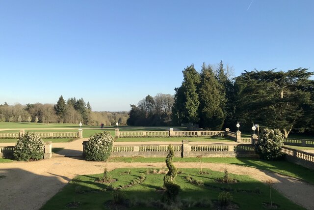
Heythrop Park

Heythrop Park is a Grade II* listed early 18th-century country house 1 mile (1.6 km) southeast of Heythrop in Oxfordshire. It was designed by the architect...

Nearby Amenities

Located within 500m of 51.940618,-1.495016
Power: pole
Lat/Long: 51.9381172/-1.5006316
Power: pole
Lat/Long: 51.9380676/-1.5007174
Power: pole
Lat/Long: 51.9375053/-1.4993066
Power: pole
Lat/Long: 51.9369464/-1.4979279
Power: pole
Lat/Long: 51.936404/-1.4965975
Power: pole
Lat/Long: 51.9375682/-1.4992261
Power: pole
Lat/Long: 51.9370291/-1.497885
Power: pole
Lat/Long: 51.9364767/-1.496501
Power: pole
Lat/Long: 51.944449/-1.4971933
Power: pole
Lat/Long: 51.9437189/-1.4983309
Power: pole
Lat/Long: 51.9424366/-1.5003028
Power: pole
Lat/Long: 51.94124/-1.5021451
Power: pole
Lat/Long: 51.9439009/-1.4903218
Power: pole
Lat/Long: 51.943356/-1.4896472
Power: pole
Lat/Long: 51.9427994/-1.4889552
Power: pole
Lat/Long: 51.9420304/-1.4886702
Power: pole
Lat/Long: 51.9412432/-1.4883756
The data included in this document is from www.openstreetmap.org. The data is made available under ODbL.

Have you been to Chalford Oaks?

Leave your review of Chalford Oaks below (or comments, questions and feedback).