Boghall Plantation

Wood, Forest in Durham

England

Boghall Plantation

Sedgefield, Spring Lane According to the OS benchmark database this gap has been a field entrance with stone gateposts. One gatepost had a benchmark. There are no gateposts in the location today.
Sedgefield, Spring Lane Credit: Mel Towler

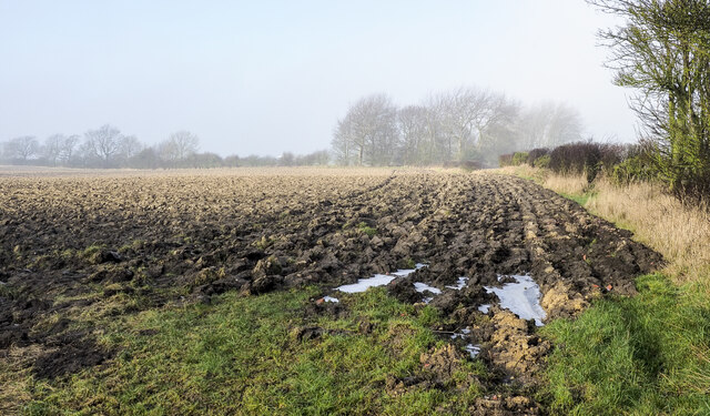
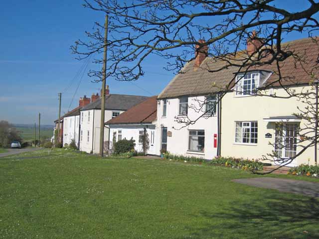
Boghall Plantation is a picturesque woodland located in Durham, England. Situated near the village of Wood, this expansive forest covers approximately 200 acres of land and is a popular destination for nature enthusiasts and outdoor adventurers alike.

The plantation is characterized by its diverse range of tree species, including oak, beech, and birch, which create a stunning and vibrant canopy overhead. The forest floor is covered with a lush carpet of ferns, moss, and wildflowers, providing a rich habitat for various flora and fauna.

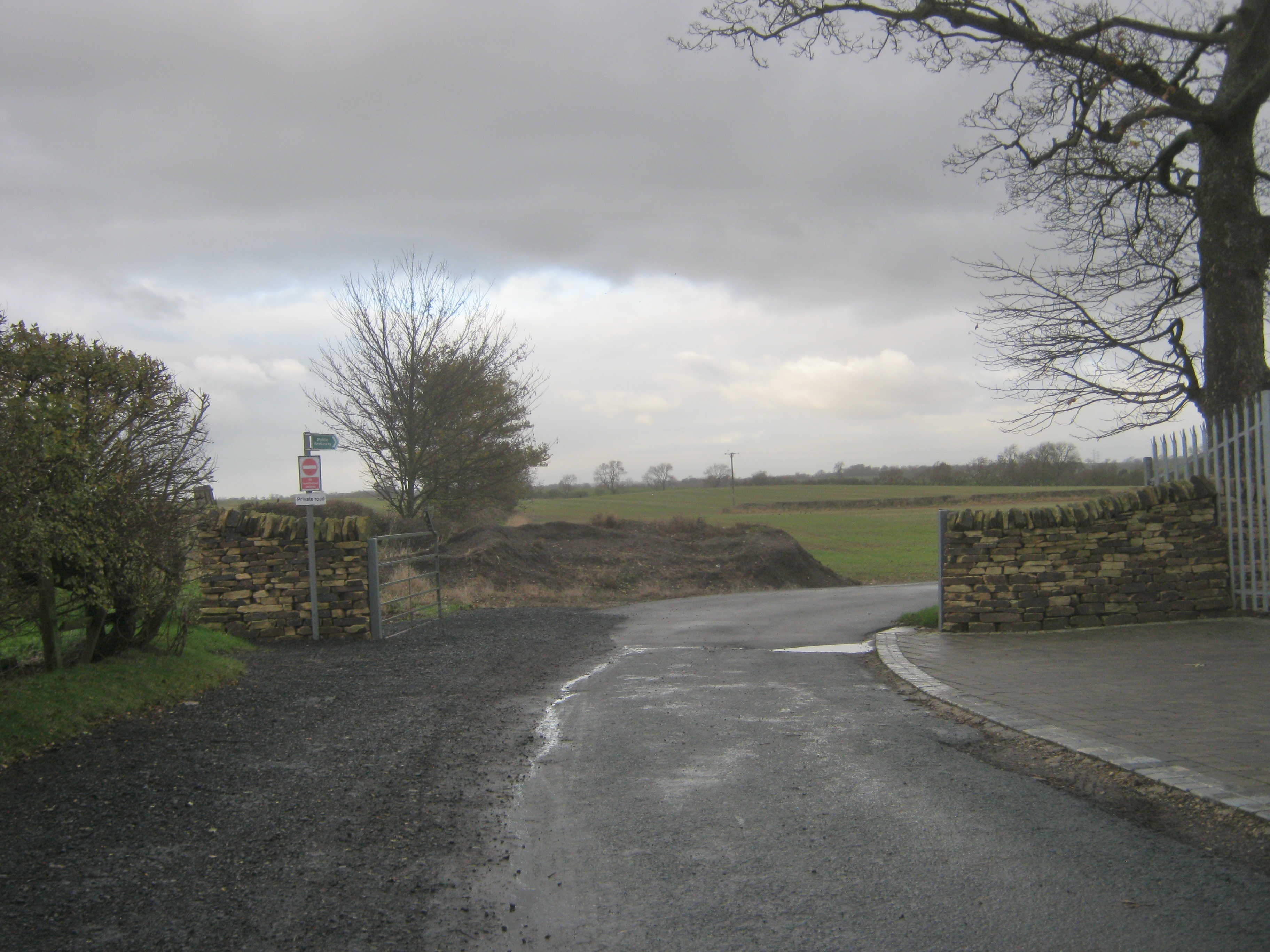
Visitors to Boghall Plantation can enjoy a network of well-maintained trails that wind through the forest, offering opportunities for walking, hiking, and cycling. These trails cater to all levels of fitness and provide access to some of the most scenic spots within the woodland.

Nature lovers will appreciate the abundance of wildlife that call Boghall Plantation home. From squirrels and rabbits to a variety of bird species, there is always something to discover and observe within the forest. The peaceful ambiance of the plantation makes it an ideal location for birdwatching and wildlife photography.

In addition to its natural beauty, Boghall Plantation also has historical significance. The site was once part of a larger estate and has remnants of old stone walls and enclosures that date back several centuries. These historical features add an intriguing element to the overall experience of exploring the woodland.

Overall, Boghall Plantation in Durham is a captivating destination that offers a unique combination of natural beauty, recreational opportunities, and historical significance. Whether visiting for a peaceful walk, a family picnic, or simply to immerse oneself in the tranquility of nature, this woodland is sure to leave a lasting impression on all who venture within its bounds.

If you have any feedback on the listing, please let us know in the comments section below.

Boghall Plantation Images

Images are sourced within 2km of 54.62524/-1.4651885 or Grid Reference NZ3425. Thanks to Geograph Open Source API. All images are credited.

Sedgefield, Spring Lane According to the OS benchmark database this gap has been a field entrance with stone gateposts. One gatepost had a benchmark. There are no gateposts in the location today.
Sedgefield, Spring Lane
According to the OS benchmark database this gap has been a field entrance with stone gateposts. One gatepost had a benchmark. There are no gateposts in the location today.
Trailer in field corner Despite appearing to be in reasonable condition the vehicle has probably been abandoned - its wooden bed has virtually decomposed. It's in a field corner west of the farm at Mordon Moor and is close to the route of a public footpath.
Trailer in field corner
Despite appearing to be in reasonable condition the vehicle has probably been abandoned - its wooden bed has virtually decomposed. It's in a field corner west of the farm at Mordon Moor and is close to the route of a public footpath.
Route of public footpath across large field The path enters the field via a stile to the left of the distant farmhouse and makes its way in an almost direct line towards the camera location. There's not a trace of the path on the ground despite the requirement that reinstatement be made after any field operations have been carried out. The path route passes the corner of the trees in the image.
Route of public footpath across large field
The path enters the field via a stile to the left of the distant farmhouse and makes its way in an almost direct line towards the camera location. There's not a trace of the path on the ground despite the requirement that reinstatement be made after any field operations have been carried out. The path route passes the corner of the trees in the image.
Fence and shed alongside Peter's Lane Peter's Lane is a bridleway running away from the village at Mordon through two farms. The start of it past Village Farm is impassable on foot and so impossible for a horse. It was accessed via Harpington Hill, the way through and past the buildings there being a torment of mud (fortunately frozen), rubble and abandoned farm equipment. Here, at the edge of grid square NZ3426 heading away from the farms the going was simply awkward due to frozen ground pitted by animals' hooves.
Fence and shed alongside Peter's Lane
Peter's Lane is a bridleway running away from the village at Mordon through two farms. The start of it past Village Farm is impassable on foot and so impossible for a horse. It was accessed via Harpington Hill, the way through and past the buildings there being a torment of mud (fortunately frozen), rubble and abandoned farm equipment. Here, at the edge of grid square NZ3426 heading away from the farms the going was simply awkward due to frozen ground pitted by animals' hooves.
Bridleway of Peter's Lane At last a waymark, there's one on a post left of the gate!
Peter's Lane is a bridleway running away from the village at Mordon through two farms. The start of it past Village Farm is impassable on foot and so impossible for a horse. It was accessed via Harpington Hill, the way through and past the buildings there being a torment of mud, rubble and abandoned farm equipment. Here, beyond the farm the waymark confirms the route and the only problem on the day was frozen mud.
Bridleway of Peter's Lane
At last a waymark, there's one on a post left of the gate! Peter's Lane is a bridleway running away from the village at Mordon through two farms. The start of it past Village Farm is impassable on foot and so impossible for a horse. It was accessed via Harpington Hill, the way through and past the buildings there being a torment of mud, rubble and abandoned farm equipment. Here, beyond the farm the waymark confirms the route and the only problem on the day was frozen mud.
Deeply furrowed field A ploughed field with its furrows frozen into place, with thin mistiness in the distance.
Deeply furrowed field
A ploughed field with its furrows frozen into place, with thin mistiness in the distance.
Ice along farm road Ice lids for pools, many with the water gone from beneath them with the residues of snow or frost along the farm road north from the eastern end of Mordon village.
Ice along farm road
Ice lids for pools, many with the water gone from beneath them with the residues of snow or frost along the farm road north from the eastern end of Mordon village.
Minor road entering Mordon from the east As the road signs announces, Mordon lies ahead. The blue and yellow style of the sign is one found frequently in County Durham; this one incorporates the village name into the speed limit sign as is often the case.
Minor road entering Mordon from the east
As the road signs announces, Mordon lies ahead. The blue and yellow style of the sign is one found frequently in County Durham; this one incorporates the village name into the speed limit sign as is often the case.
Peter's Lane... the route of a public bridleway! The walker is on the route known as Peter's Lane. The start of it is alongside farm buildings at the eastern end of the village of Mordon - it's entirely inaccessible there, on foot, never mind with a horse!
Access to it had to be gained by the road approaching the farm at Harpington Hill then, once on the lane, by a passage among farm buildings, mud, rubble and abandoned farm equipment.
Beyond all that is the tract of ground ahead in the image which was made passable on the day only as the mud, ruts and pools were largely frozen!
Peter's Lane... the route of a public bridleway!
The walker is on the route known as Peter's Lane. The start of it is alongside farm buildings at the eastern end of the village of Mordon - it's entirely inaccessible there, on foot, never mind with a horse! Access to it had to be gained by the road approaching the farm at Harpington Hill then, once on the lane, by a passage among farm buildings, mud, rubble and abandoned farm equipment. Beyond all that is the tract of ground ahead in the image which was made passable on the day only as the mud, ruts and pools were largely frozen!
Weighbridge at North Farm, Foxton
Victorian era postbox VR embossed postbox, no longer in use, built into the side of a farm building at Foxton.
Victorian era postbox
VR embossed postbox, no longer in use, built into the side of a farm building at Foxton.
Foxton Lane
Foxton Lane
Track to West House
Track to West House
Heley House
Heley House
Spring Lane Minor road serving farms to the south of Sedgefield.
Spring Lane
Minor road serving farms to the south of Sedgefield.
Triangulation Pillar at West House Field Farm
Foxton, near Sedgefield A very remote hamlet consisting of a farm and several barn conversions on a private road between Stillington and Sedgefield.
Foxton, near Sedgefield
A very remote hamlet consisting of a farm and several barn conversions on a private road between Stillington and Sedgefield.
Bungalow at Foxton, near Sedgefield On the private road between Stillington and Sedgefield
Bungalow at Foxton, near Sedgefield
On the private road between Stillington and Sedgefield
Show me another place!

Boghall Plantation is located at Grid Ref: NZ3425 (Lat: 54.62524, Lng: -1.4651885)

Unitary Authority: County Durham

Police Authority: Durham

What 3 Words

///presses.leaky.variances. Near Sedgefield, Co. Durham

Nearby Locations

Boghall Plantation

Related Wikis

Mordon

Mordon is a village and civil parish in County Durham, England. It is situated a few miles to the north-east of Newton Aycliffe. The population recorded...

Foxton, County Durham

Foxton is a small village in County Durham, England. It is situated to the north-west of Stockton-on-Tees, near Stillington. The origin of the place-name...

Sedgefield Racecourse

Sedgefield Racecourse is an English left-handed horse racing course, used for jump racing. It is owned by Arena Racing Company and located close to the...

Shotton, Sedgefield

Shotton is a village in County Durham, in England. It is situated to the north-west of Stockton-on-Tees. == Governance == An electoral ward with the same...

Railway Stell West

Railway Stell West is a Site of Special Scientific Interest in the Sedgefield district of County Durham, England. The site consists of a length of ditch...

Sedgefield

Sedgefield is a market town and civil parish in County Durham, England. It had a population of 5,211 as at the 2011 census. It has the only operating racecourse...

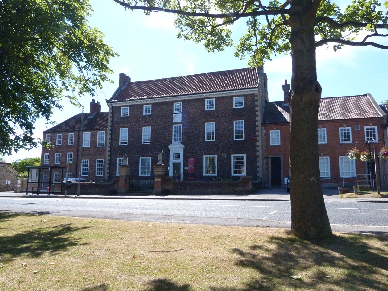
The Manor House, Sedgefield

The Manor House in Sedgefield, County Durham was built in 1707 on high ground in a country setting looking on to St. Edmund's Church as a mansion house...

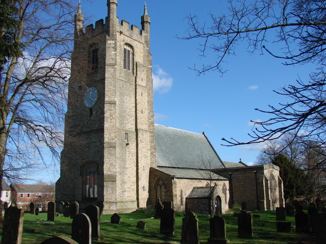
Church of St Edmund, Sedgefield

The Church of St Edmund is a Church of England parish church in Sedgefield, County Durham. The church is a Grade I listed building and dates from the 13th...

Nearby Amenities

Located within 500m of 54.62524,-1.4651885
Bog Hall Farm
Addr City: Stockton-on-Tees
Addr Postcode: TS21 2HE
Place: farm
Source Name: OS_OpenData_StreetView
Source Postcode: CodePoint Open
Lat/Long: 54.6220184/-1.465897
Power: pole
Lat/Long: 54.6209423/-1.463369
Power: pole
Lat/Long: 54.6212994/-1.4653592
Power: pole
Lat/Long: 54.6219532/-1.466652
Power: pole
Lat/Long: 54.6225301/-1.4677839
Power: pole
Lat/Long: 54.6230635/-1.4688367
Power: pole
Lat/Long: 54.6236878/-1.4700638
Power: pole
Lat/Long: 54.6243889/-1.4714491
Power: pole
Lat/Long: 54.6250698/-1.4727688
The data included in this document is from www.openstreetmap.org. The data is made available under ODbL.

Have you been to Boghall Plantation?

Leave your review of Boghall Plantation below (or comments, questions and feedback).