Belmont Wood
Wood, Forest in Yorkshire Harrogate
England
Belmont Wood

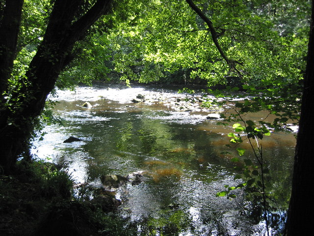
Belmont Wood is a picturesque woodland located in the county of Yorkshire, England. Nestled amidst the stunning landscape of the Yorkshire Dales National Park, this woodland offers a serene and tranquil escape for nature enthusiasts and outdoor adventurers alike.
Covering an area of approximately 500 acres, Belmont Wood is a mix of ancient trees and diverse flora and fauna. The wood is primarily comprised of broadleaf trees such as oak, beech, and ash, creating a rich and vibrant canopy that provides shade and shelter for a variety of wildlife.
The wood is crisscrossed with a network of well-maintained trails, making it easily accessible for visitors to explore. These trails meander through the wood, offering breathtaking views of the surrounding countryside and glimpses of wildlife in their natural habitat. It is not uncommon to spot deer, rabbits, and an array of bird species while wandering through the wood.
Belmont Wood is also home to a number of important historical and archaeological features. There are remnants of ancient settlements and burial grounds that date back to the Iron Age and Roman times, providing a fascinating insight into the area's rich cultural heritage.
Visitors to Belmont Wood can enjoy a range of outdoor activities, including hiking, birdwatching, and photography. The wood is particularly popular during the autumn months when the leaves transform into a stunning palette of reds, oranges, and golds.
Overall, Belmont Wood is a captivating woodland that offers both natural beauty and historical significance. Whether seeking solace in nature or exploring the area's past, this wood is a must-visit destination in Yorkshire.
If you have any feedback on the listing, please let us know in the comments section below.
Belmont Wood Images
Images are sourced within 2km of 54.004634/-1.4801296 or Grid Reference SE3456. Thanks to Geograph Open Source API. All images are credited.


Belmont Wood is located at Grid Ref: SE3456 (Lat: 54.004634, Lng: -1.4801296)
Division: West Riding
Administrative County: North Yorkshire
District: Harrogate
Police Authority: North Yorkshire
What 3 Words
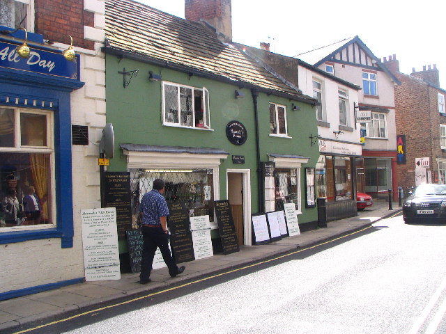
///rabble.prefix.ghost. Near Knaresborough, North Yorkshire
Nearby Locations
Related Wikis

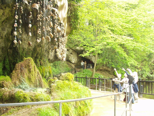
Mother Shipton's Cave
Mother Shipton's Cave (or "Old Mother Shipton's Cave") is at Knaresborough, North Yorkshire, England, near the River Nidd. Nearby is a petrifying well...

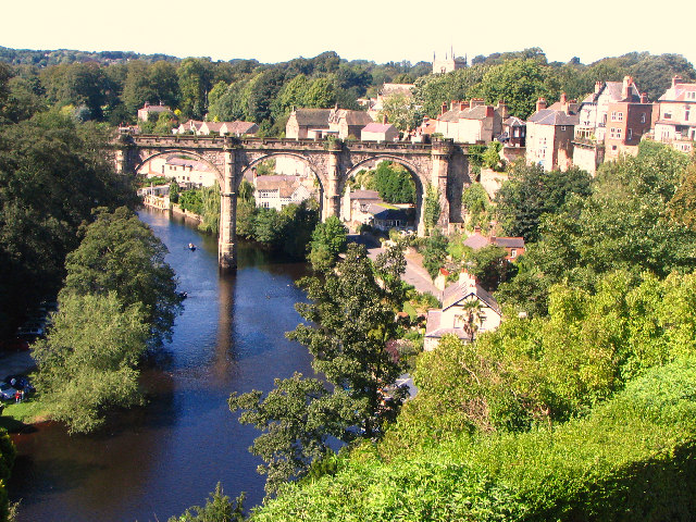
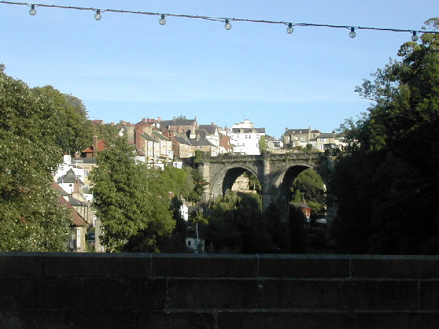
Knaresborough Viaduct
Knaresborough Viaduct is a viaduct in the North Yorkshire town of Knaresborough, England. The viaduct carries the Harrogate line over the River Nidd in...
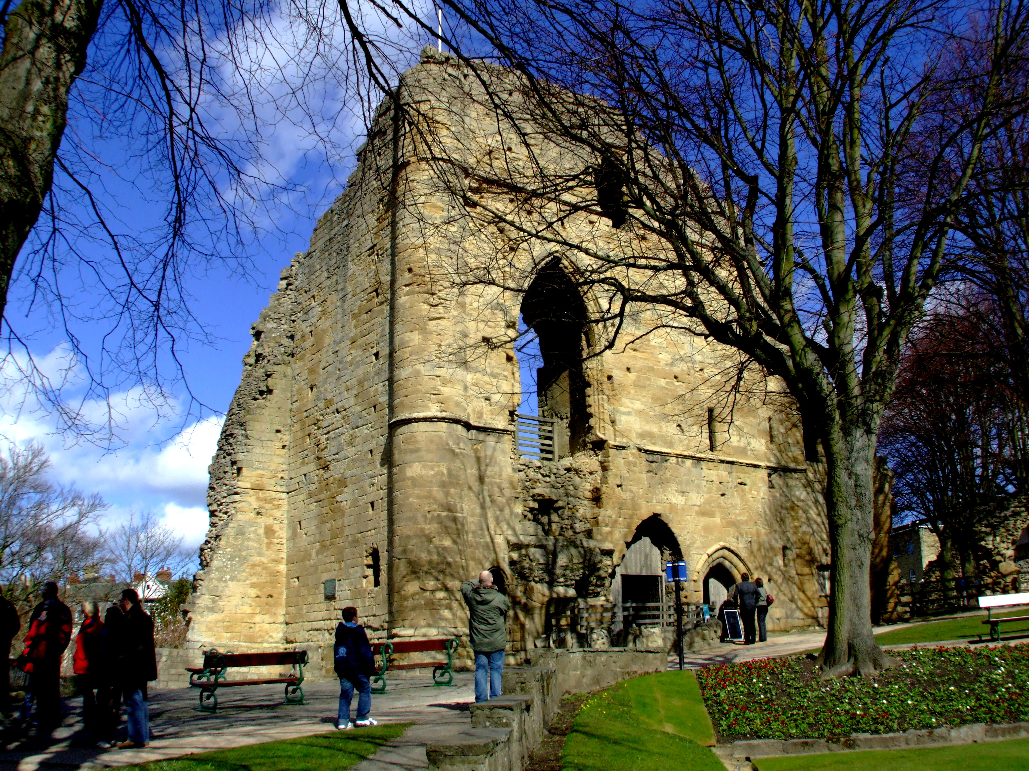
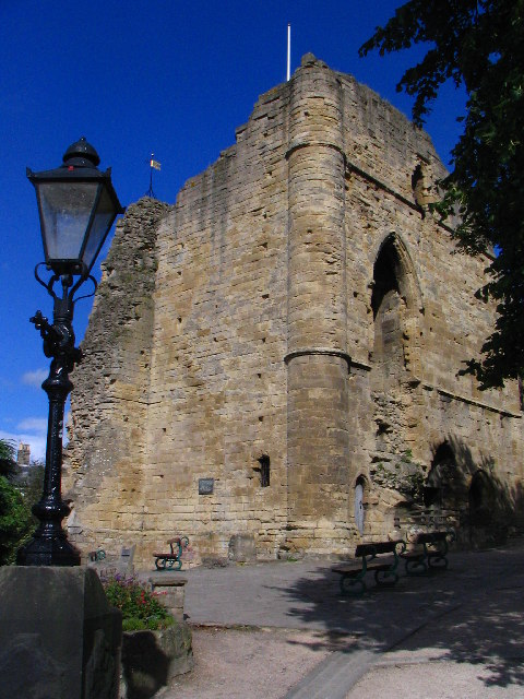
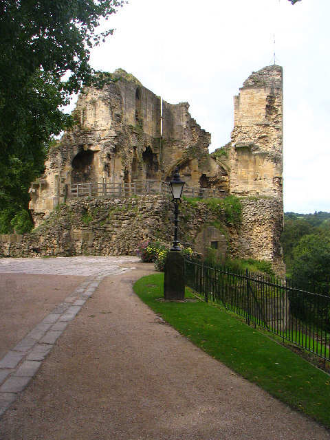
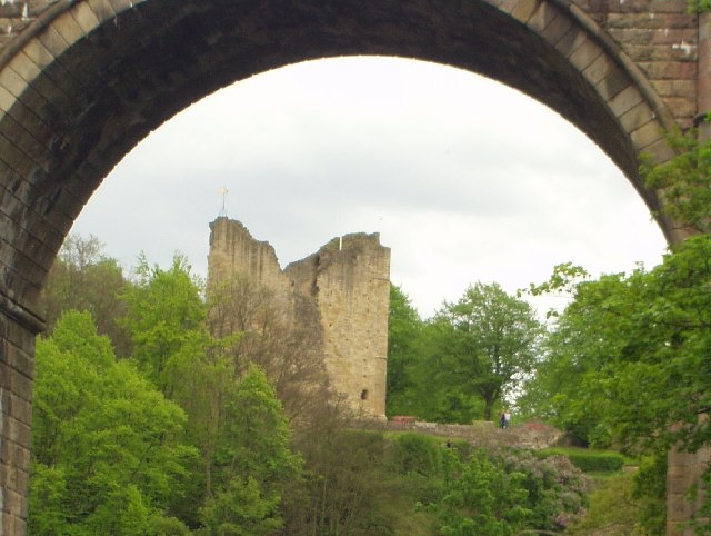
Knaresborough Castle
Knaresborough Castle is a ruined fortress overlooking the River Nidd in the town of Knaresborough, North Yorkshire, England. == History == The castle was...

St John the Baptist Church, Knaresborough
St John the Baptist Church is a parish church in the Church of England located in Knaresborough, North Yorkshire. It is the largest church in the town...

Knaresborough railway station
Knaresborough railway station is a Grade II listed station serving the town of Knaresborough in North Yorkshire, England. It is located on the Harrogate...

Knaresborough Zoo
Knaresborough Zoo was a zoo located in the grounds of Conyngham Hall, Knaresborough, a small market town within the district of Harrogate, North Yorkshire...
Nidderdale Rural District
Nidderdale was a rural district in the West Riding of Yorkshire from 1938 to 1974. It was created from the combination of most of the disbanded rural districts...
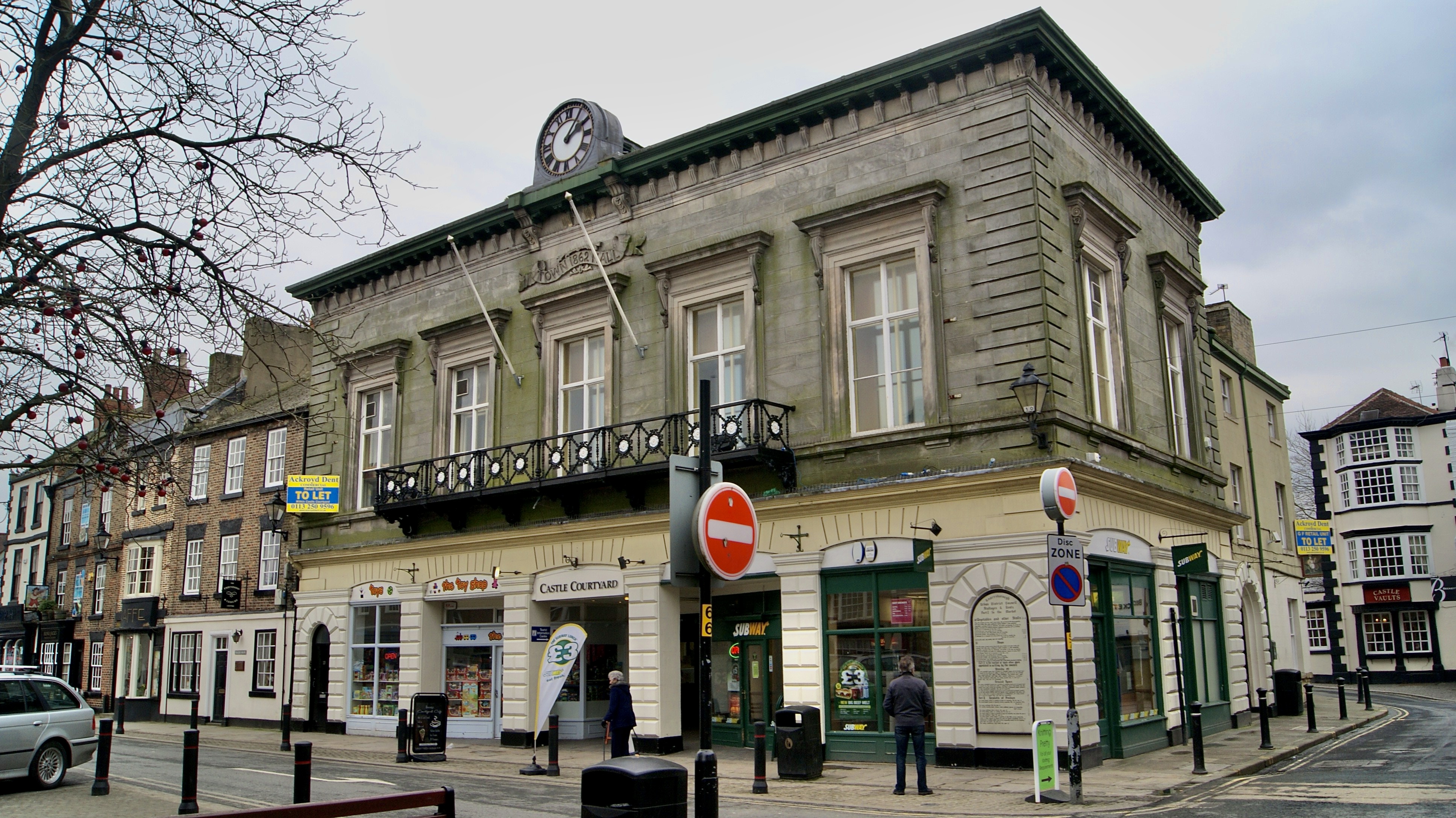
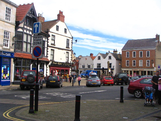
Old Town Hall, Knaresborough
The Old Town Hall is a former municipal building in the Market Place, Knaresborough, North Yorkshire, England. The structure, which was used as an events...
Nearby Amenities
Located within 500m of 54.004634,-1.4801296Have you been to Belmont Wood?
Leave your review of Belmont Wood below (or comments, questions and feedback).