Sparsholt Firs

Wood, Forest in Berkshire Vale of White Horse

England

Sparsholt Firs

Farmland, Sparsholt
Farmland, Sparsholt Credit: Andrew Smith

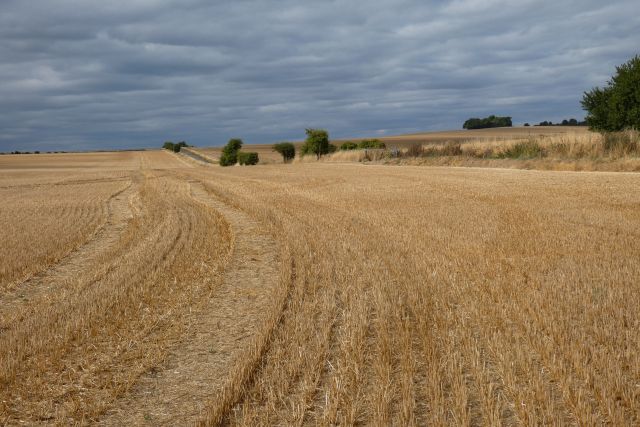
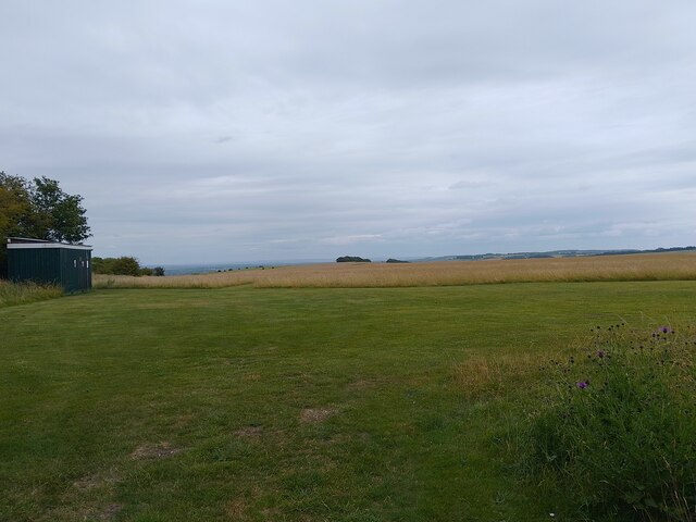
Sparsholt Firs is a picturesque wood located in Berkshire, England. Situated near the village of Sparsholt, it covers an area of approximately 100 acres and forms part of the larger Sparsholt and Lains Barn Woods complex.

The woodland is predominantly made up of broadleaf trees, including oak, beech, and ash, which create a dense canopy and provide a rich habitat for a variety of flora and fauna. Bluebells carpet the forest floor in the spring, while ferns and mosses thrive in the damp and shaded areas.

Sparsholt Firs is known for its diverse wildlife. Birdwatchers can enjoy the sight of various species, including woodpeckers, nuthatches, and treecreepers. The wood is also home to a range of mammals, such as badgers, foxes, and deer, which can sometimes be spotted by lucky visitors.

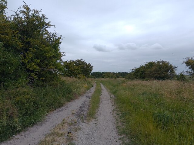
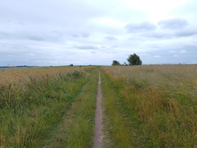
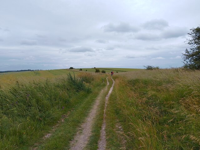
The wood offers several walking trails that meander through its enchanting landscape, allowing visitors to fully immerse themselves in nature. The paths are well-maintained, making them accessible to all, and there are benches along the way for those looking to take a moment to appreciate the tranquility of their surroundings.

Sparsholt Firs is a popular destination for nature enthusiasts, photographers, and families seeking a peaceful retreat. Its natural beauty, combined with its accessibility and range of wildlife, makes it a wonderful place to explore and reconnect with the natural world.

If you have any feedback on the listing, please let us know in the comments section below.

Sparsholt Firs Images

Images are sourced within 2km of 51.560916/-1.5085061 or Grid Reference SU3484. Thanks to Geograph Open Source API. All images are credited.

Farmland, Sparsholt
Farmland, Sparsholt
White Horse Model Club Club 0277 of the British Model Flying Association, accessed off the Ridgeway. Assumedly they meet in the container?
White Horse Model Club
Club 0277 of the British Model Flying Association, accessed off the Ridgeway. Assumedly they meet in the container?
B4001 Ridgeway car park A car park off the B4001 on the route of the Ridgeway.
B4001 Ridgeway car park
A car park off the B4001 on the route of the Ridgeway.
The Ridgeway Looking towards Gramp's Hill on the Ridgeway, a long distance path.
The Ridgeway
Looking towards Gramp's Hill on the Ridgeway, a long distance path.
The Ridgeway Looking towards Gramp's Hill on the Ridgeway, a long distance path.
The Ridgeway
Looking towards Gramp's Hill on the Ridgeway, a long distance path.
Hackpen Hill farm track A farm track down Hackpen Hill from the Ridgeway.
Hackpen Hill farm track
A farm track down Hackpen Hill from the Ridgeway.
The Ridgeway Looking towards Gramp's Hill on the Ridgeway, a long distance path.
The Ridgeway
Looking towards Gramp's Hill on the Ridgeway, a long distance path.
The Ridgeway Looking towards Gramp's Hill on the Ridgeway, a long distance path.
The Ridgeway
Looking towards Gramp's Hill on the Ridgeway, a long distance path.
The Ridgeway signpost I have no idea why this signpost is so far away from the track!
The Ridgeway signpost
I have no idea why this signpost is so far away from the track!
Hackpen Hill path A path across Hackpen Hill from the Ridgeway.
Hackpen Hill path
A path across Hackpen Hill from the Ridgeway.
The Ridgeway Looking towards Gramp's Hill on the Ridgeway, a long distance path.
The Ridgeway
Looking towards Gramp's Hill on the Ridgeway, a long distance path.
The Ridgeway Looking towards Gramp's Hill on the Ridgeway, a long distance path.
The Ridgeway
Looking towards Gramp's Hill on the Ridgeway, a long distance path.
Hackpen Hill from the Ridgeway Looking towards Hackpen Hill from the Ridgeway.
Hackpen Hill from the Ridgeway
Looking towards Hackpen Hill from the Ridgeway.
The Ridgeway Looking towards Gramp's Hill on the Ridgeway, a long distance path.
The Ridgeway
Looking towards Gramp's Hill on the Ridgeway, a long distance path.
The Ridgeway Looking towards Gramp's Hill on the Ridgeway, a long distance path.
The Ridgeway
Looking towards Gramp's Hill on the Ridgeway, a long distance path.
The Ridgeway Looking towards Gramp's Hill on the Ridgeway, a long distance path.
The Ridgeway
Looking towards Gramp's Hill on the Ridgeway, a long distance path.
The Ridgeway Looking towards Gramp's Hill on the Ridgeway, a long distance path.
The Ridgeway
Looking towards Gramp's Hill on the Ridgeway, a long distance path.
The Ridgeway Looking towards the B4001 on the Ridgeway, a long distance path.
The Ridgeway
Looking towards the B4001 on the Ridgeway, a long distance path.
Show me another place!

Sparsholt Firs is located at Grid Ref: SU3484 (Lat: 51.560916, Lng: -1.5085061)

Administrative County: Oxfordshire

District: Vale of White Horse

Police Authority: Thames Valley

What 3 Words

///radiates.skip.alas. Near Lambourn, Berkshire

Nearby Locations

Sparsholt Firs

Related Wikis

Hackpen, Warren & Gramp's Hill Downs

Hackpen, Warren & Gramp's Hill Downs is a 71.4-hectare (176-acre) biological Site of Special Scientific Interest in Letcombe Bassett in Oxfordshire.The...

Highlands Farm Pit

Highlands Farm Pit is a 0.6-hectare (1.5-acre) geological Site of Special Scientific Interest in Henley-on-Thames in Oxfordshire. It is a Geological Conservation...

Seven Barrows

Seven Barrows is a Bronze Age bowl barrow cemetery, 4-hectare (9.9-acre) of which are designated a biological Site of Special Scientific Interest, at Upper...

Westcot

Westcot is a hamlet in the civil parish of Sparsholt, about 4 miles (6.4 km) west of Wantage in the Vale of White Horse, England. == External links... ==

Nearby Amenities

Located within 500m of 51.560916,-1.5085061
Bus Stop
Ridgeway
Bus: yes
Naptan AtcoCode: 340000680RID
Naptan Bearing: W
Naptan CommonName: Ridgeway
Naptan Indicator: Corner
Naptan Landmark: Sparshot Turn
Naptan NaptanCode: oxfapwmd
Naptan Street: B4001
Naptan Verified: no
Public Transport: platform
Source: naptan_import
Lat/Long: 51.5636247/-1.5056405
The Ridgeway National Trail
Board Type: notice
Information: board
Tourism: information
Lat/Long: 51.5633456/-1.5050386
Material: wood
Power: pole
Source: Bing
Lat/Long: 51.5588483/-1.5043574
Power: pole
Source: Bing
Lat/Long: 51.5636974/-1.5073856
Power: pole
Source: Bing
Lat/Long: 51.5621867/-1.5083888
Material: wood
Power: pole
Source: Bing
Lat/Long: 51.5596169/-1.5070961
Material: wood
Power: pole
Source: Bing
Lat/Long: 51.561428/-1.5089037
Power: pole
Source: Bing
Lat/Long: 51.5629387/-1.5078925
Material: wood
Power: pole
Source: Bing
Lat/Long: 51.5586049/-1.5029895
Material: wood
Power: pole
Source: Bing
Lat/Long: 51.5601507/-1.5085443
Communication Microwave: yes
Communication Mobile Phone: yes
Height: 71
Man Made: tower
Tower Construction: lattice
Tower Type: communication
Lat/Long: 51.5604518/-1.5097108
Sparsholt Firs
Place: locality
Lat/Long: 51.5635367/-1.5053075
The data included in this document is from www.openstreetmap.org. The data is made available under ODbL.

Have you been to Sparsholt Firs?

Leave your review of Sparsholt Firs below (or comments, questions and feedback).