Dipford
Settlement in Somerset Somerset West and Taunton
England
Dipford
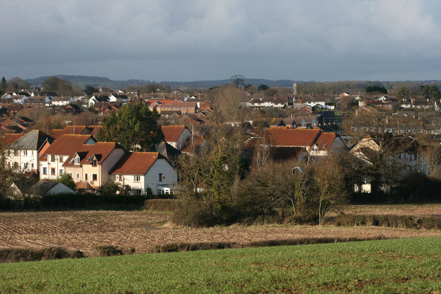
Dipford is a charming village located in the county of Somerset, England. Situated in the picturesque countryside, it is nestled between the larger towns of Taunton and Ilminster. Dipford boasts a population of around 500 residents, giving it a close-knit and friendly community atmosphere.
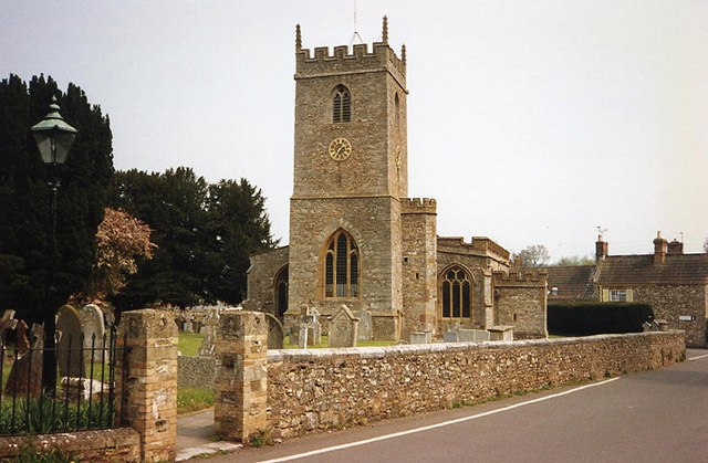
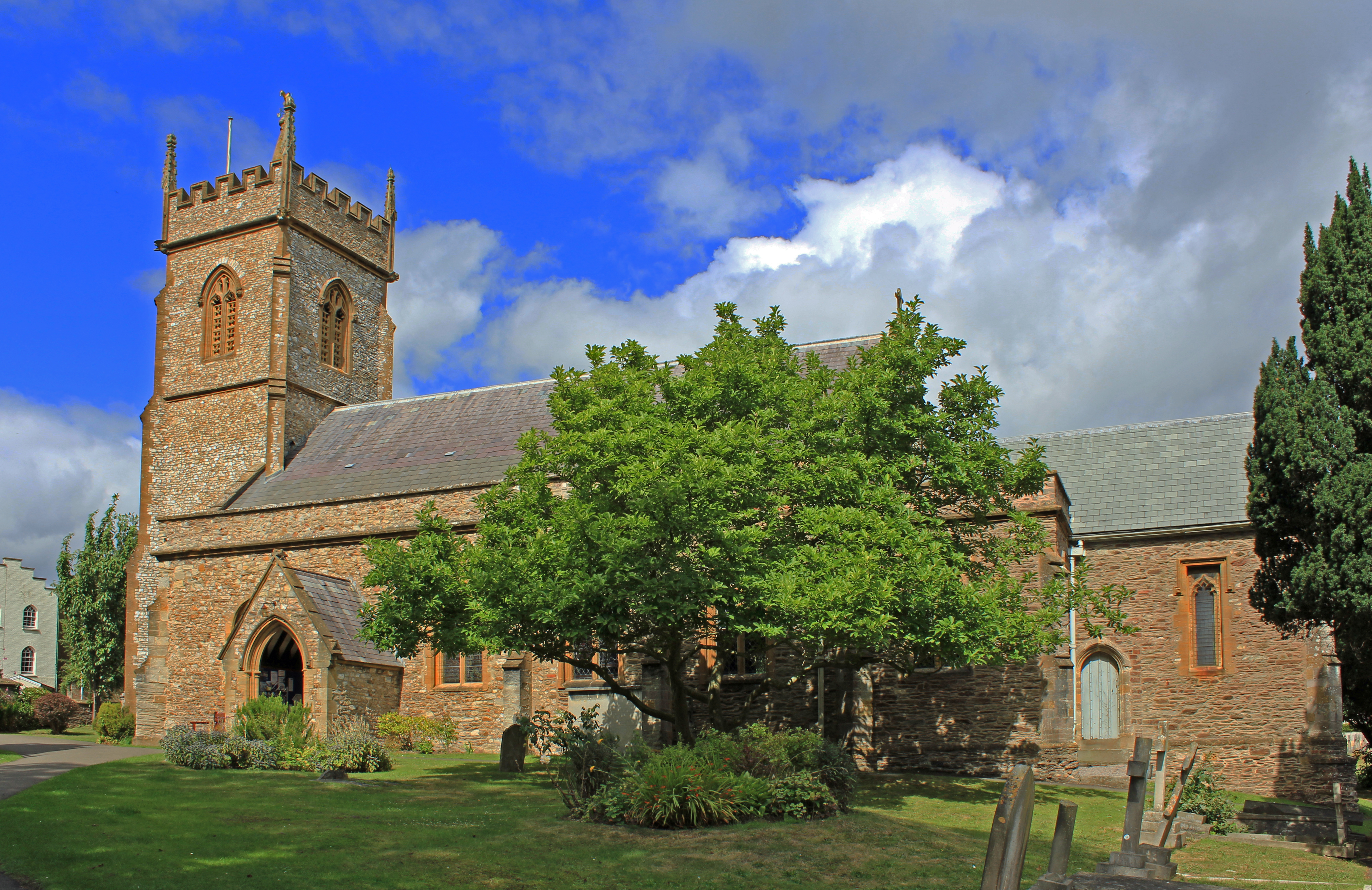
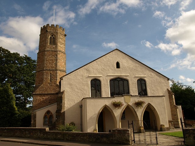
The village is known for its rich history, dating back to medieval times. Evidence of this history can be seen in the architecture of the village, with a number of well-preserved thatched cottages and stone buildings. One notable landmark is the 12th-century St. Mary's Church, which stands proudly in the heart of the village.
Dipford's natural surroundings are a major draw for both locals and visitors. The nearby River Tone meanders through the area, providing beautiful views and opportunities for outdoor activities such as fishing and hiking. The surrounding rolling hills and meadows offer breathtaking landscapes, making it a popular spot for nature lovers and photographers.
The village also benefits from a range of amenities. There is a local primary school, a community center, and a small grocery store that caters to the daily needs of residents. For more extensive shopping and entertainment options, the nearby towns provide a wider range of facilities.
Overall, Dipford offers a peaceful and idyllic setting, perfect for those seeking a tranquil rural lifestyle. Its historical charm, natural beauty, and strong sense of community make it a delightful place to live or visit in the heart of Somerset.
If you have any feedback on the listing, please let us know in the comments section below.
Dipford Images
Images are sourced within 2km of 50.99221/-3.131899 or Grid Reference ST2022. Thanks to Geograph Open Source API. All images are credited.


Dipford is located at Grid Ref: ST2022 (Lat: 50.99221, Lng: -3.131899)
Administrative County: Somerset
District: Somerset West and Taunton
Police Authority: Avon and Somerset
What 3 Words
///drops.spruced.bookings. Near Taunton, Somerset
Nearby Locations
Related Wikis
Trull
Trull is a village, electoral ward and civil parish in Somerset, England, situated near Taunton. The parish, which includes Dipford, has a population of...
Comeytrowe
Comeytrowe is a south western suburb of Taunton and former civil parish, now in the parish of Taunton in the county of Somerset, England. In 2011 the parish...

Queen's College, Taunton
Queen's College is a co-educational independent school located in Taunton, the county town of Somerset, England. It is a day/boarding school for pupils...
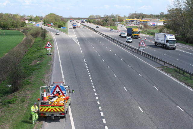
Taunton Deane services
Taunton Deane services is a double sided motorway service station on the M5 motorway near Taunton, England. It is owned by Roadchef. == Location == The...
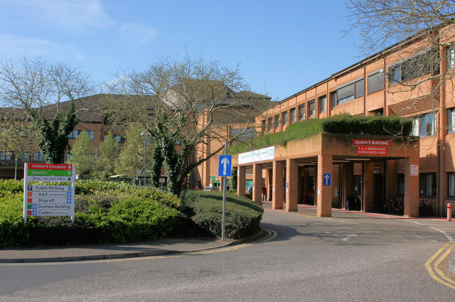
Musgrove Park Hospital
Musgrove Park Hospital is a large NHS hospital located in Taunton, Somerset, England, run by Somerset NHS Foundation Trust. Originally a US Army General...

Poundisford Park
Poundisford Park north of Pitminster, Somerset, England is an English country house that typifies progressive housebuilding on the part of the West Country...
St George's Church, Fons George
The Church of St George is an Anglican church in Taunton, Somerset, England, which dates from Saxon times. It is the parish church for Wilton, within the...
Bishop's Hull
Bishop's Hull is a village and civil parish in Somerset, England, in the western suburbs of Taunton. It includes the areas of Rumwell, Rumwell Park, Roughmoor...
Related Videos

Trull Waterfall | Somerset | England and Christmas Greetings
Trull Waterfall can turn make you look younger according to some Trip Advisor reviews, so what better place to go in the busy run ...

Weekly Walk: Trull Taunton Somerset Feb 2024
Join us on our weekly walking tour as we explore the Village of Trull in Taunton Somerset. This week I have a walking companion ...

Merry Christmas 2018
Cllr John Hunt's Christmas Card 2018. Comeytrowe, Galmington and Bishop's Hull.

2005 Vauxhall Vivaro Walk through and demonstration
The Vauxhall Vivaro SWB 2700 Panel Van is for sale with Car Daws as of 13/01/2021. The website is www.cardaws.com for more ...
Nearby Amenities
Located within 500m of 50.99221,-3.131899Have you been to Dipford?
Leave your review of Dipford below (or comments, questions and feedback).