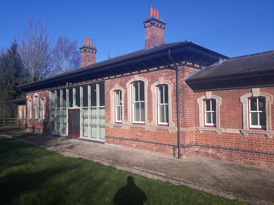
Stoney Flatts Wood

Wood, Forest in Leicestershire North West Leicestershire

England

Stoney Flatts Wood

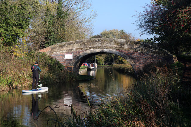
Bridge 61A, Ashby Canal Bridge 61a marks the end of the 21 miles of canal under the control of the Canal & River Trust. A short stretch beyond here belongs to the Ashby Canal Association and is used for moorings - in any case as the sign states it was temporarily closed when this photograph was taken. The long-term aspiration is to restore the canal through to Moira but for the time being this is as far as most boaters can go.
Bridge 61A, Ashby Canal Credit: Stephen McKay

Stoney Flatts Wood is a captivating woodland located in Leicestershire, England. Spanning over a vast area, this natural gem is renowned for its scenic beauty and diverse flora and fauna. As a designated Site of Special Scientific Interest (SSSI), it holds significant ecological and conservation value.

The wood is characterized by its dense canopy of mature trees, predominantly consisting of oak, birch, and ash species. These towering trees provide a cool and tranquil atmosphere, offering shelter to a plethora of wildlife species. Stoney Flatts Wood is home to a range of mammals, including badgers, foxes, and deer, as well as numerous bird species, such as woodpeckers, owls, and warblers.

Visitors to Stoney Flatts Wood can enjoy a variety of recreational activities. The well-maintained footpaths and trails allow for pleasant walks and hikes, enabling visitors to explore the woodland's nooks and crannies. The wood also boasts an abundance of wildflowers, creating a colorful and aromatic setting during the spring and summer months.

The wood's conservation status is emphasized by the presence of several rare and protected plant species. These include the wood anemone, bluebell, and orchids, which thrive in the rich, moist soil. The diverse range of habitats within the wood, including ponds and wetland areas, further contributes to the unique biodiversity of Stoney Flatts Wood.

Overall, Stoney Flatts Wood is a captivating woodland that offers a haven for nature enthusiasts and conservationists alike. Its picturesque scenery, abundant wildlife, and ecological importance make it a must-visit destination for those seeking solace in the embrace of nature.

If you have any feedback on the listing, please let us know in the comments section below.

Stoney Flatts Wood Images

Images are sourced within 2km of 52.702029/-1.5004401 or Grid Reference SK3311. Thanks to Geograph Open Source API. All images are credited.

Bridge 61A, Ashby Canal Bridge 61a marks the end of the 21 miles of canal under the control of the Canal & River Trust. A short stretch beyond here belongs to the Ashby Canal Association and is used for moorings - in any case as the sign states it was temporarily closed when this photograph was taken. The long-term aspiration is to restore the canal through to Moira but for the time being this is as far as most boaters can go.
Bridge 61A, Ashby Canal
Bridge 61a marks the end of the 21 miles of canal under the control of the Canal & River Trust. A short stretch beyond here belongs to the Ashby Canal Association and is used for moorings - in any case as the sign states it was temporarily closed when this photograph was taken. The long-term aspiration is to restore the canal through to Moira but for the time being this is as far as most boaters can go.
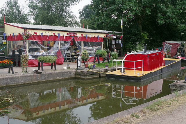
Snarestone Canal Terminus Just beyond the winding hole (turning point) at the northern end of the 21 miles of the Ashby Canal available for navigation, the Ashby Canal Association has a shop selling souvenirs and canal memorabilia. The chosen colour scheme is red and cream finished off with a British Railways style Snarestone totem sign (quite inauthentic actually - Snarestone station was closed in LMS days). The workboat is painted in matching colours.
Snarestone Canal Terminus
Just beyond the winding hole (turning point) at the northern end of the 21 miles of the Ashby Canal available for navigation, the Ashby Canal Association has a shop selling souvenirs and canal memorabilia. The chosen colour scheme is red and cream finished off with a British Railways style Snarestone totem sign (quite inauthentic actually - Snarestone station was closed in LMS days). The workboat is painted in matching colours.
Ashby Canal - bridge No. 61 Near Snarestone Wharf. The bridge is a turnover bridge and takes the towpath from one side to the other.
Ashby Canal - bridge No. 61
Near Snarestone Wharf. The bridge is a turnover bridge and takes the towpath from one side to the other.
Snarestone Wharf On the partly restored Ashby Canal.
Snarestone Wharf
On the partly restored Ashby Canal.
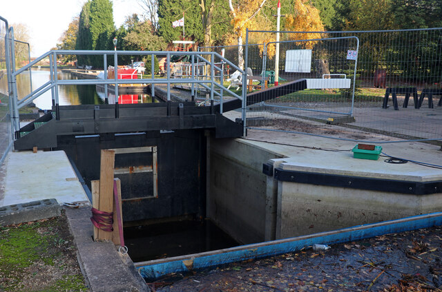
Ashby Canal, Snarestone Wharf A newly installed stop lock gate that is not yet in use as there are stop planks holding back the water on both sides.
Ashby Canal, Snarestone Wharf
A newly installed stop lock gate that is not yet in use as there are stop planks holding back the water on both sides.
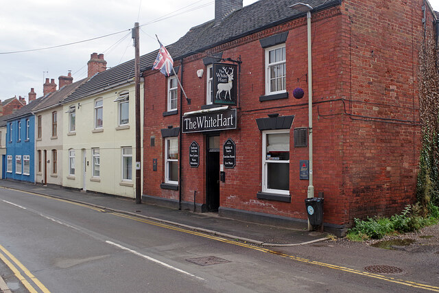
The White Hart, Measham Measham, with a population of just over 5,000, is a former mining village (Measham Colliery closed in 1986) in the Leicestershire coalfield. Especially on a dull day it is, in all fairness, a rather drab looking place with no real centre that straggles along the former A453 road. Here on Bosworth Road, the White Hart is a traditional friendly back street local.
The White Hart, Measham
Measham, with a population of just over 5,000, is a former mining village (Measham Colliery closed in 1986) in the Leicestershire coalfield. Especially on a dull day it is, in all fairness, a rather drab looking place with no real centre that straggles along the former A453 road. Here on Bosworth Road, the White Hart is a traditional friendly back street local.
Ashby Canal Coal Mine Marker
Snarestone Wharf - engine beams Snarestone Wharf is operated by the Ashby Canal Association. These two beam engine beams came from the adjoining Snarestone Pumping Station and were built by Bever, Dorling & Company of Dewsbury in 1890-2. The pumping station building is now a house but still retains parts of the engines and their supporting structure. The beams have been erected here with some of the handrails and one of the hand winches from the site.
The beams in their original location are seen here - <a href="https://www.geograph.org.uk/photo/1552999">SK3410 : Beam engine parts, Snarestone Pumping Station</a>.
Snarestone Wharf - engine beams
Snarestone Wharf is operated by the Ashby Canal Association. These two beam engine beams came from the adjoining Snarestone Pumping Station and were built by Bever, Dorling & Company of Dewsbury in 1890-2. The pumping station building is now a house but still retains parts of the engines and their supporting structure. The beams have been erected here with some of the handrails and one of the hand winches from the site. The beams in their original location are seen here - SK3410 : Beam engine parts, Snarestone Pumping Station.
Snarestone Wharf - slipway and swans On the partly restored Ashby Canal.
Snarestone Wharf - slipway and swans
On the partly restored Ashby Canal.
Snarestone Wharf, Ashby Canal This is the base of the Ashby Canal Association on this part restored canal.
Snarestone Wharf, Ashby Canal
This is the base of the Ashby Canal Association on this part restored canal.
Snarestone Pumping Station A former steam powered water pumping station that is now a house. The former boiler house is on the left and the engine house on the right. The chimney is a fine survivor. Parts of the beam engines remain in situ but the beams have been plinthed on Snarestone Wharf where there is an excellent display board.
Snarestone Pumping Station
A former steam powered water pumping station that is now a house. The former boiler house is on the left and the engine house on the right. The chimney is a fine survivor. Parts of the beam engines remain in situ but the beams have been plinthed on Snarestone Wharf where there is an excellent display board.
Snarestone Pumping Station Severn Trent's current replacement for the former steam powered Snarestone Pumping Station. The original building is now a house. The station supplies Hinckley with water.
Snarestone Pumping Station
Severn Trent's current replacement for the former steam powered Snarestone Pumping Station. The original building is now a house. The station supplies Hinckley with water.
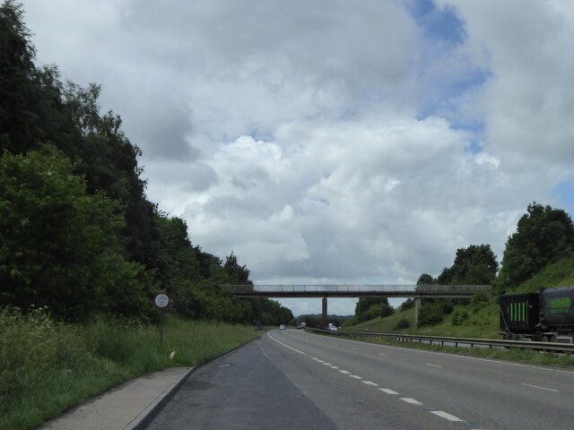
Footbridge over the A42 at Measham
Bosworth Road Looking towards Measham [where the teapots come from].
Bosworth Road
Looking towards Measham [where the teapots come from].
Large L shaped field off Bosworth Road Almost a national flag.
Large L shaped field off Bosworth Road
Almost a national flag.
Telegraph poles crossing a field The vast open spaces of the Mease valley.
Telegraph poles crossing a field
The vast open spaces of the Mease valley.
Green field, blue sky Large arable field between Bosworth Road and Quarry Lane.
Green field, blue sky
Large arable field between Bosworth Road and Quarry Lane.
Ashby Canal Mine Seam Marker Showing the depths of the Stockings, Eureka, Well and Kilburn coal seams, at the crossroads of Bosworth Road and Gallows Lane.
Ashby Canal Mine Seam Marker
Showing the depths of the Stockings, Eureka, Well and Kilburn coal seams, at the crossroads of Bosworth Road and Gallows Lane.
Show me another place!

Stoney Flatts Wood is located at Grid Ref: SK3311 (Lat: 52.702029, Lng: -1.5004401)

Administrative County: Leicestershire

District: North West Leicestershire

Police Authority: Leicestershire

What 3 Words

///limes.schematic.uptake. Near Measham, Leicestershire

Nearby Locations

Stoney Flatts Wood Measham

Related Wikis

Nearby Amenities

Located within 500m of 52.702029,-1.5004401
Barrier: kissing_gate
Lat/Long: 52.7012523/-1.5018982
Noexit: yes
Lat/Long: 52.7022292/-1.5023648
Noexit: yes
Lat/Long: 52.7035624/-1.5026491
Generator Method: photovoltaic
Generator Output Electricity: yes
Generator Source: solar
Generator Type: solar_photovoltaic_panel
Location: roof
Power: generator
Lat/Long: 52.7036565/-1.5065331
Generator Method: photovoltaic
Generator Output Electricity: yes
Generator Source: solar
Generator Type: solar_photovoltaic_panel
Location: roof
Power: generator
Lat/Long: 52.7033964/-1.5069006
Turning Circle
Lat/Long: 52.7044627/-1.4983048
The data included in this document is from www.openstreetmap.org. The data is made available under ODbL.

Have you been to Stoney Flatts Wood?

Leave your review of Stoney Flatts Wood below (or comments, questions and feedback).