Bradbury Plantation

Wood, Forest in Durham

England

Bradbury Plantation

Ice along farm road Ice lids for pools, many with the water gone from beneath them with the residues of snow or frost along the farm road north from the eastern end of Mordon village.
Ice along farm road Credit: Trevor Littlewood

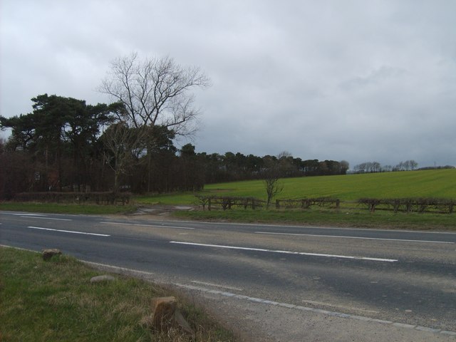
Bradbury Plantation, located in Durham, is a scenic and picturesque woodland area known for its abundant natural beauty and diverse plant life. Spanning over a vast area, the plantation is a haven for nature enthusiasts and offers a tranquil escape from the hustle and bustle of city life.

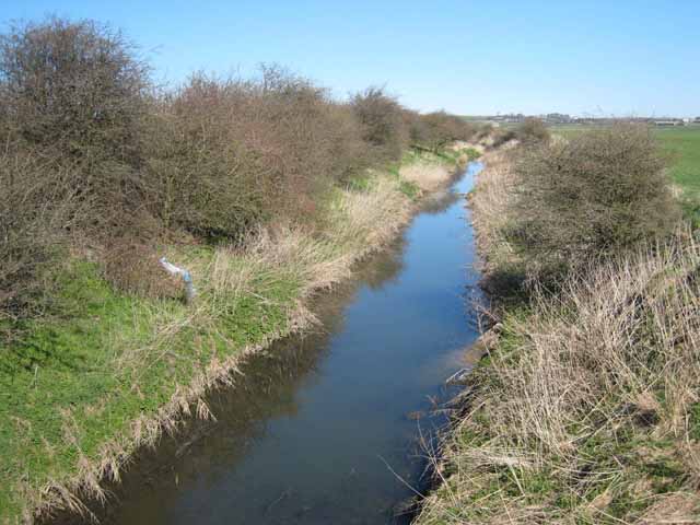
The plantation is primarily composed of dense forests, with towering trees that create a lush canopy overhead. The Wood, Forest area of the plantation is especially captivating, featuring a wide variety of tree species such as oak, beech, maple, and pine. These trees provide a habitat for numerous wildlife species, including deer, squirrels, and various bird species.

Visitors to Bradbury Plantation can explore the woodland through a network of well-maintained trails, which wind through the forest, offering breathtaking views of the surrounding landscape. The trails are ideal for hiking, jogging, or simply enjoying a leisurely stroll amidst nature.

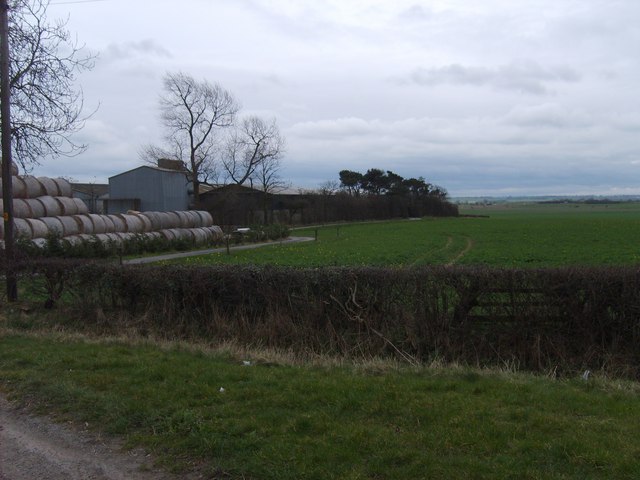
In addition to its natural beauty, Bradbury Plantation is also home to a rich history. The plantation has been carefully preserved and features remnants of old structures, including a historic farmhouse and barn. These structures serve as a reminder of the area's agricultural past and provide a glimpse into the lives of those who once inhabited the land.

Overall, Bradbury Plantation in Durham offers a captivating blend of natural splendor and historical significance. Whether one seeks solitude in nature, a place for outdoor activities, or an opportunity to delve into local history, this woodland sanctuary provides a truly enriching experience for all who visit.

If you have any feedback on the listing, please let us know in the comments section below.

Bradbury Plantation Images

Images are sourced within 2km of 54.640471/-1.5094725 or Grid Reference NZ3127. Thanks to Geograph Open Source API. All images are credited.

Ice along farm road Ice lids for pools, many with the water gone from beneath them with the residues of snow or frost along the farm road north from the eastern end of Mordon village.
Ice along farm road
Ice lids for pools, many with the water gone from beneath them with the residues of snow or frost along the farm road north from the eastern end of Mordon village.
Minor road entering Mordon from the east As the road signs announces, Mordon lies ahead. The blue and yellow style of the sign is one found frequently in County Durham; this one incorporates the village name into the speed limit sign as is often the case.
Minor road entering Mordon from the east
As the road signs announces, Mordon lies ahead. The blue and yellow style of the sign is one found frequently in County Durham; this one incorporates the village name into the speed limit sign as is often the case.
Cattle grazing, Preston Carrs
Mown field
Mown field
Hedge and farmland
Hedge and farmland
Railway track
Railway track
Mordon  Village
Mordon Village
Railway Bridge :  Bradbury Over the East Coast Main Line. Looking toward Bradbury Village.
Railway Bridge : Bradbury
Over the East Coast Main Line. Looking toward Bradbury Village.
Bradbury Wesleyan  Chapel Dated 1895. For Sale!
Bradbury Wesleyan Chapel
Dated 1895. For Sale!
Train South A Train crosses the A689 near the A1 Junction 60.
Train South
A Train crosses the A689 near the A1 Junction 60.
Borehole Plantation Wood to the north of the A689 near junction 60 of the A1.
Borehole Plantation
Wood to the north of the A689 near junction 60 of the A1.
Nunstainton Grange Farm south of the A689 near junction 60 of the A1.
Nunstainton Grange
Farm south of the A689 near junction 60 of the A1.
Great Isle Farm Between Mordon and Newton Aycliffe in mid-southern County Durham, there is an extensive area of low-lying and formerly marshy land drained by the River Skerne and its tributaries. Great Isle is so-called because it stands on a low hill above the plain and was at one time an island in the marshes.
Great Isle Farm
Between Mordon and Newton Aycliffe in mid-southern County Durham, there is an extensive area of low-lying and formerly marshy land drained by the River Skerne and its tributaries. Great Isle is so-called because it stands on a low hill above the plain and was at one time an island in the marshes.
River Skerne Between Mordon and Newton Aycliffe in mid-southern County Durham, there is an extensive area of low-lying and formerly marshy land drained by the River Skerne (itself a tributary of the Tees) and its tributaries.
River Skerne
Between Mordon and Newton Aycliffe in mid-southern County Durham, there is an extensive area of low-lying and formerly marshy land drained by the River Skerne (itself a tributary of the Tees) and its tributaries.
East Coast Main Line at Mordon Carrs Between Mordon and Newton Aycliffe in mid-southern County Durham, there is an extensive area of low-lying and formerly marshy land drained by the River Skerne and its tributaries. The placename Carr means marshy willow wood. The East Coast Main Line crosses these lowlands north of Darlington. Here seen is a Great North Eastern train. Note the service road which runs alongside the line for some distance.
East Coast Main Line at Mordon Carrs
Between Mordon and Newton Aycliffe in mid-southern County Durham, there is an extensive area of low-lying and formerly marshy land drained by the River Skerne and its tributaries. The placename Carr means marshy willow wood. The East Coast Main Line crosses these lowlands north of Darlington. Here seen is a Great North Eastern train. Note the service road which runs alongside the line for some distance.
Crossing on the East Coast Main Line Network Rail are none too keen on these unguarded pedestrian level crossings on railways - especially a high speed line such as this one. All comparable crossings on the West Coast Main Line have now been replaced with bridges.
Crossing on the East Coast Main Line
Network Rail are none too keen on these unguarded pedestrian level crossings on railways - especially a high speed line such as this one. All comparable crossings on the West Coast Main Line have now been replaced with bridges.
Truck racing on the A1(M) Probably not really. It just looks that way from the safety of the surrounding countryside.
Truck racing on the A1(M)
Probably not really. It just looks that way from the safety of the surrounding countryside.
Mordon Carrs Between Mordon and Newton Aycliffe in mid-southern County Durham, there is an extensive area of low-lying and formerly marshy land drained by the River Skerne and its tributaries. The name Carr means a marshy willow wood. A Trans-pennine Express can be seen on the East Coast Main Line <a href="https://www.geograph.org.uk/gridref/NZ3125">NZ3125</a> with the A1(M) <a href="https://www.geograph.org.uk/gridref/NZ3025">NZ3025</a> beyond.
Mordon Carrs
Between Mordon and Newton Aycliffe in mid-southern County Durham, there is an extensive area of low-lying and formerly marshy land drained by the River Skerne and its tributaries. The name Carr means a marshy willow wood. A Trans-pennine Express can be seen on the East Coast Main Line NZ3125 with the A1(M) NZ3025 beyond.
Show me another place!

Bradbury Plantation is located at Grid Ref: NZ3127 (Lat: 54.640471, Lng: -1.5094725)

Unitary Authority: County Durham

Police Authority: Durham

What 3 Words

///shuttered.supporter.happier. Near Sedgefield, Co. Durham

Nearby Locations

Bradbury Plantation

Related Wikis

Bradbury railway station

Bradbury railway station served the village of Bradbury, County Durham, England from 1844 to 1950 on the East Coast Main Line. == History == The station...

Bradbury, County Durham

Bradbury is a village in the County Durham district, in the ceremonial county of Durham, England. It is situated between Sedgefield and Newton Aycliffe...

Railway Stell West

Railway Stell West is a Site of Special Scientific Interest in the Sedgefield district of County Durham, England. The site consists of a length of ditch...

Mordon

Mordon is a village and civil parish in County Durham, England. It is situated a few miles to the north-east of Newton Aycliffe. The population recorded...

Nearby Amenities

Located within 500m of 54.640471,-1.5094725
Railway: signal
Railway Signal Direction: forward
Railway Signal Main: GB-NR:main
Railway Signal Main Design: individual
Railway Signal Main Form: light
Railway Signal Main Height: normal
Railway Signal Main States: red;green;yellow;flashing_yellow;double_yellow;flashing_double_yellow
Railway Signal Operator: Network Rail
Railway Signal Position: left
Ref: T 461
Lat/Long: 54.6387554/-1.5063245
Railway: signal
Railway Signal Direction: forward
Railway Signal Main: GB-NR:main
Railway Signal Main Form: light
Railway Signal Main Height: normal
Railway Signal Operator: Network Rail
Railway Signal Position: left
Lat/Long: 54.6367744/-1.5068888
The data included in this document is from www.openstreetmap.org. The data is made available under ODbL.

Have you been to Bradbury Plantation?

Leave your review of Bradbury Plantation below (or comments, questions and feedback).