Bow Wood

Wood, Forest in Derbyshire Derbyshire Dales

England

Bow Wood

Footpath to Matlock Cliff From Littlemoor Lane
Footpath to Matlock Cliff Credit: Neil Theasby

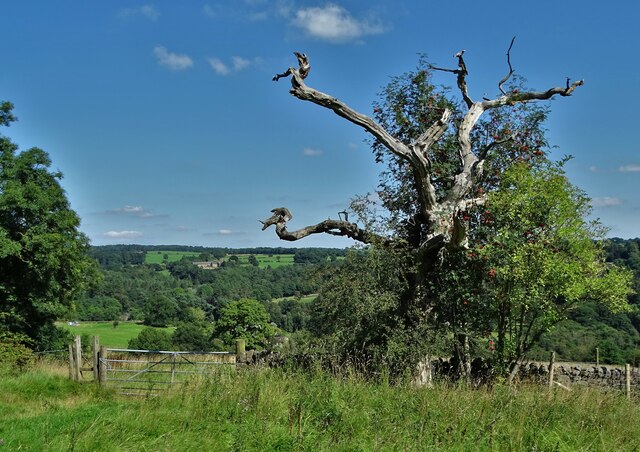
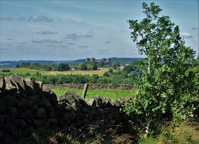
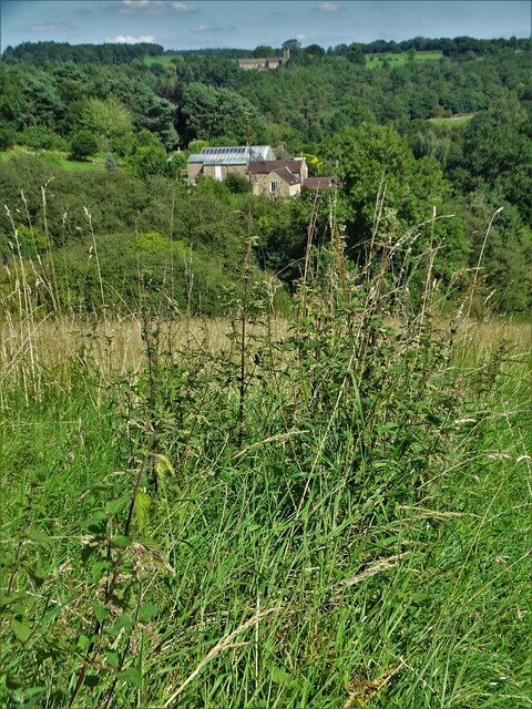
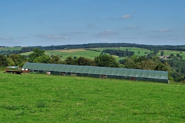
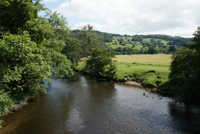
Bow Wood is a picturesque forest located in Derbyshire, England. Spanning over an area of approximately 500 acres, this enchanting woodland is a haven for nature lovers and outdoor enthusiasts alike. Known for its tranquility and diverse flora and fauna, Bow Wood offers a serene escape from the bustling city life.

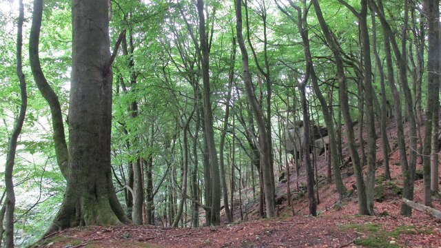
The forest is predominantly composed of deciduous trees, including oak, birch, and beech. These towering giants provide a lush canopy, creating a cool and refreshing atmosphere. The forest floor is adorned with a carpet of bluebells during the spring, painting the landscape in vibrant hues.

Bow Wood is home to a variety of wildlife species, making it an ideal spot for birdwatchers and wildlife enthusiasts. Buzzards, woodpeckers, and tawny owls can often be spotted among the treetops, while badgers, foxes, and deer roam the forest floor.

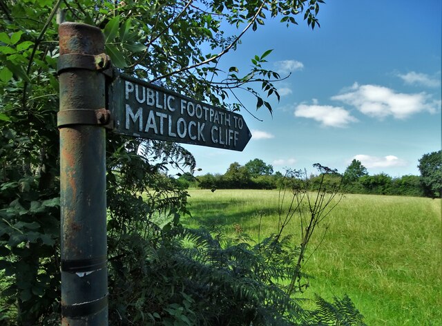
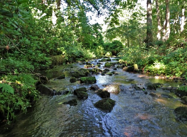
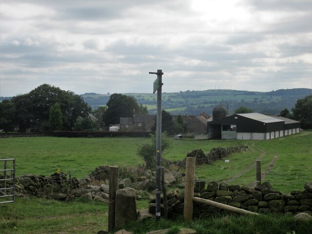
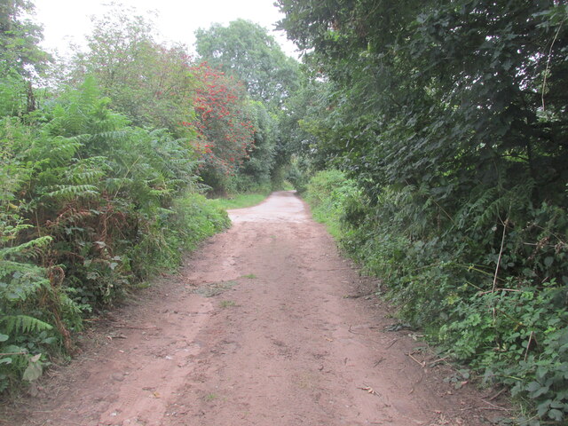
Several walking trails crisscross the forest, allowing visitors to explore its natural beauty at their own pace. These well-maintained paths lead to hidden ponds, babbling brooks, and secluded picnic areas, providing ample opportunities for relaxation and exploration.

The forest is open to the public throughout the year, and visitors are encouraged to respect the natural surroundings and adhere to any signage or restrictions in place. Bow Wood is a cherished natural gem in Derbyshire, offering a serene retreat where visitors can immerse themselves in the beauty of nature and experience a true sense of tranquility.

If you have any feedback on the listing, please let us know in the comments section below.
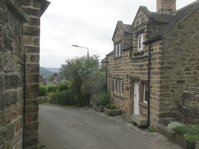
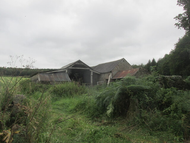
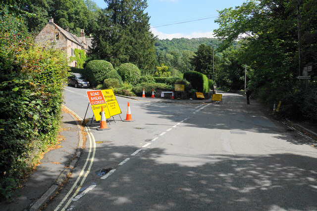
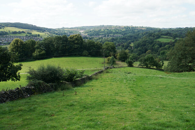
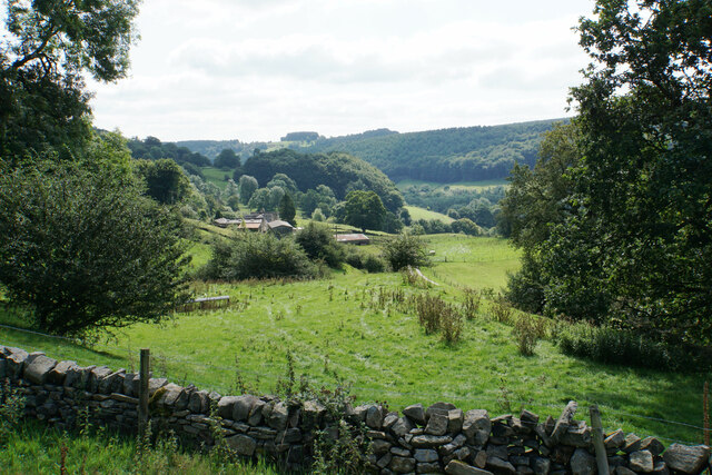
Bow Wood Images

Images are sourced within 2km of 53.104205/-1.5312695 or Grid Reference SK3156. Thanks to Geograph Open Source API. All images are credited.

Footpath to Matlock Cliff From Littlemoor Lane
Footpath to Matlock Cliff
From Littlemoor Lane
Mill House, Lea Mill With the old mill pond in the foreground now an attractive garden feature.
Mill House, Lea Mill
With the old mill pond in the foreground now an attractive garden feature.
Lea Brook Flowing through Upper Doe Carr Wood
Lea Brook
Flowing through Upper Doe Carr Wood
North of Coumbs Wood looking towards Dethick
Upper Holloway Farm Walking along the footpath that runs down towards the farm.
Upper Holloway Farm
Walking along the footpath that runs down towards the farm.
Cottages in Holloway Narrow street in the village.
Cottages in Holloway
Narrow street in the village.
Intake Lane Close to Birchwood Farm campsite.
Intake Lane
Close to Birchwood Farm campsite.
Old barn alongside the Midshires Way Intake Lane.
Old barn alongside the Midshires Way
Intake Lane.
Bauston Tor In the trees above the Incline.
Bauston Tor
In the trees above the Incline.
View to Riber Castle from Hearthstone Lane
View to Low Leas House ...and beyond that to Dethick with its church tower peeping above the trees. Dethick was the home of Anthony Babington after whom The Babington Plot of 1586 was named. It was a plan born out of bitter religious competition that would have involved the assassination of Queen Elizabeth I.
View to Low Leas House
...and beyond that to Dethick with its church tower peeping above the trees. Dethick was the home of Anthony Babington after whom The Babington Plot of 1586 was named. It was a plan born out of bitter religious competition that would have involved the assassination of Queen Elizabeth I.
Matlock town sign on Littlemoor Lane
Modern barn on a hillside by High Leas Farm
Raised path along the street at Lea. A quiet little village.
Raised path along the street at Lea.
A quiet little village.
River Derwent at Cromford Looking downstream from the Mill Road bridge.
River Derwent at Cromford
Looking downstream from the Mill Road bridge.
Road closure at the bottom of Willersley Lane The lane is closed further on for roadworks on Starkholmes Road. The closure is likely to last at least 18 months. If you go straight on here, Lea road ahead is also closed further on due to subsidence.
Road closure at the bottom of Willersley Lane
The lane is closed further on for roadworks on Starkholmes Road. The closure is likely to last at least 18 months. If you go straight on here, Lea road ahead is also closed further on due to subsidence.
Hillside above Cromford A footpath from Lea descends into the Derwent valley here. Middleton Top is on the opposite hill.
Hillside above Cromford
A footpath from Lea descends into the Derwent valley here. Middleton Top is on the opposite hill.
Meadow Wood Farm The eastern side of the Derwent valley.
Meadow Wood Farm
The eastern side of the Derwent valley.
Show me another place!

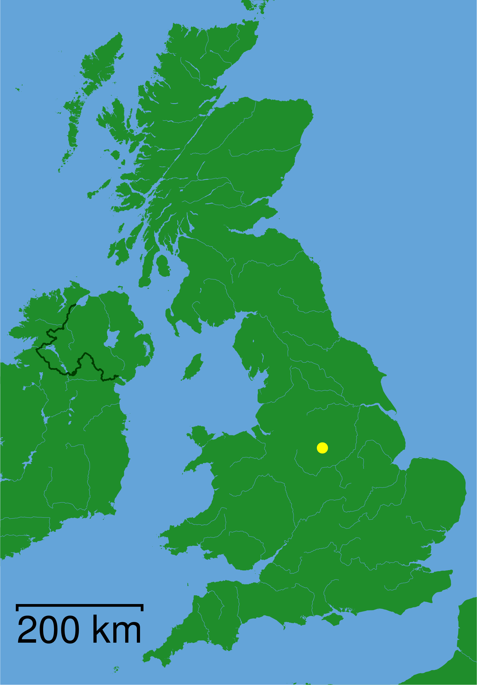
Bow Wood is located at Grid Ref: SK3156 (Lat: 53.104205, Lng: -1.5312695)

Administrative County: Derbyshire

District: Derbyshire Dales

Police Authority: Derbyshire

What 3 Words

///relations.grad.homing. Near Cromford, Derbyshire

Related Wikis

High Peak Junction

High Peak Junction, near Cromford, Derbyshire, England, is the name now used to describe the site where the former Cromford and High Peak Railway (C&HPR...

Leawood Pump House

The Leawood Pump House (also known as High Peak Pump House) was built near Cromford, Derbyshire, England in 1849 to supply water to the Cromford Canal...

Christ Church, Holloway

Christ Church, Holloway is a Grade II* listed parish church in the Church of England in Holloway, Derbyshire. == History == The foundation stone was laid...

Cromford railway station

Cromford railway station is a Grade II listed railway station owned by Network Rail and managed by East Midlands Railway. It is located in the village...

Derwent Valley Heritage Way

The Derwent Valley Heritage Way (DVHW) is a 55 miles (89 km) waymarked footpath along the Derwent Valley through the Peak District (as far as Rowsley)...

Cromford Wharf

Cromford Wharf is at Cromford in Derbyshire, England. It is located at the northern terminus of the Cromford Canal, which opened in 1794 and ran 14.5 miles...

Cromford Mill

Cromford Mill is the world's first water-powered cotton spinning mill, developed by Richard Arkwright in 1771 in Cromford, Derbyshire, England. The mill...

St John the Baptist's Church, Dethick

St John the Baptist's Church, Dethick is a Grade II* listed parish church in the Church of England in Dethick, Derbyshire. == History == The church was...

Nearby Amenities

Located within 500m of 53.104205,-1.5312695
Lea Bridge
Is In: Derbyshire, England, UK
Place: village
Lat/Long: 53.103145/-1.5264897
Tourism: picnic_site
Lat/Long: 53.1005196/-1.5334915
Covered: no
Leisure: picnic_table
Lat/Long: 53.1000197/-1.5327276
Toilets
Fee: no
Lat/Long: 53.1003039/-1.533476
Tourism: picnic_site
Lat/Long: 53.0999269/-1.5325988
Barrier: stile
Material: wood
Steps: 1
Stile: stepover
Lat/Long: 53.1065782/-1.5277836
Barrier: stile
Material: wood
Steps: 1
Stile: stepover
Lat/Long: 53.1073971/-1.528318
Pisani plc
Man Made: works
Source: survey
Website: http://www.pisanimaterials.co.uk/
Lat/Long: 53.1012408/-1.5369009
Bus Stop
Bus: yes
Ele: 74.0000000
Naptan AtcoCode: 1000DLBL2701
Naptan NaptanCode: dbsdtpad
Public Transport: platform
Lat/Long: 53.1015574/-1.5290455
Bus Stop
Bus: yes
Ele: 73.0000000
Public Transport: platform
Lat/Long: 53.1014124/-1.5291475
Barrier: stile
Steps: 1
Stile: stepover
Lat/Long: 53.1064757/-1.5276562
Barrier: stile
Material: stone
Steps: 1
Stile: stepover
Lat/Long: 53.1083777/-1.5292373
Barrier: stile
Material: stone
Stile: squeezer
Lat/Long: 53.1060085/-1.527602
Ele: 75.0000000
Lat/Long: 53.1016596/-1.5288537
Ele: 70.0000000
Lat/Long: 53.1008344/-1.5310937
Ele: 67.0000000
Lat/Long: 53.101282/-1.5321799
Ele: 66.0000000
Lat/Long: 53.1011857/-1.5322374
Ele: 67.0000000
Lat/Long: 53.1010962/-1.5318683
Ele: 66.0000000
Lat/Long: 53.1010101/-1.5311073
Barrier: stile
Stile: squeezer
Lat/Long: 53.1026276/-1.5271529
Ele: 125
Lat/Long: 53.1036566/-1.5332711
Ele: 126
Lat/Long: 53.1040882/-1.5338826
Ele: 142
Lat/Long: 53.1044682/-1.5332067
Ele: 142
Lat/Long: 53.1045264/-1.5333396
Ele: 147
Lat/Long: 53.1048396/-1.5336876
Ele: 157
Lat/Long: 53.1048913/-1.5332379
Ele: 167
Lat/Long: 53.1051134/-1.5324361
Ele: 167.0000000
Lat/Long: 53.1055004/-1.5329179
Ele: 196.0000000
Lat/Long: 53.1074501/-1.5344416
Ele: 197.0000000
Lat/Long: 53.1079916/-1.5345447
Ele: 199.0000000
Lat/Long: 53.1080295/-1.5345577
Ele: 70.0000000
Lat/Long: 53.1012117/-1.5292579
Ele: 70.0000000
Lat/Long: 53.1011715/-1.5291956
Ele: 76.0000000
Lat/Long: 53.1008804/-1.5278745
Ele: 73
Information: board
Tourism: information
Lat/Long: 53.1003006/-1.5327197
Ele: 122
Lat/Long: 53.1028469/-1.5289537
Ele: 123
Lat/Long: 53.1028974/-1.52889
Ele: 124
Lat/Long: 53.103013/-1.5287688
Ele: 127
Lat/Long: 53.1033255/-1.528725
Ele: 127.0000000
Lat/Long: 53.1037027/-1.5285122
Ele: 124.0000000
Lat/Long: 53.1041628/-1.5286003
Ele: 121.0000000
Lat/Long: 53.1046458/-1.5286293
Ele: 116.0000000
Lat/Long: 53.1049774/-1.5286299
Ele: 113.0000000
Lat/Long: 53.1052481/-1.5286454
Ele: 80.0000000
Lat/Long: 53.0998993/-1.5327801
Ele: 77.0000000
Lat/Long: 53.099925/-1.5327371
Post Box
Brand: Royal Mail
Brand Wikidata: Q638098
Brand Wikipedia: en:Royal Mail
Operator: Royal Mail
Operator Wikidata: Q638098
Ref: DE4 972
Lat/Long: 53.1032092/-1.5259545
Bus Stop
Bus: yes
Public Transport: platform
Lat/Long: 53.1025463/-1.5272599
Barrier: stile
Material: stone
Stile: squeezer
Lat/Long: 53.1067704/-1.5366923
Information: route_marker
Tourism: information
Lat/Long: 53.1003116/-1.5327415
Covered: yes
Leisure: picnic_table
Lat/Long: 53.1003801/-1.5334336
Covered: yes
Leisure: picnic_table
Lat/Long: 53.1003238/-1.5331627
Covered: yes
Leisure: picnic_table
Lat/Long: 53.1003777/-1.5332928
Covered: no
Leisure: picnic_table
Lat/Long: 53.0999678/-1.5326585
Covered: no
Leisure: picnic_table
Lat/Long: 53.10005/-1.5327685
Defibrillator
Access: yes
Defibrillator Location: On the steps of a stationary, red, railway carriage.
Emergency: defibrillator
Indoor: no
Ref GB The Circuit: 7F5AD21E-1C32-47E9-9032-AD280089FC03
Lat/Long: 53.1001185/-1.533113
Barrier: stile
Material: wood
Source: survey;gps
Stile: stepover
Lat/Long: 53.1059389/-1.531921
High Peak Junction
Old Name: Sheep Pasture Bottom
Railway: yard
Lat/Long: 53.1001627/-1.5334248
Ele: 70.0000000
Lat/Long: 53.100908/-1.5312507
The data included in this document is from www.openstreetmap.org. The data is made available under ODbL.

Have you been to Bow Wood?

Leave your review of Bow Wood below (or comments, questions and feedback).