Wainbody Wood
Wood, Forest in Warwickshire Warwick
England
Wainbody Wood

Wainbody Wood is a picturesque woodland located in the county of Warwickshire, England. Situated in the southern part of the county, it covers an area of approximately 200 acres. The woodland is part of the wider network of green spaces within the city of Coventry and is a popular destination for nature lovers and outdoor enthusiasts.
The wood is predominantly made up of mature deciduous trees, including oak, ash, and beech. These towering trees create a dense canopy, providing a habitat for a variety of wildlife species. Visitors to Wainbody Wood can expect to see an array of birdlife, such as woodpeckers, song thrushes, and blue tits. Additionally, the wood is home to small mammals like foxes, badgers, and squirrels.
A network of well-maintained footpaths crisscrosses the woodland, offering visitors the opportunity to explore the area at their own pace. The paths wind through the trees, revealing beautiful vistas and tranquil spots perfect for picnics or quiet contemplation. A small stream meanders through the wood, adding to its natural charm and providing a water source for the local wildlife.
Wainbody Wood is not only a haven for nature, but it also holds historical significance. The wood was once part of the ancient Forest of Arden, which spanned across Warwickshire and neighboring counties. Today, remnants of this ancient woodland can still be found in Wainbody Wood, adding an air of enchantment and mystery to the area.
Overall, Wainbody Wood is a delightful destination for those seeking a peaceful escape into nature. Its diverse flora and fauna, combined with its historical importance, make it a truly special place within Warwickshire.
If you have any feedback on the listing, please let us know in the comments section below.
Wainbody Wood Images
Images are sourced within 2km of 52.371931/-1.5414643 or Grid Reference SP3174. Thanks to Geograph Open Source API. All images are credited.


Wainbody Wood is located at Grid Ref: SP3174 (Lat: 52.371931, Lng: -1.5414643)
Administrative County: Warwickshire
District: Warwick
Police Authority: Warwickshire
What 3 Words
///limit.rash.slide. Near Kenilworth, Warwickshire
Nearby Locations
Related Wikis
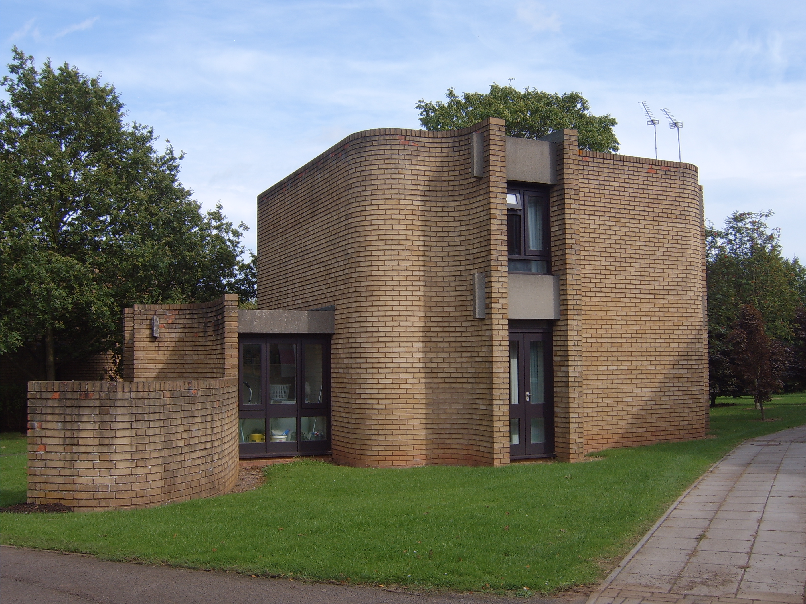
Houses for Visiting Mathematicians
The Houses for Visiting Mathematicians (also known as the Mathematics Research Centre houses) are a set of five houses and two flats, built for academics...

Warwick Medical School
Warwick Medical School is the medical school of the University of Warwick and is located in Coventry, United Kingdom. It was opened in 2000 in partnership...

Bishop Ullathorne Roman Catholic School
Bishop Ullathorne RC School was established in Coventry, England, in 1953 and in 2006 it was awarded specialist status as a Humanities College. The school...
Coventry Alvis F.C.
Coventry Alvis Football Club is a football club based in Coventry, West Midlands, England. They are currently members of the Midland League Division Two...
Nearby Amenities
Located within 500m of 52.371931,-1.5414643Have you been to Wainbody Wood?
Leave your review of Wainbody Wood below (or comments, questions and feedback).