Birch Wood

Wood, Forest in Derbyshire Derbyshire Dales

England

Birch Wood

North of Coumbs Wood looking towards Dethick
North of Coumbs Wood looking towards Dethick Credit: Neil Theasby

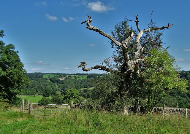
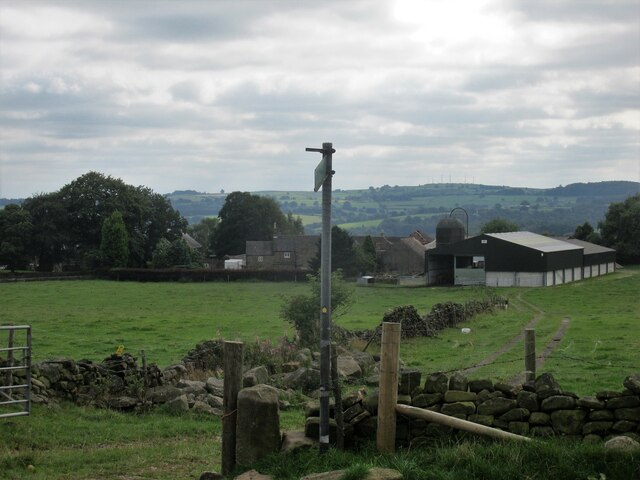
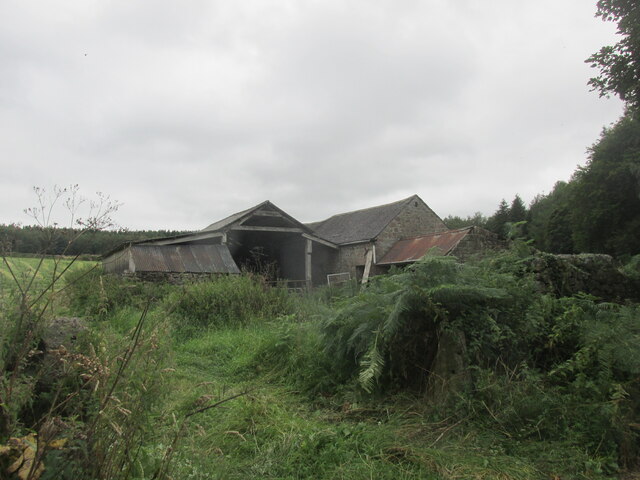
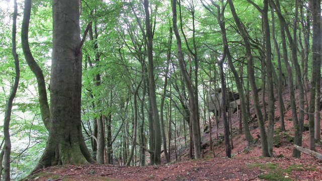
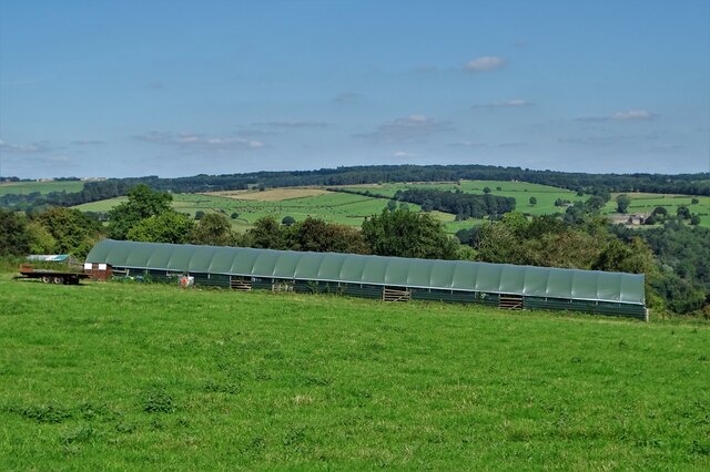
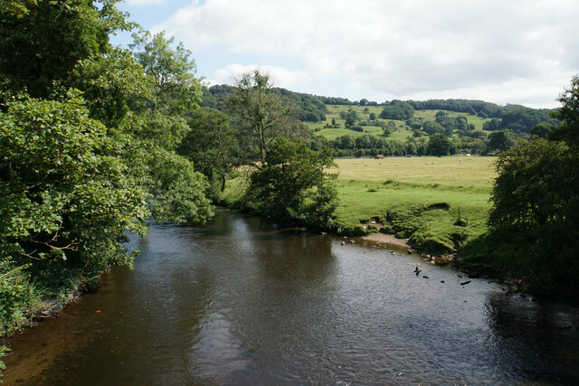
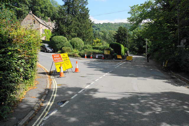
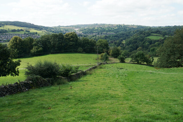
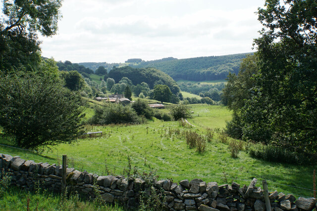
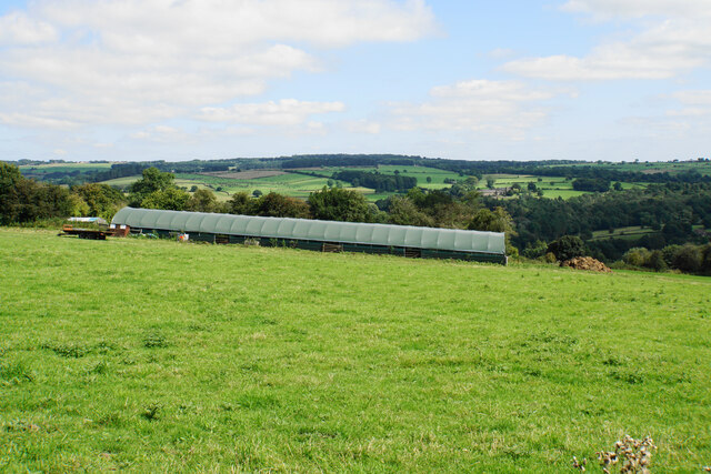
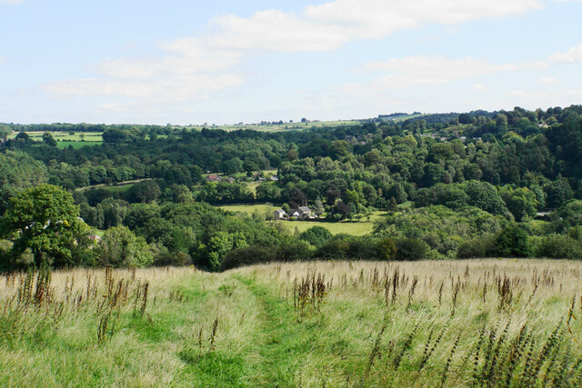
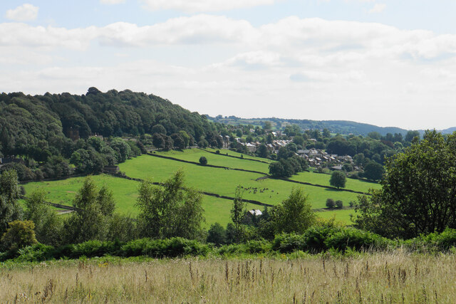
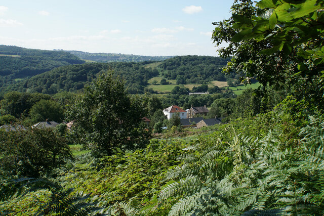
Birch Wood is a picturesque forest located in Derbyshire, England. Covering an area of approximately 100 acres, it is known for its abundant growth of birch trees, which give the wood its name. The woodland is situated in a rural area, surrounded by rolling hills and lush greenery, creating a serene and tranquil atmosphere.

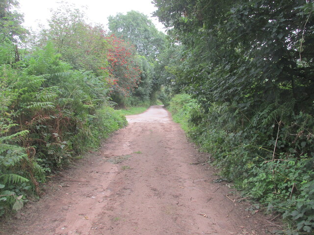
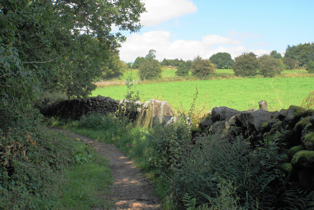
The wood is easily accessible, with several walking trails and footpaths that crisscross through the area, allowing visitors to explore and enjoy the natural beauty of the forest. These paths offer stunning views of the surrounding countryside and provide opportunities for birdwatching and wildlife spotting.

Birch Wood is home to a diverse range of flora and fauna. Apart from the characteristic birch trees, the forest is also home to oak, beech, and ash trees, which further enhance the scenic beauty of the area. The forest floor is carpeted with an array of wildflowers and ferns, creating a vibrant and colorful landscape during the spring and summer months.

The woodland is a haven for wildlife, providing a habitat for various species. Visitors may encounter red deer, foxes, badgers, and numerous bird species, including woodpeckers, owls, and songbirds. Nature enthusiasts will find plenty of opportunities for wildlife photography and observation.

Birch Wood is a popular destination for nature lovers, hikers, and families looking to enjoy a day out in the great outdoors. Its natural beauty, peaceful ambiance, and diverse wildlife make it an ideal spot for relaxation and exploration.

If you have any feedback on the listing, please let us know in the comments section below.

Birch Wood Images

Images are sourced within 2km of 53.097965/-1.5354592 or Grid Reference SK3155. Thanks to Geograph Open Source API. All images are credited.

North of Coumbs Wood looking towards Dethick
Upper Holloway Farm Walking along the footpath that runs down towards the farm.
Upper Holloway Farm
Walking along the footpath that runs down towards the farm.
Cottages in Holloway Narrow street in the village.
Cottages in Holloway
Narrow street in the village.
Intake Lane Close to Birchwood Farm campsite.
Intake Lane
Close to Birchwood Farm campsite.
Old barn alongside the Midshires Way Intake Lane.
Old barn alongside the Midshires Way
Intake Lane.
Bauston Tor In the trees above the Incline.
Bauston Tor
In the trees above the Incline.
Modern barn on a hillside by High Leas Farm
River Derwent at Cromford Looking downstream from the Mill Road bridge.
River Derwent at Cromford
Looking downstream from the Mill Road bridge.
Road closure at the bottom of Willersley Lane The lane is closed further on for roadworks on Starkholmes Road. The closure is likely to last at least 18 months. If you go straight on here, Lea road ahead is also closed further on due to subsidence.
Road closure at the bottom of Willersley Lane
The lane is closed further on for roadworks on Starkholmes Road. The closure is likely to last at least 18 months. If you go straight on here, Lea road ahead is also closed further on due to subsidence.
Hillside above Cromford A footpath from Lea descends into the Derwent valley here. Middleton Top is on the opposite hill.
Hillside above Cromford
A footpath from Lea descends into the Derwent valley here. Middleton Top is on the opposite hill.
Meadow Wood Farm The eastern side of the Derwent valley.
Meadow Wood Farm
The eastern side of the Derwent valley.
Hearthstone Lane An ancient route which climbs the ridge between Lea Brook and the River Derwent.
Hearthstone Lane
An ancient route which climbs the ridge between Lea Brook and the River Derwent.
Cloche by High Leas Farm The cloche is for the benefit of livestock and not for plants. The valley of Lea Brook is behind.
Cloche by High Leas Farm
The cloche is for the benefit of livestock and not for plants. The valley of Lea Brook is behind.
Footpath to Lea The village of Lea is in the trees on the other side of the valley. The valley of Lea Brook runs between.
Footpath to Lea
The village of Lea is in the trees on the other side of the valley. The valley of Lea Brook runs between.
Hillside above Lea Brook Looking down the valley towards Holloway which is on the other side.
Hillside above Lea Brook
Looking down the valley towards Holloway which is on the other side.
Long Lane A quiet lane which acts very well as a footpath. You can see a few of the rooftops of Lea ahead.
Long Lane
A quiet lane which acts very well as a footpath. You can see a few of the rooftops of Lea ahead.
Path from Holloway to Long Lane Signs warn that this is a cliffside path but it does not seem particularly precarious.
Path from Holloway to Long Lane
Signs warn that this is a cliffside path but it does not seem particularly precarious.
View over the northern end of Holloway A view from a path leading up to Long Lane. The Derwent valley is in the background.
View over the northern end of Holloway
A view from a path leading up to Long Lane. The Derwent valley is in the background.
Show me another place!

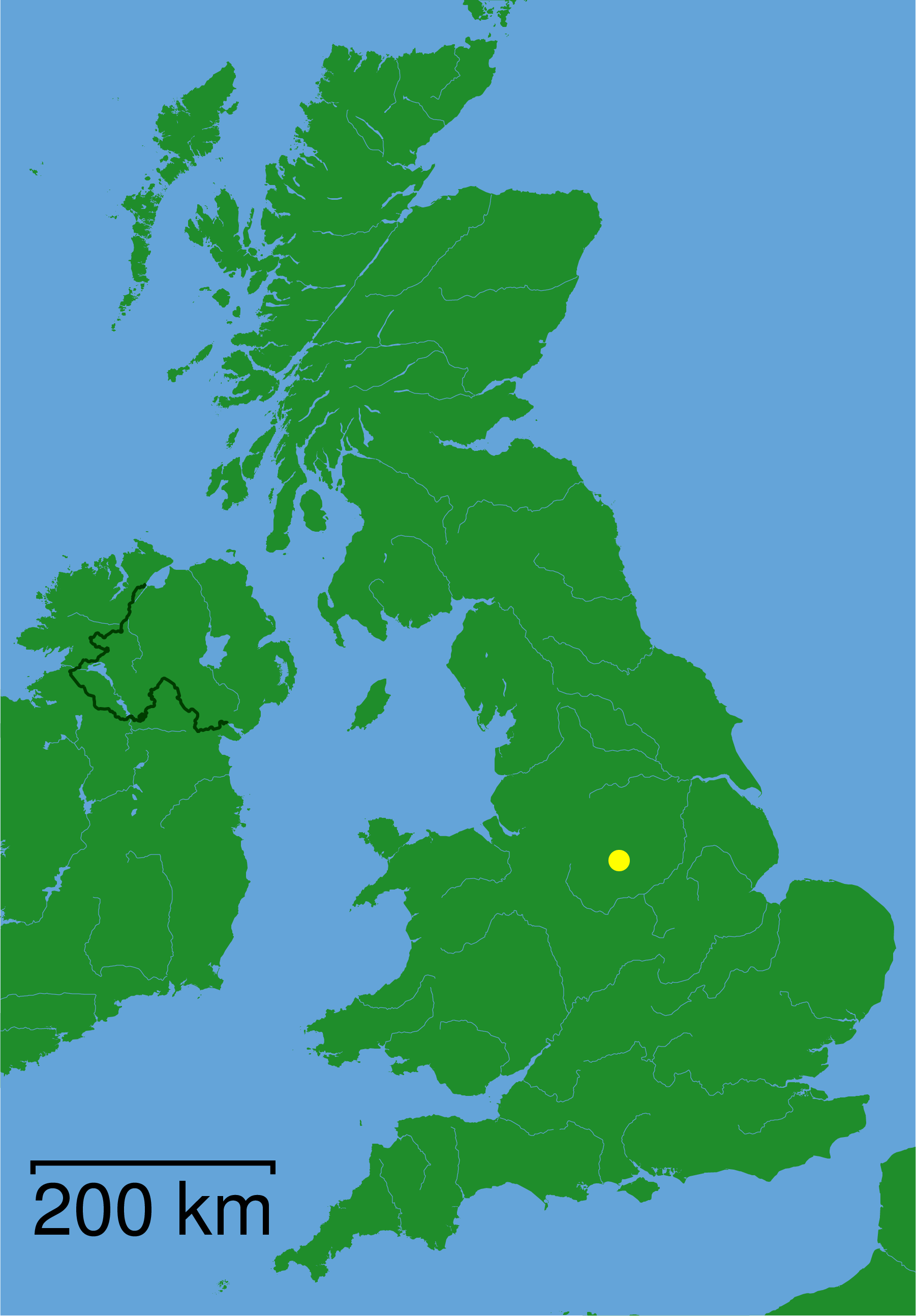
Birch Wood is located at Grid Ref: SK3155 (Lat: 53.097965, Lng: -1.5354592)

Administrative County: Derbyshire

District: Derbyshire Dales

Police Authority: Derbyshire

What 3 Words

///sued.compacts.nutty. Near Cromford, Derbyshire

Related Wikis

High Peak Junction

High Peak Junction, near Cromford, Derbyshire, England, is the name now used to describe the site where the former Cromford and High Peak Railway (C&HPR...

Leawood Pump House

The Leawood Pump House (also known as High Peak Pump House) was built near Cromford, Derbyshire, England in 1849 to supply water to the Cromford Canal...

Christ Church, Holloway

Christ Church, Holloway is a Grade II* listed parish church in the Church of England in Holloway, Derbyshire. == History == The foundation stone was laid...

Cromford Wharf

Cromford Wharf is at Cromford in Derbyshire, England. It is located at the northern terminus of the Cromford Canal, which opened in 1794 and ran 14.5 miles...

Derwent Valley Heritage Way

The Derwent Valley Heritage Way (DVHW) is a 55 miles (89 km) waymarked footpath along the Derwent Valley through the Peak District (as far as Rowsley)...
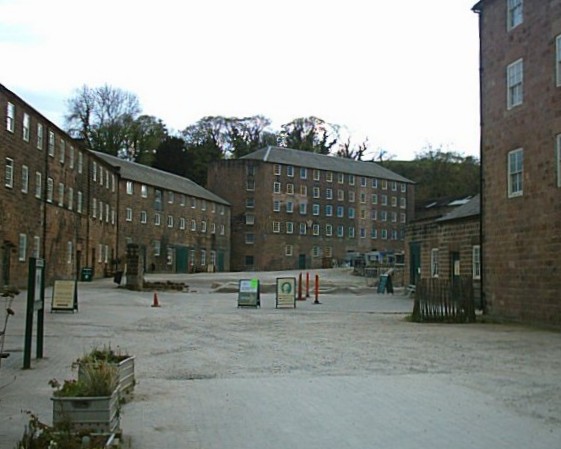
Cromford Mill

Cromford Mill is the world's first water-powered cotton spinning mill, developed by Richard Arkwright in 1771 in Cromford, Derbyshire, England. The mill...

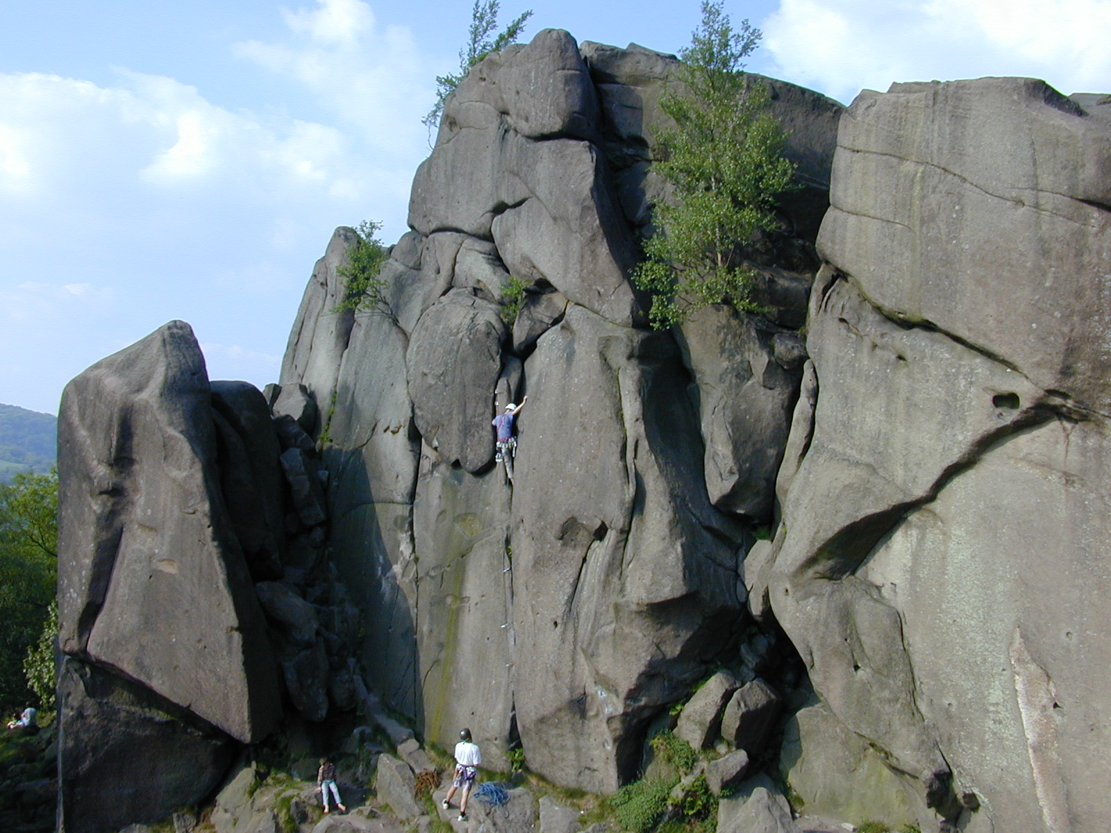
Black Rocks (Derbyshire)

Black Rocks (or Stonnis Rocks), is a small outcrop of ashover gritstone, between Cromford and Wirksworth in Derbyshire, the Peak District, England. It...

Cromford railway station

Cromford railway station is a Grade II listed railway station owned by Network Rail and managed by East Midlands Railway. It is located in the village...

Nearby Amenities

Located within 500m of 53.097965,-1.5354592
Post Box
Brand: Royal Mail
Brand Wikidata: Q638098
Brand Wikipedia: en:Royal Mail
Operator: Royal Mail
Operator Wikidata: Q638098
Post Box Mounting: pier
Post Box Type: lamp
Ref: DE4 963
Lat/Long: 53.1010351/-1.5373212
Tourism: picnic_site
Lat/Long: 53.1005196/-1.5334915
Bench
Lat/Long: 53.0989117/-1.5322812
Bench
Lat/Long: 53.0991539/-1.5323156
Bench
Lat/Long: 53.099592/-1.5323928
Covered: no
Leisure: picnic_table
Lat/Long: 53.1000197/-1.5327276
Toilets
Fee: no
Lat/Long: 53.1003039/-1.533476
Tourism: picnic_site
Lat/Long: 53.0999269/-1.5325988
Bench
Lat/Long: 53.0973762/-1.5311422
Railway: loading_gauge
Lat/Long: 53.0981902/-1.5320581
Barrier: lift_gate
Bicycle: yes
Foot: yes
Lat/Long: 53.0990336/-1.5364069
Pisani plc
Man Made: works
Source: survey
Website: http://www.pisanimaterials.co.uk/
Lat/Long: 53.1012408/-1.5369009
Ele: 70.0000000
Lat/Long: 53.1008344/-1.5310937
Ele: 92.0000000
Lat/Long: 53.0971807/-1.5283011
Bench
Ele: 76.0000000
Lat/Long: 53.0968064/-1.5291555
Ele: 81
Lat/Long: 53.0968211/-1.5286966
Ele: 76.0000000
Lat/Long: 53.0967982/-1.5287509
Ele: 77.0000000
Lat/Long: 53.0968261/-1.5288914
Ele: 67.0000000
Lat/Long: 53.101282/-1.5321799
Ele: 66.0000000
Lat/Long: 53.1011857/-1.5322374
Ele: 67.0000000
Lat/Long: 53.1010962/-1.5318683
Ele: 66.0000000
Lat/Long: 53.1010101/-1.5311073
Ele: 76.0000000
Lat/Long: 53.0976852/-1.5284646
Ele: 75.0000000
Lat/Long: 53.0983787/-1.5280558
Ele: 74
Lat/Long: 53.0991475/-1.5319407
Ele: 73
Information: board
Tourism: information
Lat/Long: 53.1003006/-1.5327197
Ele: 74.0000000
Lat/Long: 53.0969288/-1.5310145
Ele: 72.0000000
Lat/Long: 53.0966994/-1.5308717
Ele: 73.0000000
Lat/Long: 53.0958514/-1.5304491
Bench
Ele: 91
Lat/Long: 53.1005153/-1.5361273
Ele: 94
Railway: catch_pit
Lat/Long: 53.1004566/-1.5363399
Description: The Catch Pit
Ele: 98.0000000
Information: board
Tourism: information
Lat/Long: 53.1005834/-1.5369438
Bench
Ele: 91
Lat/Long: 53.1004283/-1.5359342
Barrier: stile
Material: stone
Source: survey
Steps: 1
Stile: stepover
Lat/Long: 53.0958268/-1.5360845
Barrier: stile
Ele: 167.0000000
Material: stone
Source: survey;gps
Stile: squeezer
Lat/Long: 53.0950429/-1.5371856
Barrier: stile
Ele: 178.0000000
Stile: squeezer
Lat/Long: 53.0939542/-1.5383532
Barrier: stile
Steps: 1
Stile: stepover
Lat/Long: 53.0958649/-1.5359892
Ele: 88.0000000
Lat/Long: 53.0997084/-1.5335845
Hazard Forward: horses
Lat/Long: 53.0953309/-1.5305315
Ele: 80.0000000
Lat/Long: 53.0998993/-1.5327801
Ele: 77.0000000
Lat/Long: 53.099925/-1.5327371
Barrier: stile
Ele: 90.0000000
Steps: 2
Stile: stepover
Lat/Long: 53.0993308/-1.5334445
Ele: 107.0000000
Lat/Long: 53.0982841/-1.5334944
Note: site of former aqueduct
Lat/Long: 53.0976068/-1.5284549
Description: Lea Wood Pump House
Information: board
Tourism: information
Lat/Long: 53.0973533/-1.5311607
Information: route_marker
Tourism: information
Lat/Long: 53.095858/-1.5359722
Information: route_marker
Tourism: information
Lat/Long: 53.1003116/-1.5327415
Information: route_marker
Tourism: information
Lat/Long: 53.0967589/-1.5290884
Covered: yes
Leisure: picnic_table
Lat/Long: 53.1003801/-1.5334336
Covered: yes
Leisure: picnic_table
Lat/Long: 53.1003238/-1.5331627
Covered: yes
Leisure: picnic_table
Lat/Long: 53.1003777/-1.5332928
Covered: no
Leisure: picnic_table
Lat/Long: 53.0999678/-1.5326585
Covered: no
Leisure: picnic_table
Lat/Long: 53.10005/-1.5327685
Defibrillator
Access: yes
Defibrillator Location: On the steps of a stationary, red, railway carriage.
Emergency: defibrillator
Indoor: no
Ref GB The Circuit: 7F5AD21E-1C32-47E9-9032-AD280089FC03
Lat/Long: 53.1001185/-1.533113
High Peak Junction
Old Name: Sheep Pasture Bottom
Railway: yard
Lat/Long: 53.1001627/-1.5334248
Lea Wood Nature Reserve
Information: board
Tourism: information
Lat/Long: 53.0967892/-1.5287488
Ele: 70.0000000
Lat/Long: 53.100908/-1.5312507
Water Point
Lat/Long: 53.0957813/-1.5339527
Direction: SW
Generator Method: photovoltaic
Generator Output Electricity: yes
Generator Solar Modules: 16
Generator Source: solar
Generator Type: solar_photovoltaic_panel
Location: roof
Power: generator
Lat/Long: 53.0993727/-1.5340563
Capacity: 1
Tourism: camp_pitch
Lat/Long: 53.0958884/-1.5344301
Capacity: 1
Tourism: camp_pitch
Lat/Long: 53.0958264/-1.5343362
Capacity: 1
Tourism: camp_pitch
Lat/Long: 53.095774/-1.5342464
Capacity: 1
Tourism: camp_pitch
Lat/Long: 53.0957056/-1.5341404
Capacity: 1
Tourism: camp_pitch
Lat/Long: 53.0956516/-1.5340747
Capacity: 1
Tourism: camp_pitch
Lat/Long: 53.095778/-1.534068
Capacity: 1
Tourism: camp_pitch
Lat/Long: 53.0958513/-1.5341659
Capacity: 1
Tourism: camp_pitch
Lat/Long: 53.0959109/-1.5342571
Capacity: 1
Tourism: camp_pitch
Lat/Long: 53.0959786/-1.5343389
Capacity: 1
Tourism: camp_pitch
Lat/Long: 53.0960374/-1.5344287
Capacity: 1
Tourism: camp_pitch
Lat/Long: 53.0959568/-1.5345468
The data included in this document is from www.openstreetmap.org. The data is made available under ODbL.

Have you been to Birch Wood?

Leave your review of Birch Wood below (or comments, questions and feedback).