Baldwin Wood
Wood, Forest in Derbyshire Amber Valley
England
Baldwin Wood

Baldwin Wood is a picturesque forest located in Derbyshire, England. Covering an area of approximately 500 acres, this enchanting woodland is a haven for nature lovers and outdoor enthusiasts alike. The forest is named after Baldwin, an ancient Saxon lord, who once owned the land.
Baldwin Wood is renowned for its diverse ecosystem and rich biodiversity. The forest is predominantly composed of oak, beech, and birch trees, which create a stunning display of colors during the autumn season. The forest floor is blanketed with a variety of wildflowers, including bluebells, primroses, and foxgloves, adding to its natural beauty.
The wood is home to an array of wildlife, making it a haven for nature enthusiasts. Visitors may spot native animals such as deer, squirrels, and badgers, as well as a myriad of bird species including woodpeckers, owls, and warblers. The tranquil environment offers a perfect escape from the hustle and bustle of everyday life, allowing visitors to immerse themselves in the serenity of nature.
Baldwin Wood offers numerous recreational activities, catering to both individuals and families. There are well-maintained walking trails that wind through the forest, providing an opportunity to explore its captivating landscapes. Additionally, the forest is equipped with picnic areas and designated spots for birdwatching, allowing visitors to fully appreciate the natural wonders surrounding them.
Overall, Baldwin Wood is a true gem in Derbyshire, offering a serene and captivating experience for all who venture into its embrace.
If you have any feedback on the listing, please let us know in the comments section below.
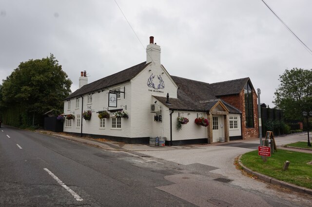
Baldwin Wood Images
Images are sourced within 2km of 52.941233/-1.5410522 or Grid Reference SK3038. Thanks to Geograph Open Source API. All images are credited.


Baldwin Wood is located at Grid Ref: SK3038 (Lat: 52.941233, Lng: -1.5410522)
Administrative County: Derbyshire
District: Amber Valley
Police Authority: Derbyshire
What 3 Words
///castle.prep.atomic. Near Derby, Derbyshire
Nearby Locations
Related Wikis
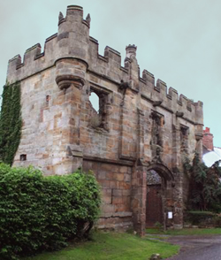
Mackworth Castle
Mackworth Castle was a 14th- or 15th-century structure located in Derbyshire, at the upper end of Mackworth village near Derby. The home for several centuries...

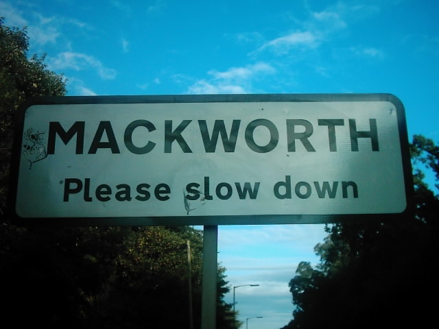
Mackworth, Amber Valley
Mackworth is a village and civil parish in the borough of Amber Valley, in Derbyshire, England. The 2011 Census recorded a population for the parish of...
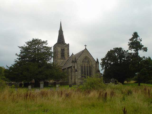
All Saints' Church, Mackworth
All Saints’ Church, Mackworth is a Grade I listed parish church in the Church of England in Mackworth, Derbyshire. == History == The church dates from...
Mackworth, Derby
Mackworth is a suburb and electoral ward of the city of Derby, England. Is it located on the north-west of the city near to Markeaton Park and the suburb...

Meynell Langley
Meynell Langley is a small area of settlement in Derbyshire, England. It is located between Kirk Langley and Kedleston. Meynell Langley Hall is the ancestral...

Derby County F.C. Women
Derby County Women are an English women's football club affiliated with Derby County F.C. The first team currently play in the FA Women's National League...

Mickleover F.C.
Mickleover Football Club is a football club based in the Mickleover suburb of Derby, Derbyshire, England. They are currently members of the Southern League...
All Saints Church, Kedleston
All Saints' Church, Kedleston, is a redundant Anglican Church approx. 4 miles [6km] north-west of Derby, and all that remains of the medieval village of...
Nearby Amenities
Located within 500m of 52.941233,-1.5410522Have you been to Baldwin Wood?
Leave your review of Baldwin Wood below (or comments, questions and feedback).