Big Rough

Wood, Forest in Derbyshire South Derbyshire

England

Big Rough

Straw Bales SK3025 is mainly open fields but also has the farmers straw and silage store.
Straw Bales Credit: Rob Court

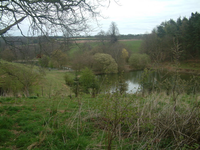
Big Rough is a picturesque woodland located in the county of Derbyshire, England. Situated near the town of Chesterfield, it covers an area of approximately 500 acres and is known for its dense, ancient forest and natural beauty. The woodland is nestled within the wider Peak District National Park, offering visitors a tranquil and idyllic escape from the hustle and bustle of urban life.

The woodland is characterized by its diverse range of tree species, including oak, birch, beech, and ash, which create a dense canopy overhead. The forest floor is covered in a rich carpet of mosses, ferns, and wildflowers, adding to the enchanting atmosphere. Numerous streams and small waterfalls can be found throughout the woodland, adding to its natural charm.

Big Rough is a haven for wildlife, boasting a wide variety of fauna. Visitors may spot deer, foxes, badgers, and an array of bird species, including woodpeckers and owls. The woodland also supports a diverse insect population, making it a popular destination for nature enthusiasts and photographers.

The woodland offers a network of well-maintained walking trails, allowing visitors to explore its beauty at their own pace. These trails cater to different fitness levels and provide opportunities to discover hidden corners and panoramic views. Additionally, designated picnic areas and benches are scattered throughout the woodland, providing visitors with the perfect spot to rest and enjoy the surroundings.

Overall, Big Rough in Derbyshire is a captivating woodland that offers a peaceful and immersive nature experience. Its ancient forest, diverse wildlife, and well-maintained trails make it a popular destination for outdoor enthusiasts and a haven for those seeking solace in nature.

If you have any feedback on the listing, please let us know in the comments section below.

Big Rough Images

Images are sourced within 2km of 52.811522/-1.5426857 or Grid Reference SK3023. Thanks to Geograph Open Source API. All images are credited.

Straw Bales SK3025 is mainly open fields but also has the farmers straw and silage store.
Straw Bales
SK3025 is mainly open fields but also has the farmers straw and silage store.
Open Field Much of this square is taken up by a large open field
Open Field
Much of this square is taken up by a large open field
Bridleway through farmland The bridleway runs N-S, parallel with Foremark Reservoir, just behind the trees in the right of the picture. The reservoir does not appear on the 1930s map.
Bridleway through farmland
The bridleway runs N-S, parallel with Foremark Reservoir, just behind the trees in the right of the picture. The reservoir does not appear on the 1930s map.
Foremark Reservoir The building in the foreground is the sailing club.
Foremark Reservoir
The building in the foreground is the sailing club.
Bridleway South of Repton Park Farm The bridleway runs north through the slight valley towards the village of Repton. A pair of buzzards were circling overhead when this picture was taken.
Bridleway South of Repton Park Farm
The bridleway runs north through the slight valley towards the village of Repton. A pair of buzzards were circling overhead when this picture was taken.
Repton Shrubs Most of the gridsquare is taken up by Repton Shrubs which is an area of woodland owned by the Forestry Commission. Unfortunately there is only one footpath that runs along the north edge of the woods.
Repton Shrubs
Most of the gridsquare is taken up by Repton Shrubs which is an area of woodland owned by the Forestry Commission. Unfortunately there is only one footpath that runs along the north edge of the woods.
Farmland West of Bretby Mill Much of this grid square is taken up with sheep farming.
Farmland West of Bretby Mill
Much of this grid square is taken up with sheep farming.
Hill Farm
Hill Farm
Plantation Part of this square has been planted with trees with funding from the Millennium Commission as part of a national tree planting project.
Plantation
Part of this square has been planted with trees with funding from the Millennium Commission as part of a national tree planting project.
Flood Noahs Ark is a dwelling built on high ground. Foresight perhaps?
Flood
Noahs Ark is a dwelling built on high ground. Foresight perhaps?
Undulating Sheep on the hills west of Hoofies Farm
Undulating
Sheep on the hills west of Hoofies Farm
Bretby Hall Converted Hospital
Bretby Hall
Converted Hospital
Monument at Bretby
Monument at Bretby
Lakes at Bretby Hall The lakes viewed from the footpath running along the Southern edge of Bretby Hall. The strip of land separating these two lakes provides the crossing point of the footpath from Bretby to Hoolies wood and from there to either Upper Midway or Hartshorne.
Lakes at Bretby Hall
The lakes viewed from the footpath running along the Southern edge of Bretby Hall. The strip of land separating these two lakes provides the crossing point of the footpath from Bretby to Hoolies wood and from there to either Upper Midway or Hartshorne.
Pumping station below Foremark Reservoir dam
Fishing boats waiting at Foremark Reservoir In the background are masts of boats at the Burton Sailing Club.
Fishing boats waiting at Foremark Reservoir
In the background are masts of boats at the Burton Sailing Club.
Bondwood Farm
Bondwood Farm
Communication mast near Foremark Reservoir Taken in the gathering dusk of a fine June evening.
Communication mast near Foremark Reservoir
Taken in the gathering dusk of a fine June evening.
Show me another place!

Big Rough is located at Grid Ref: SK3023 (Lat: 52.811522, Lng: -1.5426857)

Administrative County: Derbyshire

District: South Derbyshire

Police Authority: Derbyshire

What 3 Words

///skin.shins.jars. Near Repton, Derbyshire

Nearby Locations

Big Rough

Related Wikis

Repton Rural District

Repton was a rural district in Derbyshire, England from 1894 to 1974. It was created under the Local Government Act 1894 from the part of the Burton upon...

South Derbyshire (UK Parliament constituency)

South Derbyshire is a constituency represented in the House of Commons of the UK Parliament since 2010 by Heather Wheeler, a Conservative. == Boundaries... ==

South Derbyshire

South Derbyshire is a local government district in Derbyshire, England. The district covers the towns of Melbourne and Swadlincote as well as numerous...
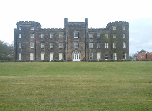
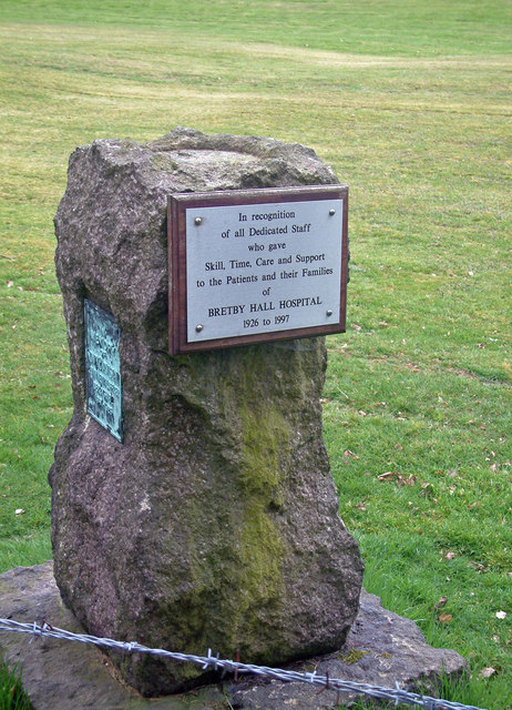
Bretby Hall

Bretby Hall is a country house at Bretby, Derbyshire, England, north of Swadlincote and east of Burton upon Trent on the border with Staffordshire. It...

Nearby Amenities

Located within 500m of 52.811522,-1.5426857
The data included in this document is from www.openstreetmap.org. The data is made available under ODbL.

Have you been to Big Rough?

Leave your review of Big Rough below (or comments, questions and feedback).